The short answer
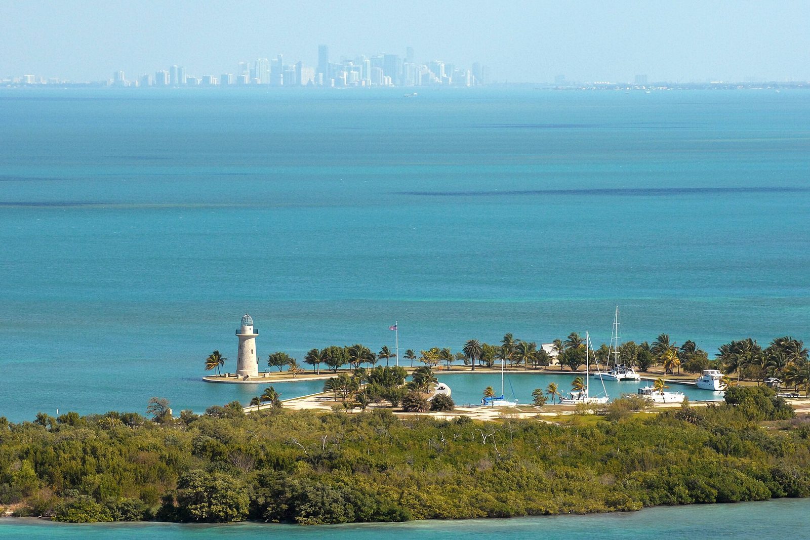
Biscayne National Park lies on the doorstep of Miami, at the southern end of Biscayne Bay. It protects four worlds that blend into one another. A long fringe of mangrove forest lines the mainland shore; then come the clear, shallow bay and the northernmost of the Florida Keys; and about ten miles offshore lies the top end of Florida’s Coral Reef. President Lyndon Johnson signed it into being as Biscayne National Monument on October 18, 1968, after a long local fight to stop the islands being built over. The only part reachable by car is the visitor centre at Convoy Point, near Homestead; the rest is reached by boat.
From Tally’s diary
The water was so clear and so shallow that the boat seemed to hang over the bottom, and I kept leaning out to look at the grass waving underneath. Behind us, a long way off, a city stood up out of the sea like a row of teeth. Nobody out there paid it any attention, least of all the pelican, who dropped in beside me like a dropped suitcase.
Why it's worth knowing
The Keys before the Keys. The Florida Keys do not begin at Key Largo. North of it lie nearly 50 more keys, islands built on ancient coral reefs, that the railroad passed by and the developers never reached. Elliott Key, the largest island in the park, is often counted as the first of the Florida Keys. Its forest of mahogany, gumbo limbo, paradise tree and ironwood grows nowhere in the continental United States outside South Florida, and the endangered Schaus’ swallowtail butterfly flutters through it. There are no roads or bridges out to any of them.
The city that never was. In the 1950s and 60s the northern keys looked, to many people, like land going to waste. There were plans to dredge 8,000 acres of bay bottom for a jetport, and for Seadade, an industrial seaport with a channel 40 feet deep through the clear shallows. In 1961 thirteen landowners voted unanimously to create the City of Islandia. Against them stood doctors and pilots, farmers and writers, and the fight grew ugly: the president of the local Izaak Walton League said his dog was poisoned. A vacuum-cleaner magnate, Herbert Hoover Jr., flew congressmen over the bay in a blimp, sure that anyone who saw it would fall for it. When the park side was close to winning, the Islandia landowners bulldozed “spite highway” down Elliott Key. Congress, led by the local Representative Dante Fascell, created the monument anyway.
A reef full of night shifts. The coral reef is the third largest in the world, and more than 500 kinds of reef fish live on the park’s stretch of it. It never really sleeps. When the soft corals pull in their polyps at dusk, the hard corals open theirs to feed; parrotfish wrap themselves in sleeping bags of mucus while octopuses and squirrelfish come out to hunt. A goliath grouper weighing 500 pounds may peer out from under a ledge. In 1877 the boat designer Ralph Munroe called the water over it “a sort of liquid light, rather than water.”
The field notes
Six wrecks and a lighthouse
The reef that makes the water so beautiful is also knife-edged, and ships have been running onto it for centuries. Six wrecks now make up the park’s Maritime Heritage Trail, reached only by boat. The Alicia went down in 1905 loaded with silks and silverware, and so many salvage crews fought over her, 70 groups of them, that the United States rewrote its salvage laws for good. The Lugano, lost in 1913, was then the largest ship ever to wreck in the Florida Keys and lies 25 feet down on Long Reef. The steel schooner Mandalay, once known as “the red carpet ship of the windjammer fleet”, sank in 1966 in water shallow enough to snorkel. Watching over them is Fowey Rocks Lighthouse, the “Eye of Miami”, first lit in 1878, whose great lens was shown off at the Centennial Exposition in Philadelphia before it ever reached the reef.
Houses on stilts
Out on the shallow flats at the park’s northern end, a handful of wooden houses stand on stilts above the seagrass. Stiltsville began in the 1930s, when a man known as “Crawfish Eddie” Walker built the first shack on the water. It became the place to be seen for winter visitors from Miami Beach, and stories of illegal drink and gambling brought police raids on the Bikini Club and the Quarterdeck Club. At its peak, in 1960, there were 27 buildings. Hurricanes and fires took them one by one; after Hurricane Andrew in 1992, seven were left, none of them from the heyday. A trust now looks after them, and going inside takes a permit.
Pineapples and limes on Porgy Key
In 1897 Israel Lafayette Jones, a Black farm worker and boatman from North Carolina, bought Porgy Key for $300. He and his sons cleared it by hand, cutting through gumbo limbo, mahogany and vines sharp enough to slice skin, and found coral limestone underneath that suited pineapples and key limes. The Jones farm became one of the largest growers of both on Florida’s east coast. His sons were named King Arthur and Sir Lancelot, and Lancelot Jones went on to stand with the campaigners who saved the bay. The family’s land, bought for $300, eventually sold for nearly $1.5 million, and Florida marks October 13 as Lancelot Jones Day.
Ten thousand years of people
At the end of the last ice age the sea was so much lower that Biscayne Bay was a broad, dry savannah where people may have hunted mammoths and mastodons. As the water rose, the bay filled in, and some of the oldest traces of people here are probably underwater. About 2,500 years ago the people of the area settled down and began leaving great heaps of conch and whelk shells; later the Tequesta lived from the sea rather than from crops. After Europeans arrived in the 16th century, smallpox and measles swept through, and by the mid-1700s almost all of the area’s native people were gone.

November 2012Sea fans and corals on the reef, lit from above.
Photograph: NPS, Public domain, cropped

January 2010An American crocodile resting on the rocks.
Photograph: NPS / Judd Patterson, Public domain

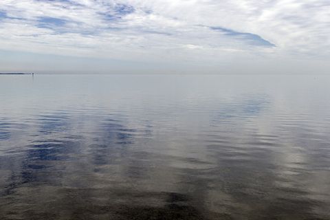
November 2012Biscayne Bay on a calm, grey day.
Photograph: Acroterion, CC BY-SA 4.0, cropped
- Look down through the bottom of the boat. (Looked. A fish looked back. We both pretended it was a coincidence.)
- Find the island at the very start of the long chain of islands. (Found it. It did not look like a beginning. Beginnings rarely do.)
- Count the houses standing in the sea on long legs. (Counted them twice, from opposite sides, and got two different numbers. Both are now on the list.)
- Wait on the dock for the slow grey shape that grazes under the boards. (It came at lunchtime and ate very slowly, as if there were all the time in the world. There was.)
- Walk the old road that never got a single car. (It is a tunnel of leaves now, and much better at being a road than it would have been.)
A relic from Biscayne National Park
Relic, entry 343Sprouts while still on the treeCan float for up to a year
A red mangrove propagule, adrift. Red mangroves grow at the very edge of the water on arching prop roots, and their seeds sprout while still on the tree. What drops into the bay is a seedling already, long, green and pointed, like a large green bean or a cigar. It can float for up to a year, standing upright in the water as it goes, before it finds a muddy shore to anchor in and grow into another tree. A whole coastline of mangroves begins this way, one floating bean at a time.
Tally, in the marginA green bean, I thought, that had fallen into the bay by mistake, until it turned out to be a whole tree in waiting, bobbing along looking for a shore. I gave it a gentle push in the right direction, which it did not need.
Getting there
- 1
By road
The Florida Turnpike, exit 6, and SW 328th Street lead four miles east to the end of the road.
- 2
By boat
Guided trips leave from the visitor centre for the islands, the reef and the wrecks.
- ✓
How to get there. The Dante Fascell Visitor Center is at Convoy Point, 9700 SW 328th Street in Homestead, south of Miami, the only part of the park reachable by road. From the Florida Turnpike, exit 6 (Speedway Boulevard) leads south to SW 328th Street, then four miles east to the end of the road; from US Highway 1, Speedway Boulevard or Palm Drive in Homestead lead to the same street. The islands, the reef and the wrecks are reached by boat: guided trips leave from the visitor centre, and the coral reef lies more than ten miles out from the mainland. There is no entrance fee.
When to go. The park is open all the time to boats. Manatees are seen more often in the colder months.
Safety. The State Department’s travel advisories cover other countries, so none applies here. The park’s alerts page carries current closures and conditions on the water.
Mark this place
The passport stamp for this place.
Common questions
Is Biscayne National Park mostly water?
Almost entirely. About 95 per cent of Biscayne National Park in Florida is water: the bay, the lagoons and the sea over the reef, with the mangrove shore and a string of small islands making up the rest.
Where is Biscayne National Park?
Just south of Miami. Biscayne National Park’s visitor centre is at Convoy Point in Homestead, Florida, off the Florida Turnpike, and the park covers the southern part of Biscayne Bay out to the reef.
Are the Florida Keys in Biscayne National Park?
The first of them are. Nearly 50 keys lie north of Key Largo, and the northernmost Florida Keys, among them Elliott Key, Boca Chita Key and Adams Key, are inside Biscayne National Park, with no road or bridge to any of them.
How far out is the coral reef in Biscayne National Park?
More than ten miles from the mainland. The reef in Biscayne National Park is the northern end of Florida’s Coral Reef, the third largest in the world, and is reached by boat.
What is Stiltsville?
A cluster of houses on stilts in Biscayne Bay. Stiltsville, in the northern part of Biscayne National Park, began with a shack built in the 1930s; it had 27 buildings at its peak in 1960 and seven after Hurricane Andrew in 1992.
What was spite highway?
A road built to spoil a future park. In 1968 landowners bulldozed a swath six lanes wide and seven miles long down Elliott Key to stop Biscayne National Monument; it never became a road, and the forest has grown over it.
Can you see shipwrecks in Biscayne National Park?
Yes, six of them. Biscayne National Park’s Maritime Heritage Trail links six wrecks from 1878 to 1966 and Fowey Rocks Lighthouse; some are shallow enough to snorkel and others suit divers.
Does Biscayne National Park charge an entrance fee?
No. There is no entrance fee at Biscayne National Park; fees are charged only for things such as overnight docking and camping.
Photographs on this page
Tap a photograph to see it full size.
Photograph: NPS / Judd Patterson, Public domain
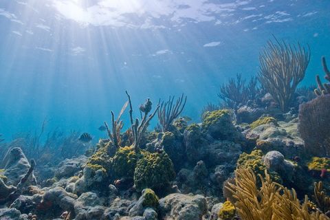
Photograph: NPS, Public domain, cropped
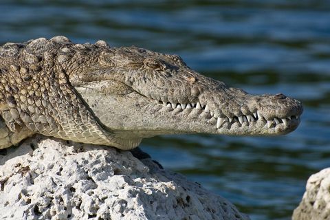
Photograph: NPS / Judd Patterson, Public domain
Photograph: Acroterion, CC BY-SA 4.0, cropped


