The short answer
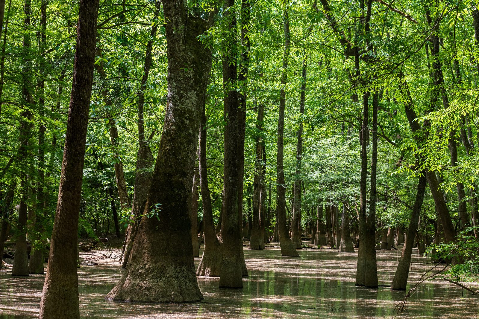
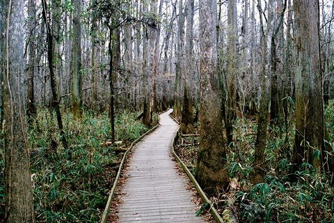
Congaree National Park covers more than 26,000 acres of bottomland and upland forest in the Midlands of South Carolina, about 30 minutes from Columbia Metropolitan Airport. Almost 80% of it lies in the floodplain of the Congaree River, where the floods spread fresh soil through forested wetlands, oxbow lakes, sloughs and slow creeks lined with bald cypress and tupelo. The 2.6-mile Boardwalk Trail starts at the Harry Hampton Visitor Center, and a marked canoe trail follows Cedar Creek.
From Tally’s diary
The boardwalk wandered off among the trees and the trees went up and up, and under me the water lay brown and perfectly still, full of little wooden points poking through it like the tops of hats. I walked very slowly. Something said something rude from very high overhead. I agreed with it, mostly to keep the peace.
Why it's worth knowing
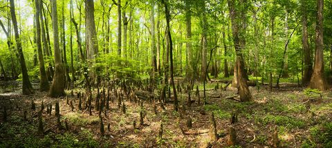
Knees in the water. In the lowest ground the bald cypresses and tupelos stand in the water, and around the cypresses rise their own knobbly “knees”, crowding the old sloughs like a field of wooden stumps. Cedar Creek’s marked canoe trail winds about 15 miles through this wilderness, from Bannister’s Bridge to the Congaree River, past some of the tallest trees in eastern North America, and paddlers watch for river otters, deer, turtles, wading birds and the occasional alligator.
Flood and flame. Two forces shape the park. Down on the floodplain, the river’s floods deposit fresh, nutrient-rich soil. Up on the bluffs along the northern edge, an upland pine forest depends on fire to clear out competing trees and keep open, grassy savannahs, home to the red-cockaded woodpecker, the indigo snake and the southern fox squirrel. Both forests were once everywhere: bottomland forests like this covered about 30 million acres of the South-east and longleaf pine savannahs about 90 million. Only scattered remnants survive.
Saved by a newspaperman. After the Civil War the Chicago lumberman Francis Beidler bought 15,000 acres of the floodplain for its giant cypresses. His family kept the land after the logging stopped and leased it to hunt clubs. A member of one, the newspaper editor Harry Hampton, spent years exploring the floodplain, decided it was the last of its kind and size, and argued for it in his columns. When logging threatened again in the late 1960s, a new generation took up the call, “Congaree Action Now”, and in 1976 Congress made it a national monument. The visitor center bears Hampton’s name, and the clearing where his hunt club stood is on the Sims Trail.
The field notes
A refuge in the woods
For enslaved people on the plantations around the floodplain, this jungle-like wilderness was a refuge. While a few made the long journey north, many instead ran to the woods to live free while staying near their families and supplies. Called maroons, they sometimes lived for years in the forest, facing both slave catchers and the river’s floods, and chose to decide their own future rather than have it decided for them.
The people the river is named for
The park and the river are named for the Congaree people, who once lived in this region. Little is known about them: many are thought to have died in the 1600s and 1700s through warfare and diseases brought by European colonization, and the survivors were absorbed into neighbouring tribes. People have lived on and used this floodplain for at least 10,000 years. The Spanish who came through in the sixteenth century left behind something that is still here: the hogs they brought for food.
The road to the coast
On the quieter east side of the park, the Bates Ferry Trail follows a road that dates back to when South Carolina was a British colony, and may be older still. It runs along a narrow strip of land inside a former bend of the river, now the oxbow lake called Bates Old River. Ferries carried goods across the river here on their way to the coast; the road played its part in the American Revolution, and in 1865 saw a skirmish as General Sherman’s army marched across South Carolina.

June 2013The boardwalk winding through tall bare trunks in winter.
Photograph: NPS, Public domain, cropped

June 2011Cypress knees rising from the forest floor.
Photograph: Congaree National Park, Cypress Knees, CC BY 2.0

April 2021Palmettos under the floodplain trees.
Photograph: cappellacci, Congaree Palmettos, CC BY 2.0, cropped
- Look straight up the tallest tree I could find. (Looked. Kept looking. A needle landed in my eye, which I took as a hint.)
- Count the knobbly wooden points sticking out of the water. (They kept appearing behind each other. The water is very good at hiding things.)
- Paddle the creek without bumping anything. (Bumped a log. Apologised. Bumped it again on the way back. We are now acquainted.)
- Find the quietest spot in the woods. (Found it. Then I sneezed. The woods forgave me, after a while.)
- Wait on the bench for the river to rise. (Waited. It did not. The mosquitoes, on the other hand, arrived promptly.)
A relic from Congaree National Park
Relic, entry 335In an old cypress-tupelo sloughAround the bald cypress
A cypress knee standing up out of a slough. Along the Weston Lake Trail, an old cypress-tupelo slough, a dried-up river bed, is crowded with these knobbly wooden points, sticking up out of the water around the bald cypress trees that grow in the lowest, wettest ground of the floodplain. The boardwalk passes the same cypress and tupelo trees on its way down from the bluff.
Tally, in the marginA wooden knee standing up out of the water with no leg attached, which worried me until I saw dozens more, all perfectly calm about it. I sat on the boardwalk and kept them company. I have never felt so outnumbered by knees.
Getting there
- 1
From Interstate 77
From exit 5, Bluff Road runs east about 8 miles; Old Bluff Road leads 4.5 miles to the park sign.
- 2
By bus
The COMET bus, Route 47, stops outside the visitor center.
- 3
By canoe
A marked canoe trail winds about 15 miles along Cedar Creek.
- ✓
How to get there. From Interstate 77, exit 5, Highway 48 (Bluff Road) runs east for about 8 miles; a slight right onto Old Bluff Road leads 4.5 miles to the park entrance sign, and the Harry Hampton Visitor Center is a mile beyond. For GPS, the park gives the address 100 National Park Road, Hopkins, SC 29061, because some devices go astray on the park’s name. Charlotte is about two hours away up Interstate 77, and Augusta about an hour and 45 minutes. Columbia Metropolitan Airport is about 30 minutes from the park, and Charlotte and Charleston airports about two hours. The COMET bus, Route 47, stops outside the visitor center; ride-share services may not pick up from the park.
When to go. The river floods about ten times a year, and floods can close the backcountry trails and parts of the boardwalk; the elevated part of the boardwalk and the Bluff, Firefly and Longleaf trails stay above it. Mosquitoes are about from mid-spring until mid-autumn.
What to arrange ahead. The park does not rent canoes or kayaks; outfitters in Columbia do, and some hold permits to guide paddling trips in the park. Cell reception in the park is unreliable.
Safety. The State Department’s travel advisories cover other countries, so none applies here. Water levels on Cedar Creek and the river, and current flood alerts, are on the park’s conditions page.
Mark this place
The passport stamp for this place.
Common questions
Is Congaree National Park a swamp?
Mostly a floodplain, which is not quite the same thing. At Congaree National Park the bottomland forest is covered by floodwater from time to time, about ten times a year, while a true swamp has water flowing over it all year; parts of the floodplain are swampy, but not all of it.
How tall are the trees at Congaree?
Very tall: the canopy averages more than 100 feet. Congaree National Park holds the highest concentration of champion-sized trees in North America, and its tallest, a loblolly pine, measured 170 feet.
How often does Congaree flood?
About ten times a year. With almost 80% of Congaree National Park in the floodplain of the Congaree River, floods regularly close the backcountry trails and parts of the boardwalk.
Can you canoe at Congaree National Park?
Yes, on Cedar Creek. A marked canoe trail of about 15 miles winds through the Congaree wilderness from Bannister’s Bridge to the Congaree River; paddlers bring their own boats or rent them in Columbia.
Where is Congaree National Park?
In the Midlands of South Carolina, south-east of Columbia. Congaree National Park is about 30 minutes from Columbia Metropolitan Airport, reached from exit 5 of Interstate 77 by Bluff Road and Old Bluff Road.
Who was Harry Hampton?
The newspaperman who first fought for Congaree. Harry Hampton, a member of a hunt club on the land, wrote columns arguing that the old-growth forest of the Congaree floodplain should be saved; the park’s visitor center is named for him.
Why is it called Congaree?
For the Congaree people. Congaree National Park and the Congaree River take their name from the Congaree people who once lived in this part of South Carolina, about whom little is known.
Photographs on this page
Tap a photograph to see it full size.
Photograph: cappellacci, Bald Cypress, Congaree National Park, CC BY 2.0, cropped
Photograph: NPS, Public domain, cropped
Photograph: Congaree National Park, Cypress Knees, CC BY 2.0
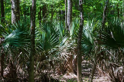
Photograph: cappellacci, Congaree Palmettos, CC BY 2.0, cropped


