Region
North America
Canyons, geysers and great waterfalls, big tides and giant trees, polar bears on the bay, and a walled city above a river.
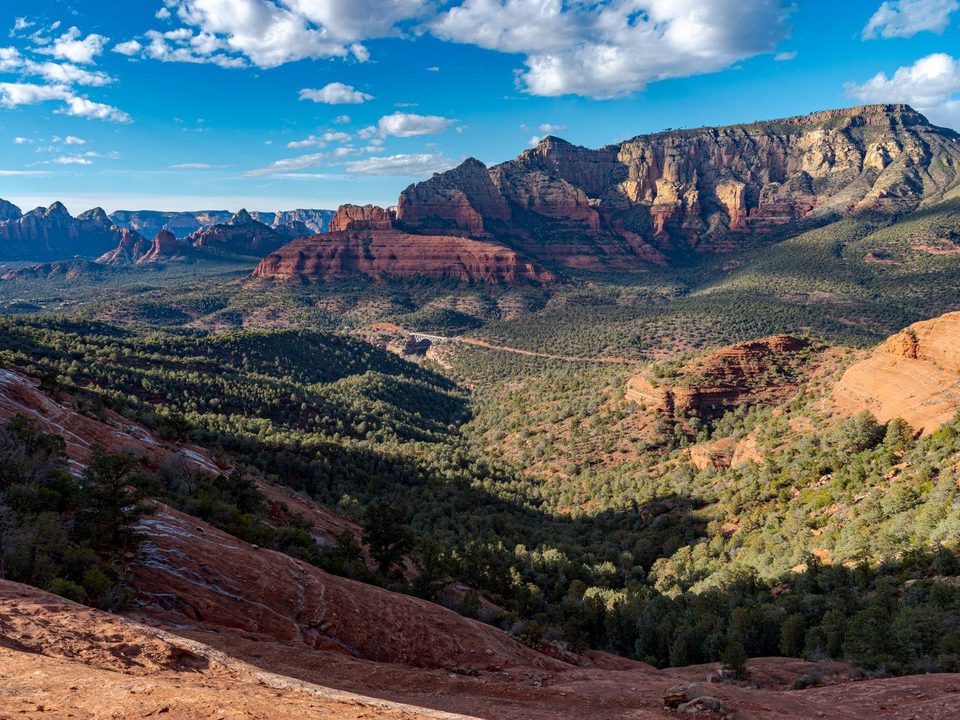
Sedona. Photograph: deborah.soltesz, CC0
North America's places run from the subarctic rivers of Canada and Alaska to the coral keys off southern Florida, and from Atlantic tides to desert dunes and red rock. Many lie inside national parks, the Grand Canyon among them. Others are older human places, such as a Norse camp in Newfoundland and the ceremonial earthworks of Ohio. At the Bay of Fundy the ocean leaves twice a day. Getting in ranges from a paved park road to a ferry, a seaplane or a floatplane; Nahanni, in the Northwest Territories, has no road. Seasons count most in the north: Nahanni's runs from 15 June to 15 September, and the months for Churchill's polar bears are October and November.
104 places in this region
 Gros Morne TablelandsNewfoundland and Labrador
A slab of the Earth's mantle pushed to the surface: orange, barren, and part of the evidence that proved plate tectonics.
 Sequoia National ParkCalifornia
The largest tree on Earth by volume, and a species whose cones can stay sealed for twenty years until fire, a squirrel or a beetle opens them.
 Acadia National ParkMaine
The national park private citizens bought back acre by acre and gave away, with 45 miles of roads built to keep cars out.
 Isle RoyaleMichigan
A wilderness island in Lake Superior where wolves and moose have been studied since 1958: the longest-running predator-prey study on Earth.
 The Dry TortugasFlorida
Sixteen million bricks, seventy miles out to sea: the largest masonry fort in the western hemisphere, never finished and never attacked.
 Brooks FallsAlaska
Brown bears stand at the lip of a waterfall catching leaping salmon: a queue ordered by rank, with a platform for watching it.
 The Bay of FundyNew Brunswick / Nova Scotia
The highest tides on Earth: walk the ocean floor at low water, paddle over your footprints six hours later.
 NahanniNorthwest Territories
Náįlįcho, a waterfall twice Niagara's height, and four great canyons in a roadless reserve: among the first UNESCO sites ever listed.
 SedonaArizona, USA
Sandstone stained by rust, a chapel grown from a cliff, and a town named for the postmaster's wife.
 The cenotes of the YucatánYucatán, Mexico
An asteroid cracked the bedrock in a ring 66 million years ago; the sinkholes tracing that ring today are far younger than the shortcut version says.
 SG̱ang GwaayHaida Gwaii, British Columbia
Cedar mortuary poles left to lean, weather and fall, because the Haida Nation decided they should, and UNESCO's listing accepts it.
 Mammoth CaveKentucky
The longest cave known, and still growing. The 1972 connection that made it so was already on an enslaved guide’s map, drawn from memory in 1842.
 The Hopewell Ceremonial EarthworksOhio
Earthworks aligned to a lunar cycle of 18.6 years: a pattern nobody could establish alone, since a person sees only about three of them in a lifetime.
 Wood Buffalo National ParkAlberta / Northwest Territories
Bigger than Switzerland, with the only wild nesting ground of the whooping crane and a beaver dam found from orbit, and 4,000 visitors a year.
 Great Sand DunesColorado
The tallest dunes in North America exist because two creeks carry the escaping sand back. In late spring one of them runs in waves, every twenty seconds.
 The Florida KeysMonroe County, Florida
A hundred and thirteen miles of highway across open water, built on the piers of a railroad a hurricane destroyed in 1935. The old bridges still run alongside.
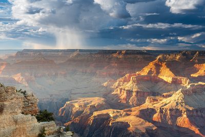 The Grand CanyonArizona, United States
Nearly two billion years of rock, and a hole cut through it that geologists still date three ways: 70 million years for part of it, 5 to 6 million for the whole, or a lake that spilled.
 YellowstoneWyoming, Montana and Idaho, United States
The colours around Yellowstone's hot springs are living microbes. From one small pool off the boardwalks came the bacterium whose enzyme made copying DNA practical.
 Niagara FallsOntario, Canada and New York, United States
A treaty sets how much water goes over Niagara Falls: twice as much by day in the tourist season as at night. The rest goes through tunnels to power stations, and in 1969 the American Falls was turned off.
 BanffAlberta, Canada
Canada's national parks began with a quarrel over a hot spring in 1885. The spring is now closed to bathers, because it is the main home of a snail found nowhere else.
 ChurchillManitoba, Canada
Polar bears gather at Churchill each autumn to wait for Hudson Bay to freeze. The ones that come into town can be held by the province until the ice forms, then let go onto it.
 YosemiteCalifornia, United States
For most of a century a waterfall of burning embers was pushed off a Yosemite cliff every summer night. The Park Service stopped it in 1968. Each February the sun now sets a real waterfall alight.
 ArchesUtah, United States
More than 2,000 sandstone arches stand over a buried salt bed in Utah. One fell in the night in 2008, and the Park Service says new ones form about as fast as old ones fall.
 Crater LakeKlamath County, Oregon, United States
A lake in the collapsed top of a volcano, with no river in or out: rain and snow keep it full. It is the deepest in the United States, and it is a lake seen from the rim.
 Quebec CityQuébec, Canada
The only walled city north of Mexico nearly pulled its walls down in the 1870s. A governor general stopped it, and the gates you walk through were rebuilt afterwards, wider and for show.
 KennecottAlaska, United States
A copper-mill town of red timber buildings above a rubble-covered glacier in Alaska, almost empty since 1938. The road stops at a footbridge, and the last five miles are on foot, by bike or by shuttle.
 Anacapa IslandCalifornia, United States
Three narrow volcanic islets an hour off the California coast, reached by a ladder and 154 stairs, with a forty-foot stone arch at one end and the world’s largest breeding colony of western gulls on top.
 Bisti/De-Na-Zin WildernessNew Mexico, United States
A trail-less badland in north-west New Mexico of grey and rust clay mounds, stone caps on thin necks and petrified logs, with no water and no marked paths. Its rocks record the end of the age of dinosaurs.
 L’Anse aux MeadowsNewfoundland and Labrador, Canada
Grassed-over outlines of Norse turf halls at the northern tip of Newfoundland, the only confirmed Norse site in the Americas. Wood cut there has been dated, by its tree rings and a solar storm, to the year 1021.
 Île BonaventureGaspé Peninsula, Quebec, Canada
A wooded island off Percé at the tip of the Gaspé Peninsula, Quebec, where tens of thousands of pairs of northern gannets nest on the cliff tops. Summer boats cross from Percé; a forest trail leads to the colony.
 Fogo Island (Newfoundland)Newfoundland and Labrador, Canada
The largest of Newfoundland’s offshore islands, a ferry ride from Farewell: old fishing outports of painted wooden houses, icebergs drifting past in spring, and Brimstone Head, one of the four corners of the flat earth, by a joke society’s reckoning.
 White SandsTularosa Basin, New Mexico, United States
A field of dunes made of gypsum, not quartz, in a desert basin of southern New Mexico: bright, cool underfoot and the largest of its kind on Earth, wholly surrounded by a missile range whose tests can shut the road for hours.
 Carlsbad CavernsGuadalupe Mountains, New Mexico, United States
A cave in the Guadalupe Mountains of New Mexico, dissolved by acid from below, whose Big Room is among the largest cave chambers in North America; on summer evenings a colony of free-tailed bats pours out of its natural entrance.
 Spotted LakeSouth Okanagan, British Columbia, Canada
A small lake in the dry hills of southern British Columbia that evaporates each summer into pools of green, blue and yellow minerals: a sacred medicine lake of the Syilx Okanagan Nation, who bought back its land in 2001, and seen, as they ask, from the roadside fence.
 Okefenokee SwampSouth-east Georgia and north-east Florida, United States
A vast, shallow peat swamp on the Georgia–Florida line, with tea-dark water, cypress hung with moss and some of North America’s densest alligator country, which a company once tried to drain, loggers stripped, miners nearly reached, and the world listed as heritage in 2026.
 Racetrack PlayaDeath Valley National Park, Inyo County, California, United States
A dead-flat dry lakebed in the remote north of Death Valley where rocks of up to hundreds of pounds leave long trails across the mud, a puzzle for decades until scientists filmed thin, windblown ice pushing them in December 2013.
 Mistaken PointAvalon Peninsula, Newfoundland and Labrador, Canada
A fog-bound headland at the south-eastern tip of Newfoundland where tilted slabs of ancient deep-sea floor are crowded with the imprints of creatures about 565 million years old, among the first large, complex life on Earth, seen only on a guided walk.
 Going-to-the-Sun RoadGlacier National Park, Montana, United States
Fifty miles across Glacier National Park and over the Continental Divide at Logan Pass, built from 1919 to 1932 with a single switchback west of the Divide where one engineer had wanted fifteen, and opened in full each summer only when the snowplows get through, by early July in most recent years.
 Trail Ridge RoadRocky Mountain National Park, Colorado, United States
Forty-eight miles of US 34 across Rocky Mountain National Park, eleven of them above the trees and up to 12,183 feet, on what the Park Service calls the highest continuous paved road in the United States; open to through travel only from late May to mid-October, and in summer with a timed-entry reservation in the middle of the day.
 Big Sur and Highway 1Monterey County, California, United States
Two lanes cut into mountains that fall straight into the Pacific, on a coast the US Geological Survey counts among the most landslide-prone in the American West; Highway 1 through Big Sur reopened end to end in January 2026 for the first time in almost three years.
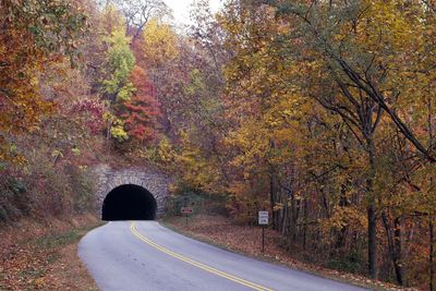 Blue Ridge ParkwayVirginia and North Carolina, United States
A 469-mile two-lane road along the crests of the Appalachians from Virginia to the Great Smokies, begun as a Depression public-works project in 1935 and finished only in 1987; Hurricane Helene closed every mile of it in 2024.
 Natchez Trace ParkwayMississippi, Alabama and Tennessee, United States
A 444-mile two-lane parkway from the Mississippi River at Natchez to the hills south of Nashville, with a 50 mph limit and no commercial traffic, laid along a travel corridor the Park Service says people have used for 10,000 years.
 The Icefields ParkwayBanff and Jasper national parks, Alberta, Canada
Highway 93 North between Lake Louise and Jasper: 232 kilometres along the Continental Divide past glaciers, milky lakes and the Columbia Icefield, with a national park pass required, no cell service along the way, and in winter no fuel or food for the whole distance.
 The Cabot TrailCape Breton Island, Nova Scotia, Canada
A 298-kilometre loop around the northern tip of Cape Breton Island in Nova Scotia, about a third of it through Cape Breton Highlands National Park, where the road climbs onto a plateau of spruce and bog and drops back to the sea again and again; open all year, with a park pass needed for the national park section.
 Great Smoky MountainsTennessee and North Carolina, United States
Old, rounded mountains on the Tennessee–North Carolina line, the most visited national park in the United States, with no entrance fee, more kinds of salamander than almost anywhere, and a few nights each spring when its fireflies flash in step.
 Zion National ParkWashington, Kane and Iron counties, Utah, United States
A canyon in south-western Utah with sandstone walls up to 2,640 feet high, a river you can wade up between them, and Angels Landing, a ridge whose chained final half-mile has needed a lottery permit since 2022.
 Mackinac IslandMackinac County, Michigan, United States
A small limestone island in Lake Huron, off the tip of Michigan, where motor vehicles have been banned since 1898; the town moves by horse, carriage and bicycle, and its shore road is the only state highway in the United States closed to cars.
 CharlestonSouth Carolina, United States
A South Carolina port of pastel houses and church steeples on a peninsula between two rivers, where the Civil War began at a fort in the harbour and Gullah basket makers still coil sweetgrass by the road.
 Bryce Canyon National ParkGarfield and Kane counties, Utah, United States
Not a canyon but a row of natural amphitheatres on the edge of a Utah plateau, 8,000 to 9,000 feet up, crowded with orange and white spires of rock that ice prises loose on more nights of the year than not, under one of the darkest skies in the national parks.
 Santa FeNew Mexico, United States
The capital of New Mexico and the oldest state capital in the US, founded in 1610 nearly 7,000 feet up, a city of low brown adobe buildings that an ordinance of 1957 still requires, with Native artisans under the Palace portal and galleries up Canyon Road.
 BermudaBermuda (British Overseas Territory)
More than 150 limestone islands alone in the North Atlantic, where a red single-celled sea creature tints the beaches pink, the law has every household collect the rain from its own roof, and a harbour town settled in 1612 keeps its old square.
 Grand Teton National ParkTeton County, Wyoming, United States
A short, steep range in north-western Wyoming whose highest peak rises more than 7,000 feet straight out of the sagebrush valley of Jackson Hole, with lakes at its foot, homestead barns on Mormon Row, and the only commercial airport inside a US national park.
 Alabama Hills and Movie RoadInyo County, California, United States
Rounded granite boulders and natural arches west of Lone Pine, California, below Mount Whitney, where the Bureau of Land Management counts more than 400 films shot since 1920 and a stone window called Mobius Arch frames the highest peak in the lower 48 states.
 CelestúnYucatán, Mexico
A fishing town on the north-west coast of the Yucatán, beside a mangrove estuary of 81,482 hectares, a biosphere reserve since 2000, where more than 18,000 American flamingos can gather at some times of year and fresh water from the peninsula’s aquifer rises to meet the sea.
 Isla HolboxQuintana Roo, Mexico
A long, thin fishing island of sand streets and few cars off the north coast of the Yucatán, inside the Yum Balam protected area, where the government’s whale-shark plan opens the swimming season each year from 15 May to 17 September.
 Everglades National ParkMiami-Dade, Monroe and Collier counties, Florida, United States
The southern end of Florida’s slow river of grass: sawgrass marsh, a mangrove coast and alligators beside the boardwalks, set aside in 1947 as the first US national park created for its biodiversity rather than its scenery.
 St. AugustineNorth-east Florida, United States
A Spanish colonial town on Florida’s Atlantic coast, founded in 1565, and its fort of shell stone, the Castillo de San Marcos, whose walls swallowed English cannonballs instead of shattering.
 Florida’s SpringsNorth and central Florida, United States
Clear springs across north and central Florida where manatees gather out of the cold each winter, among them Three Sisters at Crystal River, in what the US Fish and Wildlife Service calls the only refuge created for them. Four stops, and four separate trips.
 The Platte RiverCentral Nebraska, United States
A wide, shallow river in the farm country of central Nebraska where, each March, sandhill cranes come down at sunset in their hundreds of thousands to sleep on the sandbars.
 The Lower Rio Grande ValleyHidalgo County and the lower Rio Grande, Texas, United States
The farmed delta at the southern tip of Texas, where a federal refuge and a chain of small parks keep the last thickets of a vanished woodland, and subtropical birds reach the northern edge of their range.
 Hawk MountainKittatinny Ridge, Pennsylvania, United States
A wooded ridge in Pennsylvania where hawks, eagles and falcons ride the wind south each autumn, counted from the boulders of the world’s first refuge for birds of prey, founded in 1934.
 High IslandUpper Texas Coast, United States
Oak woods on a salt dome above the marshes of the upper Texas coast, where spring songbirds land after crossing the Gulf of Mexico and spoonbills and egrets nest on a rookery island in a pond.
 Bosque del ApacheSocorro County, New Mexico, United States
A wildlife refuge on the Rio Grande in the New Mexico desert, where staff flood fields and marshes each winter for tens of thousands of sandhill cranes, snow geese and ducks.
 Chiricahua National ParkArizona, United States
A small national park of rhyolite pinnacles and balanced rocks on a sky-island range in south-eastern Arizona, renamed from a national monument in October 2026, with a guest-ranch fireplace built from stones carved by Buffalo Soldiers.
 DenaliAlaska, United States
Six million acres of Alaskan wilderness crossed by a single road, most of it open only to buses in summer, around North America’s highest peak, and patrolled in winter by the Park Service’s only sled dogs.
 Mesa VerdeColorado, United States
Nearly 5,000 Ancestral Pueblo sites on a tilted green tableland in south-western Colorado, including about 600 villages built into cliff alcoves, entered by ladder on ranger-led tours.
 Gates of the ArcticAlaska, United States
A national park in Alaska’s Brooks Range, wholly north of the Arctic Circle, with no roads, trails, signs or visitor facilities inside it: visitors fly in by small plane or walk in, and must bring everything they need.
 Glacier BayAlaska, United States
Fjords and tidewater glaciers west of Juneau, where the ice that filled the inlet in 1794 has pulled back far up the bay, and most visitors arrive on a cruise ship that does not dock in the park.
 Olympic National ParkWashington, United States
One park with three landscapes on a Washington peninsula: glacier-capped mountains, a rain forest where trees grow on fallen logs, and 73 miles of wilderness coast, where the largest dam removal in US history let a river run free again.
 Big Bend National ParkTexas, United States
A Texas desert park on the great bend of the Rio Grande, with a whole mountain range inside it, more than 450 bird species, a homesteader’s hot spring bubbling up through an old bathhouse floor, and the darkest skies of any park unit in the lower 48, the Park Service says.
 Channel Islands National ParkCalifornia, United States
Five islands off the southern California coast, reached only by boat, where a fox the size of a housecat, found nowhere else on Earth, was brought back from fifteen animals on two islands, and where one of the largest sea caves in the world is coloured by its own rock, lichen and algae.
 Joshua Tree National ParkCalifornia, United States
A southern California park where the Mojave and Colorado deserts meet, named for a spiky yucca that DNA put in the agave family, with granite boulders, a cactus garden that may be one single plant, dark skies, and a national monument a determined gardener campaigned into being in 1936.
 Petrified Forest National ParkArizona, United States
An Arizona park of striped badlands strewn with tree trunks turned to quartz more than 200 million years ago and cracked into lengths that look sawn, with an eight-room pueblo built of the stone wood, a 1932 car on the old Route 66, and the Painted Desert along its north end.
 Shenandoah National ParkVirginia, United States
A road that rides the crest of the Blue Ridge for 105 miles, past stone-walled overlooks built in the 1930s, waterfalls in the hollows and several hundred black bears in the woods below.
 Mount Rainier National ParkWashington, United States
A 14,410-foot volcano wearing more ice than any other peak in the lower 48, ringed by wildflower meadows and old forest, where Paradise once measured more snow in a winter than anywhere on Earth.
 Redwood National and State ParksCalifornia, United States
The tallest trees on Earth, on a foggy northern California coast: old-growth coast redwoods up to 379 feet, elk in the meadows, 40 miles of wild shore, and condors flying again after more than a century away.
 Canyonlands National ParkUtah, United States
A high-desert wilderness in south-east Utah where the Green and Colorado rivers meet and split the land into four districts no road joins: a mesa on cliffs 1,000 feet high, forests of stone spires, a maze, and life-sized figures painted on a canyon wall.
 Saguaro National ParkArizona, United States
More than two million giant saguaros in two halves either side of Tucson, Arizona: cacti that flower by night, house owls and woodpeckers in their trunks, and wait 60 to 75 years before they grow their first arms.
 Glacier National ParkMontana, United States
A million acres of the Rocky Mountains on the Canadian border, built of red and green rock from an ancient sea, with fossils 1.5 billion years old, a peak that sends its rain to three oceans, and the glaciers the park was named for.
 Badlands National ParkSouth Dakota, United States
Striped buttes and spires that wear away about an inch a year, giving up fossils of ancient mammals as they go, in a sea of prairie where bison graze again.
 Black Canyon of the Gunnison National ParkColorado, United States
A gorge so deep, steep and narrow that its rims nearly face each other across the dark, with Colorado's highest cliff striped in pink crystal and no bridge from one side to the other.
 Capitol Reef National ParkUtah, United States
A wrinkle of red cliffs and white domes nearly 100 miles long, with thousand-year-old rock carvings and, in the middle of the desert, a pioneer orchard where anyone may pick the fruit in season.
 Congaree National ParkSouth Carolina, United States
The largest old-growth bottomland forest left in North America, with more champion trees than anywhere else on the continent and a river that floods through it about ten times a year.
 Gateway Arch National ParkMissouri, United States
A stainless-steel arch 630 feet tall and exactly as wide, ridden to the top in tilting little pods, beside the courthouse where Dred and Harriet Scott sued for their freedom.
 Guadalupe Mountains National ParkTexas, United States
The highest point in Texas, on top of a reef built in a tropical sea 265 million years ago, with a canyon of autumn colour on one side of the mountains and white gypsum dunes on the other.
 Indiana Dunes National ParkIndiana, United States
Sand dunes on the southern shore of Lake Michigan, where the science of ecology took root in the 1890s, with more native orchids than Hawaii and commuter trains stopping inside the park.
 Kenai Fjords National ParkAlaska, United States
An icefield that catches about 60 feet of snow each winter, sending glaciers down the mountains to fjords where seals rest on floating ice and whales feed.
 Lake Clark National Park and PreserveAlaska, United States
Four million roadless acres of volcanoes, glacier-fed lakes and bear-filled coast, reached only by small plane, where a man built a cabin with hand tools and lived in it for thirty years.
 Lassen Volcanic National ParkCalifornia, United States
All four kinds of volcano in one corner of northern California, a peak that erupted in 1914 and 1915, a basin of boiling pools and roaring steam, and snow that can lie 30 feet deep.
 New River Gorge National Park and PreserveWest Virginia, United States
A river with a young name that may be one of the oldest in the world, cutting a deep forested gorge of whitewater and coal towns, spanned by a steel arch 876 feet above the water.
 Biscayne National ParkFlorida, United States
A national park that is 95 per cent water, within sight of Miami's towers: a clear, shallow bay, mangroves, the first of the Florida Keys and a coral reef ten miles out.
 Cuyahoga Valley National ParkOhio, United States
A green river valley between Cleveland and Akron, on a river that once caught fire: a canal towpath, a 60-foot waterfall, beavers back in the marsh and bald eagles nesting by the water.
 Great Basin National ParkNevada, United States
A mountain island in the Nevada desert, with bristlecone pines thousands of years old near its summit, a marble cave full of rare formations at its foot, and some of the clearest night skies in the country.
 Hot Springs National ParkArkansas, United States
A national park in the middle of a town, where rain that fell about 4,400 years ago comes up from deep underground at 143°F beside a street of grand old bathhouses.
 Kings Canyon National ParkCalifornia, United States
A granite canyon carved by ice and a roaring river, and up the road in Grant Grove, the second-largest tree on Earth, which has served as the Nation's Christmas Tree since 1926.
 North Cascades National ParkWashington, United States
Jagged mountains in northern Washington hung with more than 300 glaciers, with more kinds of plant than any other US national park, and a valley at the end of a long lake that no road reaches.
 Pinnacles National ParkCalifornia, United States
The jagged spires of half a volcano that erupted near Los Angeles and rode the San Andreas Fault 195 miles north, with caves under fallen boulders and California condors overhead.
 Theodore Roosevelt National ParkNorth Dakota, United States
Painted badlands along the Little Missouri River where a young Theodore Roosevelt came to hunt bison, stayed to ranch and to grieve, and found the ideas that made him a great conservationist.
 Voyageurs National ParkMinnesota, United States
A park of big lakes and rocky islands on the Canadian border, on the old canoe route of the fur traders, where much of the exploring is done by boat and the rock is half as old as the Earth.
 Wind Cave National ParkSouth Dakota, United States
A cave whose small natural entrance breathes hard enough to blow a hat off, with more boxwork than all the other caves on Earth together, under a prairie where bison graze.
 Death Valley National ParkCalifornia and Nevada, United States
The hottest, driest and lowest place in North America: salt flats 282 feet below sea level, dunes, painted canyons and, after a good winter's rain, hillsides of wildflowers.
 Katmai National Park and PreserveAlaska, United States
A roadless stretch of the Alaska Peninsula where the 20th century's greatest eruption buried a valley in ash, with at least 14 active volcanoes, a wild Pacific coast and brown bears fattening on salmon.
 Rocky Mountain National ParkColorado, United States
Sixty peaks over 12,000 feet on the Continental Divide, with elk in the meadows, pikas on the tundra and, in a few miles of climbing, a change of landscape like a drive from Denver to Alaska.
 Wrangell–St. Elias National Park and PreserveAlaska, United States
The largest national park in the United States, as big as six Yellowstones: four mountain ranges, nine of the country's 16 highest peaks, a volcano that still steams and glaciers big enough to grow forests on.
About this hub
Nearby on the shelf
- The US National Parks (collection, 56)
- Canada (collection, 10)
- The whole map
Know somewhere that belongs here?
Each place page names its sources and the date it was checked.
Photo credits for the thumbnails
- Gros Morne Tablelands: Photograph: Dunmaghlas, CC BY-SA 4.0, cropped
- Sequoia National Park: Photograph: NPS, Public domain, cropped
- Acadia National Park: Photograph: Victoria Stauffenberg, Public domain (PD-USGov, US National Park Service)
- Isle Royale: Photograph: Tony Webster from Minneapolis, Minnesota, United States, Lake Superior Shore at Isle Royale National Park, CC BY 2.0, cropped
- The Dry Tortugas: Photograph: Melissa Clark, CC BY-SA 4.0, cropped
- Brooks Falls: Photograph: Christoph Strässler from Oberdorf BL, Schweiz, Brown Bears at Brooks Falls, Katmai National Park, CC BY-SA 2.0, cropped
- The Bay of Fundy: Photograph: The Cosmonaut, Sea stacks - Hopewell Rocks1, CC BY-SA 2.5 CA, cropped
- Nahanni: Photograph: Paul Gierszewski (Gierszep), Public domain, cropped
- Sedona: Photograph: deborah.soltesz, CC0
- The cenotes of the Yucatán: Photograph: dronepicr, Beautiful Cenote Samula in Valladolid, Mexico, CC BY 2.0, cropped
- SG̱ang Gwaay: Photograph: Christine Rondeau, Gwaii Haanas National Park, CC BY 2.0, cropped
- Mammoth Cave: Photograph: Jackie Wheet, NPS via NPGallery, Public domain (PD-USGov, US National Park Service), cropped
- The Hopewell Ceremonial Earthworks: Photograph: amanderson2 via Flickr, Seip Mound Hopewell Culture National Historic Park, CC BY 2.0, cropped
- Wood Buffalo National Park: Photograph: Naturedata, CC0, cropped
- Great Sand Dunes: Photograph: Patrick Myers, NPS via NPGallery, Public domain (PD-USGov, US National Park Service)
- The Florida Keys: Photograph: Kimon Berlin, Old Bahia Honda Bridge, CC BY-SA 2.0, cropped
- The Grand Canyon: Photograph: Romain Guy, CC0, cropped
- Yellowstone: Photograph: NPS / Jacob W. Frank, Public domain
- Niagara Falls: Photograph: Maksim Sokolov, CC BY-SA 4.0
- Banff: Photograph: TerryDOtt, Sunrise Reflections - Lake Louise, Alberta, Canada, CC BY 2.0, cropped
- Churchill: Photograph: Emkmiller100, CC BY-SA 4.0
- Yosemite: Photograph: Aram via Unsplash, Unsplash licence
- Arches: Photograph: Jacob W. Frank, National Park Service, Public domain
- Crater Lake: Photograph: Trougnouf (Benoit Brummer), CC BY 4.0, cropped
- Quebec City: Photograph: Wilfredor, CC BY-SA 4.0, cropped
- Kennecott: Photograph: NPS / Matthew Yarbrough, Kennecott Mill Town - 22446654985, CC BY-SA 2.0
- Anacapa Island: Photograph: Shauna Bingham, CINMS, NOAA, Public domain (PD-USGov-NOAA), cropped
- Bisti/De-Na-Zin Wilderness: Photograph: Bureau of Land Management (Bob Wick), Public domain (PD-USGov, Bureau of Land Management)
- L’Anse aux Meadows: Photograph: Gordon Leggett, CC BY-SA 4.0, cropped
- Île Bonaventure: Photograph: Andrea Schaffer, Bonaventure Island, CC BY 2.0
- Fogo Island (Newfoundland): Photograph: Paul Asman and Jill Lenoble, Fogo and Brimstone Head, CC BY 2.0
- White Sands: Photograph: Krzysztof Ziarnek, Kenraiz, CC BY-SA 4.0
- Carlsbad Caverns: Photograph: National Park Service, Daniel Leifheit, Public domain (PD-USGov, US National Park Service)
- Spotted Lake: Photograph: Christoph Strässler, CC BY-SA 4.0, cropped
- Okefenokee Swamp: Photograph: Fsendek1904, CC BY-SA 4.0
- Racetrack Playa: Photograph: Romain Guy, CC0, cropped
- Mistaken Point: Photograph: Tracyanne, CC BY-SA 4.0, cropped
- Going-to-the-Sun Road: Photograph: NPS, Public domain
- Trail Ridge Road: Photograph: DXR, CC BY-SA 4.0, cropped
- Big Sur and Highway 1: Photograph: King of Hearts, Bixby Creek Bridge May 2011 002, CC BY-SA 3.0
- Blue Ridge Parkway: Photograph: Carol M. Highsmith, Library of Congress, Public domain, cropped
- Natchez Trace Parkway: Photograph: Carol M. Highsmith, Library of Congress, Public domain, cropped
- The Icefields Parkway: Photograph: Ethan Sahagun, CC BY-SA 4.0
- The Cabot Trail: Photograph: Eric Van Lochem, CC BY-SA 4.0, cropped
- Great Smoky Mountains: Photograph: Brett Meliti via Unsplash, Unsplash licence
- Zion National Park: Photograph: Stin-Niels Musche via Unsplash, Unsplash licence
- Mackinac Island: Photograph: P. Hughes, CC BY 4.0, cropped
- Charleston: Photograph: Daniel Vorndran / DXR, CC BY-SA 4.0, cropped
- Bryce Canyon National Park: Photograph: King of Hearts, CC BY-SA 4.0, cropped
- Santa Fe: Photograph: Daniel Schwen, CC BY-SA 4.0
- Bermuda: Photograph: P. Hughes, CC BY-SA 4.0, cropped
- Grand Teton National Park: Photograph: Brady Stoeltzing via Unsplash, Unsplash licence
- Alabama Hills and Movie Road: Photograph: Jesse Pluim / Bureau of Land Management, Public domain, sensor-dust specks removed
- Celestún: Photograph: Gildardo Sánchez, Flamingos, Celestún Mayo 2014, CC BY 2.0, cropped
- Isla Holbox: Photograph: Michiel Ton via Unsplash, Unsplash licence
- Everglades National Park: Photograph: G. Gardner, NPS via Flickr, Public domain (PD-USGov, US National Park Service)
- St. Augustine: Photograph: Philip Davis via Unsplash, Unsplash licence, cropped
- Florida’s Springs: Photograph: Keith Ramos / USFWS via USFWS, Public domain (PD-USGov, US Fish and Wildlife Service), cropped
- The Platte River: Photograph: Tom Koerner / USFWS, Public domain, cropped
- The Lower Rio Grande Valley: Photograph: Mark Olsen via Unsplash, Unsplash licence, cropped
- Hawk Mountain: Photograph: Nicholas A. Tonelli, Flickr - Nicholas T - Far View, CC BY 2.0, cropped
- High Island: Photograph: Frank Schulenburg, CC BY-SA 4.0, cropped
- Bosque del Apache: Photograph: Jason Crotty, Sandhill Crane and Snow Geese, CC BY 2.0
- Chiricahua National Park: Photograph: Jonathan Flash, Inspiration Point Chiricahua Arizona, CC BY 2.0, cropped
- Denali: Photograph: NPS Photo / Emily Mesner, Public domain, cropped
- Mesa Verde: Photograph: National Park Service, Public domain
- Gates of the Arctic: Photograph: Sean Tevebaugh, NPS, Public domain
- Glacier Bay: Photograph: Yvrsigmatech, Margerie Glacier, Tarr Inlet, CC BY 2.0
- Olympic National Park: Photograph: NPS Photo / Fagerlund, Public domain, cropped
- Big Bend National Park: Photograph: Carol M. Highsmith, Public domain, cropped
- Channel Islands National Park: Photograph: Björn S..., Potato Harbor, CC BY-SA 2.0, cropped
- Joshua Tree National Park: Photograph: NPS / Brad Sutton, Public domain
- Petrified Forest National Park: Photograph: VALOHAZ, CC0, cropped
- Shenandoah National Park: Photograph: NPS / Luca Pfeiffer, Public domain
- Mount Rainier National Park: Photograph: Dllu, CC BY-SA 4.0, cropped
- Redwood National and State Parks: Photograph: Alexey Komarov, CC BY-SA 4.0
- Canyonlands National Park: Photograph: Myrabella / Wikimedia Commons, CC BY-SA 4.0, cropped
- Saguaro National Park: Photograph: NPS / Todd M. Edgar, Public domain
- Glacier National Park: Photograph: NPS / Tim Rains, Public domain, cropped
- Badlands National Park: Photograph: Krzysztof Ziarnek, Kenraiz, CC BY-SA 4.0, cropped
- Black Canyon of the Gunnison National Park: Photograph: Massimo Catarinella, BlackCanyonoftheGunnisonNationalPark, CC BY-SA 3.0
- Capitol Reef National Park: Photograph: Nur Nafis Naim, CC BY 4.0, cropped
- Congaree National Park: Photograph: cappellacci, Bald Cypress, Congaree National Park, CC BY 2.0, cropped
- Gateway Arch National Park: Photograph: Daniel Schwen, CC BY-SA 4.0
- Guadalupe Mountains National Park: Photograph: Carl Young, CC BY-SA 4.0, cropped
- Indiana Dunes National Park: Photograph: Matthew Dillon, Indiana Dunes National Park, CC BY 2.0, cropped
- Kenai Fjords National Park: Photograph: NPS, Public domain
- Lake Clark National Park and Preserve: Photograph: NPS / Buck Mangipane, Public domain, cropped
- Lassen Volcanic National Park: Photograph: NPS, Public domain, cropped
- New River Gorge National Park and Preserve: Photograph: Andrew Heneen, CC BY 4.0, cropped
- Biscayne National Park: Photograph: NPS / Judd Patterson, Public domain
- Cuyahoga Valley National Park: Photograph: Erik Drost, CC BY 4.0, cropped
- Great Basin National Park: Photograph: Ken Lund, Wheeler Peak, Great Basin National Park, Nevada132, CC BY-SA 2.0, cropped
- Hot Springs National Park: Photograph: daveynin, Buckstaff Bathhouse, CC BY 2.0, cropped
- Kings Canyon National Park: Photograph: Carson Chiavatti, CC BY-SA 4.0, cropped
- North Cascades National Park: Photograph: NPS / Deby Dixon, Public domain, cropped
- Pinnacles National Park: Photograph: Brocken Inaglory, Rock formations at Pinnacles National Park 2, CC BY-SA 3.0, cropped
- Theodore Roosevelt National Park: Photograph: Acroterion, CC BY-SA 4.0, cropped
- Voyageurs National Park: Photograph: NPS, Public domain, cropped
- Wind Cave National Park: Photograph: NPS, Public domain, cropped
- Death Valley National Park: Photograph: King of Hearts / Wikimedia Commons, Zabriskie Point Death Valley December 2013 001, CC BY-SA 3.0, cropped
- Katmai National Park and Preserve: Photograph: NPS / Lian Law, Public domain
- Rocky Mountain National Park: Photograph: National Park Service, Public domain, cropped
- Wrangell–St. Elias National Park and Preserve: Photograph: NPS / Jacob W. Frank, Public domain