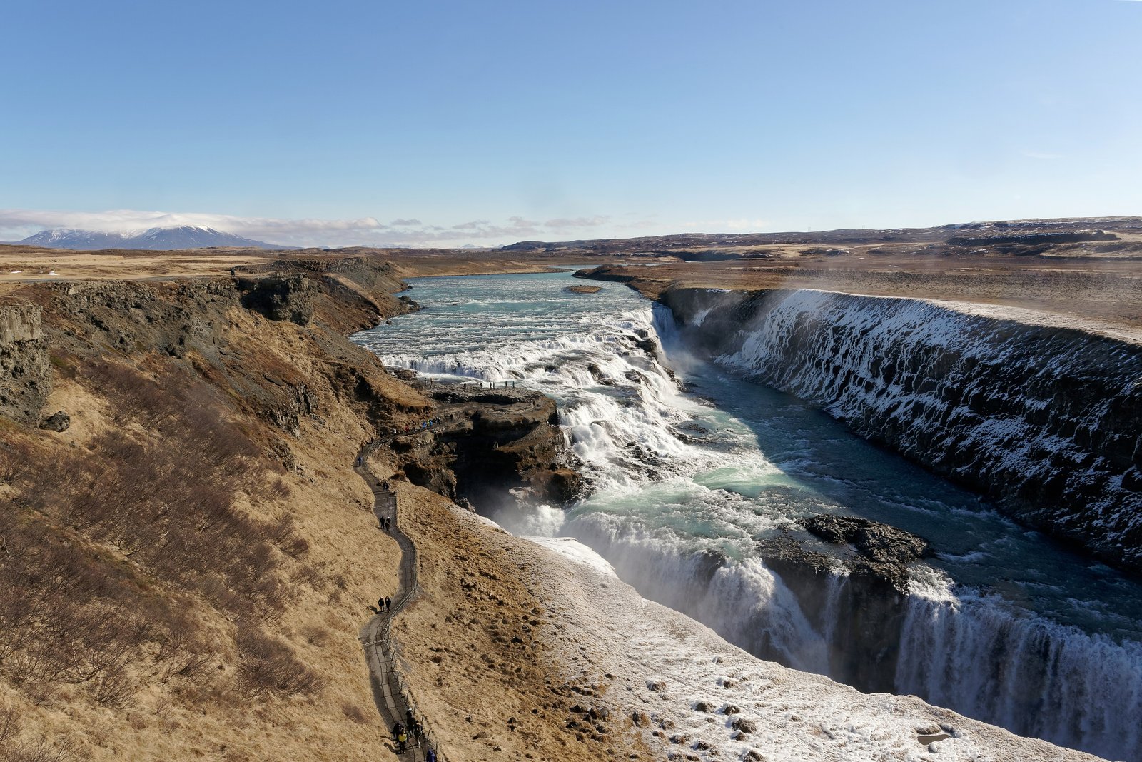

- Where
- Hvítá river, south-west Iceland
- Coordinates
- 64.3269° N
20.1211° W - The drops
- Upper 11 m, lower 20 m
(Environment Agency; Wikipedia: 21 m) - Canyon
- About 2.5 km long, 70 m deep
(Environment Agency) - Protected
- 9 March 1979
- Memorial
- Sigríður Tómasdóttir
(1871–1957) - Advisory
- Iceland Level 1
Flat brown moor, no trees, a wind that never once let up, and a grey river that still seemed to remember being ice. It turned a corner, stepped down twice and then dropped sideways into the ground as if through a trapdoor. The spray came up the path to meet me. At the top a small stone face was watching the water, so I stood beside it and watched too.
The short answer
Gullfoss, the “Golden Falls”, is a waterfall on the Hvítá in south-west Iceland. The river is fed by the Langjökull and Hofsjökull glaciers, according to the Environment Agency of Iceland, and at Gullfoss it turns sharply west, runs down a broad, curved staircase of rock and then plunges in two stages into a canyon that lies across its path. The agency gives the upper fall as 11 metres and the lower as 20, 32 metres in all over three steps, and the canyon, Gullfossgljúfur, as about 2.5 km long and 70 metres deep; Wikipedia gives the lower fall as 21 metres. Wikipedia’s figures for the flow are 141 cubic metres a second on average in summer and 80 in winter. Gullfoss is one of Iceland’s most visited sights and part of the Golden Circle day trip with Þingvellir and Geysir, and has been a protected area since 9 March 1979.
Why it's worth knowing
Most tellings of Gullfoss’s story say a woman saved it. The records differ on how.
Early in 1907, the Environment Agency’s history of the falls says, an Englishman asked about buying Gullfoss, and Tómas Tómasson of the farm of Brattholt answered: “I will not sell my friend.” The falls were rented all the same. Wikipedia’s account says its owners, Tómas and Halldór Halldórsson, leased it, indirectly, to foreign investors who planned to generate electricity. Tómas’s daughter Sigríður Tómasdóttir, born at Brattholt in 1871, had grown up guiding visitors to the falls with her sisters; by the agency’s account they built the first path down to it. She fought the lease. Wikipedia records that she made many trips of about 120 km to Reykjavík, by some accounts on foot, took legal action with the lawyer Sveinn Björnsson, later Iceland’s first president, and reportedly threatened to throw herself into the falls.
Her case did not win in court. Wikipedia’s article on her says her legal efforts failed but won her public attention, and its article on the falls says the investors’ attempts failed partly for lack of money. The Environment Agency records the ending plainly: in 1928 the rent for the falls stopped coming, and the rental agreement became void. The agency also says she “was victorious in the end”, and both can be true. She won the argument; the money ran out on the scheme. A memorial to her was built by the falls in 1978, and on 9 March 1979 the minister of education signed the order protecting Gullfoss.
The field notes
Two ideas about a canyon
The Environment Agency describes two theories of how the canyon formed. In one, a great glacial outburst flood at the end of the last ice age cut it at a stroke; in the other, the Hvítá has been cutting it steadily since the glacier began to melt. The agency considers the second the more plausible. The falls themselves step over hard layers of dolerite, with a softer sediment layer of conglomerate, mudstone and gravel between them, which the agency says shows 8 metres thick in the falls and 40 metres at the canyon’s mouth.
The land and the stone
The ending took decades. The Environment Agency records that on 11 December 1976 part of the Brattholt land was given to the Nature Conservation Council, on condition that it be fenced by the end of 1977 and used only in the spirit of the Nature Conservation Act; Wikipedia’s account says the falls were later sold to the state. Sigríður died in 1957 and is buried in the churchyard at Haukadalur. Her memorial above the falls, a relief of her profile, is the work of the sculptor Ríkarður Jónsson, by Wikipedia’s account, and a nature-conservation award in Iceland carries her name.
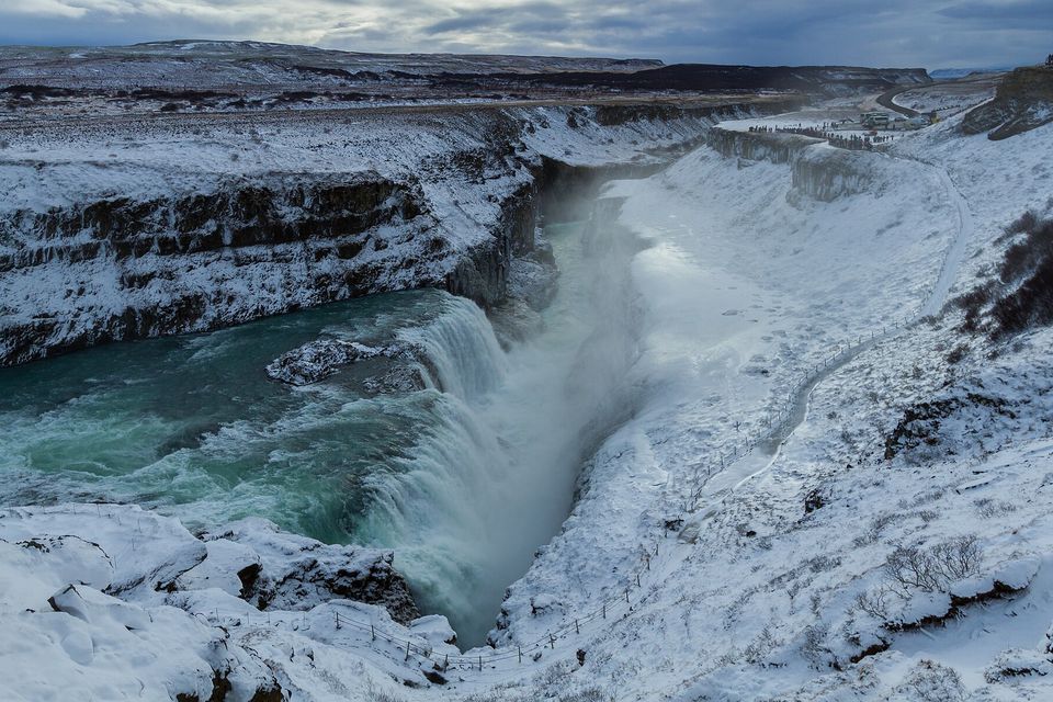
Gullfoss in February 2017, the river still falling between banks of snow.
Photograph: Pierre-Selim Huard · CC BY 4.0 · cropped
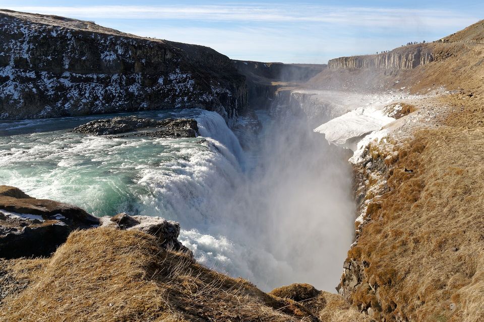
Gullfoss, where the river drops into the gorge in a cloud of spray, May 2023.
Photograph: Jakub Hałun · CC BY-SA 4.0
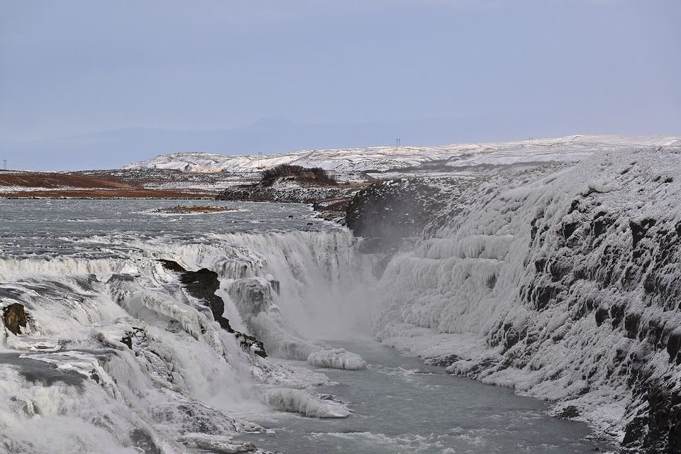
The Hvítá cascades down the upper fall while ice crusts the far canyon wall, February 2026.
Photograph: G. Edward Johnson · CC BY 4.0
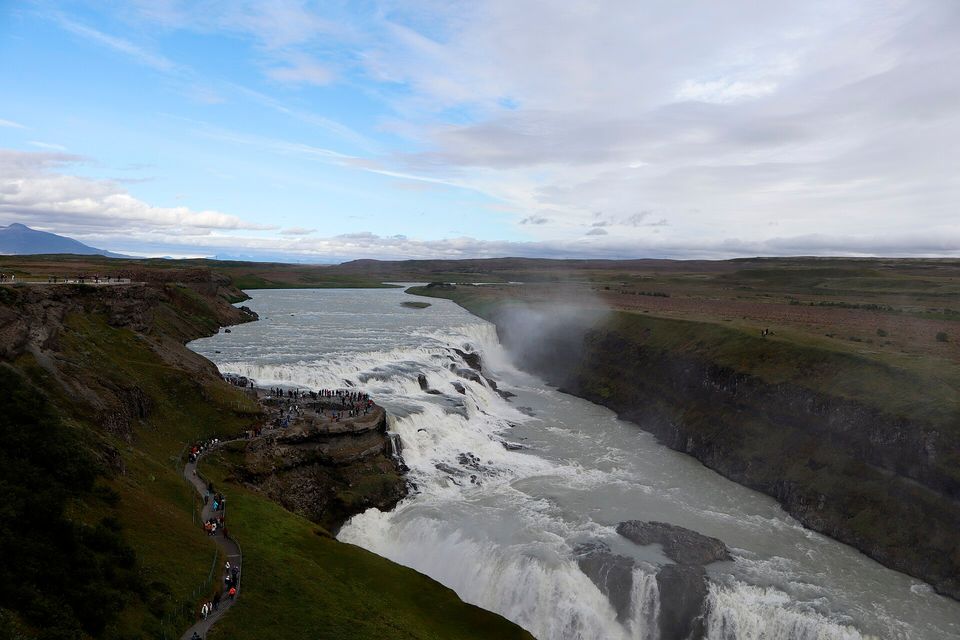
The lower path to the rock ledge beside the falls, busy with visitors, August 2026.
Photograph: Syrio · CC BY-SA 4.0
- Look down from the top first, then take the lower path out towards the edge, if it is open, and feel the noise through your feet.
- Wear something that does not mind being rained on from below.
- Read the list out loud at the edge of the falls. Not one word of it could be heard, and it has never sounded better.
- Stop at the stone face at the top and say thank you, whoever you believe saved it.
- Come back in winter, when the spray freezes on everything, and keep well inside the ropes.
The stone face above the falls. A memorial to Sigríður Tómasdóttir of Brattholt, a relief of her profile by the sculptor Ríkarður Jónsson, set up beside the falls in 1978, near the path she and her sisters first made for visitors. She spent years fighting the lease that would have turned Gullfoss into electricity. The court did not side with her, and the lease lapsed when the rent stopped, but the falls were never dammed, and it is her face, not the investors’, that looks down at the water.
Tally, in the marginI had been introducing her all afternoon as the lady who watches the falls. I shall need a bigger word than watches.
Getting there
How to get there. Gullfoss is on the Golden Circle, a loop of about 250 km from Reykjavík and back that also takes in Þingvellir and Geysir, according to Visit South Iceland. It is reached by car or on a day tour from the capital.
At the falls. A path runs along the top of the canyon, and a lower path leads out towards the edge of the falls. In winter, Iceland Review and Visit South Iceland warn, spray freezes into sheets of ice on the rocks that slope to the canyon edge, and the lower trails are sometimes closed; the only warning may be a sign or a rope. Check SafeTravel.is before you go, and stay inside the ropes.
When to go. Summer brings the heaviest flow and long evenings. Winter brings ice formations and short days, and closed paths on some of them.
Safety. The State Department has Iceland at Level 1, exercise normal precautions. Its advisory notes quickly changing weather, dangerous natural features, active volcanoes and earthquakes, with no area-specific warnings; the recent eruptions on the Reykjanes peninsula are about 120 km from Gullfoss, by this entry’s measurement.
Mark this place
Common questions
How tall is Gullfoss?
Gullfoss drops in two main stages. The Environment Agency of Iceland gives the upper fall as 11 metres and the lower as 20, 32 metres in all over three steps; Wikipedia gives the lower fall as 21 metres. The water plunges into Gullfossgljúfur, a canyon the agency describes as about 2.5 km long and 70 metres deep.
Who saved Gullfoss?
Sigríður Tómasdóttir (1871–1957), daughter of one of the owners of Gullfoss, is credited with saving it from a hydroelectric scheme. She fought the lease to foreign investors with the lawyer Sveinn Björnsson; her case failed in court, but the Environment Agency of Iceland records that the lease became void in 1928 when the rent stopped. A memorial to her stands above the falls.
Did Sigríður Tómasdóttir threaten to throw herself into Gullfoss?
Wikipedia’s account says Sigríður Tómasdóttir reportedly threatened to throw herself into Gullfoss during her campaign against the lease of the falls for hydroelectric power in the early twentieth century. Wikipedia marks the story as reported rather than established.
When was Gullfoss protected?
Iceland’s minister of education signed the order protecting Gullfoss on 9 March 1979, according to the Environment Agency of Iceland. Part of the neighbouring Brattholt farmland had been given to the Nature Conservation Council in December 1976, and a memorial to Sigríður Tómasdóttir was built by the falls in 1978.
Where is Gullfoss?
Gullfoss is on the Hvítá river in south-west Iceland, between the municipalities of Bláskógabyggð and Hrunamannahreppur. It is one of the three main stops on the Golden Circle day trip from Reykjavík, with Þingvellir and Geysir; Visit South Iceland gives the whole loop as about 250 km.
Can you visit Gullfoss in winter?
Yes, but the lower paths at Gullfoss are sometimes closed in winter, when spray freezes on the rocks that slope towards the canyon edge, according to Iceland Review and Visit South Iceland. Check SafeTravel.is for closures and keep inside the ropes.
How was the Gullfoss canyon formed?
The Environment Agency of Iceland describes two theories for the Gullfoss canyon: a single glacial outburst flood at the end of the last ice age, or steady erosion by the Hvítá river since the glacier began to retreat. The agency considers steady erosion the more plausible. The falls step over layers of dolerite.
Is Gullfoss the same place as Þingvellir?
No. Gullfoss is a waterfall on the Hvítá river; Þingvellir is a rift valley and national park about 50 km to the west, where Iceland’s assembly met in the open air. Both are stops on the Golden Circle day trip from Reykjavík, along with the geothermal area at Geysir.