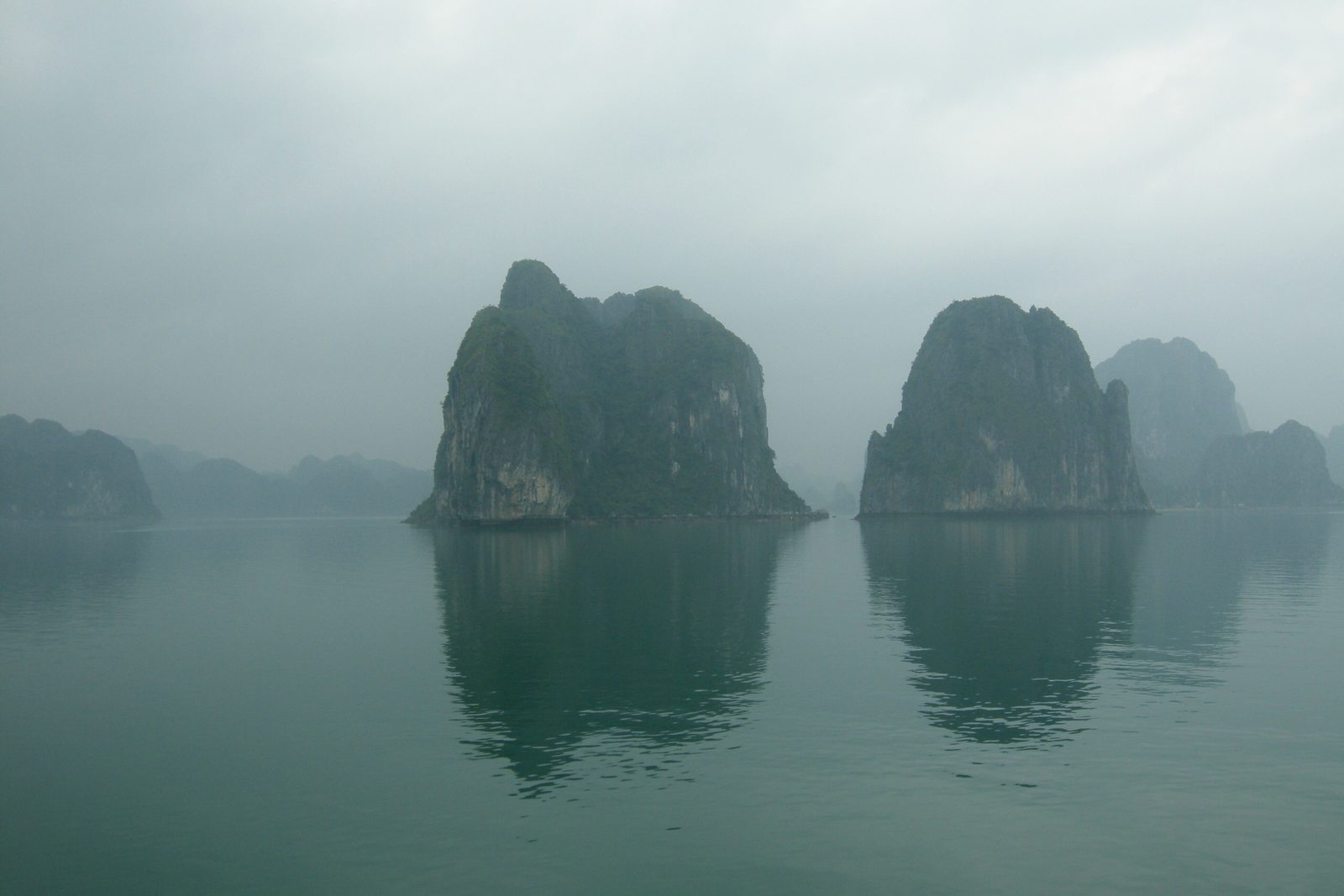

- Where
- Gulf of Tonkin,
Quang Ninh province, Vietnam - Coordinates
- 20.9000° N
107.2000° E - Islands
- About 1,600 (UNESCO);
1,969 in the wider bay (Wikipedia) - The towers
- Mostly 50–100 m high,
up to six times taller than wide - Status
- UNESCO 1994 and 2000;
extended with Cat Ba in 2023 - The name
- Hạ Long,
“descending dragon” - Best visited
- By boat, with an eye
on the weather
Woke on a boat to a mist full of stone: steep towers with jungle on their heads, standing straight up out of flat green water, each one nibbled in at the waterline. A woman rowed me through a tunnel so low I ducked, into a round lake with no other way in. Houses floated past with dogs on the porches. I gave up counting towers and waved at them instead.
The short answer
Ha Long Bay is an area of the Gulf of Tonkin off north-eastern Vietnam, in Quang Ninh province, filled with steep limestone islands. UNESCO inscribed it in 1994 and, for its geology, in 2000; in 2023 it extended the property to take in the neighbouring Cat Ba Archipelago, under Hai Phong, and renamed it Ha Long Bay – Cat Ba Archipelago. UNESCO’s description of the extended property gives 65,650 hectares and 1,133 islands and islets; its shorter description of the bay speaks of some 1,600. Wikipedia’s account gives the wider bay as about 1,553 square kilometres with 1,969 islets, of which 989 have names and about 40 are inhabited. The name Hạ Long means descending dragon; Wikipedia’s account says it does not appear in the country’s old books before the nineteenth century, and turns up in the late nineteenth century on a French maritime chart.
Why it's worth knowing
The postcard shows islands. The geology says hills. Wikipedia’s account of the bay’s karst describes most of the islands as individual towers of a classic fenglin, or tower-karst, landscape, mostly 50 to 100 metres high, whose intervening plains have been submerged by the sea; among them are clusters of cone-shaped hills, fengcong. The bay in its present form, the same account says, appeared after the sea reached its highest level in the middle Holocene. In other words, a range of limestone hills formed on land over millions of years, and then the sea came in.
That is what UNESCO means by marine-invaded tower karst, and it is why the bay is listed for its geology as well as its beauty. UNESCO calls Ha Long Bay – Cat Ba Archipelago the most extensive and best-known example of the kind, and one of the world’s most important areas of fengcong and fenglin karst. Wikipedia’s account says that on height, steepness and number of towers alone the bay is probably second only to Yangshuo in China, and that what makes it unique is that the sea has invaded it.
The field notes
The line at the waterline
The sea did more than fill the valleys. UNESCO’s description names features of shore erosion, notches and caves, among the reasons for listing. Seawater dissolves limestone where it touches it, and the waves work at the same level, so the foot of almost every tower is undercut in a horizontal groove at the tide line. Wikipedia’s account says the tidal range in the bay is 3.5 to 4 metres, and that the marine notch, a feature of limestone coasts everywhere, has here shaped a whole mature landscape.
In some places the notches have been deepened into caves that pass right through a hill into a drowned sinkhole, now a tidal lake. On Dau Be island, at the mouth of the bay, Wikipedia’s account describes the Ba Ham group, lakes enclosed within the island and reached through a curving, almost dark notch cave about 150 metres long. A marine notch cave, the same account says, can be recognised by its smooth, flat ceiling, cut level through the rock.
Older caves, higher up
The caves most visitors see were made differently. The largest, Hang Dau Go, is by Wikipedia’s account a remnant of an old cave system formed when the karst was still on land, now between 20 and 50 metres above the sea on Dau Go island. French visitors in the late nineteenth century called it the Grotte des Merveilles, and its chambers still carry their nineteenth-century graffiti.
Living on the water
People have lived on the bay for a long time: Wikipedia’s account traces successive prehistoric cultures in the area, beginning with the Soi Nhu culture of fish and shellfish gatherers more than ten thousand years ago. Until recently, by the same account, some 1,500 to 1,600 people lived in fishing villages on the bay itself, in houses on rafts, fishing and farming fish. Since May 2014, by the same account, the Quang Ninh provincial government has resettled more than 300 households ashore, to stabilise their lives and to protect the heritage landscape, keeping some villages for visitors. The villages that remain are still homes.
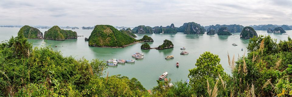
The bay from the summit of Ti Tốp island, January 2020.
Photograph: Steffen Schmitz (Carschten) · CC BY-SA 4.0
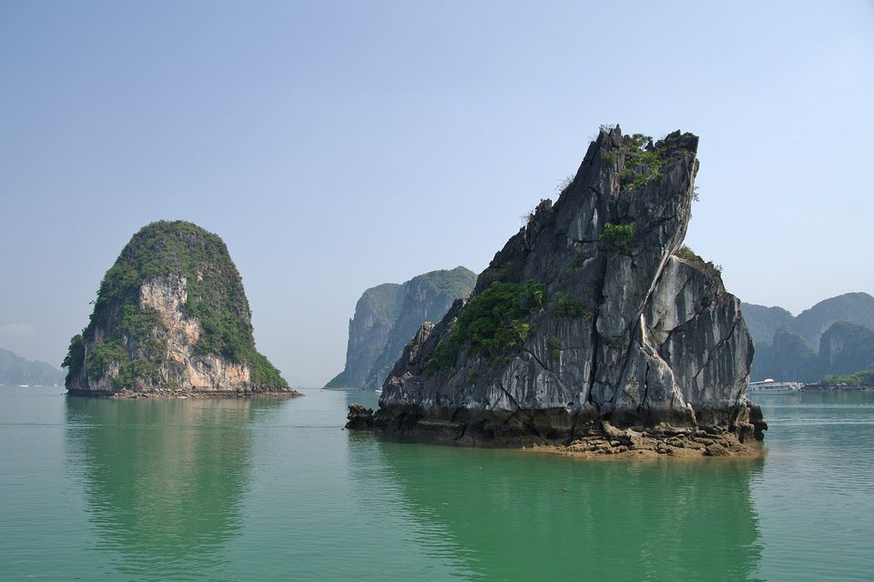
A limestone tower undercut at the tide line by the notch the sea has dissolved into it, March 2013.
Photograph: Jean-Marc Astesana · Halong (8586598253) · CC BY-SA 2.0 · cropped
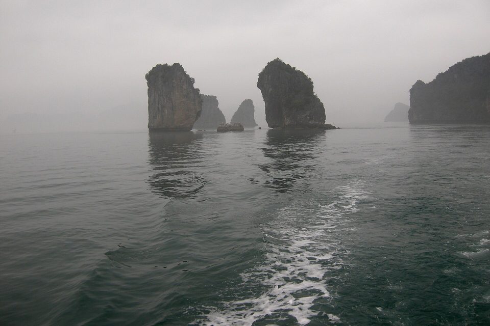
Towers in the mist astern of the boat, its wake running back towards them, March 2008.
Photograph: Vyacheslav Argenberg · CC BY 4.0
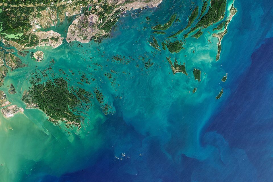
Ha Long Bay and neighbouring Bai Tu Long Bay from Landsat 8, 12 November 2020: well over a thousand islands scattered across shallow water (satellite image).
Satellite image: Joshua Stevens, NASA Earth Observatory (Landsat data from USGS) · Public domain
- Spend a night on the water if you can. The towers are different company at dawn.
- Remember the floating houses are homes. Wave, buy something if you want it, and ask before pointing a camera at anyone’s porch.
- When the crew says the weather is turning, believe them first and ask why afterwards.
- Look for the groove the sea has cut round the foot of every tower, then try to stop seeing it everywhere.
- Give one tower a name for the list. (Named several and could not find any of them again. There is now a page of names out there, looking for their towers.)
The notch. Round the foot of almost every limestone tower in Ha Long Bay runs a horizontal groove, cut in at the level of the tide, where seawater has dissolved the rock and waves have worn it back. These notches are among the features that make the bay the most extensive and best-known example of marine-invaded tower karst. They are the sea’s signature on hills that were once dry land, and in places they run on into caves that lead to lakes inside the islands.
Tally, in the marginA tidemark round the foot of every island, neat as the ring on a bath. I had been calling it nibbling all week, fondly, and the nibbling was the whole story: the islands are only what was left over.
Getting there
How to get there. Most visitors come by road from Hanoi, which expressways now link to Ha Long. Van Don International Airport, opened on 30 December 2018, is about 50 kilometres from Ha Long. Boats into the bay, from day trips to overnight cruises, leave from the harbours of Ha Long.
The weather. The climate is tropical and wet, with a hot, humid summer and a cool, dry winter; Wikipedia gives annual rainfall of 2 to 2.2 metres. Summer storms can arrive quickly. On 19 July 2025 the tour boat Wonder Sea capsized in a sudden thunderstorm in the bay and 39 people died. Choose a licensed operator, wear the life jacket you are given, and accept a cancellation or an early return when the crew or the authorities call one.
How to be there. The floating villages are homes. Visit with a local boat, buy what is offered if you want it, and ask before photographing people or their houses.
Safety. The United States has Vietnam at Level 1, exercise normal precautions. The advisory warns of petty crime in tourist areas and of landmines and unexploded ordnance, which it says are a low risk in urban areas and tourist destinations.
Mark this place
Common questions
How was Ha Long Bay formed?
Ha Long Bay in Vietnam is a limestone tower landscape that formed on land and was then flooded by the sea. Most of its islands are the tops of steep limestone towers whose surrounding plains are now underwater; Wikipedia’s account says the present bay appeared after the sea reached its highest level in the middle Holocene. UNESCO calls it the most extensive example of marine-invaded tower karst.
How many islands are in Ha Long Bay?
Counts differ with the boundary. UNESCO’s short description of Ha Long Bay speaks of some 1,600 islands and islets, and its description of the property extended in 2023, Ha Long Bay – Cat Ba Archipelago, gives 1,133 islands and islets in 65,650 hectares. Wikipedia’s account gives 1,969 islets in the wider bay of about 1,553 square kilometres.
What does Ha Long mean?
Hạ Long means descending dragon. A local legend tells of dragons sent to defend the country whose jewels became the islands of Ha Long Bay; Wikipedia’s account says the legend was reinforced by nineteenth-century Nguyen dynasty nationalism, and that the name Ha Long Bay does not appear in the country’s old books before the nineteenth century.
Is Ha Long Bay a UNESCO World Heritage Site?
Yes. UNESCO inscribed Ha Long Bay in Vietnam in 1994 and again, for its geology, in 2000. In 2023 it extended the property to include the Cat Ba Archipelago in Hai Phong, renaming it Ha Long Bay – Cat Ba Archipelago, a site of 65,650 hectares in Quang Ninh province and Hai Phong city.
What are the notches at the base of Ha Long Bay’s islands?
They are marine notches: horizontal grooves that seawater and waves have dissolved and eroded into the limestone at the tide line. UNESCO names notches and caves among Ha Long Bay’s shore-erosion features. In places the notches have been deepened into caves that cut through the islands to enclosed tidal lakes, such as the Ba Ham lakes on Dau Be island.
How do you get to Ha Long Bay from Hanoi?
Most visitors travel to Ha Long Bay by road from Hanoi, which expressways link to Ha Long in Quang Ninh province, and join a day boat or an overnight cruise from Ha Long’s harbours. Van Don International Airport, opened in December 2018, lies about 50 kilometres from Ha Long.
Is it safe to take a boat in Ha Long Bay?
Most trips are uneventful, but storms can arrive fast. On 19 July 2025 the tour boat Wonder Sea capsized in a sudden thunderstorm in Ha Long Bay and 39 people died. Use a licensed operator, wear the life jacket provided, and accept cancellations when weather warnings are issued. The United States has Vietnam at Level 1, exercise normal precautions.
Do people live in Ha Long Bay?
Some do. Wikipedia’s account says about 40 of Ha Long Bay’s islands are inhabited, and that some 1,500 to 1,600 people lived in floating fishing villages on the bay. Since May 2014 the Quang Ninh provincial government has moved more than 300 of those households ashore, keeping some villages for sightseeing tours.