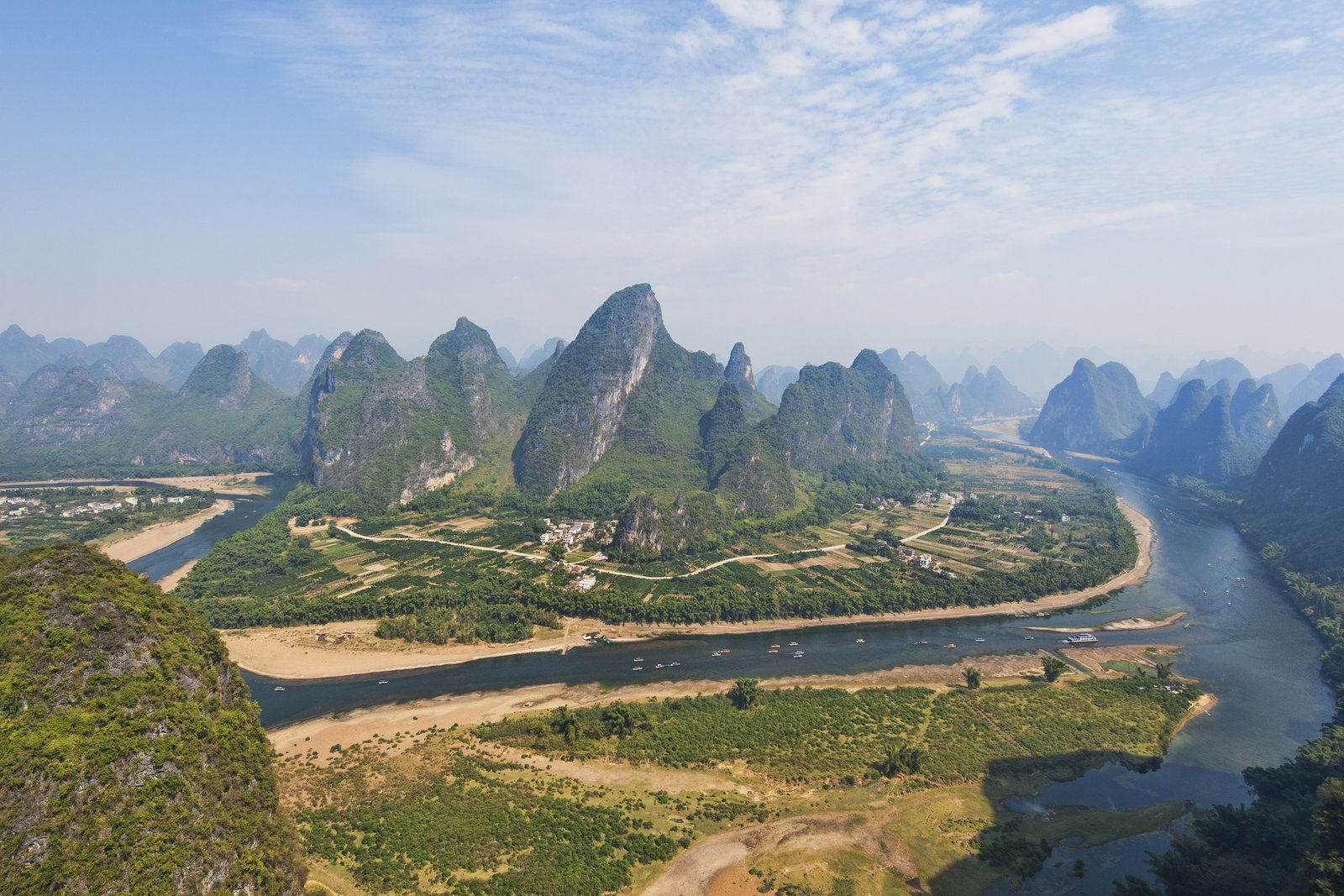

- Where
- Guangxi, China: Guilin
to Yangshuo and beyond - Coordinates
- 24.92° N
110.528° E (Xingping) - Length
- About 164 km
(Wikipedia) - Cruise stretch
- 83 km, Guilin to Yangshuo
(Guangxi government) - Landform
- Fenglin (tower) and
fengcong (cone) karst - Status
- UNESCO World Heritage,
2014 (South China Karst) - On the money
- Back of the 20-yuan note,
fifth series
Drifted downstream through soft grey mist, between hills that stood up out of flat green fields one at a time, like a crowd of green thumbs. Water buffalo stood in the shallows. A man on a narrow boat of lashed poles had black fishing birds perched beside him. Somebody on my boat held a banknote up against the hills and laughed, and I laughed too, without yet knowing why.
The short answer
The Li River (Lijiang) is the upper course of the Gui River in north-eastern Guangxi, southern China. Wikipedia gives its length as 164 kilometres, from the Mao’er Mountains in Xing’an County south through the city of Guilin and the county of Yangshuo to Pingle, where it joins other rivers to become the Gui, part of the Pearl River system. The Guangxi government describes the 83-kilometre stretch from Guilin to Yangshuo as the most typical stretch of karst landscape in the region, and Wikipedia, citing the geologist Tony Waltham, says the cruises on the Li attract millions of visitors a year. In 2014 UNESCO added the karst of Guilin, including a Lijiang section of 22,544 hectares, to the South China Karst World Heritage site.
Why it's worth knowing
The hills along the Li are not ordinary hills. UNESCO describes two kinds of karst here: fengcong, or cone karst, linked conical hills with hollows between them, and fenglin, or tower karst, isolated cones and towers standing on broad plains. Wikipedia’s account, drawing on the geologist Tony Waltham, says the towers around Yangshuo rise 30 to 80 metres in the central basin and up to 300 metres near the cone karst, with nearly vertical sides and bases narrower than one and a half times their height, and that both kinds have been evolving for the past 10 to 20 million years.
One bend of it is printed on money. The People’s Bank of China’s own descriptions of the fifth series of the renminbi give the back of the 20-yuan note as the Guilin landscape, the Li River among its hills, and the note has kept that design through its 1999, 2005 and 2019 editions. The Guangxi government’s own pages, among them the Department of Civil Affairs’ series on the region’s place-name heritage, identify the view as the Huangbu reflection, at Huangbu shoal near the old town of Xingping, where seven peaks of different sizes stand over the water. People come to Xingping to stand where the picture was taken and hold the note up to the hills.
The field notes
Down the river
The standard journey is the cruise downstream from Guilin to Yangshuo; shorter trips run on rafts. Among the named sights on the way, the Guangxi government lists the Nine Horse Fresco Hill, the Huangbu reflection and old Xingping itself. The river falls gently, from about 141 metres above sea level at Guilin to 103 metres at Yangshuo, by Wikipedia’s figures, and Wikipedia counts hundreds of caves in the hills along it.
The fishermen with birds
The Li is known for its cormorant fishermen, who fish from narrow bamboo rafts with trained birds. Wikipedia’s article on cormorant fishing says Guilin’s cormorants are famous for fishing the shallow Li, and, writing of southern China, that the practice, traditionally a way of making a living, is now performed mainly for tourists.
An old waterway
The upper Li is joined to the Xiang River, which flows north to the Yangtze, by the Lingqu canal, which Wikipedia dates to 214 BC. For centuries the canal and the Li made a single waterway between the Yangtze valley and the Pearl River delta.
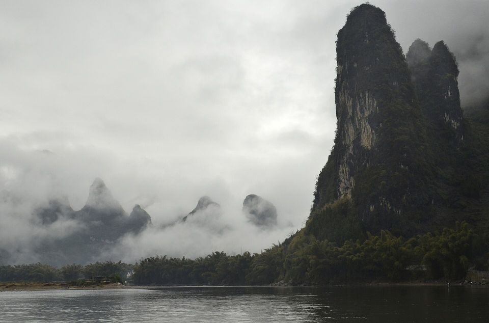
Cloud lying between the karst towers outside Xingping, with bamboo along the bank, March 2012.
Photograph: ReeveJ · Xingping 77 · CC BY-SA 3.0
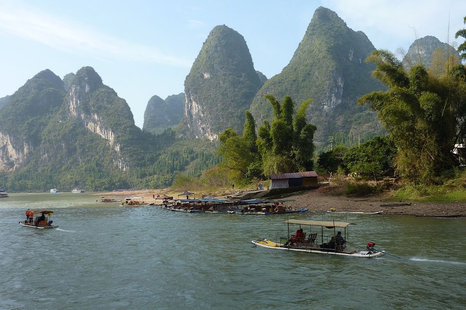
Passenger rafts and a landing on the Li River below steep karst towers, December 2011.
Photograph: Flora-Victoria · CC0 · cropped
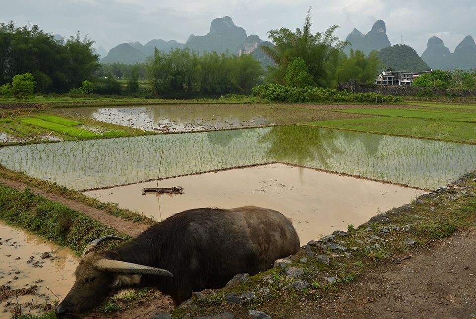
A water buffalo resting beside flooded paddies near Yangshuo, with karst peaks behind, April 2011.
Photograph: Pavel Špindler · Okolí Yangshuo · CC BY 3.0 · cropped
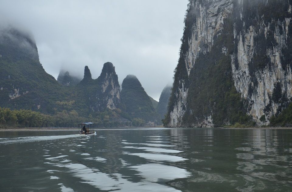
A raft crossing the Li below a limestone wall, with cloud on the peaks, March 2012.
Photograph: ReeveJ · Xingping 114 · CC BY-SA 3.0
- If you photograph the man with the fishing birds, ask first and pay him. It is his work, and so are they.
- Take the banknote out of your pocket at the right bend and decide which one is the copy.
- Go early, while the mist is still on the water and the boats are few.
- Cycle out into the fields between the hills for an afternoon, with no map worth mentioning.
- Give every hill a name as it goes by. (Named them after items on my list, and ran out of list before I ran out of hills. That has never happened before.)
The view on the back of the twenty. The fifth series of the renminbi, in its 1999, 2005 and 2019 editions, shows the Guilin landscape on the back of the 20-yuan note: the Li River among its limestone towers, with a lone fisherman on the water. The scene is the Huangbu reflection, at Huangbu shoal near Xingping. It is a relic most visitors bring with them without knowing it, and the tradition at the shoal is to take it out and hold it up to the hills.
Tally, in the marginI had been carrying this view in my pocket for a week without once looking at it. The hills were very patient about it.
Getting there
How to get there. Guilin has an international airport, Liangjiang, and high-speed rail links. The classic trip is the day cruise from piers below Guilin down to Yangshuo, returning by road; Xingping lies on the river between them, and rafts run on shorter stretches. Book cruises ahead, and avoid China’s national holiday weeks at the start of May and October if you can.
When to go. Wikipedia’s account of Guilin’s climate says about half the year’s rain falls from April to June, and that autumn is sunny and dry. Check whether cruises are running in the driest months, when the river is lowest.
How to be there. The cormorant fishermen are working. Ask before photographing them, and offer to pay.
Safety. The United States has mainland China at Level 2, exercise increased caution, because of the arbitrary enforcement of local laws, exit bans and the risk of unjust detention; the advisory has no geographic zones for the mainland. Read the full advisory before travelling, and check China’s current visa rules.
Mark this place
Common questions
Is the Li River on the 20-yuan note?
Yes. The People’s Bank of China describes the back of the fifth-series 20-yuan note as the Guilin landscape, the Li River among its limestone hills. Guangxi’s Department of Civil Affairs identifies the view as the Huangbu reflection at Huangbu shoal near Xingping, Yangshuo County, where visitors hold the note up against the scene.
How long is the Li River cruise from Guilin to Yangshuo?
The Guangxi government gives the river journey from Guilin to Yangshuo as 83 kilometres, the best-known stretch of the Li River in Guangxi, China. Cruise boats run downstream from Guilin to Yangshuo, and many visitors return to Guilin by road.
What are the hills along the Li River?
They are karst: limestone dissolved over millions of years into towers and cones. UNESCO distinguishes fenglin, or tower karst, isolated towers on flat plains, from fengcong, or cone karst, clusters of linked cones. Around Yangshuo the towers rise 30 to 80 metres, and up to 300 metres near the cone karst, by the geologist Tony Waltham’s account.
Is the Li River a World Heritage Site?
Yes, in part. In 2014 UNESCO extended the South China Karst World Heritage site to include the Guilin Karst in Guangxi, with a Lijiang (Li River) section of 22,544 hectares and a Putao section of 2,840 hectares. The extension also added karst areas in Guizhou, Chongqing and Huanjiang.
Where is Xingping?
Xingping is an old town on the Li River in Yangshuo County, Guangxi, China, downstream of Guilin and upstream of Yangshuo town. The view on the back of the 20-yuan note, the Huangbu reflection, is on the river nearby. It is not the same place as Xingping in Shaanxi province, a county-level city near Xi’an.
Do cormorant fishermen still work on the Li River?
Yes. Cormorant fishermen still work the Li River in Guangxi, China, fishing from narrow bamboo rafts with trained birds; Wikipedia’s account says the Guilin cormorants are famous for fishing the shallow river. Writing of southern China, it adds that the practice, traditionally a livelihood, is now performed mainly for tourists. Either way it is their work, so ask before photographing a fisherman.
How long is the Li River?
Wikipedia gives the Li River as 164 kilometres long, flowing from the Mao’er Mountains in Xing’an County, Guangxi, south through Guilin and Yangshuo to Pingle County, where it becomes the Gui River, a tributary of the Xi and Pearl rivers. The upper Li is linked to the Yangtze system by the ancient Lingqu canal.
When is the best time to visit the Li River?
Wikipedia’s account of Guilin’s climate says about half the year’s rain falls from April to June, when the Li River runs full, and that autumn is sunny and dry. Avoid China’s national holiday weeks in early May and early October, when the cruises and Xingping are at their busiest, and check that cruises are running in the driest months.