The short answer
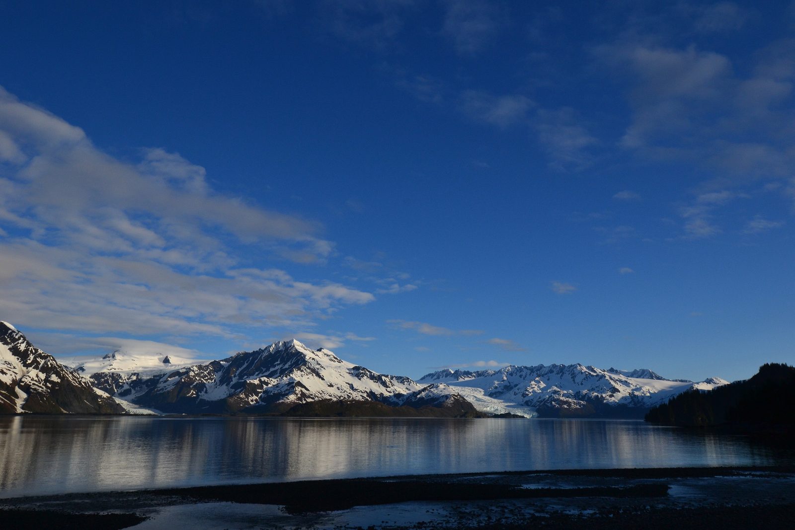
Kenai Fjords National Park lies just outside the town of Seward on Alaska’s Kenai Peninsula, 126 miles south of Anchorage. The Harding Icefield and its outflowing glaciers cover 700 square miles of the Kenai Mountains in ice, and along the coast the valleys the glaciers carved have filled with seawater to make fjords, rich in plankton, seabirds and marine mammals. Most of the park can be reached only from the water: boat tours run by local companies leave Seward’s small boat harbour daily in summer. Exit Glacier, at the end of an 8.6-mile road, is the only part of the park reachable by car. It became a national park in 1980.
From Tally’s diary
The boat put its nose into a long grey arm of the sea between mountains, and at the far end a wall of ice stood in the water, cracked and creaking and blue in the cracks. Every so often it boomed, and everyone on deck said oh. Seals lay about on the floating pieces looking as if they had paid for better seats. I said oh as well.
Why it's worth knowing
How snow becomes a glacier. Fresh snow on the icefield is about 80 per cent air. As more falls on top, the weight squeezes it into névé, then into firn, which is 20 to 30 per cent air, and after several years into solid glacial ice. The ice then flows downhill, faster in summer than in winter, because meltwater running beneath it lets it slide; in a place like this, sliding on its bed can account for up to 90 per cent of a glacier’s movement. Where two glaciers meet, their side moraines join into a dark stripe down the middle: Bear Glacier, the largest in the park, wears two.
A rare kind of coast. Fjord estuaries are found in only six parts of the planet: Chile, Norway, New Zealand, Alaska, Greenland and Antarctica. In these fjords the meeting of meltwater and ocean feeds a great bloom of phytoplankton sometime between early April and early June, turning the water deep green and feeding everything up the chain, from seabirds to whales feeding together in the fjords. Of the roughly 50 tidewater glaciers in Alaska, several flow into these fjords, and harbor seals haul out on their floating ice, safer there than on rocks the tide comes and goes over.
Ice in retreat. Photographs taken in the park in 1909 and 1940 show how far the ice has gone. Northwestern Glacier has receded more than 8 kilometres, about 5 miles, since 1950, nearly retreating out of the water and opening a fjord of sweeping granite walls; Pedersen Glacier has pulled back about 3 miles. At Exit Glacier, ridges of rubble mark where the ice stood in past years. Not every glacier is simply shrinking, though: Holgate Glacier, after retreating and thinning, has advanced again in the past few years.
The field notes
Seals and the Sugpiaq
Archaeological evidence shows that the Sugpiaq people have used the Kenai Fjords coast for more than a thousand years. Harbor seals are a highly valued subsistence resource in Sugpiaq culture, food and far more than food: hunting and sharing them nurtures relationships and keeps cultural practices alive. In one community in nearby Prince William Sound, up to 95 per cent of households rely on harbor seals. As the tidewater glaciers retreat and the floating ice that the seals rest on dwindles, the park’s researchers study the seals’ ice from the air.
Across the ice
The first known crossing of the Harding Icefield came in 1940, when two Alaskans, Eugene “Coho” Smith and Don Rising, went from Bear Glacier to Tustumena Lake. Two parties tried and failed in the mid-1960s. In 1968 a mountaineering party left Homer on horseback and made the first ascent of Truuli Peak, the highest point on the Kenai Peninsula. Some of them, Yule Kilcher among them, went on across the icefield and skied down Exit Glacier: eight days in all. More recent adventurers have crossed it solo in 14 hours, and on skis pulled by kites.
The railroad town
Seward was founded as the southern end of the Alaska Railroad because it had an ice-free port, and it became a major link for the miners and ore of the early 20th-century gold rushes. It is still the gateway: the railroad runs from Anchorage to Seward in summer, cruise ships begin and end their voyages there, and the park’s visitor center is on Fourth Avenue in town.

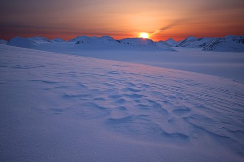
April 2009Sunrise over the Harding Icefield.
Photograph: NPS, Public domain

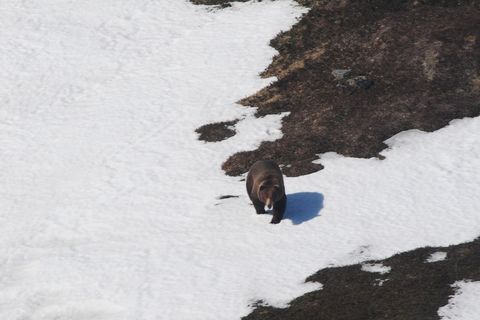
May 2009A brown bear crossing snow in Nuka Pass.
Photograph: NPS, Public domain, cropped

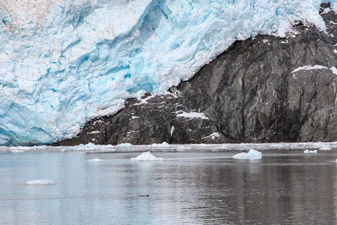
January 2000Blue ice at the face of a tidewater glacier, with floating ice in the water.
Photograph: NPS / Victoria Stauffenberg, Public domain
- Hear the ice boom. (Heard it. Jumped. Pretended I had been stretching.)
- Count the seals on one floating piece of ice. (Every time I reached the end, one slid off and another climbed on. It is a very busy piece of ice.)
- Wave to a whale. (Waved. It went under, came up somewhere else entirely and did not wave back, which seemed fair.)
- Look out over the great white field at the top of the mountains and decide where it ends. (It does not end, as far as I could see. I came down for tea.)
- Bring both warm gloves. (Brought one. The other is presumably still on the dock, managing very well without me.)
A relic from Kenai Fjords National Park
Relic, entry 339Broken from a tidewater glacierA resting place for harbor seals
A chunk of floating glacier ice in a fjord, broken from the face of a tidewater glacier that came down from the Harding Icefield. Only about 50 of Alaska’s glaciers reach the water and make such ice at all, and the ones in these fjords are worth listening to as well as watching. Harbor seals haul out on floating pieces like this to rest, safer there than on rocks the tide comes and goes over.
Tally, in the marginA lump of ice the size of a suitcase bobbing past, which I took for something brand new until it dawned on me that it had been snow first, a long time ago, on top of the mountains. It had come a long way to get wet. I felt we had a lot in common.
Getting there
- 1
By road
The Seward Highway runs 126 miles from Anchorage to Seward, and is open all year.
- 2
By rail
The Alaska Railroad runs to Seward from May to September.
- 3
To Exit Glacier
Exit Glacier Road leaves the highway at mile 3.7 and runs 8.6 miles to the nature center.
- ✓
How to get there. Seward is 126 miles south of Anchorage by the Seward Highway, a National Scenic Byway, open all year: from Anchorage it runs south as Alaska Route 1 and becomes Route 9 at about mile 35. Anchorage’s airport is the easiest way into Alaska; from there, buses, vans, rental cars and, from May to September, the Alaska Railroad all go to Seward. The only road into the park is Herman Leirer Road, known as Exit Glacier Road, which leaves the Seward Highway at mile 3.7 and runs 8.6 miles to the Exit Glacier Nature Center; shuttles and taxis run from Seward. From there the Harding Icefield Trail climbs steeply for about 4 miles to the edge of the icefield. The rest of the park, its coast and tidewater glaciers, is seen from boats.
When to go. Boat tours leave Seward daily in the summer months. From late October to mid-May the road to Exit Glacier is usually closed to cars by snow, though the area stays open to skiers, snowshoers and snowmachines.
What to arrange ahead. The park runs no boat tours itself and has no concessioners; several local companies in Seward do, with full-day trips to the tidewater glaciers and half-day trips in Resurrection Bay, and booking ahead is a good idea. Parking at Exit Glacier is limited, especially between 10:30 and 3:30.
Safety. The State Department’s travel advisories cover other countries, so none applies here. The park’s conditions page carries road, trail and bear notices.
Mark this place
The passport stamp for this place.
Common questions
How do you get to Kenai Fjords National Park?
By road or rail to Seward, then by boat or the Exit Glacier road. Kenai Fjords National Park is just outside Seward, 126 miles south of Anchorage; boat tours leave the harbour daily in summer.
Can you drive to a glacier in Kenai Fjords?
Yes, to one. Exit Glacier, at the end of the 8.6-mile Exit Glacier Road, is the only part of Kenai Fjords National Park reachable by car; the road is usually closed to cars from late October to mid-May.
How big is the Harding Icefield?
Big enough to bury mountains. The Harding Icefield and its outflowing glaciers cover 700 square miles of the Kenai Mountains in Kenai Fjords National Park, feeding at least 38 glaciers.
How much snow falls on the Harding Icefield?
About 60 feet a year, on average. Moist air from the Gulf of Alaska drops that much snow on the Harding Icefield in Kenai Fjords National Park each winter, and over the years it is squeezed into glacier ice.
Has anyone crossed the Harding Icefield?
Yes, first in 1940. Eugene “Coho” Smith and Don Rising made the first known crossing of the Harding Icefield, now in Kenai Fjords National Park, going from Bear Glacier to Tustumena Lake.
Are the glaciers in Kenai Fjords retreating?
Many have, some dramatically. Northwestern Glacier in Kenai Fjords National Park has receded more than 8 kilometres since 1950, though Holgate Glacier has advanced again in recent years.
What wildlife lives in Kenai Fjords?
Seals, whales, seabirds and bears, among many others. In Kenai Fjords National Park harbor seals rest on floating glacier ice, whales feed together in the fjords, and black bears are seen almost every day from the Harding Icefield Trail.
Photographs on this page
Tap a photograph to see it full size.
Photograph: NPS, Public domain
Photograph: NPS, Public domain
Photograph: NPS, Public domain, cropped
Photograph: NPS / Victoria Stauffenberg, Public domain


