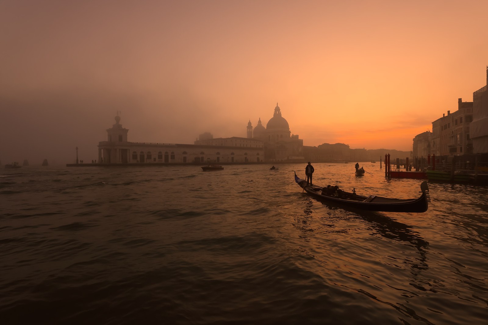

- Where
- Head of the Adriatic,
Veneto, north-east Italy - Coordinates
- 45.4375° N
12.3358° E - Setting
- Islands in a shallow lagoon;
average depth about 1.2 m - River works
- Brenta to Conche 1502–1507;
Taglio del Sile opened 1683 - Status
- UNESCO World Heritage, 1987,
as Venice and its Lagoon - Day-visitor fee
- On set peak days only;
check the city’s calendar - Best visited
- Early morning, and outside
the spring and summer peak
Got off the train and the main street was water, and the bus was a boat. Bells from every direction, washing strung between windows over green canals, and at low tide the smell of mud. Out past the last houses the water went flat to the edge of the sky, with bundles of wooden posts marking a road across it. I was lost all day and never sorry.
The short answer
Venice is a city in north-east Italy built on a cluster of small islands in the Venetian Lagoon, at the head of the Adriatic Sea. The islands are separated by canals and joined by bridges, and much of the old city stands on piles of wood driven into the mud. It was the capital of the Republic of Venice until 1797. Nearly 50,000 people live in the historic centre. UNESCO inscribed it in 1987 under a name that includes its setting: Venice and its Lagoon. That second half of the name is the subject of this entry, because the lagoon did not survive by itself.
Why it's worth knowing
A lagoon is a temporary thing. This one formed about six or seven thousand years ago, when the sea rose after the last Ice Age and flooded the coastal plain, and from then on two forces worked to end it. Rivers from the Alps carried silt in and dropped it, building marsh and then land. Along the coast, drift from the Po built sandbars that tended to close the openings to the sea.
The Republic worked against the first of those with shovels. Between 1502 and 1507 it carried the Brenta, joined to the Bacchiglione, away from the waters near the city to a single outlet at Conche in the southern lagoon; the City of Venice’s own history of the lagoon notes that this eased things near Venice and made the silting worse in the south. In 1610 the Brenta Novissimo was opened, a collector channel carrying several smaller rivers to a new outlet at Brondolo, outside the lagoon. In 1642 the Republic decreed a new course for the Piave, sending it east to the port of Santa Margherita near Caorle. In 1683 the Taglio del Sile was opened, carrying the Sile out of the northern lagoon and into the Piave’s abandoned bed, which is why the last stretch of that channel is still called the Piave Vecchia, the Old Piave. The city’s history calls it the Republic’s last major intervention on the lagoon’s catchment.
The geomorphologists Aldino Bondesan and Paolo Furlanetto, who examined more than seven thousand historical maps to reconstruct these works, describe them in their paper’s abstract as an epic struggle against the rivers, and note that the projects were only partly carried out. Wikipedia’s account of the lagoon puts the outcome plainly: the Venetian hydraulic projects, designed to stop the lagoon becoming a marsh, reversed its natural evolution.
So the water that made Venice safe is not simply nature. It is a lagoon kept on purpose, by moving rivers. And the argument has since changed sides: today the pressing threat comes from the sea, and the city’s newest defence faces the other way.
The field notes
What the lagoon is now
The Venetian Lagoon stretches from the Sile in the north to the Brenta in the south and covers about 550 square kilometres. It is connected to the Adriatic by three inlets, at Lido, Malamocco and Chioggia. It is very shallow: the average depth is about 1.2 metres, and roughly four-fifths of it is mudflat, tidal shallows and salt marsh, with only about a tenth open water and channels.
That is why a boat out on the lagoon follows marked channels, and why the Venetian solution to its rivers was to move them rather than dredge after them. Much of the lagoon’s land is made, too: many of its islands were raised or built outright, and a gradual programme of drainage made others habitable.
A city on piles
The first builders here learned to drive closely spaced piles of alder trunks, a wood noted for its resistance to water, into the mud and sand, and to build on top of them.
Counts of the city’s islands and bridges depend on what is counted. Wikipedia’s article on Venice gives 118 small islands and 438 bridges in one place and 126 islands and 472 bridges in another; this entry reports both rather than choosing.
The sea's turn: acqua alta and MOSE
High tides that flood the city, the acqua alta, are an old feature of Venetian life, and pumping of groundwater from the nineteenth century onward made the ground sink faster. On the night of 12 November 2019 the tide reached 187 centimetres at Punta della Dogana, according to the City of Venice, the highest since the record 194 centimetres of 4 November 1966.
The MOSE barrier is the answer on the seaward side: 78 mobile gates in four barriers across the three inlets, 20 and 21 at the two halves of the Lido inlet, 19 at Malamocco and 18 at Chioggia. They lie on the sea floor and rise to close the lagoon when a high tide is forecast. They were raised against a flood tide for the first time on 3 October 2020, when the sea outside reached 132 centimetres and the lagoon inside stayed at about 70.
For centuries the Republic’s engineers kept the land out. The present ones are keeping the sea out. The lagoon in between is still the thing being defended.
The fee, and the numbers behind it
The city has been trialling a charge for day visitors on its busiest days. In 2026 the Contributo di Accesso applied on set days in the spring and early summer: €5 if booked by the Wednesday before a Sunday visit, €10 if booked later. Children under 14 and several other groups, including people who work in the city, are exempt. The official Venezia Unica site says the 2026 trial has ended and that from 27 July no fee applies.
Whether and when it returns is for the city to decide each year, so check the official Venezia Unica access-fee site for the next one rather than trusting a date in an article, including this one.
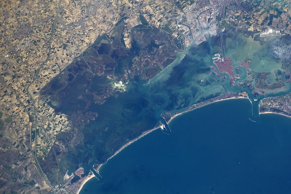
The Venetian Lagoon from the International Space Station, May 2014: Venice at upper right, the sea beyond the barrier islands.
Astronaut photograph: NASA · Public domain · cropped
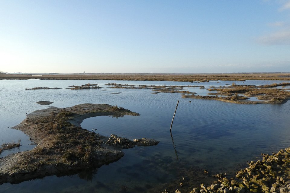
Barena, the salt-marsh flats that make up much of the lagoon, between Prà and Lio Piccolo.
Photograph: Syrio · CC BY-SA 4.0 · cropped
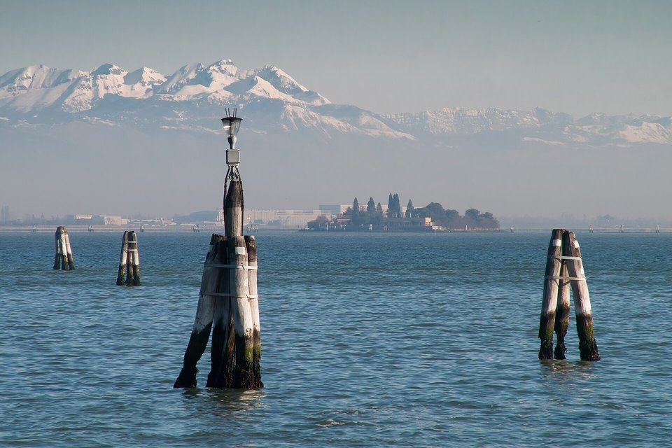
Briccole, bundled oak posts marking a lagoon channel, with the Alps beyond, March 2009.
Photograph: Reinhold Möller · CC BY-SA 4.0 · cropped
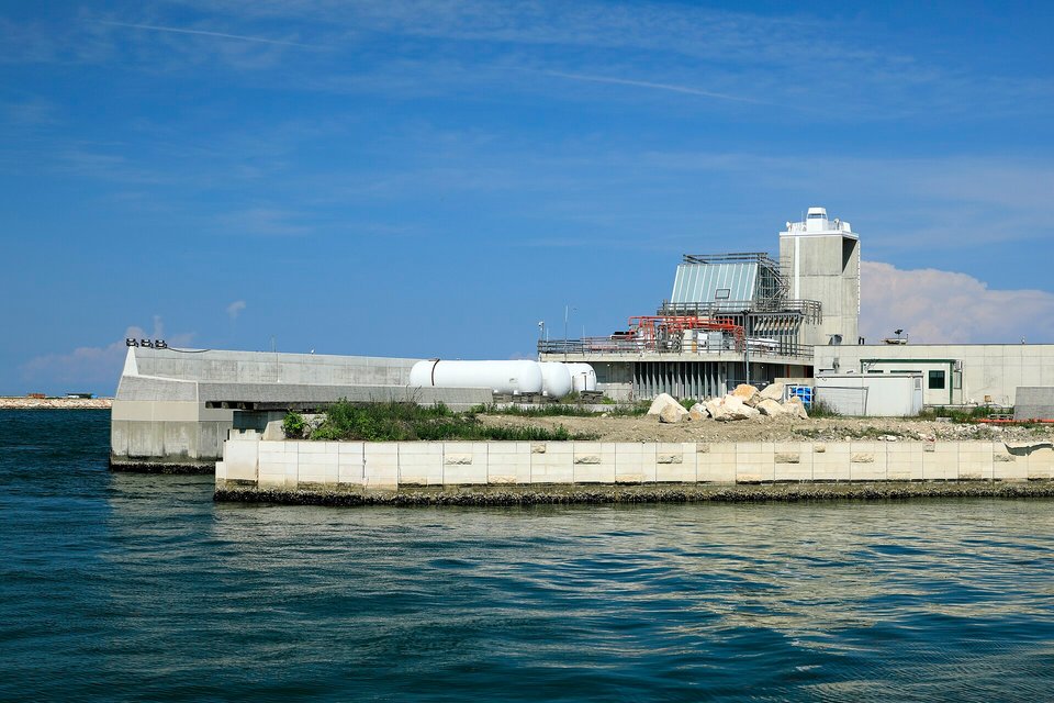
The southern land works of the MOSE barrier at Sottomarina, seen from Forte San Felice in 2022.
Photograph: Falk2 · CC BY-SA 4.0
- Arrive by water if you can, and stand at the front of the boat.
- Get lost on purpose, early, before the day visitors come.
- Stand to one side on the bridges. People here are on their way to work.
- If the water comes up into the square, do exactly what the people who live here do.
- Add nothing to the list while crossing a bridge. (Failed on the first bridge. Item retained.)
A briccola. Out in the lagoon, beyond the last houses, oak posts driven into the mud mark the channels a boat can use, often standing in clusters bound together at the top. Between them the lagoon is mostly mudflat and shallows too low to cross. The posts are wood in salt water, and shipworms bore into them, so they are replaced as they fail. The lagoon’s roads, like the lagoon, have to be kept.
Tally, in the marginPosts leaning together in the middle of the water, holding each other up. I took them for decoration until the boat turned exactly where they said to, and after that I trusted them completely.
Getting there
How to get there. Fly into Venice Marco Polo airport, on the mainland edge of the lagoon, and cross by water bus or water taxi, or by bus to Piazzale Roma. By rail, trains run across the lagoon to Venezia Santa Lucia station on the Grand Canal. Inside the city you walk or take the vaporetto, the public water bus. There are no cars.
The access fee. On the city’s designated days, day visitors pay to enter the historic centre, less if they book ahead; children under 14 and several other groups are exempt. The 2026 trial has ended. Check the Venezia Unica site for the current rules and exemptions before you book the day.
When to go. Crowds peak from spring to autumn and at weekends. Early morning is the quietest time in any season. Autumn and winter bring the highest tides; if the water is up, raised walkways go out in the busiest places and locals will know the dry routes. Check the tide forecast, and bring boots you do not mind wetting.
To see the lagoon, not only the city. Take a water bus out to the northern islands, Murano, Burano and Torcello, and watch the channel markers the boat follows. That is the lagoon the Republic kept.
Book ahead. Rooms in the historic centre, and timed entry to the most visited churches and museums, in peak season.
Mark this place
Common questions
Why did Venice divert its rivers?
To stop the Venetian Lagoon silting up into marsh and land. From the Brenta’s diversion to Conche in 1502–1507, the Republic of Venice dug new beds to carry the Brenta, the Bacchiglione, the Piave and the Sile away from the lagoon, so their sediment would not fill it. The Taglio del Sile, opened in 1683, was its last major intervention of this kind.
Is the Venetian Lagoon natural?
Partly. The Venetian Lagoon formed naturally about six to seven thousand years ago, when the rising sea flooded the upper Adriatic coastal plain. From the sixteenth century, the Republic of Venice’s river diversions stopped it filling with silt, which Wikipedia’s account of the lagoon describes as reversing its natural evolution. Many of its islands are also artificial or raised.
What is the Piave Vecchia?
The Piave Vecchia, the Old Piave, is the former lower course of the River Piave near Venice. The Republic of Venice decreed a new, more easterly course for the Piave in 1642, and in 1683 it opened the Taglio del Sile to send the River Sile out of the northern lagoon and into the Piave’s empty bed, which kept the old name.
What is MOSE in Venice?
MOSE is Venice’s flood barrier: 78 mobile gates across the Lido, Malamocco and Chioggia inlets of the Venetian Lagoon, which rise from the sea floor to close the lagoon against high tides. It was first raised against a flood on 3 October 2020, when it held the lagoon at about 70 centimetres while the sea outside reached 132.
How high was the 2019 flood in Venice?
On the night of 12 November 2019 the tide in Venice reached 187 centimetres at Punta della Dogana, according to the City of Venice, the highest since the record 194 centimetres of November 1966. Flooding tides, called acqua alta, are a recurring feature of Venetian life, and groundwater pumping from the nineteenth century onward increased the subsidence of the ground. The MOSE barrier was first raised against a flood in October 2020.
How deep is the Venetian Lagoon?
Very shallow. The Venetian Lagoon covers about 550 square kilometres, with an average depth of about 1.2 metres. Roughly 80 percent of it is mudflat, tidal shallows and salt marsh, and only about 11 percent is open water or channels, which is why boats on the lagoon follow marked channels.
Do you have to pay to enter Venice?
Not at the moment. Venice has trialled an access fee, the Contributo di Accesso, for day visitors to the historic centre on designated days. In 2026 it cost €5 booked early or €10 booked late, with children under 14 among the exempt, and the official Venezia Unica site says the trial ended and no fee applies from 27 July 2026. The city decides each year.
Is Venice a UNESCO World Heritage Site?
Yes. UNESCO inscribed Venice in 1987 under the name Venice and its Lagoon, which covers the lagoon as well as the city. The lagoon is about 550 square kilometres and joins the Adriatic through three inlets, at Lido, Malamocco and Chioggia, which since 2020 can be closed by the MOSE barrier.