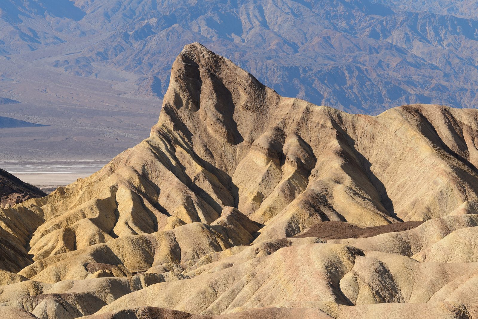
The short answer
Death Valley National Park covers all of Death Valley, a long, narrow desert trough 156 miles from north to south between two great walls of mountains, the Amargosa Range to the east and the Panamint Range to the west, in eastern California and a corner of Nevada. It holds the record for the hottest air temperature ever measured, is the driest place in North America, and at Badwater Basin reaches the lowest point on the continent. Around the valley floor lie salt flats, sand dunes, colourful canyons, old mining camps and, far to the north-west, the dry lakebed of the Racetrack. A national monument from 1933, it became a national park on October 31, 1994.
From Tally’s diary
The ground was white and crunched under my feet like old snow, but the air was hot enough to make me squint, and the mountains on the far side were wobbling in it. I licked one finger and touched the crust. Salt. I stood there a long while being the lowest thing for miles, which I found surprisingly restful.
Inside the park
- Racetrack Playa
The dry lakebed where rocks slide across the mud on their own, and the winter mornings that finally showed how.
Photograph: Romain Guy, CC0, cropped

Why it's worth knowing
An oven with a lid. Pacific storms heading inland have to cross four major mountain ranges before they reach Death Valley, dropping rain and snow on each one, so by the time the clouds arrive there is almost nothing left. The valley is deep and narrow, walled by steep mountains, and the bare ground soaks up the sunshine and gives the heat back. Hot air rises, cools before it can climb out over the walls, sinks back down, and is squeezed and heated all over again by the low elevation. On summer nights the temperature may fall no further than 85 to 95°F. Winter and spring, by contrast, are mild and very pleasant.
A sea of salt. Every flash flood in a drainage of 9,000 square miles, bigger than New Hampshire, ends up here at the lowest point, dissolving minerals from the rocks on the way. The water forms a shallow, temporary lake, the lake dries, and the salts stay behind. Over thousands of years they have built up nearly 200 square miles of salt flats at Badwater, among the largest protected salt flats in the world, mostly ordinary table salt with calcite, gypsum and borax. The crystals keep growing and push the crust into rough, chaotic shapes, and the next rain washes it blinding white again.
Flowers from nowhere. Most of Death Valley’s showy wildflowers are annuals that wait out the hard years as seeds. When a winter brings enough gentle, well-spaced rain, enough sun and not too much wind, they sprout, bloom and seed again before the heat returns. Then the lower slopes can turn gold and purple with Desert Gold and phacelia from mid-February to mid-April. Higher up, the bloom follows later, into early summer on the mountain slopes. A great year, a “superbloom”, comes only when everything lines up.
The field notes
The lost '49ers
In October 1849 a wagon train heading for the California gold fields left Salt Lake City too late in the year to risk the Sierra Nevada, with the Donner Party’s fate fresh in everyone’s mind. More than twenty of its wagons followed a short cut shown on a hand-drawn map, a route that did not exist. After about two months crossing the desert, the first of them reached the spring that feeds Furnace Creek on Christmas Eve, their oxen weak and their wagons battered. They were rescued in the end by two of their own young men, William Lewis Manly and John Rogers, who had learned to be scouts. As far as anyone knows only one of the party died in the valley, but the name they left it has stuck.
Pupfish in a desert
A few kinds of tiny fish live in the park’s springs, creeks and marshes, descendants of fish whose ancestors came up the Colorado River thousands of years ago into the lake that once filled the valley. Pupfish can live in water saltier and warmer than almost any other fish can stand; the males flash bright blue when they court. The rarest of all, the Devils Hole pupfish, about two inches long, lives in just one place on Earth. Devils Hole is a deep, water-filled cavern in a 40-acre part of the park out in the Amargosa Desert, where the water stays at 93°F all year. It is one of the most endangered fish in the world.
The castle that a cowboy said he built
Walter Scott, “Death Valley Scotty”, was a former rough-rider with Buffalo Bill’s Wild West Show who persuaded wealthy men that he had a fabulous gold mine in the valley. A Chicago insurance man, Albert Johnson, kept sending money, and finally came to see the mine for himself. Scotty led him on a gruelling ride he expected the city man to give up on. Instead Johnson stayed nearly a month, found his health much improved, and never saw a mine. The two became lifelong friends, and Johnson built a mansion in Grapevine Canyon that everyone called Scotty’s Castle. A flood in 2015 buried parts of it in mud up to ten feet deep.
Twenty mules and white gold
From 1883 to 1888 the Harmony Borax Works refined borax, the “white gold” of the desert, near Furnace Creek. It is remembered less for its ore than for its wagons, pulled out of the valley by teams of twenty mules, whose picture went on to sell soap and to name a radio and television series, Death Valley Days. Borax is still put to work in about three hundred high-tech products, from fibreglass to fire retardants.

December 2013Red Cathedral above the badlands at Zabriskie Point.
Photograph: King of Hearts / Wikimedia Commons, Zabriskie Point Death Valley December 2013 002, CC BY-SA 3.0, cropped

September 2010Sand dunes and cracked mud on the valley floor.
Photograph: NPS / D. Pate, Public domain, cropped

September 2016Salt crust at Badwater.
Photograph: Krzysztof Ziarnek, Kenraiz, CC BY-SA 4.0
- Stand at the very bottom. (Stood. Looked up. Everything else was higher than me, including the sign.)
- Find a flower in the driest place I have ever been. (Found a single yellow one in a crack. We had a long, quiet conversation.)
- Climb the tallest sand dune before breakfast. (Got halfway. The dune moved the top.)
- I lay on my back far from any lights and let the stars come out one by one, until there were too many to keep up with.
- Look for a tiny blue fish in a pool in the desert. (Looked. Found my own reflection, hot and pink.)
A relic from Death Valley National Park
Relic, entry 353About two inches longThe water never changes from 93°F
A Devils Hole pupfish, glinting blue in its pool. Devils Hole is a deep, water-filled cavern in the desert, and the whole of this fish’s world: it lives nowhere else. It is about two inches long; the males are a dark, shining blue and the females olive green, and the males blaze brighter still when they spawn, in spring and again in early autumn. The water never changes from 93°F, which suits the fish, but it is very sensitive to any change in the water level, and so are they.
Tally, in the marginA fish no longer than my thumb, I thought, in a puddle in the desert, until I learned it is the only puddle it has ever had, and the only one its family ever will. I stopped talking loudly for the rest of the afternoon.
Getting there
- 1
From the east
California 190 enters from Death Valley Junction, Nevada 374 from Beatty.
- 2
From the west
California 190 enters from Olancha, by Highway 136 from Lone Pine.
- 3
To Badwater
Badwater Road runs 18 miles south from the visitor centre.
- ✓
| J | F | M | A | M | J | J | A | S | O | N | D |
|---|---|---|---|---|---|---|---|---|---|---|---|
| January: best time | February: best time | March: best time | April: best time | November: best time | December: best time |
- Winter and spring are very pleasant on the valley floor
- Wildflowers at low elevations, in a good year, bloom from mid-February to mid-April
How to get there. Paved roads enter the park from both sides: from the east by California 190 from Death Valley Junction, Nevada 374 from Beatty, California 178 from Shoshone and Nevada 267 from US 95; from the west by California 190 from Olancha (by Highway 136 from Lone Pine) and Highway 178 from Trona. The Furnace Creek Visitor Center is the centre of the park; Badwater Basin is 18 miles south of it on Badwater Road. There is no public transport to or within the park, and no scheduled flights to its two small airstrips. Fuel is sold at Furnace Creek, Panamint Springs and Stovepipe Wells, and there is no mobile signal along most roads.
When to go. Winter and spring are very pleasant on the valley floor; summer is extreme, often above 120°F in the shade. Wildflowers at low elevations, in a good year, bloom from mid-February to mid-April.
Safety. The State Department’s travel advisories cover other countries, so none applies here. Help may be many hours away; the Park Service asks travellers to come prepared to rescue themselves, and summer storms can bring flash floods. The park’s alerts list closed roads and areas.
Mark this place
The passport stamp for this place.
Common questions
How hot does Death Valley get?
Hotter than anywhere else on record. The world’s highest recorded air temperature, 134°F (57°C), was measured at Furnace Creek in Death Valley National Park on July 10, 1913, and summer days often top 120°F in the shade.
Where is the lowest point in North America?
Badwater Basin, in Death Valley. At 282 feet below sea level it is the lowest place in Death Valley National Park and in North America, 18 miles south of the Furnace Creek Visitor Center.
Why is it called Death Valley?
Because a group of lost pioneers thought it would be their grave. In the winter of 1849-1850 a party of ’49ers was stranded in the valley; as they climbed out over the Panamint Mountains, one of them looked back and said “goodbye, Death Valley.”
When is the best time to visit Death Valley?
Winter and spring. Death Valley National Park is mild and very pleasant then, while summer days often pass 120°F in the shade and nights may stay above 85°F.
What is a superbloom in Death Valley?
A year when the desert floor fills with flowers. In Death Valley National Park most wildflowers are annuals that wait as seeds, and after well-spaced rain from autumn to spring, lower slopes can bloom gold and purple from mid-February to mid-April.
Is Death Valley good for stargazing?
Among the best in the country. Death Valley National Park has some of the darkest night skies in the United States, holds a Gold Tier rating, and was the third International Dark Sky Park in the US.
What is the Devils Hole pupfish?
One of the rarest fish on Earth. The Devils Hole pupfish lives only in Devils Hole, a deep water-filled cavern in a 40-acre part of Death Valley National Park in the Amargosa Desert, where the water stays at 93°F.
Photographs on this page
Tap a photograph to see it full size.
Photograph: King of Hearts / Wikimedia Commons, Zabriskie Point Death Valley December 2013 001, CC BY-SA 3.0, cropped
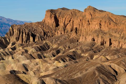
Photograph: King of Hearts / Wikimedia Commons, Zabriskie Point Death Valley December 2013 002, CC BY-SA 3.0, cropped
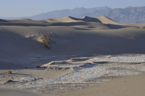
Photograph: NPS / D. Pate, Public domain, cropped
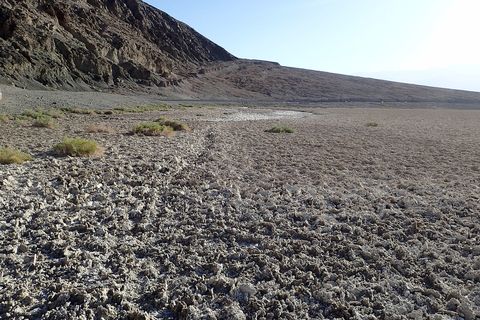
Photograph: Krzysztof Ziarnek, Kenraiz, CC BY-SA 4.0


