The short answer
Canyonlands National Park preserves 337,598 acres of colourful canyons, mesas, buttes, fins, arches and spires in the high desert of south-east Utah, carved by the Colorado River and its great tributary the Green, which joins it inside the park at the Confluence. The rivers split the park into four districts: Island in the Sky, a mesa in the north; the Needles, in the south-east; the Maze, in the west; and the rivers themselves. No bridge or road links them, and few places cross the rivers, so most people visit only one in a trip. The average elevation is over 5,000 feet. It became a national park on September 12, 1964, and Horseshoe Canyon was added in 1971.
From Tally’s diary
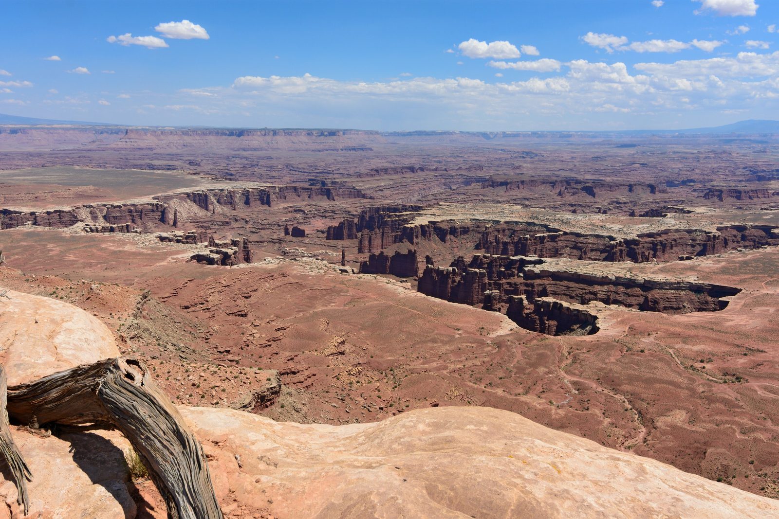
Walked out along the top until the ground ran out, which it did without warning, all at once, as if it had lost interest. Below was a whole second country, red and folded, with rivers in the bottom too far down to hear. The wind had nothing to stop it. I held my notebook shut with both hands and my pencil in my teeth.
Why it's worth knowing
Four parks in one. Island in the Sky is the easiest to see quickly, with overlooks along a paved scenic drive and the 100-mile White Rim Road looping around and below the mesa. The Needles is spikier, a district of sandstone pinnacles reached by hiking or four-wheel drive. The Maze is something else entirely: the least accessible district, reached only on dirt roads, where visitors rarely spend less than three days. And below the Confluence the combined rivers race through Cataract Canyon, fourteen miles of whitewater whose standing waves can top twenty feet at peak flow.
A layer cake, sliced. Most of this rock came from far away, from the ancestral Rockies and even the Appalachians, broken down and carried in by wind and water and laid down near sea level as river sands, swamp mud and great dune fields. There were no canyons then, only plains. Then, about 20 million years ago, the crust began to lift the whole Colorado Plateau, perhaps by as much as 10,000 feet, and the rivers started cutting down through the layers. Soft rock wears faster than hard, which gives the canyon walls their stair-step look and leaves balanced rocks and towers where a hard slab shelters a weaker one.
The Great Gallery. People have lived in and travelled through Canyonlands for more than 10,000 years and left their marks behind. In Horseshoe Canyon, north-west of the Maze, panels of ancient rock markings rank among the most significant in North America. The best known, the Great Gallery, holds well-preserved, life-sized figures with intricate designs, at the end of a seven-mile round-trip walk that drops 780 feet into the canyon.
The field notes
Where two rivers meet
Above the Confluence both the Green and the Colorado run calm, good water for canoes and kayaks. Below it, their combined flow pours down Cataract Canyon with remarkable speed and power. No road reaches the rivers near the Confluence or in Cataract Canyon; boaters start far upstream, at Green River State Park, Ruby Ranch or Mineral Bottom on the Green, or at the Potash or Moab ramps on the Colorado. Along the banks, beavers live in dens dug into the riverbanks, since the rivers are too big to dam, and peregrine falcons nest on the cliffs.
Cowboys and a champion
For early explorers, Canyonlands was more an obstacle than a destination. From the 1880s to 1975 local ranchers ran cattle through much of it as winter pasture, and cowboys searched the canyons for feed and water. In the 1950s and early 1960s, Bates Wilson, superintendent of nearby Arches National Monument, argued for a national park in what is now Canyonlands; it was created in 1964.
A sky full of stars
The parks of the Colorado Plateau share some of the darkest skies left in the lower 48, and a moonless night in Canyonlands surprises many visitors. Only about one American in ten lives where the estimated 2,500 stars that should be visible on a normal night can still be seen. Here the naked eye is enough for a sky full of them, and on a good night ordinary binoculars may even pick out the rings of Saturn.

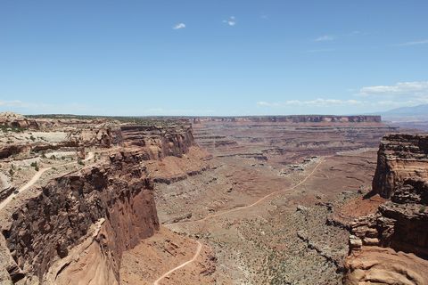
August 2011Shafer Canyon Road switchbacking down the canyon wall.
Photograph: DXR, CC BY-SA 4.0, cropped

September 2018Towers of red Organ Rock capped with White Rim Sandstone in Shafer Canyon.
Photograph: Kognos, CC BY-SA 4.0, cropped

June 2017Layered canyons stretching to the horizon.
Photograph: Julianibarra, CC0
- Be at the arch before the sun. (So was everybody else. We all whispered, which I liked.)
- Look at the painted figures for as long as they look back, and touch nothing. They have lasted this long without any help.
- Go from one part of the park to the next in a straight line. (Could not. Rivers. Went round, and round, and wrote this item in the car.)
- Count the stars after dark. (Reached a respectable figure, lost my place, began again, lost it again. The sky won on points.)
- I walked around the dark crusty soil, never across it. It is alive, and slower than I am.
A relic from Canyonlands National Park
Relic, entry 329On the cliff edge at Island in the SkyLooks towards the La Sal Mountains
Mesa Arch, on the rim at Island in the Sky. A short walk from the scenic drive ends at an arch standing right at the cliff’s edge, a window of stone with the drop on its far side and the La Sal Mountains in view at any hour. Photographers love it at sunrise.
Tally, in the marginI went to see the arch and spent the whole time looking through it, which I gather is the arrangement. Only on the walk back did I turn round and notice it had been framing the mountains for me all morning without asking for any thanks.
Getting there
- 1
To Island in the Sky
US 191 runs 10 miles north of Moab to UT 313, which climbs 22 miles to the visitor center.
- 2
To the Needles
UT 211 leaves US 191 south of Moab.
- 3
To the Maze
Hans Flat Ranger Station is about two and a half hours from Green River, the last 46 miles on a dirt road.
- ✓
| J | F | M | A | M | J | J | A | S | O | N | D |
|---|---|---|---|---|---|---|---|---|---|---|---|
| April: best time | May: best time | September: best time | October: best time |
- Spring (April–May) and autumn (mid-September to October)
How to get there. Each district has its own way in. For Island in the Sky, US 191 runs 10 miles north of Moab to UT 313, which climbs south-west for 22 miles to the visitor center, about 40 minutes from Moab. For the Needles, UT 211 leaves US 191 south of Moab. The Maze’s Hans Flat Ranger Station is about two and a half hours from Green River, the last 46 miles on a two-wheel-drive dirt road, and the canyons of the Maze lie another three to six hours on by high-clearance four-wheel drive. Most people fly into Grand Junction Regional Airport, 113 miles from Moab, or Salt Lake City International, 237 miles. Amtrak and Greyhound stop at Grand Junction and Green River, and vans run to Moab. The Park Service advises a paper map over GPS for every district.
When to go. Spring, from April to May, and autumn, from mid-September through October, are the mild and most popular seasons, with daytime highs of 60 to 80°F. Summer often passes 100°F, and late-summer monsoon storms can bring flash floods. Winters are cold, and a little snow or ice can make trails and roads impassable.
What to arrange ahead. As of 12 November 2026, permits are needed for overnight backcountry trips and for day trips by vehicle, motorbike or bicycle on the White Rim, Elephant Hill, Lavender Canyon and Peekaboo/Horse Canyon roads, reservable online from four months to two days ahead. Island in the Sky’s campground is first come, first served; some sites at the Needles can be reserved.
Safety. The State Department’s travel advisories cover other countries, so none applies here. The park has no fuel, food or lodging, mobile coverage is patchy or absent, and its own hazards are heat, flash floods and long distances; its conditions page lists road and trail news.
Mark this place
The passport stamp for this place.
Common questions
Why do no roads connect the districts of Canyonlands?
Because the rivers are in the way. The Green and Colorado rivers divide Canyonlands National Park into four districts, and with few places to cross them, driving from one district to another takes two to six hours.
What is Island in the Sky?
A mesa with a view. Island in the Sky, the most visited district of Canyonlands National Park, stands on sandstone cliffs more than 1,000 feet above the land around it, with overlooks along a paved scenic drive.
Where do the Green and Colorado rivers meet?
Deep inside Canyonlands National Park, at a place called the Confluence. Below it the combined rivers run through Cataract Canyon, fourteen miles of whitewater, and no road reaches either.
What is the Great Gallery?
A canyon wall of life-sized figures. The Great Gallery, in the Horseshoe Canyon unit of Canyonlands National Park, is the best known of its ancient rock-marking panels, which are among the most significant in North America.
When is the best time to visit Canyonlands?
Spring and autumn. Canyonlands National Park is mildest from April to May and from mid-September through October, with daytime highs of 60 to 80°F; summer often passes 100°F.
How remote is the Maze?
Very. The Maze is the least accessible district of Canyonlands National Park, reached only on dirt roads, and visitors rarely spend less than three days there.
Is Canyonlands good for stargazing?
Wonderfully. Canyonlands National Park in Utah has some of the darkest skies left in the lower 48, and on a good night ordinary binoculars may even show the rings of Saturn.
How big is Canyonlands National Park?
337,598 acres. Canyonlands National Park in south-east Utah covers that much canyon, mesa and spire country, in four districts divided by the Green and Colorado rivers.
Photographs on this page
Tap a photograph to see it full size.
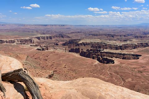
Photograph: Myrabella / Wikimedia Commons, CC BY-SA 4.0, cropped
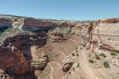
Photograph: DXR, CC BY-SA 4.0, cropped
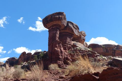
Photograph: Kognos, CC BY-SA 4.0, cropped
Photograph: Julianibarra, CC0


