
- Where
- Lighthouse Reef, Belize
the eastern edge of the Belize Barrier Reef - Coordinates
- 17.3158° N
87.5347° W - Biome
- Coral atoll, marine sinkhole
and shallow reef lagoon - Size
- About 318 m across, 124 m deep
(Cousteau’s sounding: about 125 m) - Origin
- A limestone cave flooded
as the sea rose after the ice ages - Status
- Natural Monument;
UNESCO World Heritage (reef system), 1996 - Distance
- About 70 km from the Belizean mainland
(other accounts say 80 to 100 km)
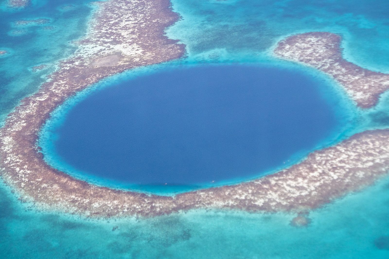
Left in the dark from a sandy island with a pelican on every post, and ran for hours over clear water, past a white line of surf on the reef. Then, in the pale shallows, a perfectly round patch of deep navy, like the pupil of an eye. Floating over it, the water went black and silent, and I hung like a coin about to be dropped in a well.
The short answer
The Great Blue Hole is a large circular marine sinkhole near the centre of Lighthouse Reef, an atoll about 70 kilometres from the mainland and from Belize City. It is 318 metres across and 124 metres deep. It formed during several phases of the Quaternary glaciations, when sea levels were much lower and the limestone was a dry cave; as the ocean rose again, the cave flooded. It is a Natural Monument within the Belize Barrier Reef Reserve System, which UNESCO listed as a World Heritage Site in 1996, and it was made famous among divers by Jacques Cousteau, who took his ship, the Calypso, there to chart it in 1971.
Why it's worth knowing
Most people know it as a photograph: a navy-blue circle in a pale reef, taken from a small plane. The photograph is of something that used to be dry.
Here is the evidence. Investigations by Cousteau’s expedition confirmed the hole’s origin as typical karst limestone, formed before the sea rose in at least four stages, which left ledges in the wall at depths of 21, 49 and 91 metres. Stalactites were retrieved from the submerged caves. A stalactite grows by mineral-laden water dripping in air, so finding them underwater confirms that the caves were once above sea level. Wikipedia’s account of the expedition adds a detail: some of the stalactites hang about 5° off vertical, all in the same direction, which indicates that the land itself tilted at some point and not only that the sea rose.
And its records have moved. Its fame rests on size. Wikipedia’s article on blue holes gives its entrance, about 300 metres, as the top of the range for blue-hole entrances, and counts it the largest blue hole when width and depth are taken together. It is not the deepest: the Taam Ja’ Blue Hole in Chetumal Bay, off the same Caribbean coast, was found in 2024 to be more than 420 metres deep, and the Dragon Hole in the South China Sea is 300.89 metres. The Great Blue Hole is wide; it is not the deepest.
It is also a serious dive. Below about 91 metres the water is dark and anoxic, beneath a layer of hydrogen sulfide.
The field notes
A cave the sea moved into
Blue holes are roughly circular, steep-walled depressions in carbonate rock. They formed during past ice ages, when sea level was 100 to 120 metres lower than it is now and the limestone was exposed to rain and chemical weathering like any other limestone country. When the sea rose at the end of the ice age the process stopped. They get their name from the contrast between the deep blue of the water in the hole and the lighter blue of the shallows around it; the colour comes from the high transparency of the water and the white carbonate sand.
The Great Blue Hole lies near the centre of the atoll, in its shallow lagoon. Cousteau’s first sounding put its depth at about 125 metres, and Wikipedia gives 124; the difference is small, and this entry gives both.
What is below ninety metres
In December 2018 two submarines descended into the hole to map its interior with sonar. The team came close to a complete three-dimensional map and reported a layer of hydrogen sulfide at about 91 metres. Water at that depth and below is dark, anoxic and devoid of life. Blue holes in general have poor water circulation, and the anoxic water can support large numbers of bacteria that live on sulfur compounds.
An earlier expedition in the summer of 1997 collected core samples from the floor and documented the cave system; all the divers had to be certified in cave diving and mixed gases.
The atoll around it
Lighthouse Reef is the easternmost part of the Belize Barrier Reef and one of its three atolls, with Turneffe Atoll and Glover’s Reef. It is about 35 kilometres long and 8 wide and encloses a sandy lagoon of about 120 square kilometres, 2 to 6 metres deep. Half Moon Caye, on the same atoll, is another Natural Monument (39.25 square kilometres, against 4.14 for the Great Blue Hole), with a rookery of magnificent frigatebirds and a nesting colony of about 4,000 red-footed boobies.
The rim of the hole itself carries a community of coral and tropical fish. The shallow reef edge is about 5 metres deep, slopes to about 10, and then drops away as a near-vertical cliff. Groupers, angelfish and butterflyfish live there, along with nurse sharks, Caribbean reef sharks and blacktip sharks. The atoll has only partial environmental protection, and the article records human impact from uncontrolled fishing and tourism.
Who made it famous
Cousteau brought the Calypso to the hole in 1971 to chart it, and is reported to have declared it one of the top five scuba-diving sites in the world. (Wikipedia’s article on the barrier reef dates his making it famous to 1970; the article on the hole says 1971.) In 2012 the Discovery Channel ranked it first on a list of “The 10 Most Amazing Places on Earth”, and in 2018 it broadcast Discovery Live: Into the Blue Hole, featuring Erika Bergman, Fabien Cousteau and Richard Branson.
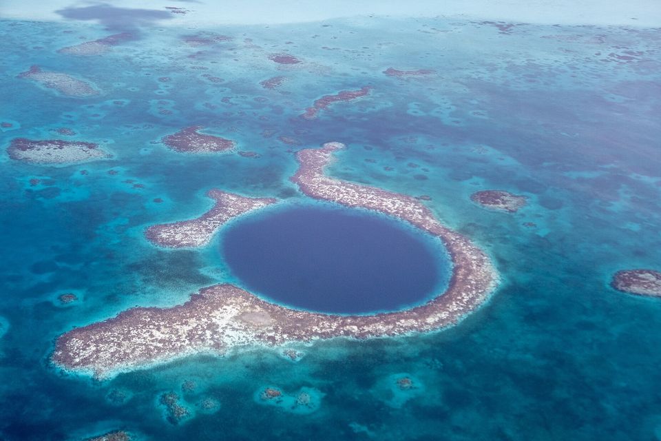
The hole in the reef of Lighthouse Reef, with patch reefs around it.
Photograph: © Xiquinho Silva · CC BY 4.0 · cropped
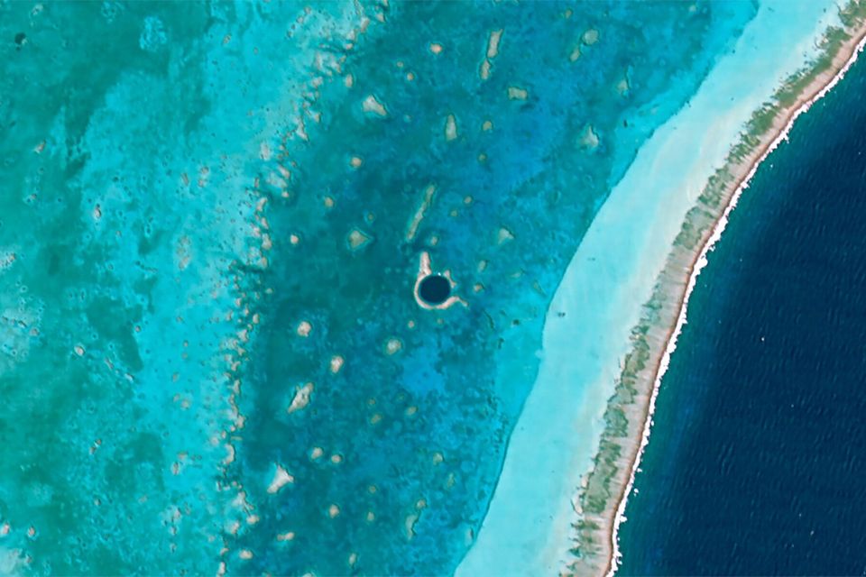
The hole from orbit, a small dark circle in the atoll’s lagoon (Hodoyoshi-1 satellite, 2015).
Satellite image: Axelspace Corporation · CC BY-SA 4.0 · cropped
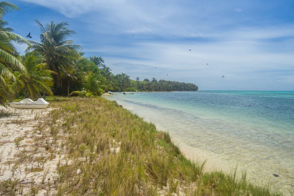
The beach on Half Moon Caye, elsewhere on Lighthouse Reef.
Photograph: dronepicr · Half moon caye Belize (20770101324) · CC BY 2.0 · cropped
- Take the flight if you can, the boat if you cannot, and both if you can.
- Look at the edge of the shallow reef, where the colour falls off a cliff.
- If you dive it, go with someone who has made the descent a hundred times. Listen to the briefing twice.
- Snorkel the shallows afterwards. Coming up from the deep, they feel like a reward.
- Float for one quiet minute above the middle and add nothing to the list. (Lasted about forty seconds.)
A stalactite that hangs five degrees off true. Cousteau’s 1971 expedition retrieved stalactites from the submerged caves of the Great Blue Hole, and some of them were off vertical by about 5° in a consistent direction, which points to the plateau itself having tilted. On Wikipedia’s account, they show the same thing twice: that the caves were once in air, and that the ground moved. Whether a diver can see stalactites in place depends on depth, conditions and the operator, and this entry does not promise it; what anyone can see is the dark circle from the air, and know that it is a room the sea moved into.
Tally, in the marginA row of stone icicles all leaning the same way, like a choir turned towards one door. I had assumed the sea did everything here. It had not occurred to me to ask the floor.
Getting there
How to get there. The hole is on Lighthouse Reef, out in the Caribbean Sea. Depending on the source, it is 70 kilometres from the mainland, 80 kilometres southeast of Belize City, or 100 kilometres from the coast. It is reached by boat or small aeroplane. Day trips and sightseeing flights leave from Belize City and from the cayes to the north, and boat trips from the mainland are long days on open water. There are no roads.
Ways to see it. A flight gives the shape and the colour that the photographs show. A boat takes you to the rim. Snorkelling on the rim and at Half Moon Caye shows you the reef and the fish. Diving the hole means descending along the wall into deep water; ask the operator what certification they require, and about depth limits, gas, briefing and emergency plans, before you book. Do not go beyond your training.
When to go. Lighthouse Reef is a marine destination, so sea conditions matter more than the calendar. Ask your operator which months and days give a calm crossing and clear water.
What to book ahead. The flight or boat, and a certified operator. Fees and permits apply in protected areas; ask your operator what is included.
Practical notes. The United States has Belize at Level 2, exercise increased caution, for crime. The one Level 3 area is Southside Belize City, from the Haulover Creek Canal south to Fabers Road, which is not on the route to the hole but is worth knowing about if you connect through the city. The advisory also notes that emergency medical services are usually unavailable or significantly delayed and that serious injuries normally require medical evacuation to another country, which matters for a deep dive. Travel insurance with evacuation cover is a sensible condition of going.
Mark this place
Common questions
How deep and how wide is the Great Blue Hole?
The Great Blue Hole is 318 metres across and 124 metres deep, according to Wikipedia’s article on it; the same encyclopedia’s article on blue holes gives about 300 metres across. Jacques Cousteau’s 1971 expedition measured about 125 metres, which is still the depth most often quoted. It is a marine sinkhole near the centre of Lighthouse Reef, off the coast of Belize.
How did the Great Blue Hole form?
It began as a limestone cave above sea level during the ice ages, when the sea was 100 to 120 metres lower than today. Investigations by Cousteau’s 1971 expedition confirmed a karst origin, in at least four stages that left ledges at 21, 49 and 91 metres. As the ocean rose after the ice ages, the cave flooded.
Are there stalactites in the Great Blue Hole?
Yes. Stalactites were retrieved from the submerged caves during Cousteau’s 1971 expedition. Because a stalactite grows only in air, they confirm that the caves were above sea level before the ocean rose. Some of the stalactites hang about 5° off vertical in a consistent direction, which indicates that the underlying plateau also tilted at some point.
What is at the bottom of the Great Blue Hole?
Dark, anoxic water. In December 2018 two submarines mapped the interior with sonar and reported a layer of hydrogen sulfide at about 91 metres, below which the water is devoid of life.
Is the Great Blue Hole the deepest blue hole in the world?
No. The Taam Ja’ Blue Hole in Chetumal Bay was found to be more than 420 metres deep in 2024, the Dragon Hole in the South China Sea is 300.89 metres, and Dean’s Blue Hole in the Bahamas is 202 metres. The Great Blue Hole is about 124 metres deep; its entrance, roughly 300 metres across, is at the top of the range Wikipedia gives for blue holes.
Where is the Great Blue Hole?
Near the centre of Lighthouse Reef, the easternmost atoll of the Belize Barrier Reef, in the Caribbean Sea off Belize. Wikipedia gives its distance from the mainland as about 70 kilometres, another of its articles puts Lighthouse Reef 80 kilometres southeast of Belize City, and a third says 100 kilometres from the coast. Trips leave from Belize City and the northern cayes.
Who made the Great Blue Hole famous?
Jacques Cousteau, who took his ship Calypso to the hole in 1971 to chart its depths and declared it one of the top five scuba-diving sites in the world. Wikipedia’s reef article gives 1970 for his making it famous. In 2012 the Discovery Channel ranked it first on its list of the ten most amazing places on Earth.
Is the Great Blue Hole protected?
Yes. It is a Natural Monument of 4.14 square kilometres and part of the Belize Barrier Reef Reserve System, which UNESCO designated a World Heritage Site in 1996. Half Moon Caye on the same atoll is a Natural Monument of 39.25 square kilometres. Wikipedia notes that the atoll has only partial protection and suffers from uncontrolled fishing and tourism.