Region
Latin America & the Caribbean
Glaciers and salt flats, rainforest, reef and great waterfalls, a canal between two oceans, and the works of peoples who built here long before Europeans arrived.
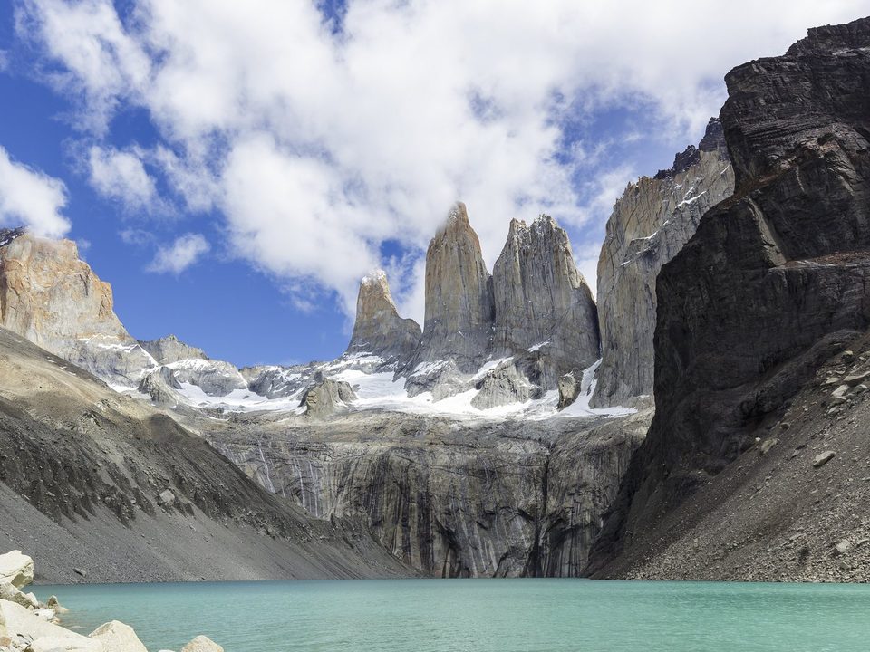
Torres del Paine. Photograph: Thomas Fuhrmann, CC BY-SA 4.0, cropped
Latin America and the Caribbean stretch from the glaciers of Patagonia to tropical rainforest and coral reef. In the far south, the Perito Moreno Glacier builds an ice dam and breaks it. Along the Andes lie high salt flats, among them Salar de Uyuni on the Bolivian Altiplano, and on the Pacific side of northern Chile is the driest non-polar desert on Earth. Machu Picchu stands in cloud forest above an Andean valley. The Osa Peninsula carries rainforest down to Costa Rica's Pacific coast, and the Caribbean islands range from volcanic, forested Dominica to flat coral islands ringed by reef. Patagonia's season runs from November to March; in the Caribbean, December to April or May is the drier time.
44 places in this region
 ChiloéLos Lagos
Sixteen wooden churches raised without iron nails by island shipwrights, and a ghost ship people still half-believe in.
 Cueva de las ManosSanta Cruz
Hundreds of hands stencilled on a canyon wall in blown pigment. More than nine in ten are left hands.
 Perito Moreno GlacierSanta Cruz
A glacier that has dammed an arm of the lake, held the water back for years, and then lost, and that is now retreating.
 Torres del PaineMagallanes
A granite laccolith built in ninety thousand years and sliced open by ice: a UNESCO biosphere reserve since 1978, though not a World Heritage Site.
 Península ValdésChubut
Orcas that throw themselves onto the beach on purpose to hunt, using a technique the young learn by practising.
 FernandinaGalápagos, Ecuador
The youngest Galápagos island: never reached by an introduced mammal, an active volcano, sneezing marine iguanas, and a tortoise that hid for 113 years.
 The Osa PeninsulaPuntarenas, Costa Rica
The most biologically intense place on Earth, by National Geographic's famous description: tapirs at the ranger station, macaws over the beach.
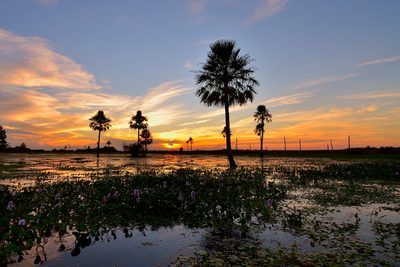 The Iberá WetlandsCorrientes, Argentina
Shining waters where jaguars walk free again after seventy years: rewilding's great showcase, patrolled by unbothered capybaras.
 DominicaCommonwealth of Dominica
Too steep for sugar, so the forest stayed, and offshore, sperm whale families live year-round instead of migrating.
 Virgin Islands National ParkUS Virgin Islands
About sixty per cent of St. John is national park, and the forest everyone calls unspoiled is second growth over terraced sugar plantations, above reefs, Taíno carvings and the ruins of Annaberg.
 Machu PicchuCusco Region, Peru
The best-known ruin in the Americas, and possibly not called Machu Picchu at all: two scholars argue that name came from an American's 1911 publications.
 Salar de UyuniPotosí Department, Bolivia
The largest salt flat on Earth, level enough that space agencies test satellites against it, and a mirror when it rains.
 The Nazca LinesIca Region, Peru
Hundreds of huge lines and animal figures scratched into a Peruvian desert, still being found: in 2024 AI helped confirm 303 new ones.
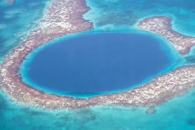 The Great Blue HoleLighthouse Reef, Belize
A perfectly round hole in a Caribbean reef, and a flooded cave: the stalactites in its walls prove it was dry when the ice ages had drawn the sea down.
 Iguazú FallsMisiones (Argentina) and Paraná (Brazil)
Argentina's park counts 275 falls; other accounts give 150 to 300, because the number depends on the river. The same river wrecked the walkway to the Devil's Throat in 2023, and it was taken apart again in 2026 before an expected flood.
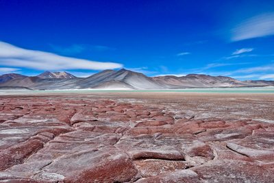 Atacama DesertNorthern Chile
The driest non-polar desert on Earth, whose soil near Yungay passed Viking-style tests for Mars in 2003, until another team grew microbes from it. In a wet year its southern end flowers.
 Lençóis MaranhensesMaranhão, north-eastern Brazil
White dunes on Brazil's north coast fill with freshwater lagoons every rainy season. The dunes move up to 25 metres a year, so the lagoons come back each year somewhere else.
 The Meeting of the WatersAmazonas, Brazil
Below Manaus, the black Rio Negro and the pale, muddy Solimões run side by side in one channel for kilometres without mixing, and the river that leaves is the one Brazil calls the Amazon.
 Gocta FallsAmazonas Region, Peru
A waterfall of 771 metres in two drops in northern Peru, in full view of the villages below it, which the wider world heard of only in 2006, together with a world ranking disputed ever since.
 The Panama CanalColón and Panamá provinces, Panama
A shortcut between two oceans that lifts every ship 26 metres on fresh water from a lake, then lets the water run to the sea. When the rain fails, fewer ships cross. Bound for the Pacific, a ship sails south-east.
 UshuaiaTierra del Fuego, Argentina
Argentina's southernmost city calls itself the world's. Across the Beagle Channel, Chile's Puerto Williams lies about 15 km farther south and has counted as a city since 2019.
 Marble CavesAysén Region, Chile
On a Patagonian lake big enough to raise its own waves, the water has hollowed a marble shore into chapels and tunnels, and glacial silt in the water turns the walls blue.
 JalapãoTocantins, Brazil
A remote stretch of Brazilian savanna with orange dunes, clear rivers and springs that push swimmers back to the surface, and a golden grass that the quilombola village of Mumbuca turned into a craft.
 Colca CanyonArequipa Region, Peru
A gorge in the southern Peruvian Andes where condors rise past the rim in the morning and the valley is stepped with terraces older than the Inca. In 1586 its two peoples told the Spanish they shaped their children's heads after mountains.
 SabaSaba, Caribbean Netherlands
A green volcano in the Caribbean with cliffs on every side, a runway of about 400 metres that only small planes use, and a road islanders built by hand after engineers said it could not be done. Its women made a trade of drawn-thread lace.
 Cabo PolonioRocha, Uruguay
A village of scattered houses on a rocky Atlantic cape in Uruguay, reached only across the dunes. Its houses have no mains power, by its residents' own preference; its lighthouse is from 1881, and sea lions crowd the islands offshore.
 The Missions of Trinidad and JesúsItapúa, Paraguay
The sandstone ruins of two Jesuit reductions in southern Paraguay, built with the Guaraní and listed by UNESCO in 1993. One church has a frieze of carved angel musicians; the other was still being built when the Jesuits were expelled, and stands unfinished.
 Robinson Crusoe IslandJuan Fernández Islands, Chile
A volcanic island far off the coast of Chile where the Scottish sailor Alexander Selkirk lived alone for four years and four months. Chile renamed it in 1966 after the novel his story helped inspire.
 IschigualastoSan Juan Province, Argentina
A valley of pale, wind-cut badlands under red cliffs in San Juan, Argentina, whose rocks of about 230 million years ago gave up some of the first dinosaurs. A guided circuit of about 40 km leads past a stone mushroom and a stone submarine.
 Fernando de NoronhaPernambuco, Brazil
A volcanic archipelago 354 km off Brazil, mostly a marine national park, where visitors pay a tax for each day they stay, spinner dolphins rest in a bay, and twin peaks stand in the surf.
 Laguna ColoradaPotosí, Bolivia
A shallow lake turned brick-red by algae and sediment, with white islands of borax, at 4,278 metres on Bolivia’s altiplano. James’s flamingo, once thought extinct, was found nesting here in the 1950s.
 Klein CuraçaoCuraçao, Kingdom of the Netherlands
A flat, uninhabited island off Curaçao, reached only by day boat across open sea. An old lighthouse stands in the middle, a tanker wreck breaks up on the windward shore, and sea turtles nest on the lee beach.
 Isla Martín GarcíaBuenos Aires Province, Argentina
A small island in the Río de la Plata that lies in Uruguayan waters but belongs to Argentina. It was a fortress, a penal colony and a prison for three presidents; a 1973 treaty keeps it a nature reserve.
 Isla Pingüino (Puerto Deseado)Santa Cruz Province, Argentina
A rocky island off Puerto Deseado, in Argentine Patagonia, where yellow-crested rockhopper penguins nest from spring to autumn: the only colony of them on the continent that visitors can reach, by authorised boat, beside an old navy lighthouse.
 BarbudaAntigua and Barbuda
A flat, quiet coral island north of Antigua, with a single village, long empty beaches of pink sand, and a great shallow lagoon whose mangroves hold what is called the world’s largest colony of magnificent frigatebirds.
 Tobago Cays (Grenadines)Southern Grenadines, Saint Vincent and the Grenadines
Five small uninhabited islands in the Southern Grenadines, set in a shallow lagoon behind the long Horseshoe Reef. The marine park around them is reached only by boat, and green turtles graze its seagrass.
 AnegadaBritish Virgin Islands
The flat one among the mountainous British Virgin Islands: a low coral island ringed by a long reef that has wrecked hundreds of ships, with miles of white beach, flamingos in its salt ponds and a rare iguana found nowhere else.
 Little CaymanCayman Islands
The smallest of the three Cayman Islands, home to 161 people and thousands of nesting red-footed boobies. Off its north coast, the reef of Bloody Bay Wall drops from snorkelling depth into the deep.
 The Diquís Stone SpheresPalmar Sur, Osa, Puntarenas Province, Costa Rica
More than 300 carved stone balls, from fist-sized to taller than a person, set in lines near the houses of chiefs on a river delta in southern Costa Rica, found by banana workers in the 1930s, dynamited by gold hunters and still not fully explained.
 Raleighvallen and VoltzbergCoppename River, Sipaliwini District, Suriname
A chain of rapids on the Coppename River in the rainforest of central Suriname, reached by charter plane or by road and dugout, and a few hours’ walk away the Voltzberg, a bare granite dome that rises over forest unbroken to every horizon.
 Quebrada de HumahuacaJujuy Province, Argentina
A high, dry Andean valley in Argentina’s far north where hills banded rose, cream, plum and green stand over adobe villages like Purmamarca, along a route of traders, the Inca and armies that people have travelled for at least 10,000 years.
 Old San JuanSan Juan, Puerto Rico, United States
The walled colonial heart of Puerto Rico’s capital, with blue cobblestone streets, a governor’s mansion built between 1533 and 1540, and El Morro, a Spanish fort begun in 1539 that steps down six levels to the Atlantic and was taken in battle only once.
 Buenos AiresBuenos Aires, Argentina
Argentina’s capital on the Rio de la Plata, where tango began in the 1880s, the acoustician Leo Beranek ranked the Teatro Colón the best room in the world for opera, the houses of Caminito are painted every colour, and fileteado sign-painting is on UNESCO’s list.
 The PantanalPoconé, Mato Grosso
A road park across the northern Pantanal of Brazil, the largest seasonally flooded plain in the Americas, where caimans, storks and jaguars share the roadside and hyacinth macaws nest in old trees.
About this hub
Nearby on the shelf
- Patagonia (collection, 6)
- Sacred & ancient places (collection, 36)
- The whole map
Know somewhere that belongs here?
Each place page names its sources and the date it was checked.
Photo credits for the thumbnails
- Chiloé: Photograph: Bjørn Christian Tørrissen, CC BY-SA 4.0, cropped
- Cueva de las Manos: Photograph: Pablo A. Gimenez from Buenos Aires, Argentina, Cueva de las Manos, CC BY-SA 2.0, cropped
- Perito Moreno Glacier: Photograph: Valentinamaur, CC BY-SA 4.0
- Torres del Paine: Photograph: Thomas Fuhrmann, CC BY-SA 4.0
- Península Valdés: Photograph: Fernanda Cabral Jeronimo, CC BY-SA 4.0, cropped
- Fernandina: Photograph: Kjersti Holmang, Marineiguanas, CC BY-SA 3.0, cropped
- The Osa Peninsula: Photograph: Bernard Gagnon, CC0, cropped
- The Iberá Wetlands: Photograph: Papa Pic, CC0, cropped
- Dominica: Photograph: Cheguemanu, CC BY-SA 4.0, cropped
- Virgin Islands National Park: Photograph: Bradley Furlow, CC BY-SA 4.0
- Machu Picchu: Photograph: Lunaloop, CC BY-SA 4.0, cropped
- Salar de Uyuni: Photograph: Karla Robinson via Unsplash, Unsplash licence
- The Nazca Lines: Photograph: Christian Haugen via Flickr, Nasca Lines - The monkey, CC BY 2.0
- The Great Blue Hole: Photograph: © Xiquinho Silva, CC BY 4.0, cropped
- Iguazú Falls: Photograph: Falk2, CC BY-SA 4.0
- Atacama Desert: Photograph: Wescottm, CC BY 4.0, cropped
- Lençóis Maranhenses: Photograph: Julius Dadalti, CC BY-SA 4.0, cropped
- The Meeting of the Waters: Photograph: Marcelo Camargo / Agência Brasil, Encontro do Rio Negro com o Solimões 01, CC BY 3.0 BR
- Gocta Falls: Photograph: Draceane, CC BY-SA 4.0, cropped
- The Panama Canal: Photograph: Dr. Thomas Liptak, CC BY-SA 4.0, cropped
- Ushuaia: Photograph: Juan Carlos Dominguez M, CC BY-SA 4.0, cropped
- Marble Caves: Photograph: M M, Marbol Caves, Puero Tranquilo, CC BY-SA 2.0, cropped
- Jalapão: Photograph: Julius Dadalti, CC BY-SA 4.0
- Colca Canyon: Photograph: Tydence Davis, Colca Canyon, Peru, CC BY 2.0
- Saba: Photograph: Fabien Lortal (Flickr: killians_red), Saba Runway march 2012, CC BY 2.0
- Cabo Polonio: Photograph: Jovarca, Tras las rocas... el faro, CC BY-SA 3.0, cropped
- The Missions of Trinidad and Jesús: Photograph: Falk Arnhold (Falk2), CC BY-SA 4.0
- Robinson Crusoe Island: Photograph: Balou46, CC BY-SA 4.0
- Ischigualasto: Photograph: Herrerajunior, CC BY-SA 4.0, cropped
- Fernando de Noronha: Photograph: CCINTRA, Fernando de Noronha - PE - Dois Irmãos, CC BY-SA 3.0
- Laguna Colorada: Photograph: Havardtl, CC BY-SA 4.0
- Klein Curaçao: Photograph: Gerrit Fries, CC BY-SA 4.0, cropped
- Isla Martín García: Photograph: Silvinarossello, ISLA AEREA, CC BY-SA 3.0, cropped
- Isla Pingüino (Puerto Deseado): Photograph: Andreacav7, CC BY-SA 4.0, cropped
- Barbuda: Photograph: CROIX, CC BY 4.0, cropped
- Tobago Cays (Grenadines): Photograph: Christian Lendl via Flickr, Petit Tabac, CC BY 2.0
- Anegada: Photograph: Cayeldo, Loblolly Bay Anegada - panoramio, CC BY-SA 3.0, cropped
- Little Cayman: Photograph: NOAA, Twilight Zone Expedition 2007, Public domain (PD-USGov-NOAA), cropped
- The Diquís Stone Spheres: Photograph: xiquinhosilva (Xiquinha Silva), CC BY 4.0
- Raleighvallen and Voltzberg: Photograph: Jan Willem Broekema, Trek to Volzberg Mountain, CC BY-SA 2.0, cropped
- Quebrada de Humahuaca: Photograph: Bernard Gagnon, CC BY-SA 4.0, cropped
- Old San Juan: Photograph: P. Hughes, CC BY-SA 4.0, cropped
- Buenos Aires: Photograph: Mauro Tchorbadjian via Unsplash, Unsplash licence
- The Pantanal: Photograph: Leonardo Ramos, CC BY-SA 4.0