The short answer
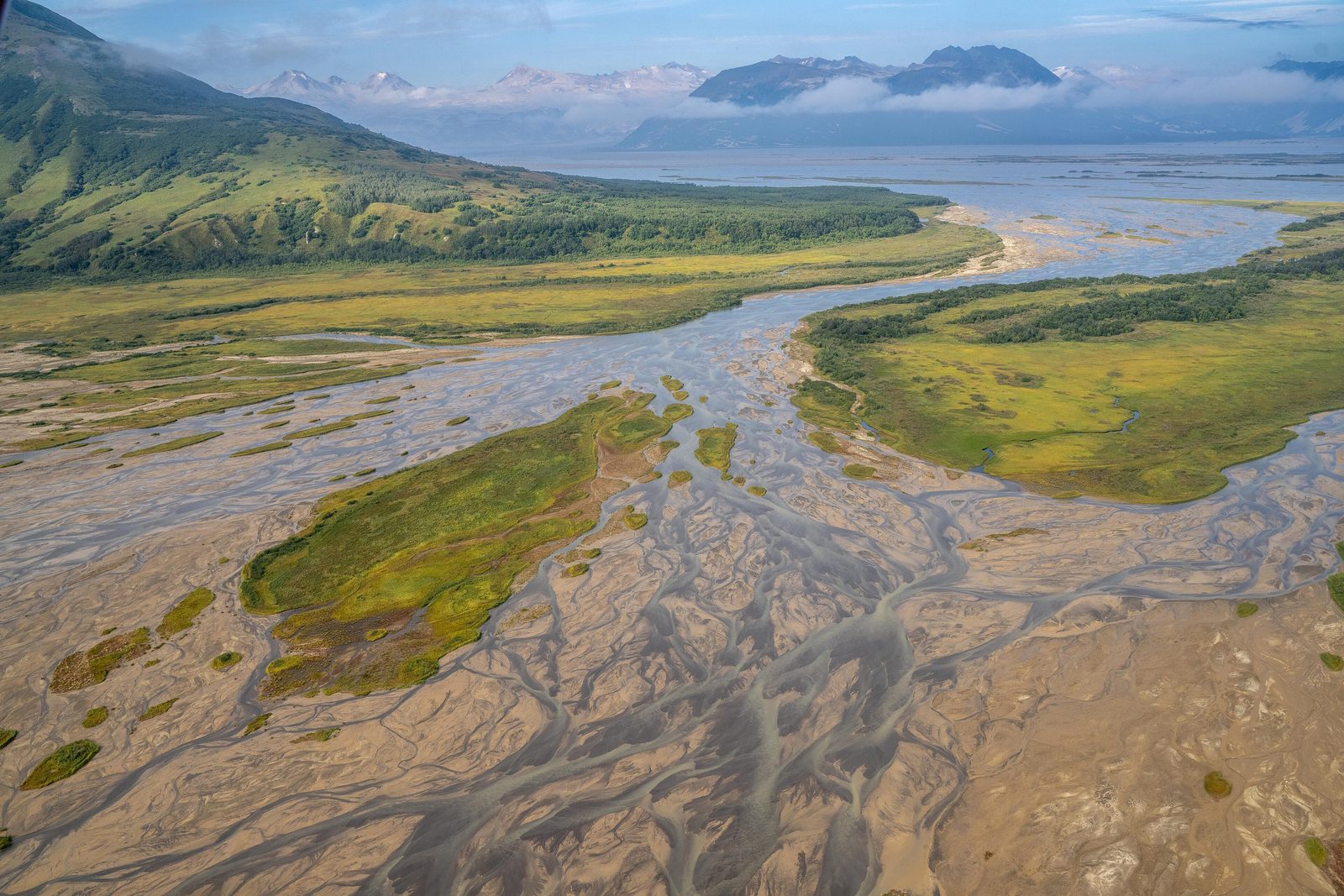
Katmai National Park and Preserve covers a huge, roadless stretch of the northern Alaska Peninsula, north-west of Kodiak Island and south-west of Homer. Its headquarters are in King Salmon, about 290 miles south-west of Anchorage, and no road joins the park, or King Salmon, to the rest of the state: people come by plane or by boat. It protects the Valley of Ten Thousand Smokes, still bare under its ash; at least 14 active volcanoes; lakes, rivers and a wild Pacific coast; and the brown bears that fish the Brooks River. It was made a national monument in 1918 because of the eruption, and was later greatly enlarged as a national park and preserve.
From Tally’s diary
The valley floor was grey and bare and went on and on, soft under my boots like ash from a very old fire, which is exactly what it was. A cold wind came down off the mountains with not a single tree to hide behind. I sat down in the middle and felt like the only small thing in a very large, quiet room.
Inside the park
- Brooks Falls
Brooks Falls, where brown bears stand at the lip of the falls in July and wait for leaping salmon.
Photograph: Christoph Strässler from Oberdorf BL, Schweiz, Brown Bears at Brooks Falls, Katmai National Park, CC BY-SA 2.0, cropped

Why it's worth knowing
A new volcano. The 1912 eruption was one of the five largest in recorded history; nothing has surpassed it since Tambora in 1815. Ash and pumice poured down the Ukak River valley at more than 100 miles an hour, turning 40 square miles of it into barren ash, so hot that it took decades to cool. Any water caught underneath flashed into steam, and the vents where it hissed out gave the Valley of Ten Thousand Smokes its name. Downwind on Kodiak Island, people lived in near darkness for almost three days. The hole left by Mount Katmai’s collapsed summit, nearly two miles across, has been slowly filling with water ever since, and now holds a lake more than 800 feet deep.
On the Ring of Fire. Katmai lies on the northern edge of the Pacific Ring of Fire, where the Pacific Plate dives beneath the North American Plate. The Alaska Peninsula and the Aleutian Islands have about 80 major volcanic centres, and at least 14 active volcanoes are inside the park alone. Much older rocks hold fossils of the sea: the Naknek Formation, 160 to 146 million years old and the largest rock formation in the park, is full of clams, scallops and coiled ammonites, the biggest of which grew six feet across.
Bears of the coast. Katmai’s brown bears are coastal brown bears, the same species as the grizzly but living on food from the coast: all five kinds of Pacific salmon, clams dug from the beaches and sedges in the coastal meadows. They are often bigger than inland grizzlies and more tolerant of one another, because their food comes concentrated in one river or meadow. Even the bears of the Brooks River, far from the ocean, count as coastal, because they live on the salmon run that comes in from Bristol Bay.
The field notes
The villages that were left
Before 1912 there were four villages lived in all year round inside what is now the park, Savonoski, Kaguyak, Kukak and Katmai, and many seasonal camps. In the days before the eruption the earthquakes grew so strong and frequent that the last two families at Katmai Village left two days early, and they were wise to. The ash fall drove everyone away. The people resettled elsewhere along the Alaska Peninsula and never went back; ash nearly buried Katmai Village, and a flood in 1916 destroyed what was left. Their descendants, mostly of Alutiiq heritage, live in Naknek, King Salmon, Perryville and other villages, and rural people keep their right to hunt, fish and gather on the preserve’s lands.
Practising for the Moon
In 1965 and 1966 NASA sent two groups of Apollo astronauts to the Valley of Ten Thousand Smokes, because its bare, ashy ground looked so much like the surface of the Moon. They were dropped off with little information and asked to collect rock samples and describe what they found, a test of how well astronauts and geologists could talk to each other. In the evenings they stayed at the fishing lodge at Brooks Camp and talked volcanoes.
Nine thousand years of people
The oldest archaeological sites in Katmai are 9,000 to 7,000 years old, left by people whose tools look like those of north-east Asia, who probably came over the land bridge on foot or across the widening Bering Strait by boat. Later peoples followed, and the remains of their houses still lie in the Brooks River area. Much of what they made, nets, clothing, shoes and baskets, has not survived in the acid soil, so archaeologists work from stone tools and house pits.

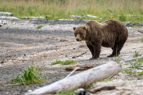
September 2021A brown bear on the beach at Katmai Bay.
Photograph: NPS / Lian Law, Public domain

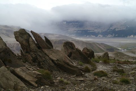
August 2018Tilted rocks above a misty valley.
Photograph: NPS / Davyd Betchkal, Public domain, cropped
- Walk out on to the grey valley floor. (Walked. Kept walking. The valley did not seem to get any smaller.)
- Find a stone light enough to float. (Found one. Left it exactly where it lay. It looked as if it had been through enough.)
- Count the mountains with snow on them. (Counted. Then some cloud moved and there were more.)
- I watched a big brown bear dig on the beach for a long time from very far away, and was glad of every bit of the distance.
- Find somewhere the astronauts stood. (Probably found it. It looked exactly like everywhere else, which I suppose was the point.)
A relic from Katmai National Park and Preserve
Relic, entry 355Flung from the Novarupta ventCracked like a loaf’s crust
A breadcrust bomb from Novarupta. During the eruption a few lumps of molten rock were flung violently out of the vent, cooling as they flew. The outside hardened first, and as the inside went on swelling with gas it split the crust open in deep cracks, like the top of a loaf of bread left too long in the oven. They came down on a landscape that was itself being buried: the ground near Novarupta lies under several hundred feet of ash and pumice.
Tally, in the marginA rock with a cracked crust like a loaf left in too long, and I nearly laughed, until I remembered it had been thrown here, still glowing, out of a brand-new mountain. I put my hands in my pockets and gave it plenty of room.
Getting there
- 1
To King Salmon
Scheduled flights from Anchorage, about 290 miles.
- 2
Into the park
Air taxis fly from King Salmon, Homer, Kodiak and other towns.
- 3
By water
Powerboats run from Naknek and King Salmon to Brooks Camp.
- ✓
How to get there. No road reaches Katmai, Brooks Camp or King Salmon from Anchorage. Scheduled flights run from Ted Stevens Anchorage International Airport to King Salmon, about 290 miles south-west of Anchorage, where the park has its headquarters and visitor centre. From there and from Anchorage, Dillingham, Homer, Kodiak and other towns, air taxis fly to Brooks Camp, the coast and other places in the park; Brooks Camp and the Naknek River can also be reached by powerboat from Naknek and King Salmon, and boats reach the Pacific coast. Authorised air taxis, bear-viewing guides and other services are listed by the Park Service’s Alaska regional office.
When to go. The park and preserve are open all year; Park Service and concession services at Brooks Camp run from June 1 to September 17.
Safety. The State Department’s travel advisories cover other countries, so none applies here. The park’s bear-safety rules apply everywhere.
Mark this place
The passport stamp for this place.
Common questions
Where is Katmai National Park?
On the northern Alaska Peninsula, in south-west Alaska. Katmai National Park and Preserve lies north-west of Kodiak Island and south-west of Homer; its headquarters are in King Salmon, about 290 miles south-west of Anchorage.
Can you drive to Katmai National Park?
No. There are no roads joining Katmai National Park and Preserve, Brooks Camp or King Salmon to the rest of Alaska; most people fly in, by scheduled flight to King Salmon and then by air taxi or boat.
What was the 1912 Novarupta eruption?
The largest volcanic eruption of the 20th century. In June 1912 Novarupta, in what is now Katmai National Park and Preserve, blew out 3.1 cubic miles of magma over 60 hours, 30 times more than Mount St. Helens in 1980.
Why is it called the Valley of Ten Thousand Smokes?
For the steam that rose from it after 1912. Hot ash buried the Ukak River valley in Katmai National Park and Preserve, and water trapped beneath it flashed into steam that hissed out of countless vents.
Did astronauts train at Katmai?
Yes. In 1965 and 1966 NASA sent two groups of Apollo astronauts to the Valley of Ten Thousand Smokes in Katmai National Park and Preserve to practise geology on ground that looked like the Moon.
How many volcanoes are in Katmai National Park?
At least 14 active ones. Katmai National Park and Preserve sits on the Pacific Ring of Fire, where the Alaska Peninsula and the Aleutian Islands have about 80 major volcanic centres.
Are Katmai's bears grizzlies?
The same species, living differently. Katmai National Park and Preserve’s brown bears are coastal brown bears, fed on salmon, clams and sedges, and are often larger and more tolerant of each other than inland grizzlies.
Photographs on this page
Tap a photograph to see it full size.
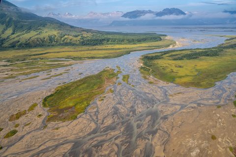
Photograph: NPS / Lian Law, Public domain
Photograph: NPS / Lian Law, Public domain
Photograph: NPS / Davyd Betchkal, Public domain, cropped


