
- Where
- Across the Isthmus of Panama,
Colón to Balboa - Coordinates
- 9.0772° N, 79.6753° W
(in the Culebra Cut) - Length
- 80–82 km
(Wikipedia gives both) - Lift
- 26 m, to the level
of Gatún Lake - Opened
- 15 August 1914
- Operated by
- Panama, since noon on
31 December 1999 - Water per ship
- 52 million gallons
(Canal Authority)
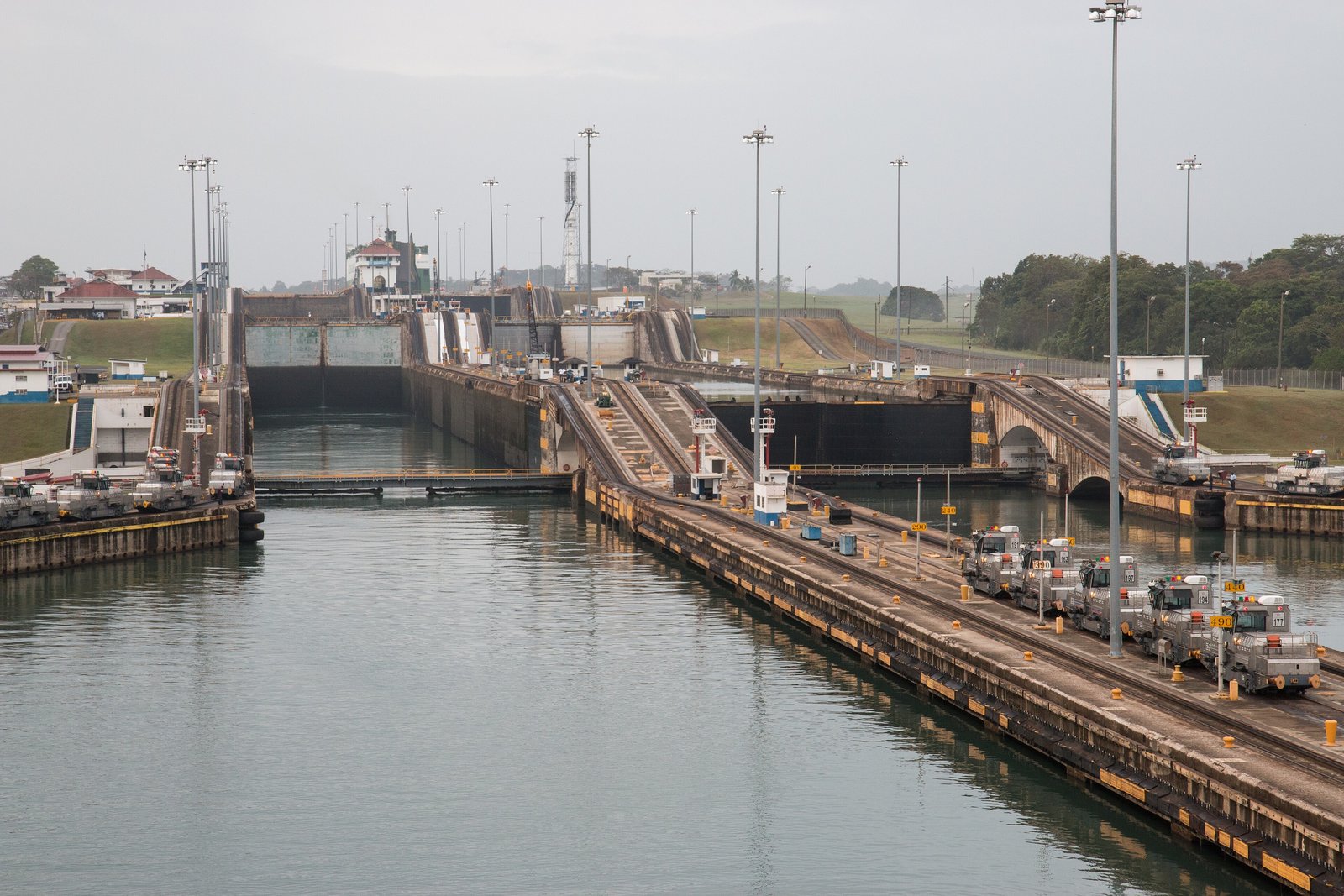
Thick wet heat, green hills, and rain coming over them in a grey curtain. From a terrace I watched a ship the size of a street rise slowly in a box of water, held on either side by ropes to small silver engines on rails. Then great doors opened and it went on towards the other ocean. Nobody else seemed to find this remarkable. I did.
The short answer
The Panama Canal is a lock canal across the Isthmus of Panama, joining the Caribbean Sea, and so the Atlantic, to the Pacific Ocean. Wikipedia gives its length as 82 kilometres in one place and 50 miles (80 kilometres) in another. France began digging in 1881 and abandoned the work in 1889; the United States built the canal that opened, which the Panama Canal Authority dates to 15 August 1914. The United States operated it until noon on 31 December 1999, when, under a treaty of 1977, it passed to Panama. The canal is not dug at sea level. Locks at each end lift ships 26 metres to Gatún Lake, made by damming the Chagres River, and lower them again on the other side.
Why it's worth knowing
The canal runs on fresh water. The Canal Authority describes its locks as water lifts: to raise a ship, water from Gatún Lake flows by gravity into a lock chamber, and to lower it, the water is let out, towards the sea. By the Authority’s own figure, 52 million gallons of fresh water are used in every transit; Wikipedia gives the same figure as about 200 million litres, and says the lake is also Panama City’s main source of drinking water.
So the busiest shortcut between two oceans depends on the rain. The Authority reported that 2023 was a particularly dry year, which it attributed chiefly to El Niño: October 2023 was the driest October since records began in 1950, 41 per cent below the expected rainfall, and the lake fell about seven feet below its usual level for the season, the lowest ever recorded in a rainy season. The canal cut the number of ships it would take each day, step by step, to 18 by February 2024. Since February 2020 ships over 125 feet long have paid a fresh-water surcharge: a fixed $10,000 a transit plus a percentage of the toll, between 1 and 10 per cent, set by how full the lake is.
The newer locks, opened in 2016 for larger ships, were built with water-saving basins beside each chamber, which the Authority says let it reuse 60 per cent of the water used in each lockage.
The field notes
South-east to the Pacific
The isthmus bends, and the canal crosses it at a slant. NASA’s Earth Observatory describes the canal as running north-west to south-east, from Colón on the Caribbean to Panama City on the Pacific, and Wikipedia notes that the general direction from the Atlantic to the Pacific is from north-west to south-east. Wikipedia’s own coordinates for the two entrances put the Pacific one about 0.4 degrees of longitude east of the Atlantic one: roughly 40 kilometres further east, by our calculation. A ship bound for the Pacific finishes its passage east of where it began.
The staircase
From the Caribbean, a ship enters the three steps of the Gatún Locks, or of the newer Agua Clara Locks beside them, and rises to Gatún Lake, which Wikipedia says was the largest human-made lake in the world when it was made. It crosses the lake, passes through the Culebra Cut across the continental divide, and descends: through the single step of Pedro Miguel and the two of Miraflores, or through the three of the newer Cocolí Locks, to Balboa and the Pacific. Wikipedia gives an average of 11.38 hours in 2017 between the outer locks.
In the original locks, ships do not steer themselves through. The Authority describes electric locomotives, nicknamed mules, that run on tracks along both walls and are made fast to the ship with wire cables to keep it centred in the chamber. They work in pairs, and a large ship may need four to eight. The Authority gives its fleet as 100.
What it cost
The canal was built at a very great cost in lives, most of them lost to disease. The Canal Authority’s own history gives 5,609 deaths from disease and accidents during the American construction, from hospital records, and says that adding the French years would bring the total to some 25,000; it adds that the true number will never be known, because the French recorded only deaths in hospital. Wikipedia records that in 1888 nine-tenths of the French workforce of about 40,000 were Afro-Caribbean workers from the West Indies.
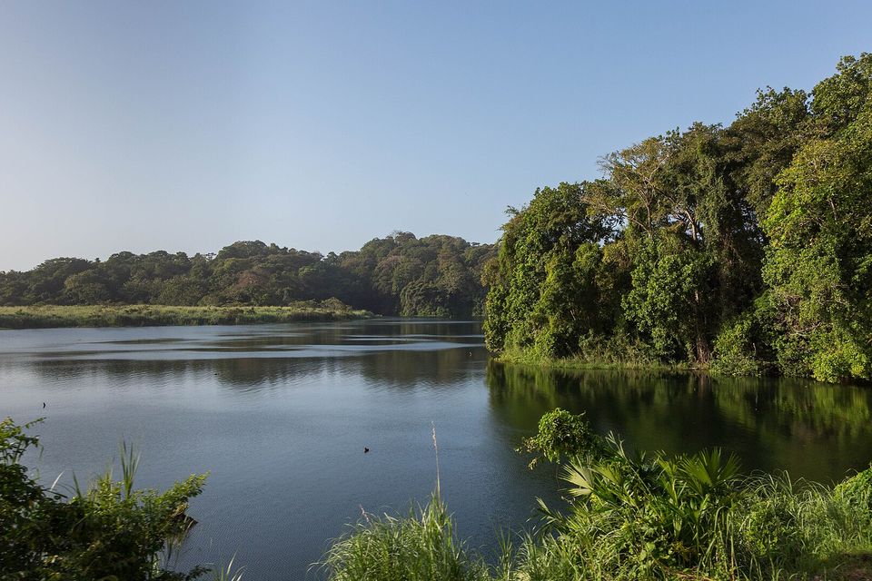
Gatún Lake, the reservoir that supplies the canal locks, seen from the Panama Canal Railway, January 2020.
Photograph: David Brossard · Gatun Lake · CC BY-SA 2.0 · cropped
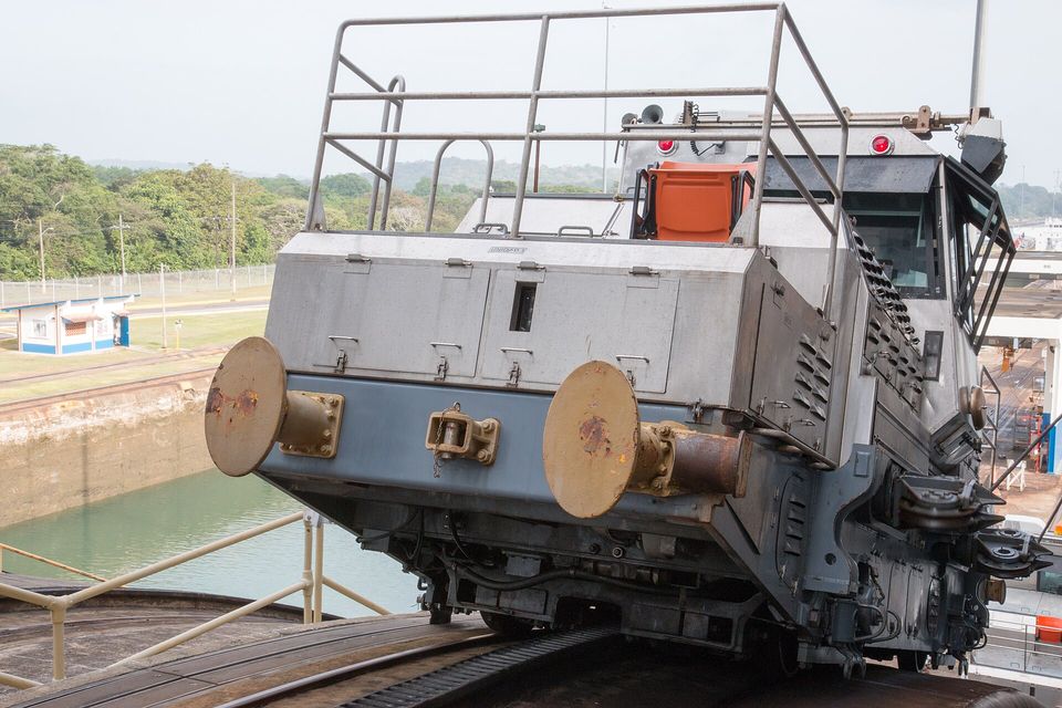
One of the canal's electric locomotives, or mules, on its track beside a lock chamber, January 2016.
Photograph: Gary Bembridge · 2016-01-28 Panama Canal Mules · CC BY 2.0
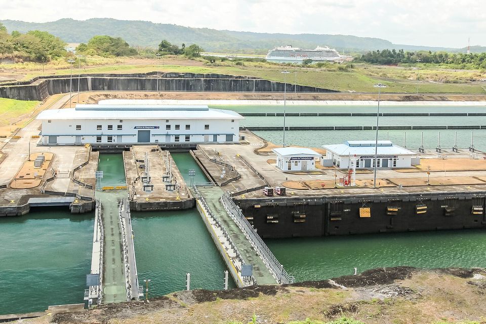
The Agua Clara locks on the Atlantic side, March 2025.
Photograph: Dr. Thomas Liptak · CC BY-SA 4.0 · cropped
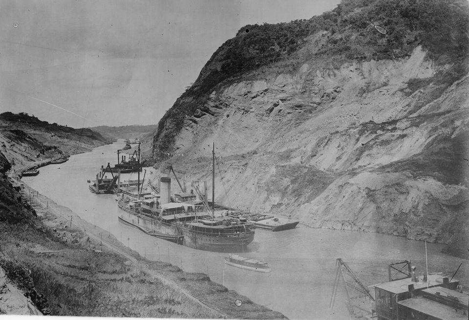
A steamer and dredges in the Culebra Cut after it was flooded in October 1913, clearing slides before the canal opened (historic photograph).
Photograph: Bain News Service, publisher (Library of Congress) · Public domain · cropped
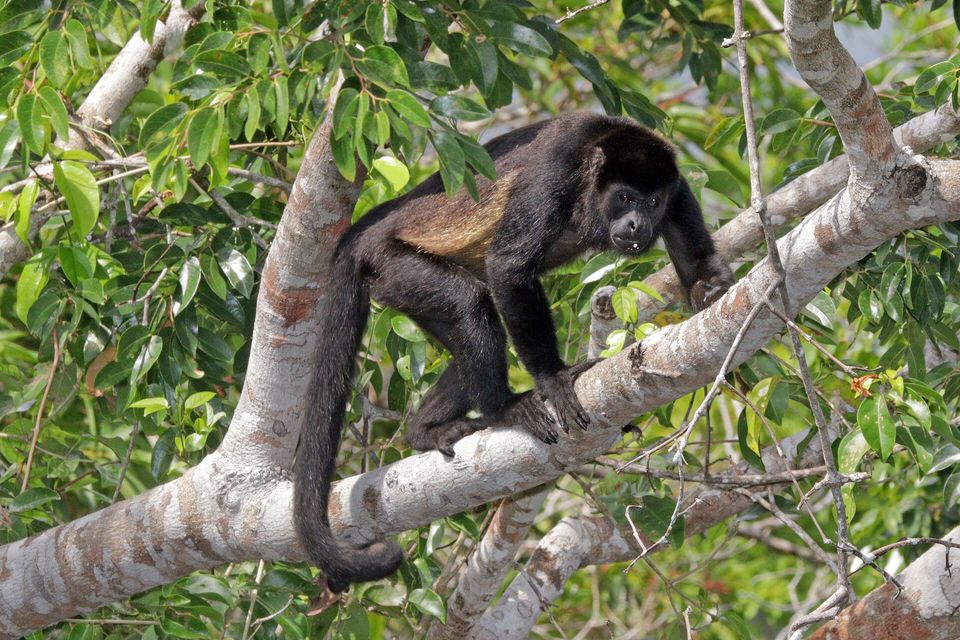
A mantled howler monkey in the forest at Gatún Lake, May 2019.
Photograph: Charles J. Sharp · CC BY-SA 4.0 · cropped
- Keep quiet at the rail while a ship is in the lock. The crews and the lock hands are concentrating, and so should you.
- Stay for one whole ship, all the way up or all the way down, before you look at anything else.
- Bring something for the rain, whatever the sky said at breakfast.
- Watch the little engines on the rails, not only the ship. They are doing the delicate part.
- Cross from one ocean to the other. (The list came through the locks with me and arrived several items higher.)
A mule. The electric locomotives that run on tracks along the walls of the Panama Canal’s original locks, made fast to each ship by wire cables. Working in pairs, they keep a ship centred in the chamber while the water lifts or lowers it; a large ship may need four to eight of them, and the Canal Authority has 100. Every ship in the old locks goes through on their cables.
Tally, in the marginSmall engines on rails, leading a ship the size of a street on ropes, as gently as you would lead a horse. I called them engines all day. Everybody here has a better name for them, and it turns out I was only one animal off.
Getting there
How to get there. Tocumen International Airport, on the eastern edge of Panama City, is the gateway. The Miraflores Locks, on the Pacific side, are a short drive from the city, and the Canal Authority runs a visitor centre there, open every day, with a covered viewing terrace over the locks, exhibition halls and a theatre; tickets can be bought online. Ships pass at irregular times, so allow a few hours, or ask on arrival when the next transits are due.
Going through. The Canal Authority gives the cruise season as October to May, when cruise lines offer full and partial transits of the canal. Book ahead.
When to go. Wikipedia’s climate account for Panama City gives a dry season from December to April and a wet season from May to November. The locks work all year; rain showers are part of the view in the wet months.
Safety. The United States has Panama at Level 2, exercise increased caution, because of crime. Its Do Not Travel areas are the Caribbean coast of the Mosquito Gulf, from Alligator Creek to Coclé del Norte, within 10 miles of the shore, and parts of the Darién region near the Colombian border. The canal corridor is about 70 kilometres east of the nearest edge of the Mosquito Gulf zone and more than 200 kilometres from the Darién areas, by our measurement.
Mark this place
Common questions
How long is the Panama Canal?
The Panama Canal is 80 to 82 kilometres long, depending on the measure; Wikipedia gives both 82 kilometres and 50 miles (80 kilometres). It crosses the Isthmus of Panama between Colón and Balboa, near Panama City, and ships take roughly half a day to pass between its outer locks.
Why does the Panama Canal need fresh water?
The Panama Canal is a lock canal. Its locks lift ships 26 metres to Gatún Lake and lower them again, and the water that fills the chambers comes from the lake by gravity and is then released towards the sea. The Panama Canal Authority puts the fresh water used in every transit at 52 million gallons.
What happened to the Panama Canal in the 2023 drought?
The Panama Canal Authority reported that October 2023 was the driest October in its records since 1950, with rainfall 41 per cent below normal, and that Gatún Lake fell about seven feet below its usual level for the season. The Authority reduced the number of daily transits, to 18 by February 2024, and restricted ships’ draft to save water.
Which direction do ships travel through the Panama Canal?
A ship crossing the Panama Canal from the Atlantic (Caribbean) side to the Pacific travels from north-west to south-east, because the Isthmus of Panama bends at that point. NASA’s Earth Observatory describes the canal as running north-west to south-east from Colón to Panama City, and the Pacific entrance lies east of the Atlantic one.
What are the mules at the Panama Canal?
The mules are electric locomotives that run on tracks along the walls of the Panama Canal’s original locks. The Panama Canal Authority says they are made fast to each ship by wire cables and work in pairs to keep it centred in the chamber; a large ship may need four to eight of them, and the fleet numbers 100.
When did Panama take control of the Panama Canal?
Panama took over the Panama Canal at noon on 31 December 1999, under the treaty signed in 1977 by Jimmy Carter and Omar Torrijos. The United States had built the canal, which opened on 15 August 1914, and operated it until then. It is now run by the Panama Canal Authority (Autoridad del Canal de Panamá).
What is the Panama Canal fresh-water surcharge?
Since 2020 the Panama Canal Authority has charged ships over 125 feet long a fresh-water surcharge on top of the toll: a fixed fee of $10,000 per transit plus a variable charge of 1 to 10 per cent of the toll, set by the level of Gatún Lake at the time. The lower the lake, the higher the percentage.
Where can you watch ships at the Panama Canal?
The easiest place is the Miraflores Visitor Center at the Miraflores Locks on the Pacific side, a short drive from Panama City. The Panama Canal Authority opens it every day, with a covered terrace overlooking the lock chambers, exhibition halls and a theatre; tickets can be bought online. Ships pass at irregular times, so ask when the next transits are due.