
- Where
- Bongará province, Amazonas
region, northern Peru - Coordinates
- 6.0231° S
77.8872° W - Height
- 771 m in two drops,
231 m and 540 m (PromPerú) - Ranking
- Disputed: announced as third
in 2006; others rank it lower - Made known
- Expedition 2002;
announced March 2006 - Neighbour
- Yumbilla, 895.4 m by laser
survey (World Waterfall Database) - Access
- On foot or horseback from
Cocachimba or San Pablo
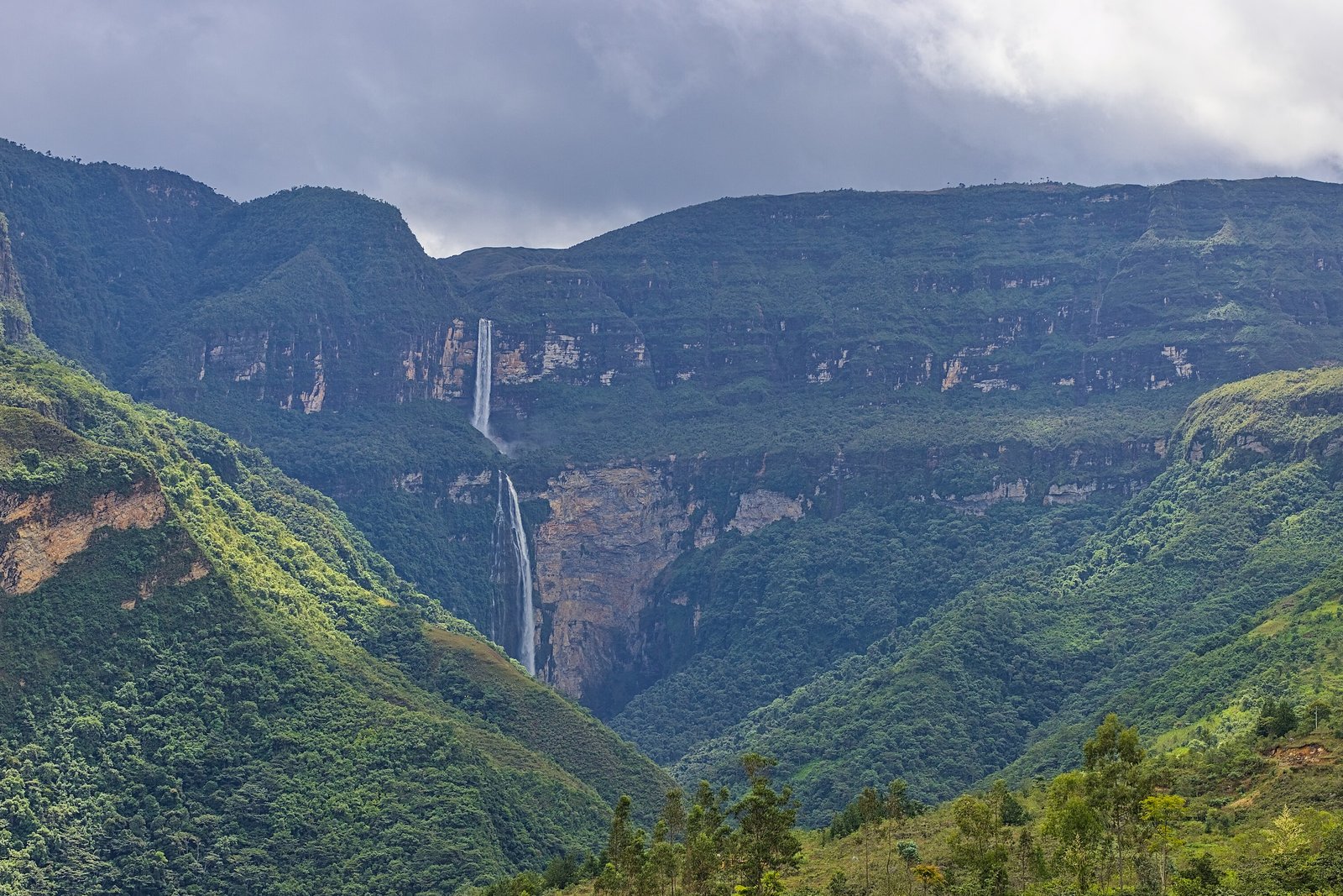
Rode a patient horse out of a village where every doorstep faced the same way, then walked down through cloud forest dripping with moss and busy with tiny hummingbirds. Then the cloud lifted: a white thread coming off a green cliff, breaking once halfway, then falling again for so long that I forgot to breathe out. The spray at the bottom was cold. I stood in it anyway.
The short answer
Gocta, the Catarata de Gocta, is a perennial waterfall in Bongará province, in the Amazonas region of northern Peru, on the forested eastern slopes of the Andes about 23 kilometres from Chachapoyas, the regional capital (our measurement). It falls in two drops into the Cocahuayco river: PromPerú, Peru’s tourism board, gives the upper drop as 231 metres and the lower as 540, 771 metres in all, and the World Waterfall Database describes the lower drop plunging nearly vertically into a huge amphitheatre. The villages of San Pablo, near the top of the upper drop, and Cocachimba, below the lower one, are the starting points for the walk. Wikipedia notes that the falls are in full view of a nearby village and had been known to local people for centuries before a 2002 expedition, led by the German Stefan Ziemendorff with Peruvian companions, made them known outside the region.
Why it's worth knowing
Gocta was not found in 2006. It was announced. Wikipedia’s account says that Ziemendorff, after his 2002 expedition, persuaded the Peruvian government to map the falls and measure their height, and that on 11 March 2006, after his third expedition, he held a press conference, reported by wire services around the world, giving the total height as 771 metres and ranking Gocta the third-tallest free-leaping waterfall in the world, after Angel Falls in Venezuela and Tugela Falls in South Africa. Two days later, on 13 March, the Peruvian government announced that the area would be developed for tourism.
The height has held up better than the ranking. Wikipedia says the third-place claim rested on outdated and incomplete information and has been widely disputed since: lists that add two Norwegian falls put Gocta fifth, and the World Waterfall Database’s list of the world’s tallest waterfalls ranks it eighteenth. Rankings of waterfalls depend on what is counted, total height or a single free drop; on the database’s free-fall list, Gocta’s lower drop of 540 metres ranks fourth. This entry gives the height, names the rankers, and makes no ranking of its own.
The same plateau has since produced a rival. The World Waterfall Database says that Yumbilla, which falls from the northern wall of the plateau Gocta drops from, was laser-surveyed by Peru’s National Geographic Institute at 895.4 metres, making it the tallest in the region, though it carries far less water.
The field notes
Why nobody said
Why a waterfall of that size stayed unknown outside its valley is a question with a local answer. The Peruvian newspaper El Comercio, as Wikipedia relays it, reported that people nearby had been afraid to reveal it because of the curse of a beautiful blonde mermaid who lived in its waters; the falls are said to be guarded by a white-haired, mermaid-like spirit whose hair can be seen flowing down the walls of the amphitheatre at the bottom. The story is the villages’ own, and this entry tells it as theirs.
Two villages, two drops
PromPerú describes the access in two halves: the upper drop is reached through San Pablo, the lower through Cocachimba, and a path links the two. The walk to the falls takes about two and a half hours in its account, on foot or partly on horseback, with some 400 to 600 metres of climbing depending on the route. Wikipedia notes a small hotel built about 10 kilometres from the base with views of the falls, and that cloud sometimes hides part of them, since they stand a little higher than Chachapoyas, which lies at 2,235 metres.
In the rain or out of it
PromPerú gives the dry season as June to October and the rainy months as roughly November or December to April or May, and notes that the falls can be visited in the rains, when the flow is at its most impressive. The trails are steeper and muddier then.
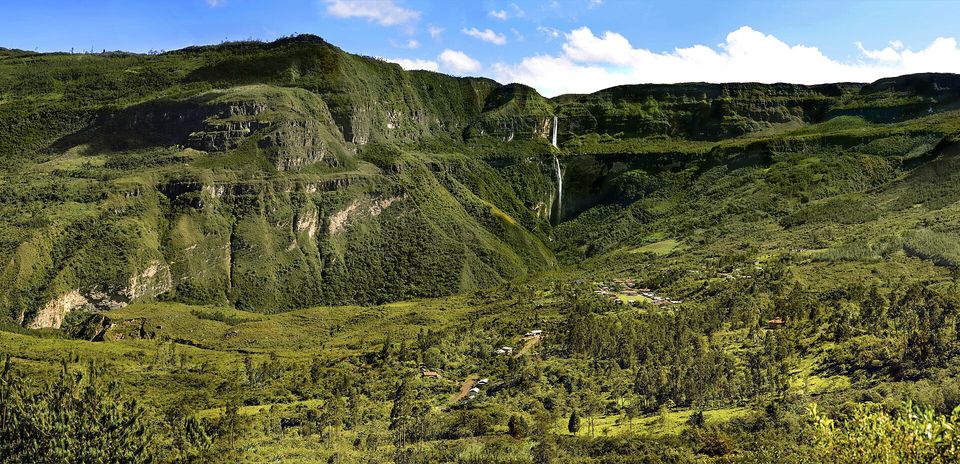
The falls above the valley and its villages, October 2017.
Photograph: Srooose · CC BY-SA 4.0
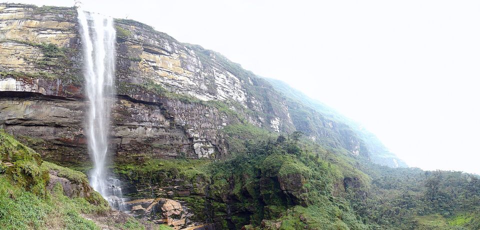
The upper fall plunging past layered sandstone, seen from its foot, August 2007.
Photograph: Martin St-Amant · Gocta - Août 2007 - 03 · CC BY 3.0
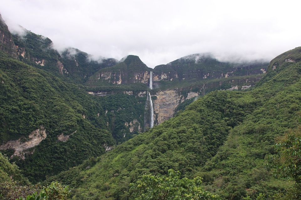
Cloud wrapping the rim above the falls, May 2023.
Photograph: Draceane · CC BY-SA 4.0 · cropped
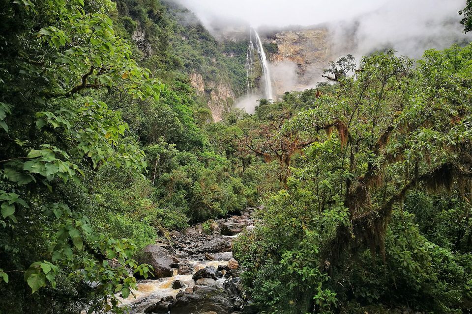
The Gocta river running out of the cloud forest below the lower fall, its foot lost in spray, January 2017.
Photograph: Pitxiquin · CC BY-SA 4.0 · cropped
- Hire your guide in the village, and ask what they call it.
- Hear the story of the lady in the water from someone who lives below it, and do not smile.
- Go in the rains for the thunder, or in the dry months if you would like your boots back.
- Ride the horse on the way back up. It knows the path, and you will not mind.
- Write down how tall it is. (Wrote ‘very’, and underlined it. Numbers are not allowed on this list, and this one would not have fitted.)
A newspaper cutting from March 2006. On 11 March 2006, after his third expedition, Stefan Ziemendorff held a press conference, reported by wire services around the world, giving Gocta’s total height as 771 metres and ranking it the third-tallest free-leaping waterfall in the world, a ranking disputed ever since. The falls are in full view of a village and had been known to the people who live near them for centuries. The newspaper El Comercio reported why nobody had said: they feared the curse of a beautiful blonde mermaid who lived in its waters.
Tally, in the marginA headline announcing a waterfall to people who had been looking at it over breakfast all their lives. I read it on the way home, rather late, and wanted to send in a correction: they knew.
Getting there
How to get there. Chachapoyas, the capital of the Amazonas region, is the base; from there the villages of Cocachimba and San Pablo are reached by road. Check current flights and road connections to Chachapoyas before you plan the trip, as the region is remote.
The walk. From either village it is about two and a half hours to the falls, on foot or partly on horseback, in PromPerú’s account. Cocachimba leads to the foot of the lower drop; San Pablo to the upper. Local guides and horses are hired in the villages. Bring rain gear in any season.
When to go. June to October is drier and the paths firmer; the rainy months bring more water over the falls and more mud on the way.
How to be there. The falls sit above villages that have lived with them far longer than anyone has measured them. Hire guides and horses there, and treat the story of the falls’ spirit with respect.
Safety. The United States has Peru at Level 2, exercise increased caution, because of crime, civil unrest and the risk of kidnapping. Its Do Not Travel areas are the Colombia border area in the Loreto region and the VRAEM valleys; the Amazonas region is not named, and Gocta lies about 770 and 850 kilometres from them respectively by our measurement. The advisory warns that demonstrations can close roads without notice and that criminal groups sometimes set up roadblocks outside Lima.
Mark this place
Common questions
How tall is Gocta Falls?
PromPerú, Peru’s tourism board, gives Gocta Falls in the Amazonas region a total height of 771 metres in two drops, an upper drop of 231 metres and a lower drop of 540 metres. The World Waterfall Database gives 2,531 feet, about the same, with the lower drop plunging nearly vertically into a large amphitheatre.
Is Gocta the third-tallest waterfall in the world?
That was the claim made when Gocta Falls in Peru was announced in March 2006, and it has been disputed ever since. Wikipedia says it rested on outdated information; lists adding two Norwegian falls put Gocta fifth, and the World Waterfall Database ranks it eighteenth by total height, though its 540-metre lower drop ranks fourth among single free falls.
Who discovered Gocta Falls?
The people who live below it. Gocta Falls, in Peru’s Amazonas region, is in full view of a nearby village and was known locally for centuries, Wikipedia notes. It became known to the wider world after a 2002 expedition by the German Stefan Ziemendorff with Peruvian companions; he announced its height at a press conference on 11 March 2006.
How do you get to Gocta Falls?
Gocta Falls in northern Peru is reached from Chachapoyas, capital of the Amazonas region, by road to the villages of Cocachimba or San Pablo. PromPerú describes a walk of about two and a half hours from either, on foot or partly on horseback; Cocachimba leads to the lower drop, San Pablo to the upper, and a path links them.
When is the best time to visit Gocta Falls?
PromPerú, Peru’s tourism board, gives June to October as the dry season at Gocta Falls in the Amazonas region, with the rainy months from about December to April. The falls can be visited in the rains, when the flow is strongest, but the paths from Cocachimba and San Pablo are wetter and muddier.
What is the legend of Gocta Falls?
The Peruvian newspaper El Comercio reported, as Wikipedia relays it, that people near Gocta Falls in Peru’s Amazonas region had kept quiet about it for fear of the curse of a blonde mermaid living in its waters. The falls are said to be guarded by a white-haired, mermaid-like spirit whose hair can be seen flowing down the walls at the bottom.
Is there a taller waterfall near Gocta?
Yes. The World Waterfall Database says Yumbilla, which falls from the northern wall of the same plateau as Gocta in Peru’s Amazonas region, was laser-surveyed by Peru’s National Geographic Institute at 895.4 metres, making it the tallest waterfall in the region. Yumbilla carries much less water than Gocta.
Is it safe to visit Gocta Falls?
The United States has Peru at Level 2, exercise increased caution, because of crime, civil unrest and the risk of kidnapping. Its Do Not Travel areas, the Colombia border area in Loreto and the VRAEM valleys, do not include the Amazonas region where Gocta Falls lies. The advisory warns that demonstrations can close roads without notice.