The short answer
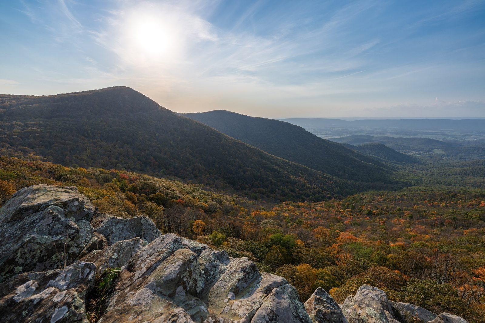
Shenandoah National Park covers more than 200,000 acres of the Blue Ridge Mountains in Virginia: a long, narrow park that stretches 105 miles from its northern entrance at Front Royal to its southern entrance near Waynesboro. Skyline Drive, the only public road through it, follows the crest the whole way at no more than 35 miles an hour, past more than 75 overlooks, so most people need three or four hours just to drive it. More than 60 peaks rise above 3,000 feet; the highest, Hawksbill Mountain, reaches 4,050 feet. President Franklin Roosevelt dedicated the new park on July 3, 1936.
From Tally’s diary
The road kept to the very top, as if it had promised to, and every few minutes it pulled over to show me something blue and far away. I stopped at nearly all of them. Off a path below, a few old apple trees stood in a row in the woods, still bearing, with nobody to pick for. I stood there a while.
Why it's worth knowing
A road on the roof. Everything in the park hangs off Skyline Drive: the campgrounds, the lodges and most of the trailheads sit beside it. Dense fog can roll over the crest on any day of the year, at any hour, and at Marys Rock it ducks through a tunnel with 12 feet 8 inches of headroom. The mountain is usually about 10°F cooler than the valley below, which is a fine reason to be up there in July.
Built by the boys. From 1933 to 1942, twelve camps of the Civilian Conservation Corps stood in and around what became the park, each home to about 200 young men at a time, more than 6,500 in all. They signed on for $30 a month, of which $25 went straight home to their parents and $5 was theirs to keep. They built the rock walls, trails, fire roads and overlooks, planted hundreds of thousands of trees and shrubs, and made much of the park that visitors see now. More than three hundred of the park’s historic structures are on the National Register of Historic Places.
A refuge, refilled. Hunting ended the bison of these mountains around 1798 and the elk in 1855; beaver and river otter were gone by the late 1800s, and bears, deer and turkey had dwindled badly. Most have come back in the past century. Several hundred black bears now live in the park, along with more than 190 kinds of resident and passing birds, the endangered Shenandoah salamander and more than 800 species of wildflower.
The field notes
The families who left
People have lived in these mountains for at least 9,000 years. By the 1930s more than 400 families lived within the lines of the future park, farming, grazing livestock and tending orchards on the slopes. When the park was established, some moved out on their own and others were moved into homes in resettlement communities set up by the Rural Resettlement Administration; several older people were allowed to live out their lives in their homes inside the park. The traces are still in the woods: the foundations of an old home, or a cluster of apple trees that was once an orchard.
One campground, once
The first park managers set up segregated facilities. Black visitors could picnic and camp at Lewis Mountain, and nowhere else in the park’s developed areas. Desegregation came officially in 1950, though the effects of separate facilities did not vanish overnight. Lewis Mountain is a quiet campground and picnic ground now.
A bugle at Skyland
Decades before the park, city people came up to Skyland Resort for clean air and mountain views. Its manager, George Freeman Pollock, ran it with a showman’s flair: his bugle woke the guests every morning, called them to meals and entertainments, and announced the daily mail, and he staged balls, costume parties, jousts, pageants and bonfires. He was a better promoter than businessman. When the park was established he owed $67,107.22 on a property appraised at less than $30,000, and he received nothing for almost four decades of work. Twelve historic Skyland buildings remain.
A President’s fishing camp
Herbert Hoover liked to fish, so his summer White House was built where two streams join to form the Rapidan River. He and Lou Henry Hoover stayed at Rapidan Camp from 1929 to 1932, in a cabin called the Brown House, and the President conducted official business from it. Leaving office, Hoover gave the camp to the National Park Service for the park that was about to be made. It is a National Historic Landmark, reached on foot from Milam Gap.
A name nobody can pin down
The park takes its name from the Shenandoah River, which flows through the valley just to the west, and nobody knows for sure what the word means. The candidates are wonderful: “daughter of the stars”, “silver water”, “river through the spruces”, “river of high mountains”, “great meadow” and “big flat place”. It may also come from a chief called Sherando, or from a people called the Senedoes, who lived in the valley until 1730.

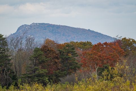
October 2024Old Rag Mountain above a band of autumn trees.
Photograph: NPS / Luca Pfeiffer, Public domain

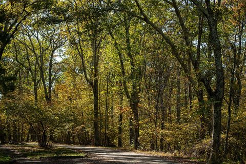
October 2024Oak forest in early autumn between Skyland and Big Meadows.
Photograph: NPS / Luca Pfeiffer, Public domain

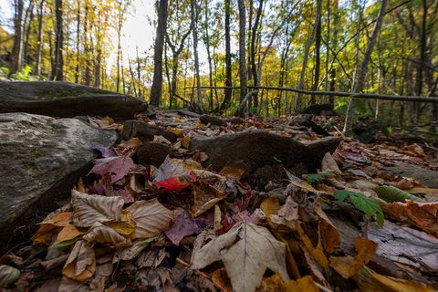
October 2024Fallen autumn leaves on the rocks by the Rose River.
Photograph: NPS / Luca Pfeiffer, Public domain
- Stop at every overlook with a stone wall and sit on the wall a minute. Somebody built it for exactly that.
- I left my sandwich on the car seat and spent the whole walk wondering who had smelled it first. A bear has a better nose than my list, and fewer manners about picnics.
- Read the list aloud at a viewpoint. (The fog came up the slope and swallowed the second half, then the view, then me.)
- I found old foundations and apple trees in the woods and left them just as they were. Somebody lived there.
- Count the deer before lunch. (Abandoned before breakfast. They kept arriving.)
A relic from Shenandoah National Park
Relic, entry 326Laid 1933 to 1942Built by men aged 18 to 23
A stone wall at an overlook on Skyline Drive. At almost any overlook, the rock wall underfoot was laid by a young man of the Civilian Conservation Corps, unmarried and aged 18 to 23 when he signed on, working five and a half days a week in all seasons and all weather. The corps ran from 1933 to 1942, and its work in the mountains turned out to be a training ground too: it helped prepare a generation for the great call-up of the Second World War.
Tally, in the marginI sat on it for most of an afternoon before it occurred to me to wonder who had carried the stones up. After that I sat on it more carefully, and thanked it when I stood.
Getting there
- 1
Four ways onto the crest
Four entrance stations lead onto Skyline Drive, from Front Royal in the north to Rockfish Gap in the south.
- 2
The nearest airports
Washington Dulles is 56 miles from the Front Royal entrance; Charlottesville-Albemarle is 31 miles from Rockfish Gap.
- 3
Fuel on the way
Fuel is sold at Big Meadows, at mile 51.
- ✓
| J | F | M | A | M | J | J | A | S | O | N | D |
|---|---|---|---|---|---|---|---|---|---|---|---|
| May: also a good time | June: also a good time | October: best time |
- Autumn colour, usually brightest in the second or third week of October
- Pink azaleas usually bloom in late May and early June, and mountain laurel is at its fullest in June
How to get there. Four entrance stations lead onto Skyline Drive: Front Royal in the north, off Route 340; Thornton Gap, on US 211 near Luray; Swift Run Gap, on US 33 near Elkton; and Rockfish Gap in the south, a few miles east of Waynesboro, off US 250 and I-64. Washington Dulles International Airport is 56 miles east of the Front Royal entrance and Reagan National 70 miles; Shenandoah Valley Regional Airport is 27 miles west of Swift Run Gap and Charlottesville-Albemarle 31 miles east of Rockfish Gap. No shuttle serves the park, so travel to and within it is by car. Many gated service roads touch the boundary; the public can enter only at the four entrance stations.
When to go. Autumn colour starts on the high ground and moves slowly downhill; it is generally at its brightest around the second or third week of October, and in recent years many trees have kept their colour well into November. Pink azaleas usually bloom in late May and early June, and mountain laurel is at its fullest in June. Spring wildflowers crowd the lower streams first.
What to arrange ahead. As of 12 November 2026, hiking Old Rag Mountain takes a day-use ticket bought in advance, on top of the park entrance pass. Marys Rock Tunnel, at mile 32.2, has a clearance of 12 feet 8 inches.
Safety. The State Department’s travel advisories cover other countries, so none applies here. Skyline Drive closes at times in bad weather, and the park’s alerts page carries its current status.
Mark this place
The passport stamp for this place.
Common questions
How long is Skyline Drive?
A long, lovely 105 miles. Skyline Drive runs the length of Shenandoah National Park along the crest of the Blue Ridge, with a top speed of 35 miles an hour and more than 75 overlooks, so most people need three or four hours just to drive it.
Where is Shenandoah National Park?
In the Blue Ridge Mountains of northern Virginia. Shenandoah National Park runs 105 miles from Front Royal in the north to near Waynesboro in the south, about 75 miles from Washington, DC.
When are the autumn colours best in Shenandoah?
Usually mid to late October. In Shenandoah National Park the colour turns first on the high ground and moves downhill, and is generally brightest around the second or third week of October, with many trees still colourful into November.
Are there bears in Shenandoah National Park?
Yes, several hundred. Black bears live throughout Shenandoah National Park in Virginia and turn up anywhere from the trails to the walk between a car and a restaurant, along with deer, bobcats and more than 190 kinds of birds.
Who built the stone walls along Skyline Drive?
Young men of the Civilian Conservation Corps. Between 1933 and 1942 more than 6,500 of them worked in and around Shenandoah National Park, building its rock walls, overlooks, trails and fire roads for $30 a month, $25 of it sent home.
Did people live in Shenandoah before it became a park?
Yes, and for a very long time. People lived in the Blue Ridge for at least 9,000 years, and in the 1930s more than 400 families lived on land that became Shenandoah National Park; when the park was established they had to leave.
What is the highest point in Shenandoah National Park?
Hawksbill Mountain, at 4,050 feet. It is the highest summit in Shenandoah National Park; the highest point on Skyline Drive itself is 3,680 feet, at mile 41.7 by the northern entrance to Skyland.
What does the name Shenandoah mean?
Nobody knows for sure. Shenandoah National Park is named for the Shenandoah River, and the guesses for the word include “daughter of the stars”, “silver water” and “river of high mountains”, or a chief called Sherando.
Photographs on this page
Tap a photograph to see it full size.
Photograph: NPS / Luca Pfeiffer, Public domain
Photograph: NPS / Luca Pfeiffer, Public domain
Photograph: NPS / Luca Pfeiffer, Public domain
Photograph: NPS / Luca Pfeiffer, Public domain


