The short answer
New River Gorge National Park and Preserve follows the New River through a deep, forested gorge in southern West Virginia, from Hinton in the south to the New River Gorge Bridge near Fayetteville in the north. It protects some of the most celebrated whitewater in America, rock walls and trails for climbers and hikers, and the remains of the coal and railroad towns that boomed and emptied along the river, such as Thurmond and Nuttallburg. Charleston, about 70 miles north-west of the park, has the nearest major airport. The river was protected as a national river in 1978 and is now a national park and preserve.
From Tally’s diary
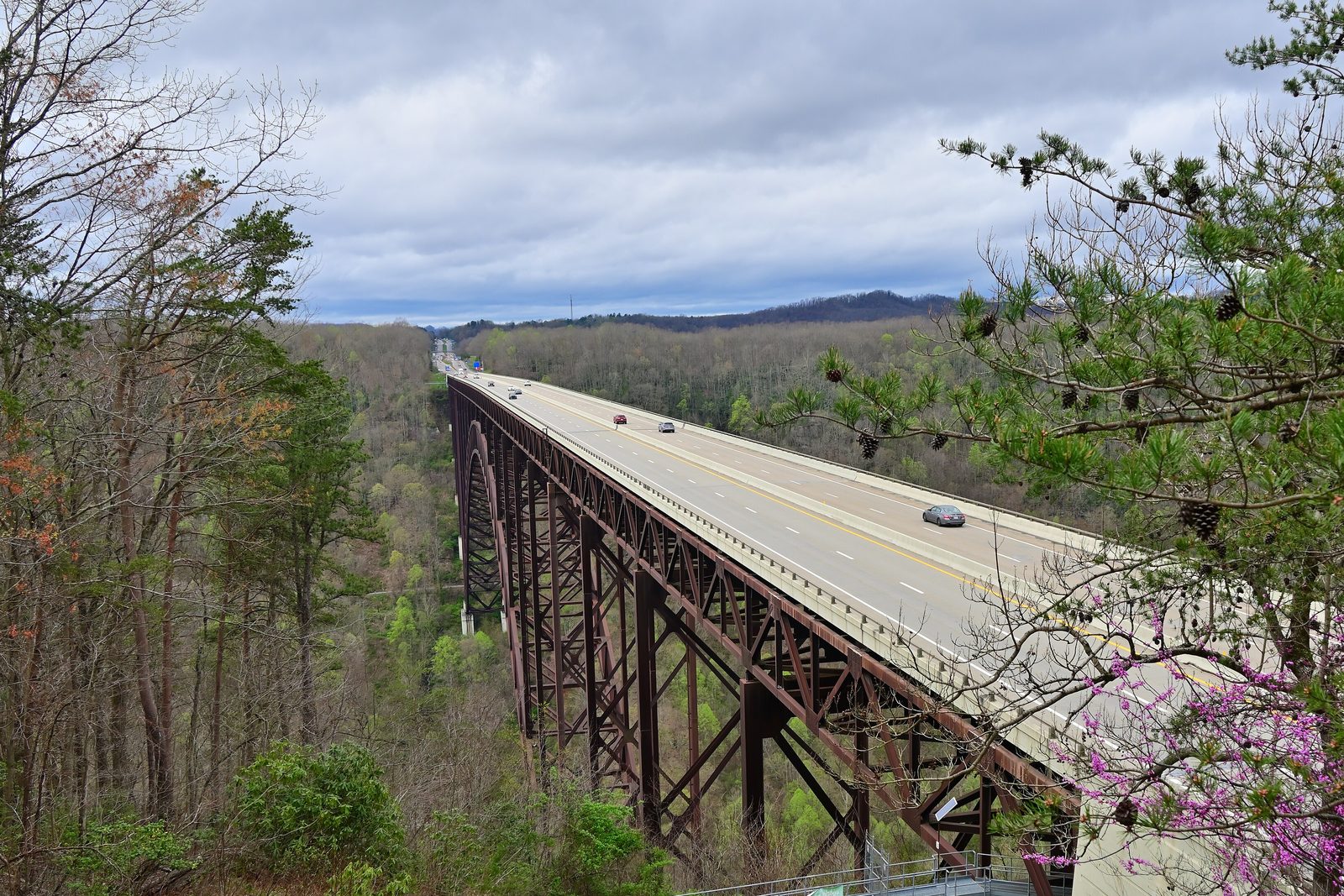
From the overlook the river was a pale ribbon a long way down, wrinkled white where it hurried, and right across the gap stood a rusty-brown arch, so high and so thin that I kept checking it was still there. A train hooted somewhere down among the trees. I waved at it, just in case.
Why it's worth knowing
Older than its name. It probably took 7 to 10 million years for the sand, mud and rotting plants of an ancient landscape to pile up and harden into the sandstone, shale and coal of the gorge walls. Long after, the river began to cut down through them, following the course of the ancient Teays River, and the gorge is a slice through all those layers. More recently, railroad cuttings and coal tips have added their own marks.
Coal towns in the trees. In the coal boom, Thurmond was a busy railroad town. In 1910 its Chesapeake and Ohio operation took in more revenue than anywhere on the line, 75,000 passengers passed through, and with coal barons among its customers its banks were the richest in the state. Its depot is a summer visitor center now, and the Cardinal train, between Chicago and New York, still makes a flag stop there for passengers who book ahead. Downriver, Nuttallburg shipped “smokeless” coal, and in the 1920s Henry Ford leased its mines to supply his steel mills, a plan that failed because he could neither control nor afford the railroad that carried the coal. Production at Nuttallburg ceased in 1958.
Big water. The upper river is mostly long pools and easier rapids up to Class III; below Thurmond the river is suitable only for advanced and expert paddlers, with powerful currents, boulders and big hydraulics. Gentler stretches suit peaceful float trips, and at Sandstone Falls a boardwalk and bridges cross two islands below the falls, which can also be seen from an overlook 600 feet above the river.
The field notes
The bridge on a quarter
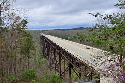
Building the bridge meant working over a gorge more than 800 feet deep. Steel was carried out over it by trolleys running on three-inch cables, strung 3,500 feet between two towers 330 feet tall, and the two halves of the arch had to meet precisely in the middle. More than 88 million pounds of steel went in, of a kind called Cor-ten, which weathers to a rust-like brown and never needs painting. It took three years and cost nearly $37 million. In 2006 the US Mint chose the bridge to represent West Virginia on its state quarter.
John Henry
When the railroad came through the region, workers drove steel by hand to blast tunnels through the mountains. The legend of John Henry tells how he and his shaker, chosen for skill and speed, raced a steam drill and won, a victory for working people everywhere, and “The Ballad of John Henry” made him famous. The legend has a real job behind it: steel drivers like him did exist. Some stories say it was silicosis, from the rock dust, that killed him in the end.
Dust and darkness
The gorge’s riches cost lives. In 1900 an explosion in the Red Ash Mine near Thurmond killed 46 miners, most of them suffocated by the poisonous air that follows a blast. In 1905 the same mine exploded again; a rescue party of 11 went in the next day and met a second explosion, and all 24 men were found dead. Worst of all was the Hawks Nest Tunnel, begun in 1930 to carry water for a power plant. In the Depression it gave work to many desperate families. Most of the workers were African American, and they drilled through silica-rich sandstone with no masks, ventilation or dust control. Many died of silicosis or lived out their lives struggling to breathe. It is counted among the worst industrial disasters in the history of the United States.

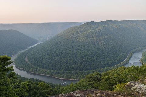
June 2023The New River curving round a forested ridge, from Grandview.
Photograph: Roller Coaster Philosophy, New River Gorge National Park - 53010450732, CC BY 2.0, cropped

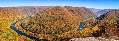
October 2023The gorge in autumn colour, with the river winding below.
Photograph: Andrew Parlette, Autumn's Reveal at New River Gorge - Flickr - aparlette, CC BY 2.0
- Count the cars crossing the arch. (Lost count when I realised I was holding my breath for each one. Stopped counting. Started breathing.)
- Ride the rapids. (Rode them. Was rearranged, quite thoroughly. I believe I am mostly the right way round again now.)
- Flag down a train at a station in the woods. (Waved. It stopped. I had not expected that, and had to think of something to say.)
- I passed the old mine openings slowly, with my hat off, and went no closer. They looked like somewhere sad things had happened.
- Find the old bank in the little railway town and ask about my account. (Nobody there, and nobody for some time, by the look of it. I left a note.)
A relic from New River Gorge National Park and Preserve
Relic, entry 342Cor-ten steel, never painted88 million pounds in the arch
A beam of the New River Gorge Bridge. It is Cor-ten steel, which weathers to a coat of rust-like brown and so never needs painting; more than 88 million pounds of it went into the arch, carried out over the gorge by trolleys on three-inch cables between towers 330 feet tall. The two halves of the arch had to meet exactly in the middle, more than 800 feet above the river, and in 2013 the finished bridge was listed in the National Register of Historic Places.
Tally, in the marginA great brown beam, which I took for rust and was ready to feel sorry about, until I learned it had meant to look like that all along. I have decided my coat works the same way.
Getting there
- 1
To the bridge
The Canyon Rim Visitor Center is on US Highway 19 by the bridge.
- 2
To Thurmond
Thurmond is seven miles down State Route 25 from the Glen Jean exit of US 19.
- 3
By train
The Cardinal train stops at Hinton and Prince.
- ✓
How to get there. Charleston, West Virginia, about 70 miles north-west of the park, has the nearest major airport, and some flights serve Beckley. The Canyon Rim Visitor Center and the bridge overlook are on US Highway 19 by the bridge, near Fayetteville, and the narrow Fayette Station Road winds down for views of the bridge from below. Grandview is reached from Interstate 64 at exit 129 and then six miles north on Route 9. Amtrak’s Cardinal stops at Hinton and Prince, and at Thurmond on request for passengers with reservations. The road to Nuttallburg, Keeneys Creek Road, is narrow, winding and steep.
When to go. Bridge Day, West Virginia’s largest one-day festival, falls on the third Saturday in October. The Thurmond Depot visitor center is open in summer.
Safety. The State Department’s travel advisories cover other countries, so none applies here. Some rapids have dangerous undercut rocks, and the park’s road and trail closures page lists current closures.
Mark this place
The passport stamp for this place.
Common questions
How old is the New River?
Possibly one of the oldest rivers in the world, despite its name. The stretch through New River Gorge National Park follows the course of part of the ancient Teays River, through rock layers about 4,000 feet thick.
How high is the New River Gorge Bridge?
876 feet above the river. The New River Gorge Bridge, beside New River Gorge National Park and Preserve in West Virginia, is a single steel arch 3,030 feet long, the longest steel span in the western hemisphere.
What is Bridge Day?
West Virginia’s largest one-day festival, on the third Saturday in October. Bridge Day at the New River Gorge Bridge celebrates its completion in October 1977; tens of thousands walk across, and BASE jumpers leap into the gorge.
Is there whitewater rafting on the New River?
Yes, some of the best in America. In New River Gorge National Park the upper river has long pools and rapids up to Class III, while below Thurmond the rapids are big and forceful, suited to advanced and expert paddlers.
What is Thurmond?
A coal-boom railroad town, now nearly empty. Thurmond, in New River Gorge National Park, had the richest banks in West Virginia and saw 75,000 rail passengers in 1910; its restored depot is a summer visitor center.
Who was John Henry?
The steel-driving hero of a famous ballad. The legend of John Henry, who raced a steam drill and won, is linked to railroad tunnel work in the region of New River Gorge National Park, and his job as a steel driver was a real one.
Where is New River Gorge National Park?
In southern West Virginia, between Hinton and Fayetteville. New River Gorge National Park and Preserve is about 70 miles south-east of Charleston, whose airport is the nearest major one.
Photographs on this page
Tap a photograph to see it full size.
Photograph: Andrew Heneen, CC BY 4.0, cropped
Photograph: Roller Coaster Philosophy, New River Gorge National Park - 53010450732, CC BY 2.0, cropped
Photograph: Andrew Parlette, Autumn's Reveal at New River Gorge - Flickr - aparlette, CC BY 2.0


