
- Where
- Just north of Siem Reap,
Cambodia - Coordinates
- 13.4125° N
103.8670° E - Built
- Early 12th century,
for Suryavarman II - Site
- 162.6 ha; moat 190 m wide,
more than 5 km round - Faith
- Built for Vishnu;
Buddhist since the late 13th century - Status
- Angkor, UNESCO World Heritage, 1992;
APSARA National Authority - Best visited
- The cooler dry months;
sunrise, then midday
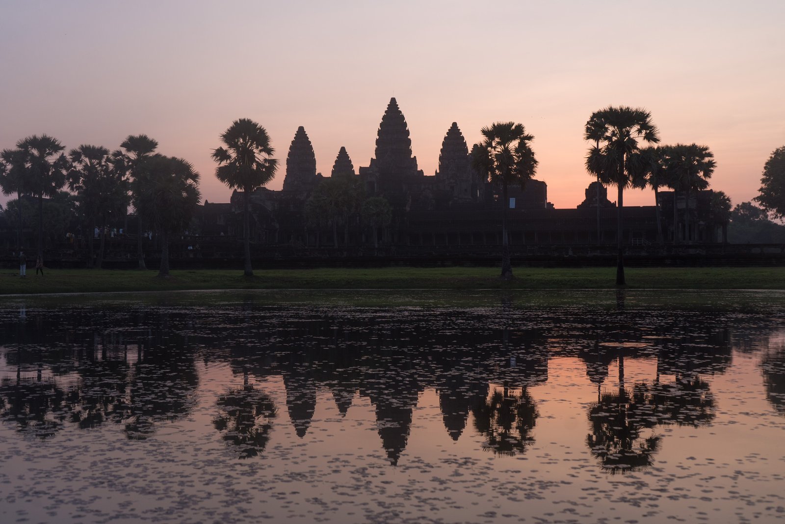
Rode out before dawn in a little carriage pulled by a motorbike, and stood with a crowd of silent people by a pond full of frogs while stone towers shaped like lotus buds came out of the night. Inside, every wall was carved with smiling women, and a monk in an orange robe was sweeping the steps as if it were an ordinary morning. For him it was.
The short answer
Angkor Wat is a temple complex just north of Siem Reap in Cambodia, built in the first half of the twelfth century as the state temple of the Khmer king Suryavarman II and dedicated to the Hindu god Vishnu. It became a Buddhist temple from the late thirteenth century and has been in religious use ever since. Wikipedia gives the site as 162.6 hectares, enclosed by an outer wall 1,024 by 802 metres and a moat 190 metres wide and more than five kilometres round, and the central tower as rising 65 metres above the ground. Unusually among Khmer temples it faces west. Angkor, the wider capital it belongs to, was inscribed by UNESCO in 1992, and the site is managed by Cambodia’s APSARA National Authority. An image of the temple has been on the Cambodian flag since 1863.
Why it's worth knowing
The picture most people carry of Angkor Wat is of a monument standing alone in a forest. The forest was hiding a city.
In 2012 a helicopter carrying an airborne laser scanner, lidar, flew over Angkor. Lidar sends pulses down through gaps in the canopy and records the ones that come back from the ground, so the shape of the earth beneath the trees can be mapped without cutting any. Damian Evans and colleagues published the results in the Proceedings of the National Academy of Sciences in 2013. They reported “an entire, previously undocumented, formally planned urban landscape into which the major temples such as Angkor Wat were integrated”.
The finding extended earlier work. In 2007, in the same journal, Evans, Christophe Pottier, Roland Fletcher and others had published a map of greater Angkor under the title “A comprehensive archaeological map of the world’s largest preindustrial settlement complex”. A second, larger lidar campaign followed in 2015. The temple on the postcard was the centre of a planned city whose street plan survived only as low ridges and hollows in the ground, which the lidar could see and a person walking through the forest could not.
The other half of the picture is wrong too. Angkor Wat was never lost to the people who lived near it. It has been a Buddhist temple for more than seven centuries, and Portuguese visitors described it in the sixteenth century, long before the French naturalist Henri Mouhot made it famous in Europe in the 1860s.
The field notes
What the lidar saw
The scans showed that the grid of the temple’s own enclosure did not stop at its walls. PNAS’s 2014 news feature on the work, “Mapping the lost megalopolis”, describes the land outside the walls as divided, a thousand years ago, into rectangles like city blocks, with canals, ponds and places where people lived. The stone temples are only the most durable part of that layout; most of Angkor’s buildings were of wood and have gone, and what survives of them is earthwork.
Lidar suits that kind of evidence, and the Cambodian Archaeological Lidar Initiative, which Evans led with a European Research Council grant, extended the survey across a much larger area of Cambodia in 2015.
A temple that faces west
Most Khmer temples face east. Angkor Wat faces west, and its reliefs are meant to be read anticlockwise. Wikipedia notes that this led scholars including Maurice Glaize and George Cœdès to suggest Suryavarman intended it as his funerary temple. The practical effect is familiar to every visitor: at sunrise the sun comes up behind the towers, seen from the western causeway, and turns them into silhouettes.
From Vishnu to the Buddha
Angkor was sacked by the Chams in 1178, and the king who restored the empire, Jayavarman VII, built a new capital, Angkor Thom, with the Bayon as its temple. From the late thirteenth century Angkor Wat was adapted for Theravada Buddhist worship. Wikipedia records seventeenth-century Japanese pilgrims identifying it with Jetavana, the Buddha’s monastery garden, and a continuous monastic presence into the eighteenth and nineteenth centuries. People come to pray at Angkor Wat today, not only to look.
The long gallery
The inner walls of the outer gallery carry bas-reliefs of scenes mostly from the Ramayana and the Mahabharata, with battles, processions, heavens and hells. The best known, on the southern section of the east gallery, shows the Churning of the Sea of Milk. The Angkor visitor code of conduct asks that nobody touch the carvings, lean on the walls or sit on fragile stone.
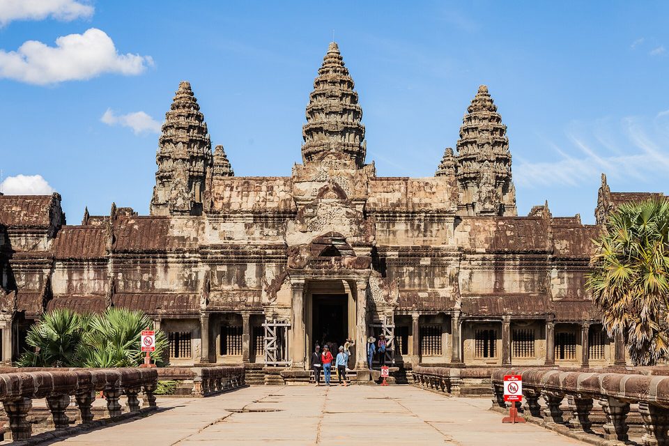
The west face of Angkor Wat from the inner causeway, July 2019.
Photograph: Supanut Arunoprayote · CC BY 4.0 · cropped
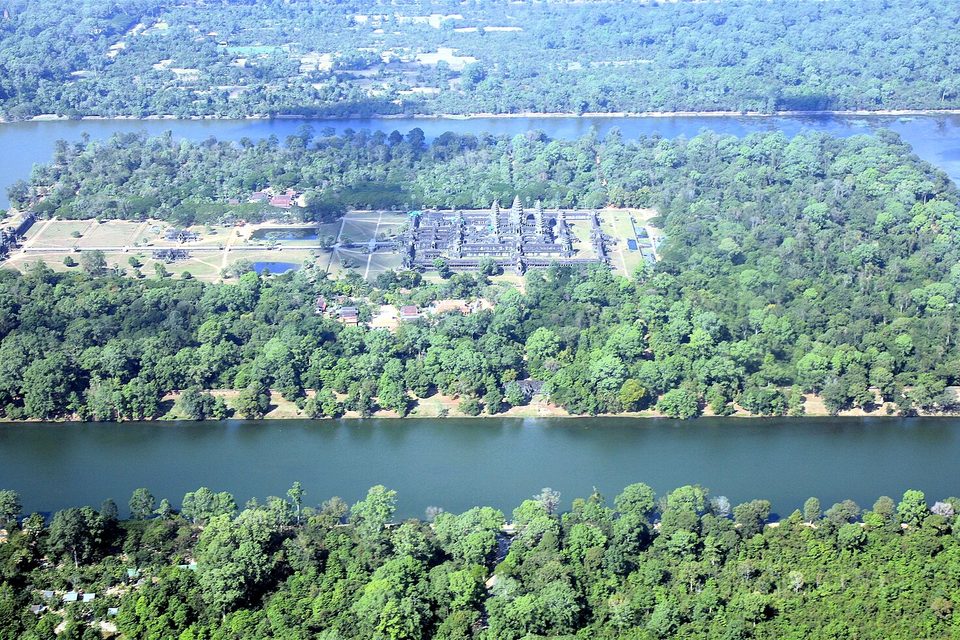
The temple and its moat from the air, December 2007.
Photograph: Steve Jurvetson · Angkor Wat aerial view · CC BY 2.0 · cropped
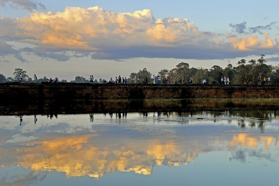
The moat and the causeway wall at sunset, December 2014.
Photograph: LBM1948 · CC BY-SA 4.0 · cropped
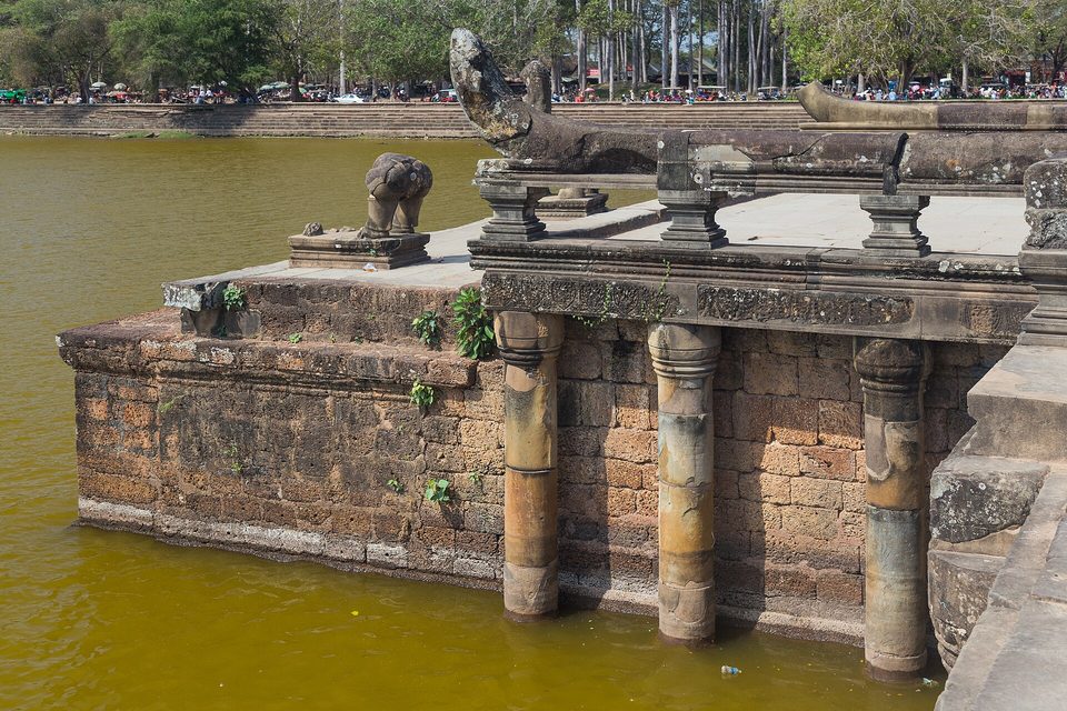
A stone terrace and balustrade with naga heads at the edge of the moat, February 2016.
Photograph: Marcin Konsek · CC BY-SA 4.0 · cropped
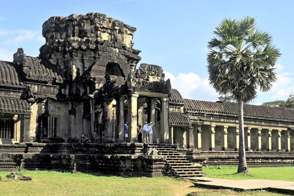
The west entrance gate and part of the outer gallery.
Photograph: LBM1948 · CC BY-SA 4.0 · cropped
- Cover your shoulders and knees, keep your voice low, and give the monks and the people praying the room they need. It is still a temple.
- Go in the dark for the sunrise, then come back in the middle of the day when the crowd has gone to lunch.
- Walk the long carved gallery slowly, all the way round, and keep your hands to yourself.
- Keep to the paths when you go further out into the countryside. The guides know why.
- See all the temples. (Revised before breakfast to: see this one properly. The others have a list of their own now, and it is already longer than this one.)
The Churning of the Sea of Milk. On the southern section of the east gallery, a twelfth-century bas-relief: on one side a long line of asuras, on the other a long line of devas, all hauling on the body of the serpent Vasuki to churn the sea, with Vishnu at the centre directing them. Wikipedia counts 92 asuras and 88 devas; Eleanor Mannikka counts 91 asuras and reads the numbers as calendrical. The two sides look at first like opponents. They are working on the same job.
Tally, in the marginGods on one side and demons on the other, all hauling on the same enormous snake. I read it for a long while as a tug of war before I noticed they were pulling together.
Getting there
How to get there. Siem Reap is the gateway, with an international airport and hotels at every price. Angkor Wat is a short ride north of the town, and most visitors hire a driver or a guide for the day.
Tickets. Entry to the Angkor park is by Angkor Pass, sold by Angkor Enterprise, the state body, through its official website and ticket counters. Children under 12 do not need a ticket. Buy only through the official channels, and check the current passes and prices there.
How to behave. Angkor Wat is a working temple. The visitor code of conduct asks for clothing that covers shoulders and knees, quiet voices, no touching or climbing on the carvings and loose stones, consideration for worshippers and monks (women should not touch a monk or sit too close to one), no litter, and no money given to children.
Safety. The State Department’s advisory names landmines and unexploded ordnance in remote areas of Siem Reap province: do not touch unknown metal objects, and use a local guide in forest or dry rice paddies. The same advisory carries a do-not-travel warning for the Thai border area; read it before you go.
When to go. The cooler, drier months around the turn of the year are the most comfortable. Arrive before dawn for sunrise from the western causeway, or come in the middle of the day when the sunrise crowd has gone.
Mark this place
Common questions
What did lidar reveal at Angkor Wat?
In 2012 an airborne lidar survey mapped the ground beneath the forest at Angkor in Cambodia. Damian Evans and colleagues reported in the Proceedings of the National Academy of Sciences in 2013 an entire, previously undocumented, formally planned urban landscape, into which major temples such as Angkor Wat had been integrated. A second, larger campaign followed in 2015.
Who built Angkor Wat and when?
Angkor Wat was built in the first half of the twelfth century as the state temple of the Khmer king Suryavarman II and was dedicated to Vishnu. From the late thirteenth century it was adapted for Theravada Buddhist worship, and it has remained in religious use ever since. It stands just north of Siem Reap in Cambodia.
Why does Angkor Wat face west?
Angkor Wat faces west, unlike most Khmer temples, which face east. Scholars including Maurice Glaize and George Coedes, as Wikipedia reports, suggested this meant Suryavarman II intended it as his funerary temple. The effect for visitors is that the sun rises behind Angkor Wat’s towers when seen from the western causeway.
Is Angkor Wat still a religious site?
Yes. Angkor Wat has been a Theravada Buddhist temple since the late thirteenth century and is used for worship today. The Angkor visitor code of conduct asks visitors to cover shoulders and knees, keep quiet, not touch the carvings, and show consideration for monks and people at prayer.
Is Angkor Wat safe to visit given the Thai border fighting?
The U.S. State Department has Cambodia at Level 2, with a Level 4 do-not-travel warning for areas within 50 km of the Cambodia–Thailand border because of fighting between the two militaries (advisory of 25 July 2025). Angkor Wat lies about 100 km from the nearest stretch of that border. The advisory also warns of landmines in remote parts of Siem Reap province. Check it before you travel.
Do you need a ticket to visit Angkor Wat?
Yes. Entry to Angkor Wat and the Angkor park is by Angkor Pass, sold by the Cambodian state body Angkor Enterprise through its official website and ticket counters. Children under 12 do not need a ticket. Angkor Enterprise publishes the current passes and prices, which should be checked before travel.
What is the Churning of the Sea of Milk at Angkor Wat?
It is a bas-relief on the southern section of the east gallery of Angkor Wat, showing devas (gods) and asuras (demons) pulling on the serpent Vasuki to churn the sea of milk under Vishnu’s direction. Wikipedia counts 92 asuras and 88 devas; the scholar Eleanor Mannikka counts 91 asuras and reads the numbers as calendrical.
How big is Angkor Wat?
Wikipedia gives the Angkor Wat site as 162.6 hectares, enclosed by an outer wall 1,024 by 802 metres and a moat 190 metres wide and more than five kilometres in perimeter. The central tower rises 65 metres above the ground. Guinness World Records lists Angkor Wat as the largest religious structure in the world.