
- Where
- Southern Alps, Canterbury
South Island, New Zealand - Coordinates
- 43.5950° S
170.1418° E - Height
- 3,724 m (University of Otago, 2013)
3,764 m before December 1991 - The collapse
- 14 December 1991
about 12 million m³ of rock and ice - Park
- National park since 1953
glaciers cover 40 per cent - Ngāi Tahu
- Most sacred ancestor
Tōpuni status since 1998 - Best visited
- Clear mornings in any season
icebergs on Hooker Lake in summer
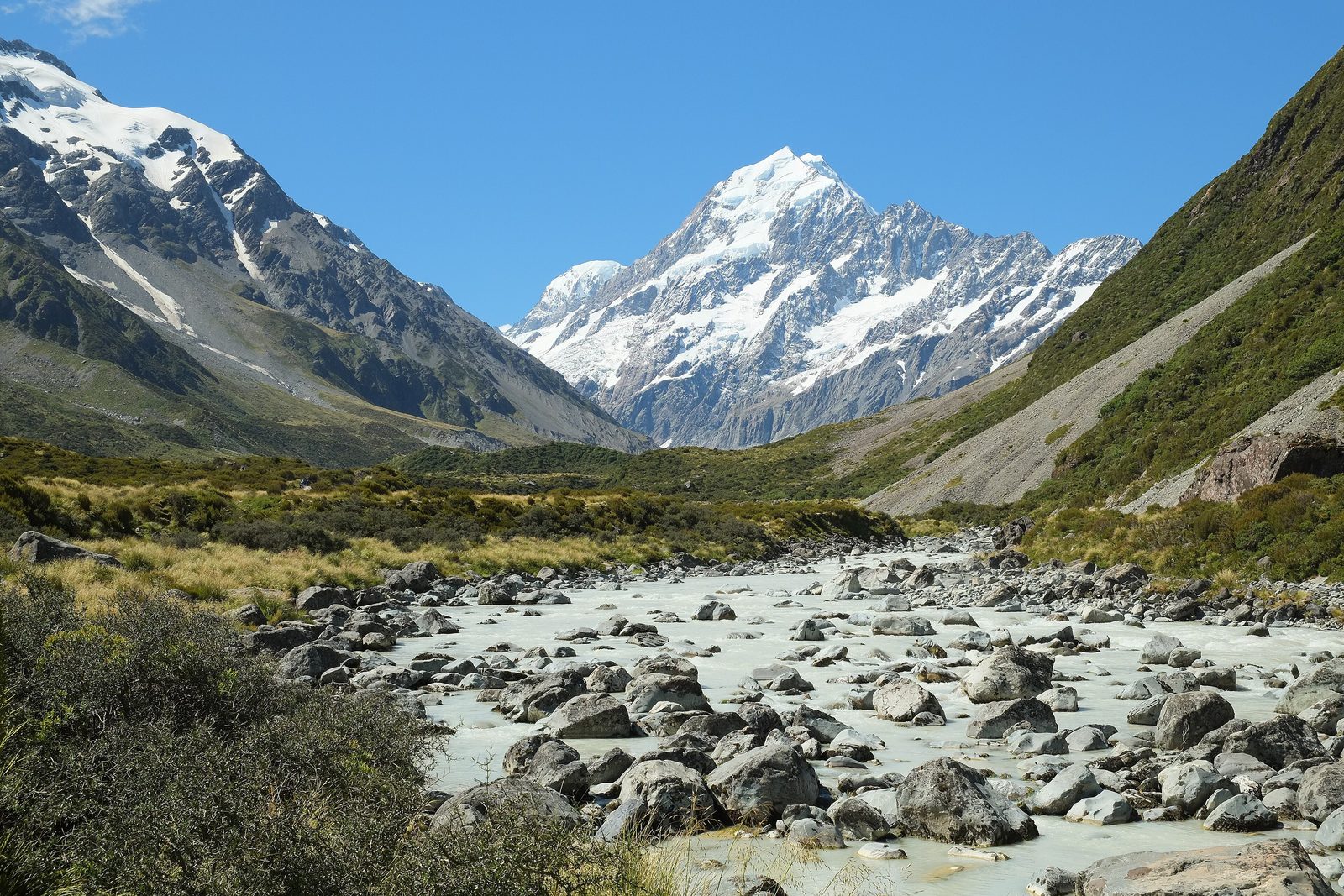
Walked up a long grey valley over swinging bridges, through tussock, beside a river the colour of milky tea, while a green mountain parrot inspected the bus for loose parts. At the end, a lake with small icebergs turning in it, and above everything a white mountain that kept its head in the cloud until I sat down. I did not ask to go up. It seemed rude.
The short answer
Aoraki / Mount Cook is the highest mountain in New Zealand, 3,724 metres at its highest point according to a 2013 survey led by the University of Otago. It stands in the Southern Alps / Kā Tiritiri o te Moana on the South Island, between the Hooker and Tasman glaciers, inside Aoraki / Mount Cook National Park, which was established in 1953 and is part of the Te Wāhipounamu – South West New Zealand World Heritage Area. To Ngāi Tahu, the iwi of most of the South Island, it is Aoraki, the most sacred of the ancestors from whom they descend. Most visitors see it from the Hooker Valley Track, a three-hour return walk from the end of the road.
Why it's worth knowing
For most of a century the mountain’s height was 3,764 metres: G. J. Roberts measured it from the west in 1881 and T. N. Brodrick from the Canterbury side in 1889, and their figures agreed closely. Then, in the early morning of 14 December 1991, Te Ara records, about 12 million cubic metres of the mountain collapsed, roared down the ice fields of the east face and fell onto the Tasman Glacier on the valley floor. The summit was about ten metres lower afterwards.
It kept shrinking. In November 2013 a climbing expedition led by the University of Otago took high-accuracy GPS readings at the top, confirming calculations from aerial photographs by Pascal Sirguey and Sebastian Vivero, working with GNS Science and New Zealand Aerial Mapping. The mountain was 3,724 metres, thirty metres below the height recorded after the collapse. The university attributes the difference to two decades of erosion of the ice cap the collapse had left exposed.
The loss fits the way these mountains work. Te Ara says the Southern Alps have risen at an average of about a centimetre a year over the last five million years, and that erosion has kept pace, so that they have never been much higher than they are now. The height of Aoraki is a reading taken in the middle of a contest between rising rock and falling ice, and lately the ice has been losing ground faster than the rock can make it up.
The mountain is also somebody. The Department of Conservation, which manages the park, describes Aoraki as the most sacred of the ancestors from whom Ngāi Tahu descend, the source of the iwi’s sense of identity and purpose, and says Ngāi Tahu believe it is not appropriate to climb onto what is effectively the head of an ancestor. The Ngāi Tahu Claims Settlement Act 1998 made its official name Aoraki / Mount Cook and gave it Tōpuni status, a symbolic cloak of protection. It also provided for a double transfer: the Crown is to vest the mountain in Te Rūnanga o Ngāi Tahu, which is to give it back seven days later, as a gift to the people of New Zealand, on a date set by Order in Council. Te Rūnanga o Ngāi Tahu describes the gift as a symbol of its commitment to co-management. Wikipedia records that neither transfer has yet taken place and that Ngāi Tahu will decide when; this entry found no record of a date being set.
The field notes
The night the top came off
The 1991 collapse came off the northern part of the summit ridge, the High Peak, in the early morning. Te Ara’s account has the debris running the length of the east face’s ice fields and out onto the Tasman Glacier. Wikipedia’s summaries put the volume at between 10 and 14 million cubic metres, depending on the source; this entry follows Te Ara’s 12 million.
The mountain has three summits along a near-horizontal ridge, from south to north the Low Peak, the Middle Peak and the High Peak, which gives it its blocky profile when seen from the east or west.
Climbing it, and stopping short
The first recorded attempt, in 1882, came within about twenty metres of the top, the Department of Conservation says. The first ascent was made on 25 December 1894 by three New Zealanders, Tom Fyfe, Jack Clarke and George Graham. Freda Du Faur, in 1910, was the first woman to reach the top.
It remains a serious mountaineering objective: heavily glaciated, crossed by large crevasses and exposed to avalanches, ice and rock fall and fast changes of weather. And out of respect for Ngāi Tahu, the New Zealand Alpine Club reports, guided parties do not set foot on the true summit, and most other climbers follow the same practice; guides are given material explaining why.
Two names, one order
Captain John Lort Stokes named the mountain Mount Cook in 1851, after James Cook, who never saw it. The 1998 settlement restored the Māori name alongside it, and Wikipedia notes that Aoraki / Mount Cook is the only one of the settlement’s dual names in which the Māori name comes first. The name was long written Aorangi, in the northern dialect.
In Ngāi Tahu tradition, as Wikipedia summarises it, Aoraki was a son of Rakinui, the Sky Father. When his canoe ran aground and tilted, he and his brothers climbed to its high side and were turned to stone by the south wind: the canoe became the South Island, Te Waka o Aoraki, and Aoraki, the tallest, the highest peak.
The park
The Department of Conservation describes Aoraki / Mount Cook National Park as 70,696 hectares, with glaciers covering 40 per cent of it and 21 peaks over 3,000 metres. Mount Cook Village, the only settlement, lies about 15 kilometres south of the summit. The weather arrives from the west: Wikipedia gives the western slopes well over 10,000 millimetres of rain and snow a year, and the village 4,484.
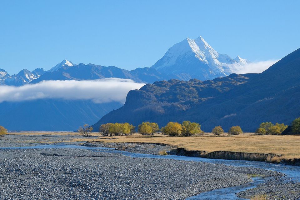
Aoraki / Mount Cook above the Tasman Valley, with autumn willows along a stream, April 2025.
Photograph: Pseudopanax · Public domain · cropped
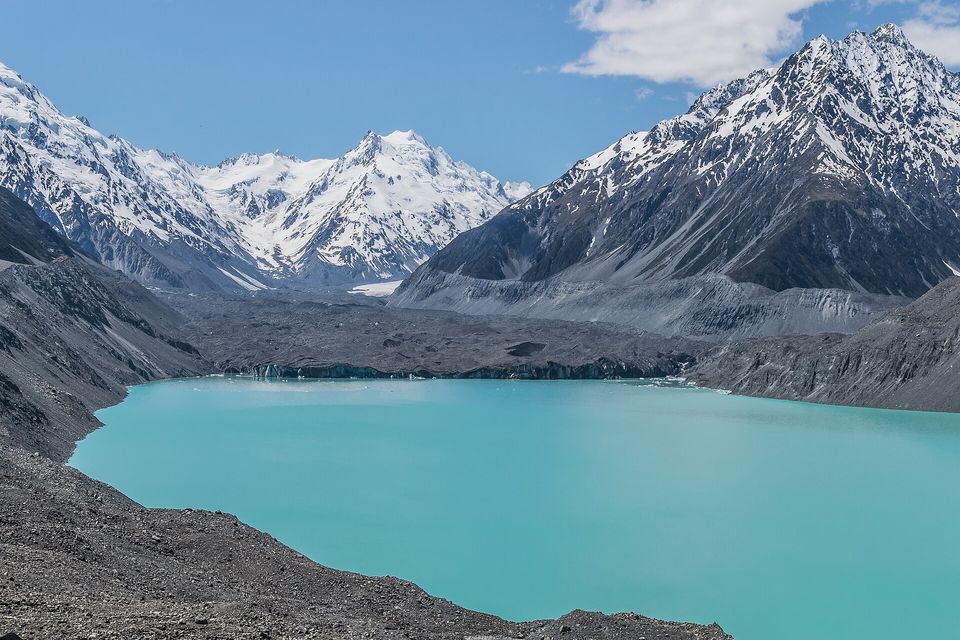
Tasman Lake at the end of the Tasman Glacier, November 2017.
Photograph: Krzysztof Golik · CC BY-SA 4.0 · cropped
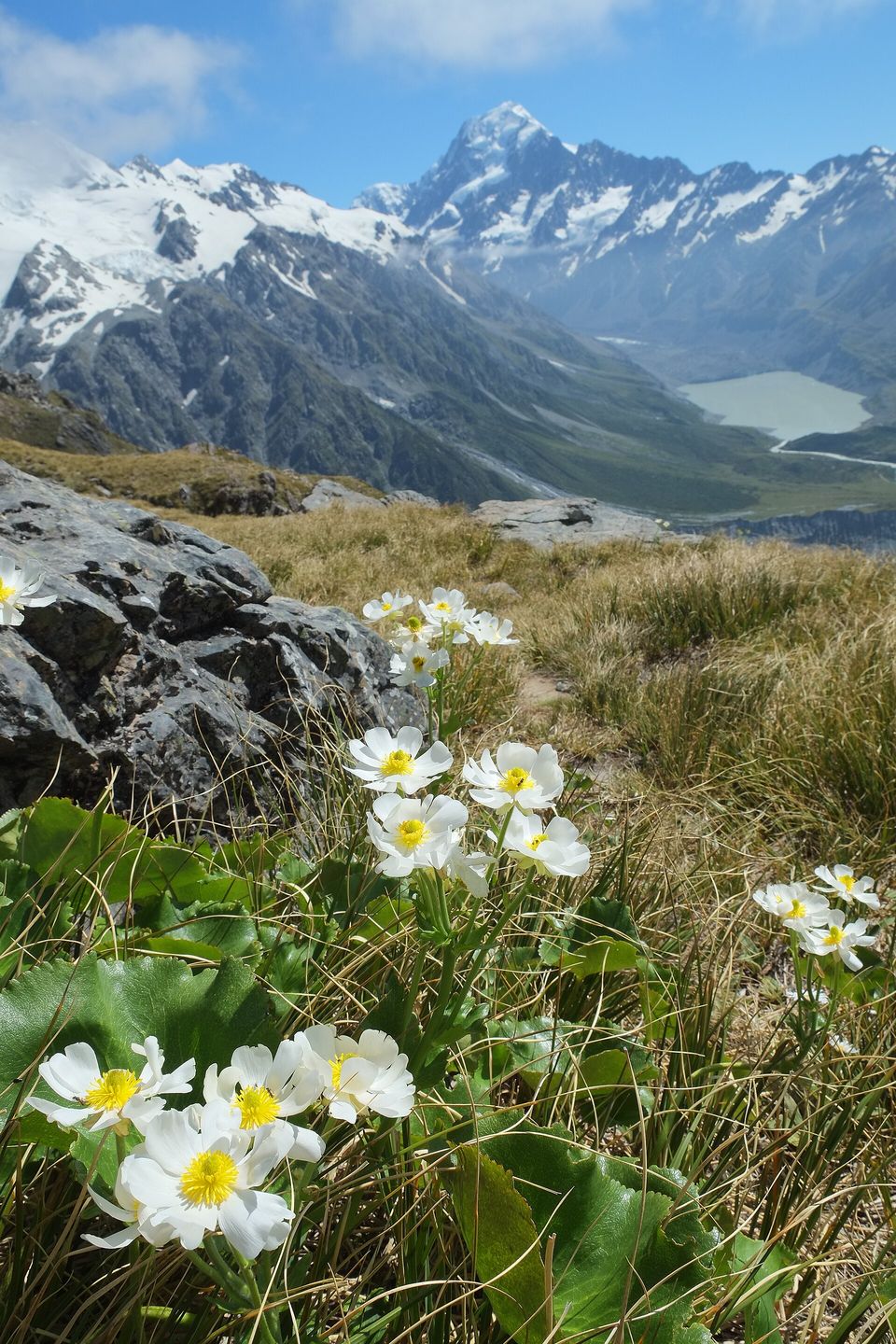
The Mount Cook buttercup (Ranunculus lyallii, also called the Mount Cook lily) in flower, with the Hooker Valley behind, January 2016.
Photograph: Pseudopanax@Wikimedia · Mount Cook Buttercups with Hooker Valley in the background · CC BY 3.0
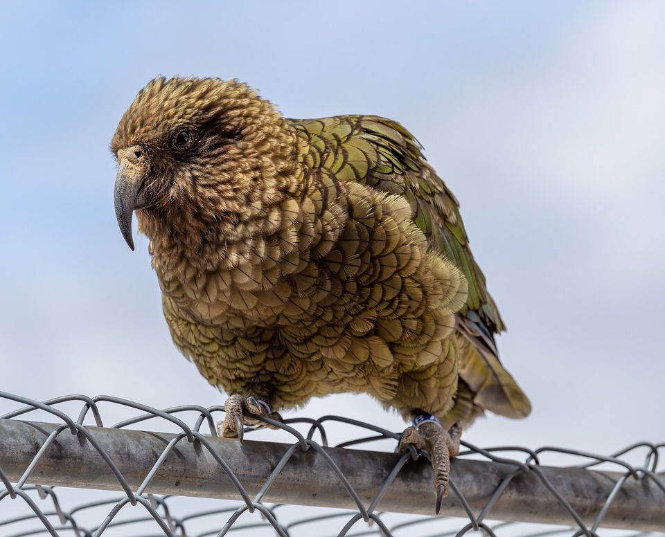
A kea, the alpine parrot, perched on a fence by Mueller Hut, January 2020.
Photograph: Michal Klajban · CC BY-SA 4.0
- Walk to the lake early, before the wind gets up and the cloud comes down.
- Stay off the icebergs. They roll.
- Admire the top from the valley, and leave it be. Some heads are not for standing on.
- Keep an eye on the green parrots and a hand on your sandwich.
- See it without cloud. (Waited all afternoon. Saw it for about as long as it takes to write this down. Item retained.)
The fallen summit. In the early morning of 14 December 1991 the top of Aoraki / Mount Cook, about 12 million cubic metres of rock and ice by Te Ara’s figure, broke away and went down the east face onto the Tasman Glacier. The summit people had surveyed for a hundred years went with it, and the mountain has been lower ever since. You cannot visit the piece that fell; it went into the ice of the valley floor. You can stand in the valley and look up at the ridge it came from, at a top that is younger than most of the people looking at it.
Tally, in the marginThe very top of a mountain, taken down in one night and spread over the valley floor. I admired the summit all morning before it occurred to me I was admiring the second one.
Getting there
How to get there. Mount Cook Village is at the end of State Highway 80, which runs up the shore of Lake Pukaki; it is a long drive from Christchurch or Queenstown. The village is small, so book a bed ahead in summer.
The walk. The Hooker Valley Track starts at the White Horse Hill car park at the end of Hooker Valley Road and takes about three hours return on a gravel path with swing bridges over the Hooker River, ending at Hooker Lake beneath the mountain. Icebergs float in the lake in summer; the Department of Conservation warns visitors not to climb on them, because they are unstable and can roll. For a second view, the Tasman Lake track leads to the lake at the end of the Tasman Glacier.
When to go. The mountain is often in cloud. Walk early, and allow a spare day in case the first one is grey. Weather changes fast at any time of year.
Climbing. Only with mountaineering experience or a licensed guide, and in the knowledge that Ngāi Tahu ask climbers not to stand on the summit.
A charge is coming, probably. The New Zealand Government has proposed charging international visitors to enter Aoraki / Mount Cook National Park, with NZ$40 proposed. The Conservation Amendment Bill that would allow it was introduced on 7 May 2026, and the Department of Conservation says the earliest a charge could start is summer 2027.
Mark this place
Common questions
How high is Aoraki / Mount Cook?
3,724 metres, according to a 2013 survey led by the University of Otago that combined aerial photography with GPS readings taken on the summit. Aoraki / Mount Cook, New Zealand’s highest mountain, had been measured at 3,764 metres from 1881 until a collapse in December 1991 lowered it by about ten metres; erosion of its ice cap took off about thirty more.
Why did Aoraki / Mount Cook get shorter?
Two reasons. On 14 December 1991, Te Ara records, about 12 million cubic metres of rock and ice collapsed from Aoraki / Mount Cook onto the Tasman Glacier, taking about ten metres off the top. The University of Otago attributes a further thirty-metre loss, found in its 2013 survey, to two decades of erosion of the ice cap the collapse exposed.
What does Aoraki mean to Ngāi Tahu?
Aoraki is the most sacred of the ancestors from whom Ngāi Tahu descend, according to the Department of Conservation, which manages Aoraki / Mount Cook National Park. The mountain gives the iwi its sense of identity and purpose, and under the Ngāi Tahu Claims Settlement Act 1998 it has Tōpuni status, a public symbol of Ngāi Tahu’s authority and relationship with the land.
Can you climb to the summit of Aoraki / Mount Cook?
Experienced mountaineers climb Aoraki / Mount Cook, but not onto the very top. The Department of Conservation says Ngāi Tahu believe it is not appropriate to climb onto what is effectively the head of an ancestor, and the New Zealand Alpine Club reports that guided parties do not set foot on the true summit. The climb is heavily glaciated and exposed to avalanches and rock fall.
Why is it called Aoraki / Mount Cook?
The Ngāi Tahu Claims Settlement Act 1998 changed the mountain’s official name from Mount Cook to Aoraki / Mount Cook, restoring its Māori name. Captain John Lort Stokes had named it Mount Cook in 1851 after James Cook, who never saw it. Wikipedia notes that it is the only dual name from that settlement in which the Māori name comes first.
Was Aoraki / Mount Cook given to Ngāi Tahu?
Not yet, as far as this entry could find. The Ngāi Tahu Claims Settlement Act 1998 provides for the Crown to vest Aoraki / Mount Cook in Te Rūnanga o Ngāi Tahu, which is to give it back to the people of New Zealand seven days later, on a date set by Order in Council. Wikipedia records that neither transfer has happened and that Ngāi Tahu will decide when.
What is the best walk to see Aoraki / Mount Cook?
The Hooker Valley Track, about three hours return from the White Horse Hill car park near Mount Cook Village, according to the Department of Conservation. It crosses the Hooker River on swing bridges and ends at Hooker Lake, directly beneath Aoraki / Mount Cook, where icebergs float in summer. The Department warns visitors not to climb on the icebergs.
Will international visitors pay to visit Aoraki / Mount Cook National Park?
Probably, from 2027 at the earliest. The New Zealand Government has proposed an access charge of NZ$40 for international visitors to Aoraki / Mount Cook National Park, one of four sites under consideration. The Conservation Amendment Bill needed to allow it was introduced on 7 May 2026, and the Department of Conservation says a charge could start no earlier than summer 2027.