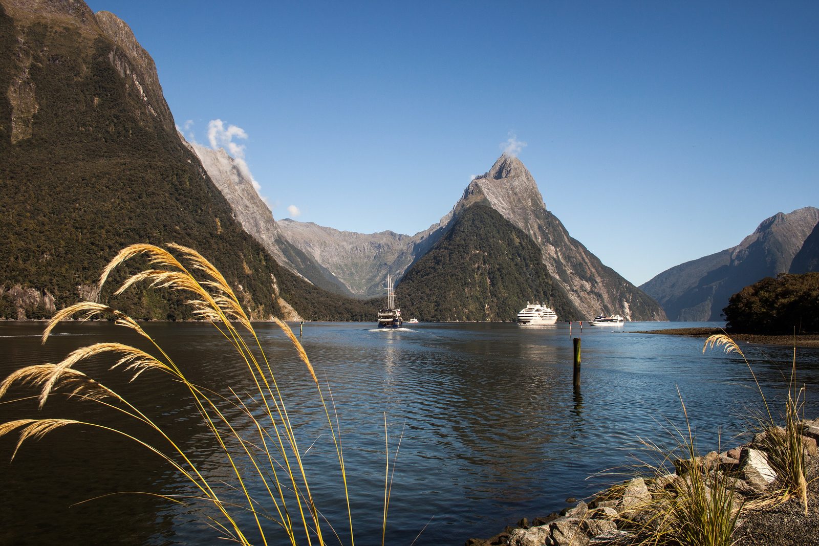

- Where
- Fiordland National Park
south-west South Island, New Zealand - Coordinates
- 44.6414° S
167.8974° E - The fiord
- About 15 km long
walls 1,200 m and more - Rain
- More than 6,000 mm a year
according to Te Ara - Name
- Milford Sound / Piopiotahi
dual name since 1998 - Status
- Te Wāhipounamu World Heritage Area
Piopiotahi Marine Reserve - Best visited
- Early or late in the day
and after heavy rain
Came through a dark tunnel in the mountain and down the other side into rain, and every cliff had grown a waterfall. The water at the bottom was black and perfectly still, the walls went straight up out of it into cloud, and a small penguin with yellow eyebrows watched the boat go by without much interest. Tiny flies ate me thoroughly. I thanked the rain anyway.
The short answer
Milford Sound / Piopiotahi is a fiord in Fiordland National Park, in the south-west of New Zealand’s South Island: a valley cut by glaciers and flooded by the sea, running about 15 kilometres inland from the Tasman Sea between rock walls that rise 1,200 metres or more. It lies within the Te Wāhipounamu – South West New Zealand World Heritage Area, and the Piopiotahi Marine Reserve runs along its northern shore. Its official name has carried both its English and its Māori names since the Ngāi Tahu Claims Settlement Act 1998. Te Ara, the government’s encyclopedia of New Zealand, gives it more than six metres of rain a year. Most visitors arrive by road through the Homer Tunnel and see it from a boat.
Why it's worth knowing
The water in Milford Sound is two waters. So much rain falls here, and runs so quickly off steep forested slopes, that a layer of fresh water, stained yellow-brown by rotting leaves and soil, floats on the denser sea water beneath it. Te Ara describes that layer cutting the light, so that only greenish light gets through.
The lid changes who lives underneath. The Department of Conservation, which manages the fiord and its marine reserve, calls the result deep-water emergence: species that elsewhere live far below the surface, black coral, red coral and sea pens among them, grow here at depths a recreational diver can reach. Offshore, Te Ara says, black coral is usually confined to depths greater than about 45 metres; in the fiords it grows as shallow as 10. The Department says Fiordland’s fiords hold about seven million black coral colonies, some of them 200 years old. In Milford Sound the deep sea comes up to meet you, because the rain has put a ceiling on it.
The English name has the landform slightly wrong as well. John Grono, a Welsh-born sealer, called it Milford Haven after the harbour in Wales, and Captain John Lort Stokes later renamed it Milford Sound. It is a fiord, which is why the national park around it is called Fiordland. It also has a Māori name: Māori knew the fiord and its tides and fish, and since 1998 the official name has carried both.
The field notes
Two names
Milford Sound / Piopiotahi is one of about ninety places given dual names under the 1998 Treaty of Waitangi settlement with Ngāi Tahu, according to Wikipedia; the New Zealand Gazetteer lists it under the combined name. The two parts are a single official name, not alternatives.
Piopiotahi means a single thrush. In the tradition Te Ara records, the hero Māui brought a thrush, a piopio, with him from Hawaiki, and when Māui died trying to win immortality the bird fled south and gave its name to the fiord. The Department of Conservation notes other tellings, among them a canoe named Piopiotahi. The piopio itself, a ground-feeding bird, is now thought to be extinct. Ngāi Tahu tradition of the fiord is recognised in the settlement itself, which records the visit of Tamaahua to Piopiotahi in search of Poutini.
Rain that makes waterfalls
Wikipedia gives a mean annual rainfall of 6,412 millimetres and up to 250 millimetres in a day. Two waterfalls, Lady Bowen Falls and Stirling Falls, run all year. After heavy rain dozens more appear down the walls, fed by rain-soaked moss, and last a few days after it stops; some fall from such a height that the wind takes them before they reach the water.
The same rain sometimes loosens whole patches of forest from the rock, and the scars of these tree avalanches can be seen regrowing along the fiord.
Under the lid
When the sea rose into the glacial valleys about 6,500 years ago, rock debris left by the glaciers formed partial barriers, or sills, across their mouths, and Te Ara says these still restrict the flow of sea water in and out: circulation in each fiord is confined to the top 20 to 40 metres. Below that, conditions resemble the deep ocean.
Black coral in the fiords is Antipathes fiordensis, and in life it looks white; it is named for the skeleton inside. Black corals are absolutely protected in New Zealand under the Wildlife Act 1953. The Piopiotahi Marine Reserve covers 690 hectares along the northern side of the fiord, from its head to Dale Point, and the Department of Conservation calls it one of the most popular places in Fiordland to dive and see the black coral.
The road in
For most of its history the fiord was reached by sea or on foot. The Milford Track, a 53.5-kilometre walk from the head of Lake Te Anau over McKinnon Pass, found in 1888, became an early tourist walking route. The road came later: the Homer Tunnel, 1.2 kilometres long and 945 metres above sea level, was completed in 1953, and Waka Kotahi, the New Zealand Transport Agency, says it opened Milford Sound to road access.
The road runs through avalanche country. The Transport Agency manages a 17-kilometre avalanche area on either side of the tunnel, and its avalanche season usually runs from June to October.
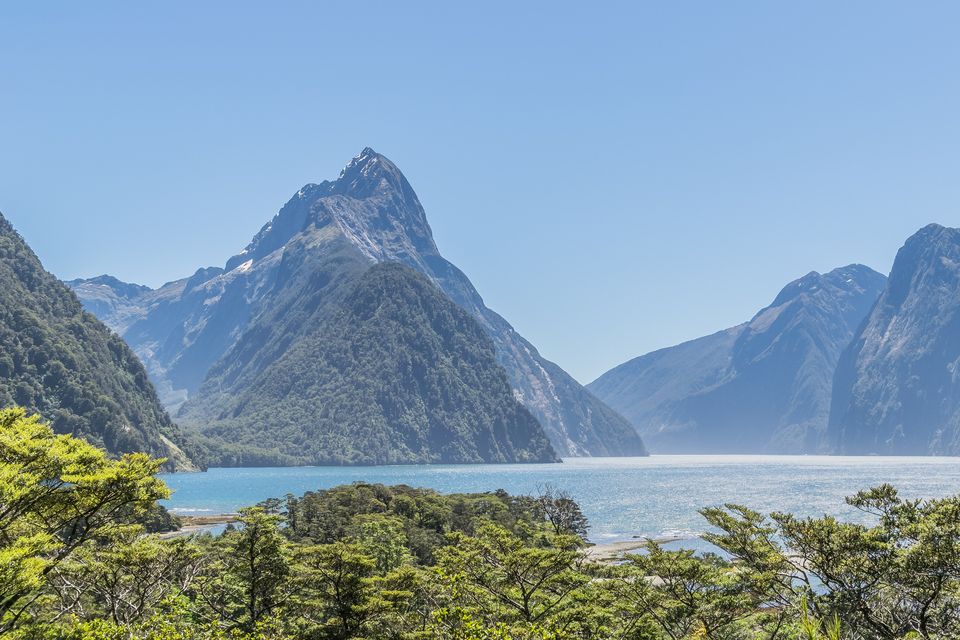
Looking down Milford Sound from the shore, November 2017.
Photograph: Krzysztof Golik · CC BY-SA 4.0 · cropped
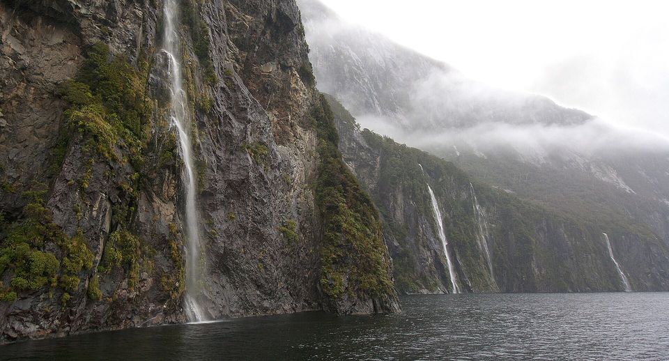
Waterfalls streaming down the fiord walls after rain, September 2011.
Photograph: Lawrence Murray · Milford Sound Waterfalls · CC BY 2.0
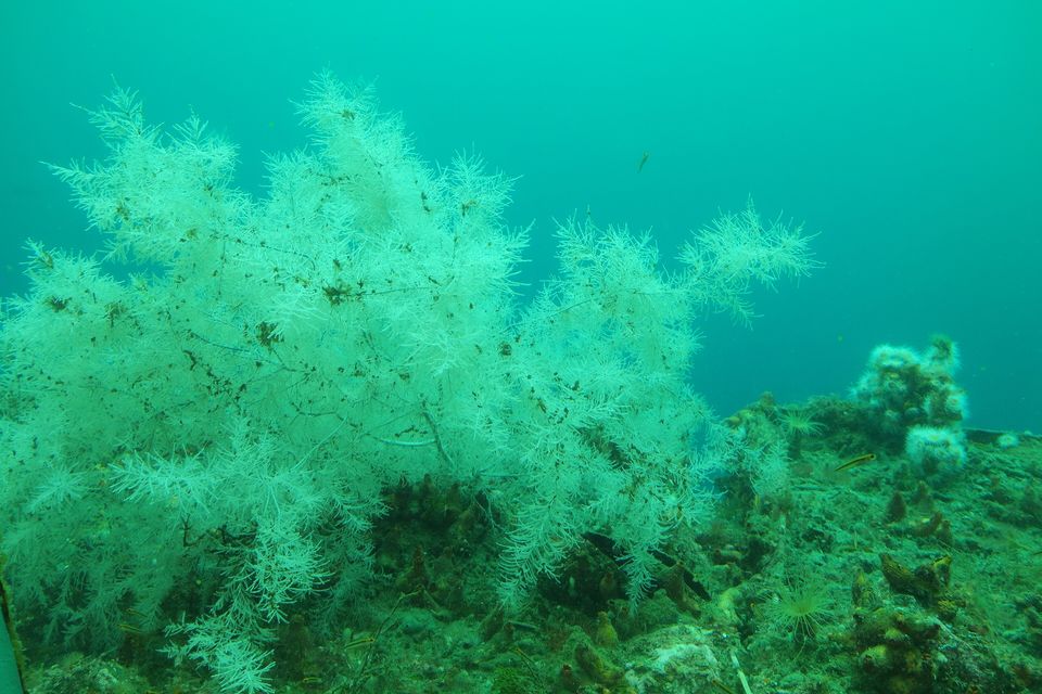
Black coral, which is white while it is alive, at the Milford Sound Underwater Observatory, January 2016.
Photograph: Pseudopanax · Public domain
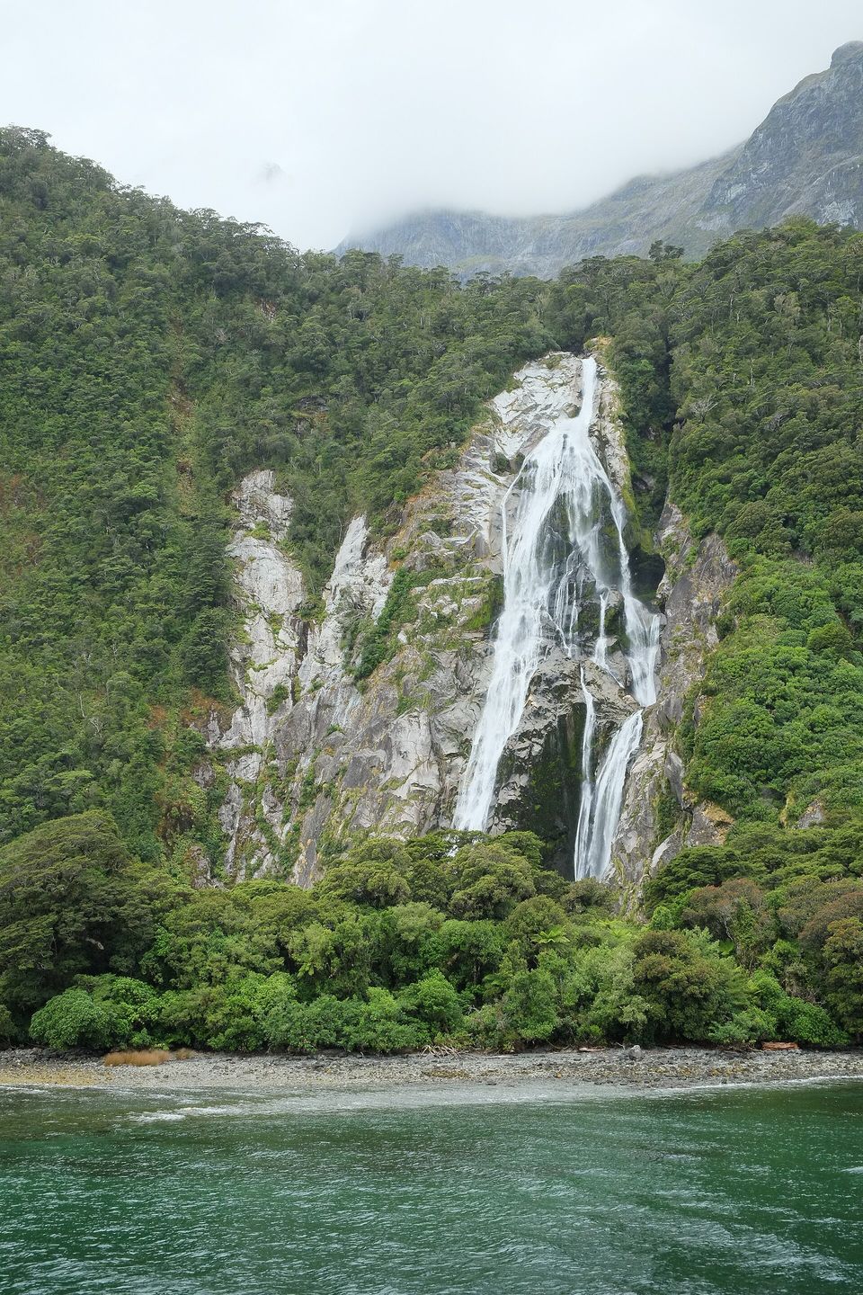
Bowen Falls dropping into the fiord in a low-flow spell, January 2016.
Photograph: Pseudopanax · Public domain
- Go when it is raining. The waterfalls only come out for weather.
- Put something on against the tiny flies before you open the car door, not after.
- Learn its other name, and how to say it. It is not a spare.
- Stay the night if you can, and be on the water before the buses arrive.
- Count the waterfalls. (Abandoned when it rained again. The list now says: count some waterfalls.)
Black coral, which is white. In the dim water under the fiord’s freshwater layer grow branching colonies of black coral, Antipathes fiordensis, which in life look white: the name belongs to the skeleton inside. Offshore they would usually be found deeper than about 45 metres; here some grow at 10. The Department of Conservation says the fiords hold about seven million colonies, some of them 200 years old, and every one is protected by law. Seeing one means diving in the marine reserve along the northern shore. The cruise boats pass over them, and almost nobody on board knows.
Tally, in the marginA coral that is white on the outside and black on the inside, living near the top because the rain made a ceiling. I sailed straight over it and only found out at dinner.
Getting there
How to get there. By State Highway 94, the Milford Road, from Te Anau, about 120 kilometres; by coach from Queenstown, a much longer round trip; or by scenic flight to Milford Sound’s small airport. The Department of Conservation suggests allowing about eight hours for the return trip from Te Anau with stops, short walks and a cruise. Fill the tank in Te Anau: there are no shops or fuel stations on the road, and the only fuel involves a detour to Gunns Camp.
Winter. Chains may be required between June and November, and avalanche closures happen in the June–October season. Check the Transport Agency’s road status on the morning you travel.
When to go. Coaches from Queenstown bunch the crowd around the middle of the day, so arrive early or late, or stay the night. Go in the rain if it comes: the temporary waterfalls are at their best during and just after it. Take insect repellent for the sandflies.
On the water and under it. Boat cruises of one to two hours leave from the visitor terminal; there are also kayak trips and overnight boats. To see the black coral you need to dive, with an operator, in the marine reserve. Accommodation at the fiord is very limited, and most visitors stay in Te Anau or Queenstown.
A charge is coming, probably. The New Zealand Government has proposed charging international visitors to enter four sites, Milford Sound / Piopiotahi among them, with NZ$40 proposed for Milford. The Conservation Amendment Bill that would allow it was introduced on 7 May 2026, and the Department of Conservation says the earliest a charge could start is summer 2027. Check the Department’s site before you go.
Mark this place
Common questions
Is Milford Sound a sound or a fiord?
A fiord. Milford Sound / Piopiotahi is a valley cut by glaciers and later flooded by the sea, in Fiordland National Park on New Zealand’s South Island. The sealer John Grono named it Milford Haven after the harbour in Wales, and Captain John Lort Stokes renamed it Milford Sound; the English name stuck, although the landform is a fiord.
What does Piopiotahi mean?
Piopiotahi, the Māori name of Milford Sound, means a single thrush. In the tradition recorded by Te Ara, the encyclopedia of New Zealand, the hero Māui brought a piopio, a now-extinct native thrush, from Hawaiki, and when Māui died the bird fled south and gave the fiord its name. The Department of Conservation records other versions. The dual name Milford Sound / Piopiotahi became official after the Ngāi Tahu Claims Settlement Act 1998.
Why does black coral grow so shallow in Milford Sound?
Because of the rain. Run-off stained by the forest floats on the sea in Milford Sound / Piopiotahi as a dark freshwater layer that cuts the light below, so deep-water species grow nearer the surface, a pattern the Department of Conservation calls deep-water emergence. Te Ara says black coral, usually deeper than about 45 metres offshore, grows as shallow as 10 metres in the fiords.
How much rain does Milford Sound get?
More than six metres a year, according to Te Ara, the encyclopedia of New Zealand; Wikipedia gives a mean of 6,412 millimetres, with up to 250 millimetres in a single day. The rain at Milford Sound / Piopiotahi feeds two permanent waterfalls, Lady Bowen Falls and Stirling Falls, and dozens of temporary ones that last a few days after a downpour.
How do you get to Milford Sound?
Milford Sound / Piopiotahi is reached by State Highway 94, the Milford Road, about 120 kilometres from Te Anau through the 1.2-kilometre Homer Tunnel; by coach from Queenstown; by scenic flight; or on foot along the 53.5-kilometre Milford Track. The Department of Conservation suggests allowing about eight hours for the return trip from Te Anau, and there is no fuel on the road.
Is the Milford Road open in winter?
Usually, but not always. The Milford Road, State Highway 94, crosses a 17-kilometre avalanche area around the Homer Tunnel, and the New Zealand Transport Agency’s avalanche season usually runs from June to October, with closures when the risk is high. Vehicles may need to carry chains between June and November. The Agency publishes the road’s status daily.
Will international visitors have to pay to visit Milford Sound?
Probably, from 2027 at the earliest. The New Zealand Government has proposed an access charge for international visitors at four sites, including Milford Sound / Piopiotahi, where NZ$40 is proposed. The Conservation Amendment Bill needed to allow it was introduced to Parliament on 7 May 2026, and the Department of Conservation says a charge could start no earlier than summer 2027.
Can you dive in Milford Sound?
Yes, with an operator. The Piopiotahi Marine Reserve covers 690 hectares along the northern side of Milford Sound, from the head of the fiord to Dale Point, and the Department of Conservation calls it one of the most popular places in Fiordland to dive and see black coral. Black corals are absolutely protected under New Zealand’s Wildlife Act 1953.