
- Where
- Leeward Islands, Society Islands,
French Polynesia - Coordinates
- 16.5010° S
151.7400° W - Size
- 30.55 km²;
10,605 people (2017) - Highest point
- Mount Otemanu,
727 m - The airstrip
- Built by US forces, 1943,
on the islet of Motu Mute - The lagoon
- One pass through the reef,
Teavanui - Getting there
- About 50 minutes by air from Tahiti,
then a boat
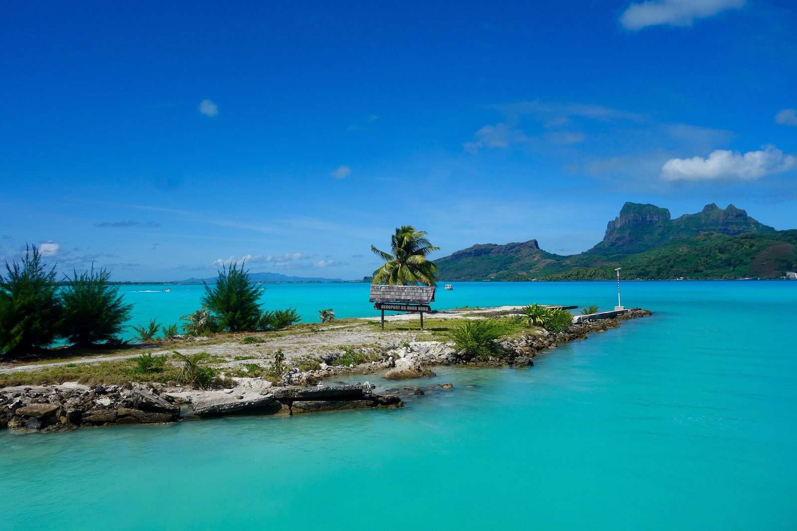
Landed on a thin strip of sand and palms in the middle of the water, and was taken the rest of the way by boat. Across the lagoon, bands of blue from glass to ink, and one dark tooth of a mountain standing over it all. Up the hill, under ferns, an iron gun was still staring out to sea. I sat beside it and kept it company.
The short answer
Bora Bora is an island in the Leeward group of the Society Islands, in French Polynesia, an overseas collectivity of France in the South Pacific. By Wikipedia’s account it has a land area of 30.55 square kilometres and had 10,605 people in 2017; its main village is Vaitape. The island is what remains of an extinct volcano, active between about 3.45 and 3.1 million years ago, whose highest points are Mount Otemanu, 727 metres, and Mount Pahia. Around it lies a lagoon, and around the lagoon a barrier reef crowned by flat islets, motu, with a single navigable pass, Teavanui, on the west. The island was an independent kingdom until France annexed it in 1888. Today it is best known for resorts built out over the lagoon.
Why it's worth knowing
Most visitors to Bora Bora arrive through a Second World War base. Early in 1942 the United States Navy needed a fuelling station in the South Pacific to support the ships and aircraft keeping the sea lanes to Australia open, and chose Bora Bora, codenamed BOBCAT. The Naval History and Heritage Command records that the first naval construction unit ever to deploy from the United States, the First Construction Detachment of 296 men, left Rhode Island on 17 January 1942 and reached Bora Bora on 17 February; they called themselves the Bobcats, and they left on 11 September 1943, by which time the war had moved west.
How many people came in all is given differently. Tahiti Tourisme gives 3,500 US military personnel; Wikipedia’s account gives nine ships and nearly 7,000 soldiers. The attraction, in Tahiti Tourisme’s account, was the deep-water bay at Faanui and a lagoon with only one easily controlled pass. Roads, a quay and a fuel depot were built, coastal guns were set on the hills, and an airstrip was laid on one of the motu. The island saw no combat, and the base closed on 2 June 1946.
The airstrip outlived the war. Wikipedia’s account says it was rebuilt for commercial service in 1958 and was French Polynesia’s only international airport until Faa’a International Airport opened on Tahiti in 1960; before then a French airline flew from Bora Bora to Los Angeles, by way of Honolulu, once a week. Tahiti Tourisme gives the end of the strip’s international role as 1963. The two dates are given here as each party gives them.
The field notes
The guns on the ridge
The coastal guns are still there. Wikipedia’s account says at least eight 7-inch naval guns were set at points around the island and that all eight remain. Tahiti Tourisme describes a walk of about two kilometres from the village of Faanui to a viewpoint, continuing along a ridge where two of the American guns still point out to sea. It lists the Motu Mute airstrip and the Faanui and Motu Mute docks among the island’s wartime heritage.
Older than the war
Long before the Americans, Bora Bora was a Polynesian island with its own sacred places. Wikipedia’s account says there were once more than 40 marae, ceremonial stone platforms, of which remains of 13 survive, with many petroglyphs; the best preserved is Marae Fare Opu, on the shore of Faanui Bay. James Cook sighted the island on 29 July 1769, guided by the Tahitian navigator Tupaia. The kingdom’s last queen, Teriimaevarua III, was made to abdicate when France annexed it in 1888.
A lagoon with one door
The lagoon’s single pass shapes the island’s life. Wikipedia’s account says Teavanui, on the west side opposite Vaitape, lets most cargo ships and cruise ships in, but that they must keep to the channel because much of the lagoon is shallow; the reef is more than two kilometres wide in places. The same shallowness gives the lagoon its colours, from indigo in the deep channel and bays to pale blue and green over the sand.
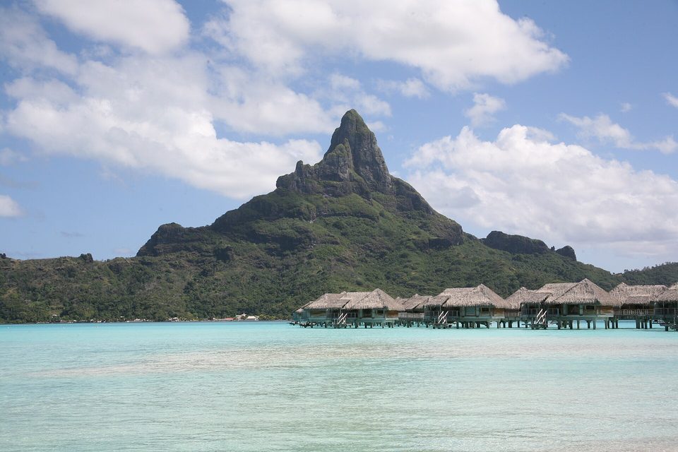
Mount Otemanu, 727 m, above the lagoon, May 2009.
Photograph: Taka-0905 · Public domain
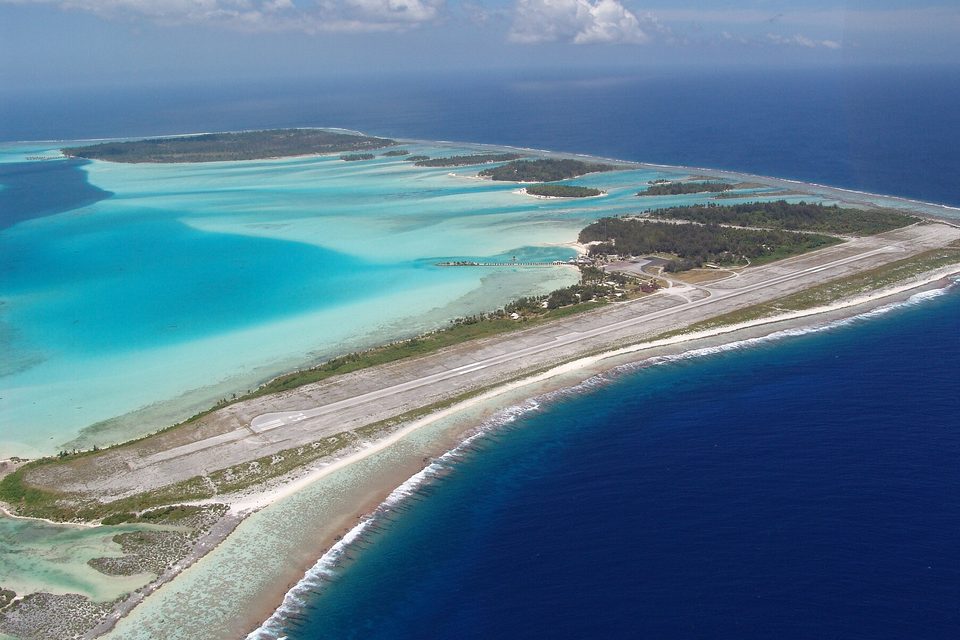
The runway laid along Motu Mute, the reef islet where US forces built the airstrip in 1943, from an arriving plane, October 2008.
Photograph: Kyprianos Biris · CC BY-SA 4.0 · cropped
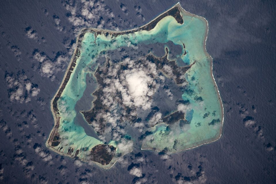
Bora Bora from the International Space Station, October 2019: the island, its wide lagoon and the ring of reef islets (astronaut photograph).
Astronaut photograph: NASA (ISS Expedition 61 crew) · Public domain
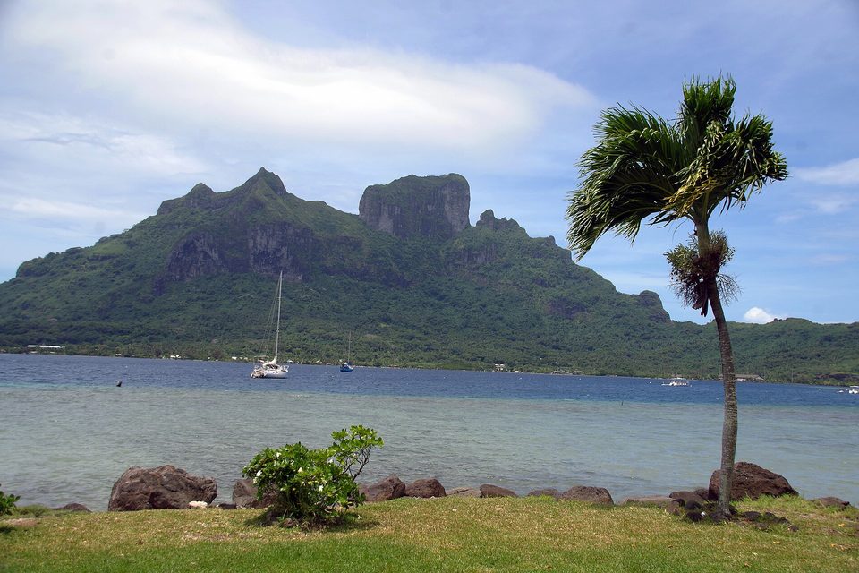
Mount Otemanu from the west shore, with yachts at anchor in the lagoon, December 2017.
Photograph: Balou46 · CC BY-SA 4.0 · cropped
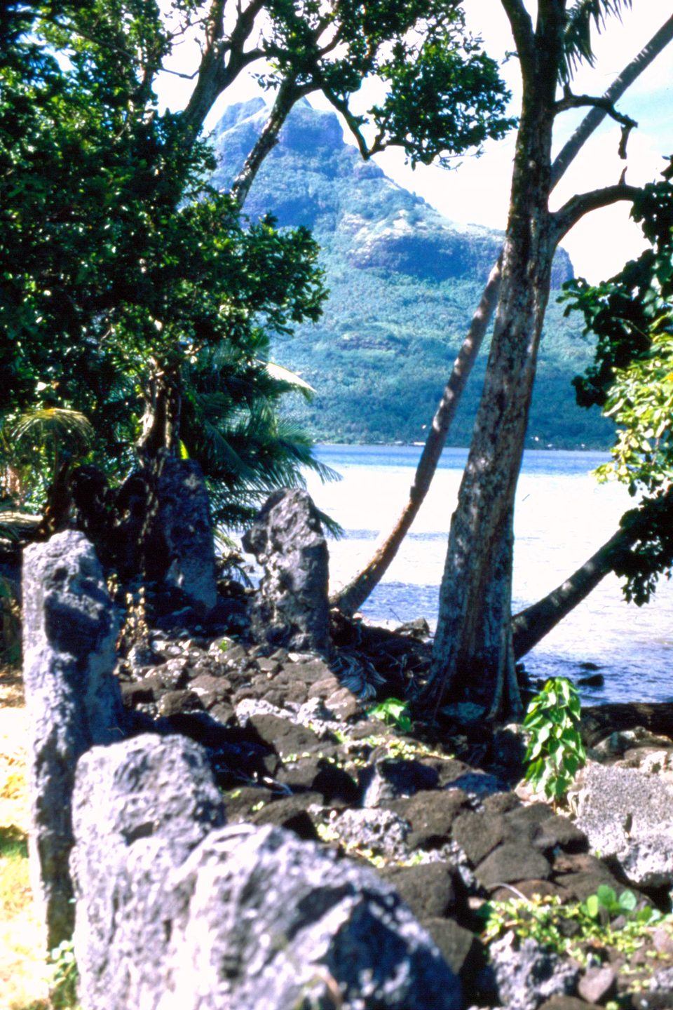
The marae Fare Opu at Faanui, on the shore of Bora Bora’s lagoon, March 2000.
Photograph: Makemake · BoraBora Marae1 · CC BY-SA 3.0 · colour-corrected
- Sit outside on the boat from the airstrip and let the lagoon introduce itself.
- Walk up to the old guns in the cool of the morning, and take water.
- Do not climb on the old stone platforms by the shore. They were built for something, and it was not sitting.
- Do not stand on the coral. It was there first, and it is alive.
- Choose a favourite blue. (Chose one, then a better one. The list has turned into a paint chart.)
The airstrip on Motu Mute. A runway laid along a flat islet of coral sand on Bora Bora’s barrier reef, built by United States forces in 1943 for the wartime fuel base codenamed Bobcat. It was rebuilt for commercial flights in 1958 and until the early 1960s was French Polynesia’s only international airport. Visitors still land on it, walk off the plane beside the lagoon, and take a boat to the island they came to see.
Tally, in the marginA runway on a sliver of sand, with a boat waiting at the end of it where a road ought to be. Somewhere in the middle of the lagoon I understood that the boat was the welcome, and it has gone into the notebook as the best one so far.
Getting there
How to get there. International flights land at Faa’a International Airport on Tahiti. From there Air Tahiti flies to Bora Bora, which it says takes from 50 minutes, with more than ten flights a day. The airport is on Motu Mute, so the last stage is by boat: Air Tahiti’s shuttle to Vaitape takes about 15 minutes and is included in the air fare. Cruise ships enter the lagoon through the Teavanui pass.
When to go. The climate is tropical and warm all year. Wikipedia gives the dry season as June to October, though some rain falls then too; the wettest months are December and January.
How to be there. The marae are sacred sites: look, and do not climb on them. In the lagoon, do not stand on coral. The walk to the wartime guns from Faanui is short but hot; go early and take water.
Safety. The United States has French Polynesia at Level 1, exercise normal precautions.
Mark this place
Common questions
Why is Bora Bora’s airport on a separate island?
Bora Bora’s airport is on Motu Mute, a flat islet on the barrier reef, because that is where United States forces built an airstrip in 1943 during the Second World War, for the fuel base codenamed Bobcat. It is still the island’s airport. Air Tahiti runs a shuttle boat across the lagoon to the main village, Vaitape, in about 15 minutes.
What was Operation Bobcat?
Operation Bobcat was the United States’ wartime base on Bora Bora, in French Polynesia, codenamed BOBCAT: a fuelling station for ships and aircraft keeping the sea lanes to Australia open. The US Navy’s First Construction Detachment, 296 men, arrived on 17 February 1942 and left on 11 September 1943. The island saw no combat, and the base closed in 1946.
Was Bora Bora’s airport the first international airport in French Polynesia?
Bora Bora’s wartime airstrip on Motu Mute was French Polynesia’s only international airport until Faa’a International Airport on Tahiti took over. Wikipedia gives Faa’a’s opening as 1960, before which a weekly service ran from Bora Bora to Los Angeles via Honolulu; Tahiti Tourisme says the Bora Bora strip remained the only international airport until 1963.
Are there Second World War guns on Bora Bora?
Yes. Wikipedia’s account says at least eight 7-inch naval guns were placed around Bora Bora by US forces during the Second World War and that all eight remain. Tahiti Tourisme describes a walk of about two kilometres from the village of Faanui to a viewpoint and a ridge where two of the guns still point out to sea.
How high is Mount Otemanu?
Mount Otemanu, the highest point of Bora Bora in French Polynesia, is 727 metres high. It and the neighbouring Mount Pahia are remnants of the extinct volcano that formed the island, which by Wikipedia’s account was active between about 3.45 and 3.1 million years ago.
How do you get to Bora Bora?
International flights to French Polynesia land at Faa’a International Airport on Tahiti. Air Tahiti flies on to Bora Bora in about 50 minutes, with more than ten flights a day, landing at the airstrip on Motu Mute; its shuttle boat to Vaitape, included in the fare, takes about 15 minutes. Cruise ships enter the lagoon through the Teavanui pass.
What are the marae on Bora Bora?
Marae are Polynesian ceremonial stone platforms, sacred sites. Wikipedia’s account says Bora Bora once had more than 40, of which remains of 13 survive, along with many petroglyphs; the best preserved is Marae Fare Opu on the shore of Faanui Bay. Visitors should look at them without climbing on them.
When is the best time to visit Bora Bora?
Bora Bora in French Polynesia is warm all year. Wikipedia gives its dry season as June to October, with some rain even then, and December and January as the wettest months. The United States has French Polynesia at Level 1, exercise normal precautions.