
- Where
- Northern Botswana
along the Chobe River - Coordinates
- 17.83° S
25.05° E (riverfront) - Protected
- Game reserve 1960;
national park 1968 - Area
- About 11,700 km²
(Botswana Tourism) - Elephants
- 131,909 in Botswana
(KAZA aerial survey, 2022) - The island
- Sedudu (Kasikili)
Botswana’s by ICJ ruling, 1999 - Advisory
- Botswana Level 2
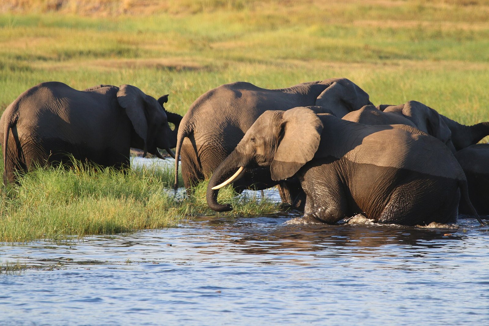
Came down through dry grey woodland on sand so deep the truck wallowed, and there was the river, wide and slow, its floodplain greener than anything behind us. The elephants arrived in families, dusty and unhurried, and some waded out to a grassy island until only their trunks showed. The boats all went round that island the same way. I lost count, then my pencil, and minded neither.
The short answer
Chobe National Park covers about 11,700 square kilometres of northern Botswana, by the Botswana Tourism Organisation’s figure, and is part of the Kavango-Zambezi Transfrontier Conservation Area (KAZA), which spans five countries. Wikipedia’s account calls it Botswana’s first national park, created as a game reserve in 1960 and declared a national park in 1968, the year the tourism organisation also gives. The tourism organisation divides it into four areas: the Chobe Riverfront, the Ngwezumba pans, Savuti and Linyanti. The riverfront, in the park’s north-eastern corner beside the town of Kasane, is the most visited, because it is where the animals come to drink. Across the river is Namibia.
Why it's worth knowing
In 2022 the KAZA partner states counted their elephants from the air. The KAZA Elephant Survey, flown between August and October 2022, estimated 227,900 elephants in the conservation area, give or take 16,743, and found 58 per cent of them in Botswana: 131,909. Its report records the highest densities at permanent water, along the Okavango and the Chobe-Linyanti-Kwando river system among others. Wikipedia’s article on the park puts the park’s own elephants at about 50,000, without a dated count, and describes these Kalahari elephants as forming the largest herds of any known elephant population.
The riverfront is where those numbers become visible. The Botswana Tourism Organisation describes large herds of elephants and buffalo converging on the Chobe’s banks to drink in the dry winter months, when water elsewhere is gone. Wikipedia’s account puts that season from May to October.
The same survey carried a warning. It counted an estimated 26,641 elephant carcasses, a carcass ratio of 10.47 per cent, with a concentration of fresh and recent carcasses in the border region between Botswana and Namibia along the Kwando-Linyanti-Chobe system, and the KAZA secretariat described that level of mortality as needing further investigation.
The field notes
The island that went to court
In the Chobe River, just upstream of Kasane, the channel splits around a low island of about 3.5 square kilometres. Botswana calls it Sedudu; Namibia calls it Kasikili. An Anglo-German treaty of 1 July 1890 had put the boundary between the two colonial spheres in the “main channel” of the Chobe, and a century later the two independent states disagreed about which channel that was: Botswana said the northern one, Namibia the southern.
They took the question to the International Court of Justice. In its judgment of 13 December 1999 the Court weighed the channels’ depth, width, flow, bed profile and navigability, found by eleven votes to four that the northern channel was the main one, and held that the island forms part of Botswana. Wikipedia’s account adds that the island has no permanent residents and is flooded for several months a year from about March.
Seventeen kilometres and a traffic plan
The riverfront drive runs about 17 kilometres from Sedudu gate to the Serondela picnic site, and nearly every visitor to Kasane uses it. Botswana’s government magazine Kutlwano reported the Department of Wildlife and National Parks’ response to the crowding: route bookings with coloured tokens, one-way traffic for game drives, and a one-way, clockwise circuit for the boats around Sedudu Island from the department’s jetty, with limits on how many boats may be on the river at once.
Serondela itself was once a timber settlement; Wikipedia’s account says the industry was moved out of the park and that its traces are still visible. The riverfront floodplain is, by the same account, the only place in Botswana to see the puku antelope.
Kasane
Kasane, the town at the park’s gate, stands near the point where Botswana, Namibia, Zambia and Zimbabwe almost meet. Wikipedia records a population of 9,244 at the 2011 census, and a brief moment of fame in 1975, when Elizabeth Taylor and Richard Burton remarried there.
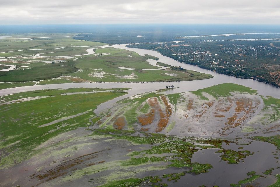
The Chobe River braiding across its floodplain beside Kasane, seen from the air, April 2022.
Photograph: Dicklyon · CC BY-SA 4.0 · cropped
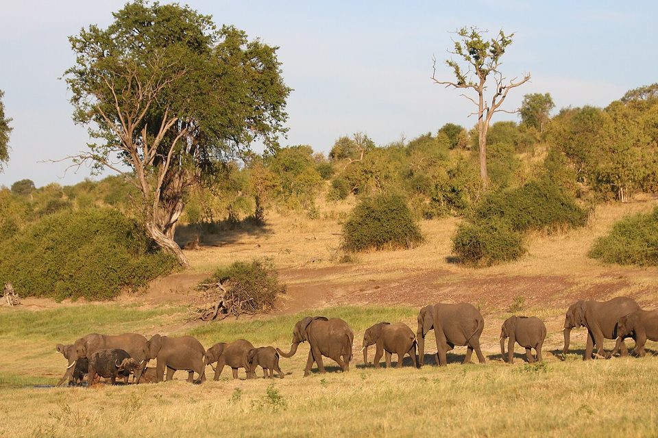
A family line of elephants walking down to the Chobe River as sunset approaches, March 2015.
Photograph: NikSimpson · CC BY-SA 4.0 · cropped
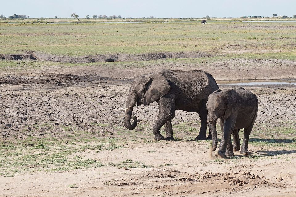
An elephant cow and calf on the cracked mud of the dry floodplain, November 2017.
Photograph: Bernard Gagnon · CC BY-SA 4.0
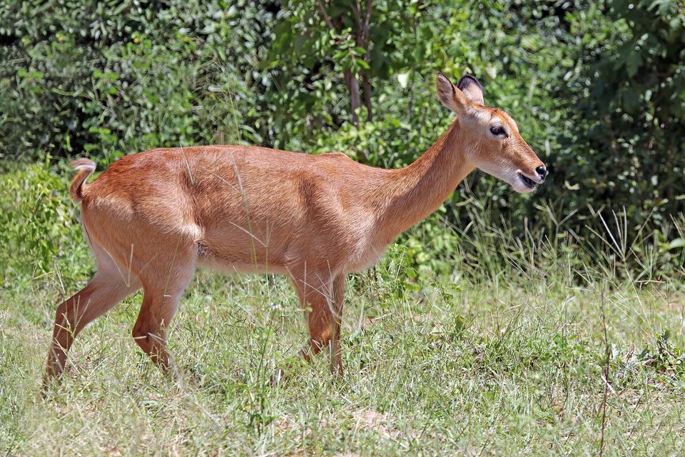
A female puku on the Chobe riverfront floodplain, March 2018.
Photograph: Charles J. Sharp · CC BY-SA 4.0
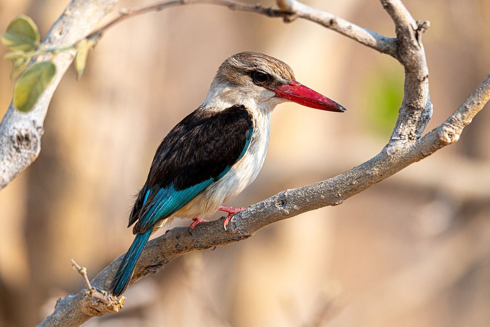
A brown-hooded kingfisher on a dry branch in Chobe National Park, September 2021.
Photograph: Christoph Strässler · Brown-hooded Kingfisher, Chobe National Park, Botswana · CC BY-SA 2.0 · cropped
- Sit by the water in the late afternoon of a dry month, and let them come to you.
- Switch the engine off and keep your voice down when a family is crossing, and let the smallest one finish.
- Take the boat once and the drive once, and do not try to squeeze both into one morning.
- Bring binoculars for the birds, and something to wipe the dust off them.
- Leave room on the page for whatever comes down to drink. (Not nearly enough room. The elephants are continued overleaf.)
A coloured route token. The riverfront drive runs about 17 kilometres from Sedudu gate to the Serondela picnic site, and nearly every visitor to Kasane uses it. To ease the crowding, Botswana’s Department of Wildlife and National Parks brought in route bookings with coloured tokens and one-way traffic for game drives, and a one-way, clockwise circuit for the boats around Sedudu Island, with limits on how many boats may be on the river at once. The island the boats circle was the subject of a case at the International Court of Justice, which ruled in 1999 that it is Botswana’s.
Tally, in the marginA coloured token, to say which way I was allowed to go. I spent the morning feeling like an explorer, and found out at lunch that I had been in a very well-run queue.
Getting there
How to get there. Kasane has its own airport, and a tarred highway runs north to it from Francistown and Gaborone. From Kasane the Victoria Falls in Zimbabwe are about 70 kilometres east by road, through the Kazungula border posts, which is why many itineraries combine the two. The riverfront section of the park is entered at Sedudu gate, just west of town.
How to see it. The Botswana Tourism Organisation lists morning and afternoon game drives and boat cruises from Kasane. Wikipedia’s account warns that driving the park needs a four-wheel-drive vehicle: the riverfront’s sand gets thick in the dry months and its roads turn to mud in the wet. Expect booked routes and one-way loops on the riverfront, under the wildlife department’s decongestion rules.
When to go. The dry season, roughly May to October, is when the herds come to the river. The rains bring green floodplains and migrant birds instead.
Safety. The State Department has Botswana at Level 2, exercise increased caution, because of crime, with no area-specific warnings; it notes that much of the country is remote and hard to reach in an emergency. Namibia, across the river, is also at Level 2.
Mark this place
Common questions
Why is Chobe National Park famous for elephants?
Chobe National Park in northern Botswana is famous for the elephant herds that gather on the Chobe River in the dry season. Botswana holds the largest share of the elephants in the Kavango-Zambezi conservation area: the 2022 KAZA aerial survey estimated 131,909 of the area’s 227,900 elephants in Botswana, with the highest densities at permanent rivers such as the Chobe.
How many elephants are there in Chobe National Park?
No dated count for Chobe National Park alone was found for this entry. Wikipedia puts the park’s elephants at about 50,000. The 2022 KAZA Elephant Survey, flown from August to October 2022, estimated 131,909 elephants in Botswana as a whole and 227,900 across the five-country conservation area.
When is the best time to see elephants at Chobe?
The dry season, from about May to October, is the best time to see elephants on the Chobe Riverfront, when water inland has dried up and herds come down to the Chobe River to drink. The Botswana Tourism Organisation describes large herds of elephants and buffalo converging on the riverbank in the dry winter months.
What is Sedudu Island?
Sedudu Island, called Kasikili Island in Namibia, is an island of about 3.5 km² in the Chobe River near Kasane. Botswana and Namibia disputed it under an 1890 Anglo-German treaty, and on 13 December 1999 the International Court of Justice ruled, by eleven votes to four, that the northern channel is the main one and that the island belongs to Botswana.
When was Chobe National Park established?
Chobe National Park was created as a game reserve in 1960 and declared a national park in 1968, by Wikipedia’s account, which calls it Botswana’s first national park; the Botswana Tourism Organisation also gives 1968. Human settlement had been cleared from the park by 1975.
How do you get to Chobe National Park?
Most visitors reach Chobe National Park through Kasane, in the far north-east of Botswana, which has an airport and a tarred road from Francistown. The riverfront section is entered at Sedudu gate, just west of Kasane, and is explored on game drives and boat cruises; driving yourself needs a four-wheel-drive vehicle.
What is the Chobe Riverfront?
The Chobe Riverfront is the north-eastern section of Chobe National Park, a strip of floodplain and woodland along the Chobe River from Sedudu gate to Serondela, about 17 km. It is the park’s most visited area, and Botswana’s wildlife department manages crowding there with booked routes, one-way game drives and a one-way boat circuit around Sedudu Island.
How far is Chobe National Park from Victoria Falls?
Kasane, the gateway town to Chobe National Park in Botswana, is about 70 km by road from the Victoria Falls in Zimbabwe, through the border posts at Kazungula. The Chobe River joins the Zambezi just east of Kasane, upstream of the falls.