Region
Africa
Dunes, deltas and salt pans, great rivers and big wildlife, mud-brick villages and a storytellers' square, and volcanic islands off the coasts.
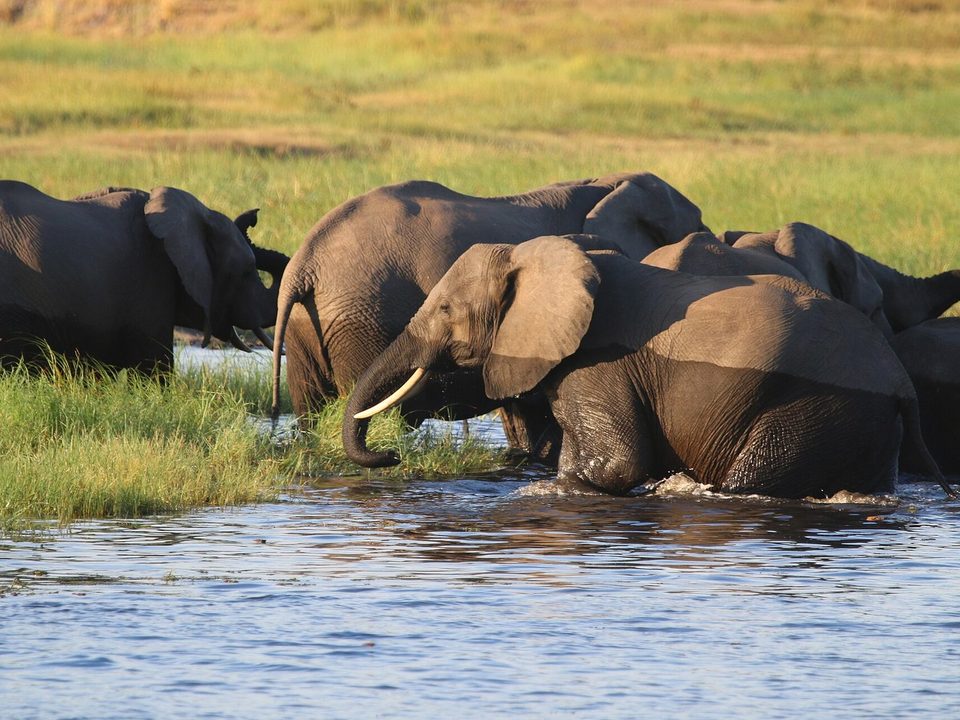
Chobe National Park. Photograph: NikSimpson, CC BY-SA 4.0, cropped
Africa's places run from desert and salt pan to river delta, rainforest and the islands off both coasts. In Namibia, the dead trees of Deadvlei stand on a white clay pan in the Namib. In Botswana, the Okavango Delta floods in the dry winter with water that fell as rain months earlier in the highlands of Angola, and the flood months concentrate the wildlife. On the Zambezi, Victoria Falls drops into a zigzag of gorges cut in basalt. People built here in stone and in earth, at Great Zimbabwe and in the rammed-earth village of Aït Benhaddou in Morocco. Offshore, the islands range from the volcanoes of Cabo Verde in the Atlantic to the palm forest of the Seychelles.
33 places in this region
 Sossusvlei & DeadvleiHardap Region, Namibia
A forest that died six centuries ago and never fell: black trees on white clay beneath the rusted-red dunes of the Namib.
 The Okavango DeltaNorth-West District, Botswana
A flood sourced a thousand kilometres away arrives exactly when Botswana's dry season leaves nothing else wet.
 Cirque de MafateRéunion, Indian Ocean
Around eight hundred people live inside a collapsed volcano with no road: everything they own arrived on a back or under a helicopter.
 The Makgadikgadi PansNorth-East District, Botswana
A salt flat on the floor of a lake that outlived its rivers, and the zebra still cross it twice a year.
 EtoshaKunene and Oshana, Namibia
A pan so barren that water becomes the scarce thing, so the animals queue for it rather than scatter across the park.
 Chã das CaldeirasFogo, Cabo Verde
A village farming inside an active crater, rebuilt on the lava that buried it in 2014 though the state said not to.
 Santo AntãoCabo Verde
The green island of a dry archipelago: steep volcanic mountains off West Africa, cut by deep valleys terraced for sugar cane and grogue. It has had no airport since the 1990s, so everyone arrives by ferry from Mindelo.
 Vallée de MaiPraslin, Seychelles
A palm forest holding the largest seed on Earth, which had a mythology for centuries before anyone found the tree.
 The Saloum DeltaFatick Region, Senegal
Mangrove islands that are partly made of shells: 218 mounds of discarded cockles and oysters, piled up over two thousand years. Some of them are cemeteries.
 PríncipePríncipe, São Tomé and Príncipe
A tiny equatorial island where a 1919 eclipse photographed through cloud helped make Einstein famous, on a cocoa estate with a much harder history.
 Victoria FallsZambezi River, Zambia and Zimbabwe
Classed as the largest sheet of falling water on Earth, and a waterfall that keeps walking upriver: the zigzag canyon below it is where it used to be.
 The Avenue of the BaobabsMenabe, Madagascar
The giant baobabs along the road north of Morondava did not grow as an avenue. They are what remains of a forest cleared for farming, and the land around them is poor ground for young trees.
 Kruger National ParkLimpopo and Mpumalanga, South Africa
South Africa's first national park turned 100 in 2026. It is named for President Paul Kruger, and historians have argued since 1994 about how much he had to do with it.
 Table MountainCape Town, Western Cape, South Africa
The only mountain with a constellation named after it, drawn in the 1750s by a French astronomer working below it. Its flat top was once the floor of a valley.
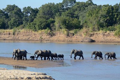 South LuangwaEastern Province, Zambia
In Zambia's Luangwa Valley, visitors were first taken out on foot in the 1950s. The river loops into lagoons that have held some of the densest hippo numbers recorded.
 Jemaa el-FnaaMedina of Marrakesh, Morocco
The great square of Marrakesh is protected for what happens on it, not what stands round it. A writer's campaign to save it helped create UNESCO's list of oral heritage.
 Aït BenhaddouOuarzazate province, Morocco
A fortified hillside village of rammed earth and mud brick in southern Morocco. Its families have mostly moved across the river, and what keeps its walls standing is restoration, helped along by the film crews that keep returning.
 Chobe National ParkChobe District, Botswana
In the dry season elephants of Africa's largest population come down to the Chobe River by the family. In the river is a grassy island Botswana and Namibia took to the World Court.
 Lac RoseDakar Region, Senegal
Senegal's pink lake gets its colour from an alga that blushes under salt and sun. After the 2022 floods it went green; by 2025 it was pink again.
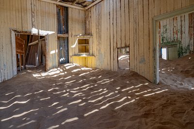 KolmanskopǁKaras Region, Namibia
A diamond town in the Namib, built after a railwayman picked up a stone in 1908. It had a ballroom, an X-ray station and free ice delivered daily; since 1956 the sand has been moving in.
 Liuwa PlainWestern Province, Zambia
A grassland in western Zambia that a Lozi king protected in the 1880s. More than 47,000 wildebeest gather on it with the first rains, and about 12,000 people still live inside the park.
 LoangoOgooué-Maritime, Gabon
A stretch of Gabon's Atlantic coast where elephants, buffalo and hippos walk out of the forest and the lagoons onto the beach. A National Geographic photographer made its hippos in the surf famous.
 Great ZimbabweMasvingo Province, Zimbabwe
The largest precolonial stone city in southern Africa, built without mortar by ancestors of the Shona. A white government once pressed archaeologists to deny who built it; in 1980 an independent country took its name.
 NzulezoWestern Region, Ghana
A whole village standing on stilts in a lake in western Ghana, reached by an hour's dugout ride through swamp forest. School, church and daily life all happen over the water, and on Thursdays the lake rests.
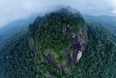
 Pico Cão GrandeCaué District, São Tomé and Príncipe
A needle of grey volcanic rock standing about 370 m straight up out of the rainforest of São Tomé: the hardened core of a volcano that has worn away. Nobody stood on top of it until 1991.
 TsodiloNorth-West District, Botswana
Four hills of pale quartzite in the flat Kalahari bush of north-west Botswana, holding over 4,500 rock paintings and revered by the Hambukushu and San as a home of ancestral spirits.
 The Bazaruto ArchipelagoInhambane Province, Mozambique
Five islands of sand off the coast of Mozambique, a national park since 1971, with giant white dunes, seagrass meadows and the last viable population of dugongs in the western Indian Ocean.
 Tsingy de BemarahaMelaky Region, Madagascar
A limestone plateau in western Madagascar worn into forests of grey blades and needles, so sharp that its Malagasy name warns against walking on it barefoot. It is visited on guided circuits from the village of Bekopaka.
 RichtersveldNorthern Cape, South Africa
A mountain desert on South Africa’s Orange River border with Namibia, watered mostly by sea fog, owned by the Nama and run with them. Its slopes hold the halfmens, a spiny single-stemmed succulent, and its tracks need a four-wheel drive.
 Aride IslandGrand’Anse Praslin, Seychelles
The northernmost granite island of the Seychelles, a nature reserve where more than a million seabirds breed. Visitors land on its one beach from a small boat, in season, and walk with a ranger; only the reserve staff live there.
 Îles de la Madeleine (Senegal)Dakar, Senegal
A handful of steep volcanic islets 4 km off Dakar, uninhabited and protected since 1976 as a national park of about 45 hectares. Red-billed tropicbirds breed on the cliffs of the largest, Sarpan, and for Dakar’s Lebu fishing families the islands are the home of the city’s protective spirit.
 Joal-FadiouthM'bour Department, Thiès Region, Senegal
A village on an island of piled-up shells at the southern end of Senegal’s Petite Côte, reached on foot over a long wooden bridge, where nine in ten people are Christian in a mostly Muslim country and the two faiths bury their dead side by side.
 La DigueInner Islands, Seychelles
A granite island of about ten square kilometres in the Seychelles, with no airport and few cars, where people get about by bicycle and ox-cart, giant boulders frame a beach Wikipedia says is often considered the world’s most photographed, and a forest reserve keeps one of the rarest flycatchers on Earth.
About this hub
Nearby on the shelf
- Deserts (collection, 20)
- Volcanoes (collection, 12)
- The whole map
Know somewhere that belongs here?
Each place page names its sources and the date it was checked.
Photo credits for the thumbnails
- Sossusvlei & Deadvlei: Photograph: Giles Laurent, CC BY-SA 4.0
- The Okavango Delta: Photograph: Eric Kilby, CC BY-SA 4.0, cropped
- Cirque de Mafate: Photograph: Air miasma, CC BY-SA 4.0, cropped
- The Makgadikgadi Pans: Photograph: Eric Kilby, CC BY-SA 4.0, cropped
- Etosha: Photograph: Giles Laurent, CC BY-SA 4.0
- Chã das Caldeiras: Photograph: Yves PICQ, CC BY-SA 4.0
- Santo Antão: Photograph: Zinneke, Fontainhas, Santo Antao, Cabo Verde 2017-04 --2, CC BY-SA 3.0
- Vallée de Mai: Photograph: Denis Costa, Public Domain Mark (Flickr, Denis Costa)
- The Saloum Delta: Photograph: Ourytima, CC BY-SA 4.0, cropped
- Príncipe: Photograph: Cgaffga, CC0, cropped
- Victoria Falls: Photograph: Christoph Strässler, Victoria Falls, Zimbabwe - 51641571756, CC BY-SA 2.0, cropped
- The Avenue of the Baobabs: Photograph: Rod Waddington, Avenue of Baobabs, CC BY-SA 2.0, cropped
- Kruger National Park: Photograph: Bernard Dupont, African Elephants (Loxodonta africana) crossing Sabie River ..., CC BY-SA 2.0, cropped
- Table Mountain: Photograph: Matti Blume, CC BY-SA 4.0, cropped
- South Luangwa: Photograph: Geoff Gallice, Luangwa River crossing, CC BY 2.0
- Jemaa el-Fnaa: Photograph: Norman Thomas (Herokk), CC BY-SA 4.0, cropped
- Aït Benhaddou: Photograph: Holger Uwe Schmitt, CC BY-SA 4.0
- Chobe National Park: Photograph: NikSimpson, CC BY-SA 4.0
- Lac Rose: Photograph: Mel-odile, CC BY-SA 4.0, cropped
- Kolmanskop: Photograph: Ralf Hüsges, CC BY 4.0, cropped
- Liuwa Plain: Photograph: Simon Berry, Gnus in Liuwa Plain National Park 01, CC BY-SA 2.0, cropped
- Loango: Photograph: TheLeftCoast, CC0, cropped
- Great Zimbabwe: Photograph: Andrew Moore, The Great Zimbabwe Hill Complex, CC BY-SA 2.0, cropped
- Nzulezo: Photograph: Kwameghana, CC BY-SA 4.0, cropped
- Pico Cão Grande: Photograph: Paulacastelli, CC BY-SA 4.0
- Tsodilo: Photograph: Joachim Huber, Tsodilo Hills, Botswana, CC BY-SA 2.0
- The Bazaruto Archipelago: Photograph: Bjørn Christian Tørrissen, Bazaruto-Island-East-Coast-From-South, CC BY-SA 3.0, cropped
- Tsingy de Bemaraha: Photograph: Rod Waddington, Big Tsingy, Madagascar, CC BY-SA 2.0, cropped
- Richtersveld: Photograph: Javier Ábalos, Richtersveld National Park, CC BY-SA 2.0
- Aride Island: Photograph: Colin J Taylor, Seychelles Aride Island Sooty Terns - panoramio (1), CC BY-SA 3.0, cropped
- Îles de la Madeleine (Senegal): Photograph: Gromane, CC0, cropped
- Joal-Fadiouth: Photograph: Moda behind the camera, CC BY-SA 4.0, cropped
- La Digue: Photograph: A.Savin, Free Art License, cropped