
- Where
- Luangwa Valley, eastern Zambia
west of the Luangwa River - Coordinates
- 13.00° S
31.50° E - Area
- About 9,050 km²
per Wikipedia - Protected
- Game reserve 1938 (or 1904)
national park 1972 (Wikipedia) - Walking safaris
- From the 1950s
credited to Norman Carr - Hippos
- About 5,000–7,000 on 165 km of river
1976–2008 (Chomba et al.) - Advisory
- Zambia Level 1
Walked out in single file behind a quiet man who stopped every so often to read the sand. Nobody spoke. A pool the river had left behind was so crowded with hippos that it grunted, and small golden antelope watched us from the far bank. We gave everybody a great deal of room. I have never been so polite on foot, and never enjoyed it more.
The short answer
South Luangwa National Park lies in the valley of the Luangwa River in eastern Zambia. Wikipedia gives its area as about 9,050 square kilometres, bounded by the river to the east and by the steep Muchinga Escarpment to the west, and places the valley at the southern end of the East African Rift. Its woodlands are mopane on the valley floor and miombo on the higher slopes, with grassland and floodplain between. Wikipedia counts more than 60 mammal species and over 400 bird species, among them elephant, buffalo and a giraffe found only in this valley. The main settlement, Mfuwe, lies just outside the eastern boundary and has the airport most visitors arrive through.
Why it's worth knowing
For most of the history of the African safari, going out after animals meant going out to shoot them. South Luangwa is where that changed shape. Zambia’s tourism agency credits Norman Carr with pioneering walking safaris in the country, and Zambia Tourism’s guide to the park says the now famous walking safari originated here.
The accounts agree on the outline and differ on the date. Wikipedia’s article on Carr says that in 1950 he petitioned Senior Chief Nsefu of the Kunda people to set aside part of his land as a game reserve, and built there the first game-viewing camp open to the public in what was then Northern Rhodesia, with the proceeds going back to the community; Zambia Tourism’s account gives the year as 1951. Guests, as Wikipedia puts it, shot with cameras and not rifles. Wikipedia calls Carr “widely regarded” as the pioneer of the walking safari; the phrase is Wikipedia’s, and no single primary record of the first walk was found for this entry.
So the idea that a visitor could walk among these animals, with a guide, and leave them alive, has a home address. It is also the reason the camps here still send guests out on foot, including, in Zambia Tourism’s description, mobile walking safaris from one overnight camp to the next along the river, in parts of the park with no roads.
The field notes
A river that leaves lakes behind
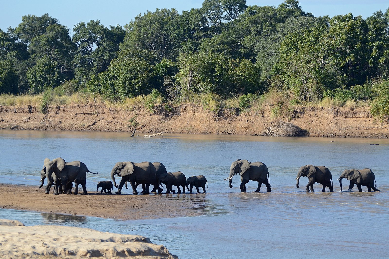
Through the valley the Luangwa meanders across a floodplain several kilometres wide, and as its loops are cut off they become oxbow lagoons. Wikipedia’s account of the river describes what follows: in the dry season the hippos are confined to the shrinking river and pools; they leave the water at night to graze, and their dung fertilises the pools, feeding the fish, which feed crocodiles and birds.
The hippos have been counted from the riverbank for decades. Work by C. Chomba and colleagues, published in 2012 in the Journal of Ecology and the Natural Environment, found the population on the surveyed stretch oscillating between about 5,000 and 7,000 animals from 1976 to 2008, in the authors’ reading a population held at the river’s carrying capacity. A related analysis of counts to 2012 over a 165-kilometre stretch gives a mean of about 35 hippos per kilometre of river and a peak of 42 per kilometre in 1984. Wikipedia’s article on the river calls the valley’s the world’s largest concentration of hippos; that superlative is Wikipedia’s, not the study’s.
A giraffe found nowhere else
The giraffes of the valley are an isolated population, known as Thornicroft’s giraffe or, in the Giraffe Conservation Foundation’s current usage, the Luangwa giraffe, and they live nowhere else. The Foundation’s State of Giraffe 2025 report puts their number at 764, an increase of 18 per cent in five years; older estimates quoted by Wikipedia and others ranged from about 550 to 650. Their classification is itself argued over: Wikipedia records them treated as a subspecies of the giraffe, as a subspecies of the Masai giraffe, or as a species of their own.
Whose valley
The park is surrounded by game management areas where people live and farm. Since 2003, according to Zambia Tourism, the organisation Conservation South Luangwa has worked with Zambia’s Department of National Parks and Wildlife on anti-poaching and on reducing conflict between people and wildlife across about 1.4 million hectares of park and surrounding land. Wikipedia notes that traditional custodianship within the Mwanya chiefdom continues to shape land use in the park’s northern Nsefu sector. The park’s black rhinos were wiped out by poaching by 1987, by Wikipedia’s account.
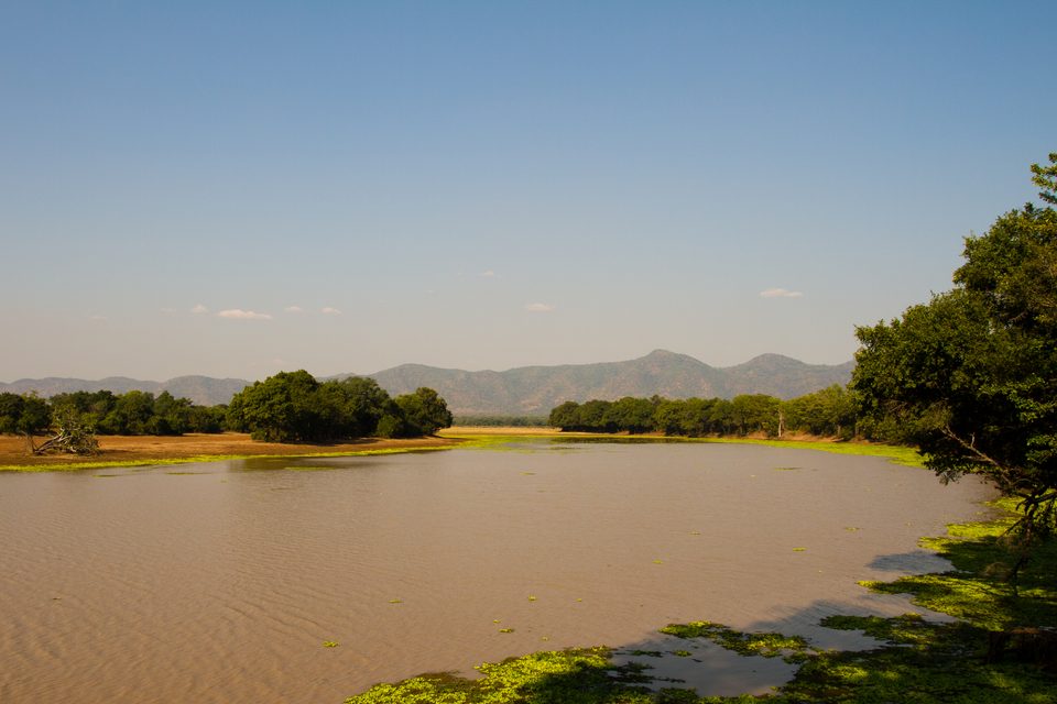
Still water on the valley floor, edged with floating plants, with hills beyond, June 2011.
Photograph: Brendan Herbert (I've Got It On Film!) · South Luangwa National Park - 51865178097 · CC BY 2.0
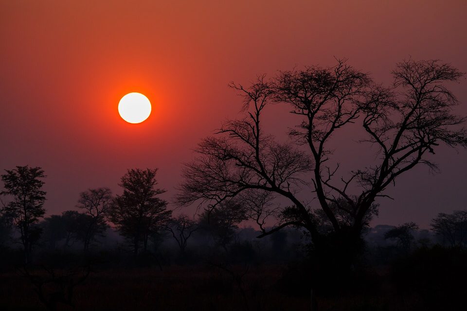
Sunrise through the haze of the dry season, August 2015.
Photograph: Thomas Fuhrmann · CC BY-SA 4.0
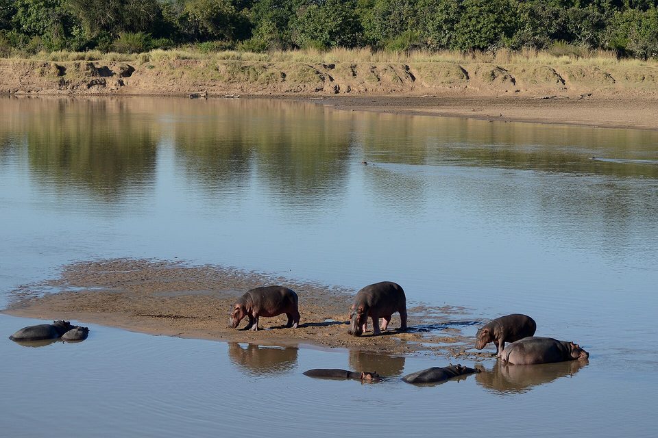
Hippos on a sand bar in the Luangwa River, July 2011.
Photograph: Geoff Gallice · Flickr - ggallice - Hippos, Luangwa River (1) · CC BY 2.0
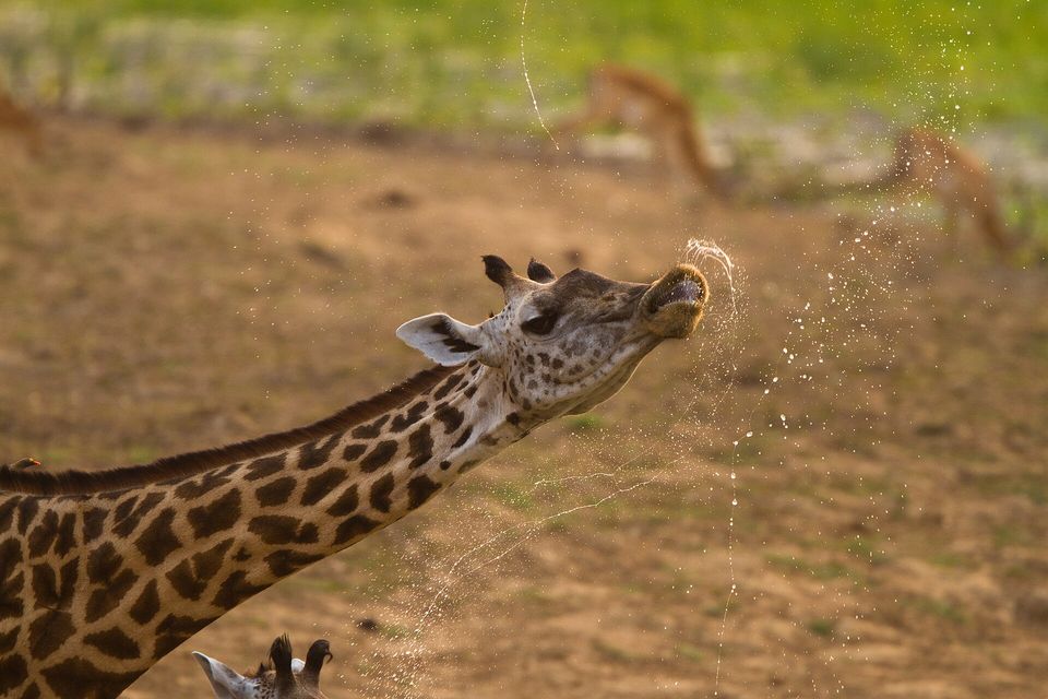
A giraffe shaking water off its muzzle after a drink, South Luangwa National Park, October 2011.
Photograph: Brendan Herbert (I've Got It On Film!) · Giraffe, South Luangwa National Park (51865180407) · CC BY 2.0
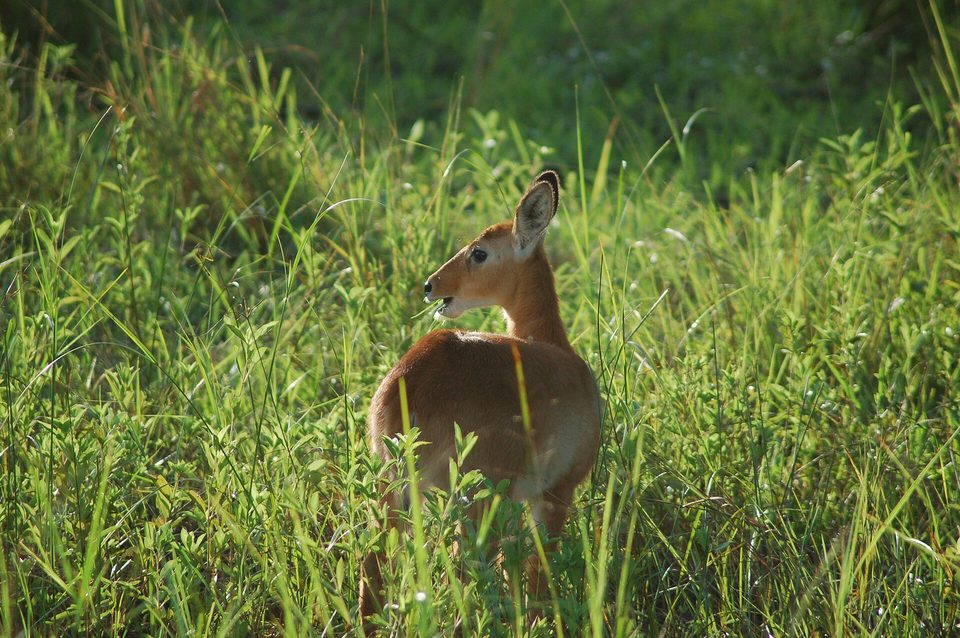
A puku in the grass, March 2007.
Photograph: Joachim Huber · Puku, South Luangwa National Park (2509249066) · CC BY-SA 2.0
- Walk behind the guide, in single file, and do what you are asked the moment you are asked.
- Sit by a lagoon at the end of the day and let the hippos have the last word.
- Spend some money in the villages outside the gate, not only in the camp, and greet people before you do business.
- Drink more water than you think you need, and then a little more.
- Walk quietly enough to hear everything. (A whole morning, and then a stick. Item to be attempted again, on tiptoe.)
A mopane leaf. The floor of the Luangwa Valley is mopane woodland, with miombo on the higher slopes, so anyone walking the valley floor walks among mopane trees. Each leaf is two leaflets on a single stalk, mirror images of each other, which gives it the shape of a butterfly. The walking safari is credited with beginning in this valley in the 1950s, and guests are still walked out through these woods, on foot, behind a guide.
Tally, in the marginA leaf shaped like a butterfly that has decided to stay. I pressed one in the diary on the first morning to keep my place, and have only this evening noticed that it has been keeping it ever since.
Getting there
How to get there. Fly from Lusaka to Mfuwe: Zambia Tourism gives the flight as about an hour, flown by Proflight Zambia all year, and Wikipedia lists flights from Lilongwe in Malawi as well. Mfuwe is also about 100 km by road from Chipata, by Wikipedia’s figure.
When to go. Zambia’s tourism agency recommends May to November for the national parks, when vegetation is thinner and animals gather near the remaining water. Zambia Tourism describes the dry season building from April to October, the hottest month, and notes that Mfuwe’s airport is busiest from about July to October. Wikipedia gives the rains as November to March.
What to book ahead. A camp, and in July to October as early as you can. Park entry is charged per person per day, with conservation and community levies; the camps usually quote them. Check current fees before you go.
On foot. Walk only with a camp’s guide, at the guide’s pace and distance. The villages outside the gate are people’s homes; visit them through a camp or a local project, and ask before photographing anyone.
Safety. The United States has Zambia at Level 1, exercise normal precautions, in an advisory reissued on 31 July 2023 with no area-specific warnings. The nearest border, with Malawi (Level 2), is about 130 km east of the park; the nearest point of the Democratic Republic of the Congo (Level 4) is roughly 180 km away or more, and Tanzania (Level 3) over 400 km (this entry’s estimates).
Mark this place
Common questions
Where is South Luangwa National Park?
South Luangwa National Park is in the Luangwa Valley of eastern Zambia, bounded by the Luangwa River to the east and the Muchinga Escarpment to the west. Its main gateway is Mfuwe, just outside the eastern boundary, which has an airport with flights of about an hour from Lusaka.
Is South Luangwa the birthplace of the walking safari?
Two tourism bodies say so. Zambia’s tourism agency credits the conservationist Norman Carr with pioneering walking safaris, and Zambia Tourism’s guide says the walking safari originated in South Luangwa, in the 1950s. No single primary record of the first walking safari was found for this entry.
Who was Norman Carr?
Norman Carr (1912–1997) was a British conservationist in Zambia, Malawi and Zimbabwe. By Wikipedia’s account, in 1950 he persuaded Senior Chief Nsefu of the Kunda people in the Luangwa Valley to set aside land as a game reserve, where he built the first public game-viewing camp in Northern Rhodesia, returning proceeds to the community.
How many hippos are in the Luangwa River?
Bank counts of hippos on the Luangwa River in Zambia, published by C. Chomba and colleagues, found the population on the surveyed stretch between about 5,000 and 7,000 from 1976 to 2008. A related analysis gives a mean of about 35 hippos per kilometre over 165 km of river, peaking at 42 per kilometre in 1984.
What is special about the giraffes in South Luangwa?
The giraffes of Zambia’s Luangwa Valley, known as Thornicroft’s or Luangwa giraffe, are an isolated population found nowhere else. The Giraffe Conservation Foundation’s State of Giraffe 2025 report estimates 764 of them, up 18 per cent in five years. Their classification, as a subspecies or a distinct species, is still debated.
When is the best time to visit South Luangwa?
Zambia’s tourism agency recommends May to November for its national parks, including South Luangwa, when vegetation is thinner and animals gather near water. The dry season builds to October, the hottest month, and the rains run from November to March. Mfuwe’s airport is busiest from about July to October.
How do you get to South Luangwa?
Most visitors to South Luangwa National Park fly from Lusaka to Mfuwe, a flight of about an hour operated all year by Proflight Zambia; Wikipedia also lists flights from Lilongwe in Malawi. Mfuwe is about 100 km by road from Chipata.
Is South Luangwa safe to visit?
The United States has Zambia, where South Luangwa National Park lies, at Level 1, exercise normal precautions, with no area-specific warnings, in an advisory reissued on 31 July 2023. Walking in the park is done with a camp’s guide, and visitors are expected to follow the guide’s instructions on pace and distance.