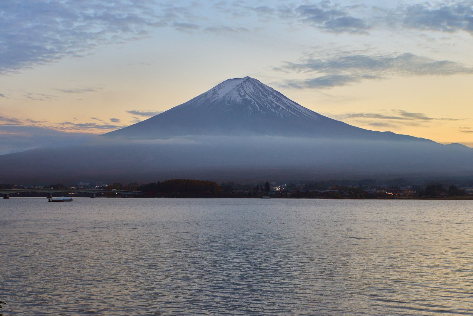

- Where
- Border of Shizuoka and Yamanashi,
central Honshu, Japan - Coordinates
- 35.3606° N
138.7274° E - Height
- 3,776 m;
the highest mountain in Japan - Last eruption
- Hoei eruption,
December 1707 to January 1708 - Summit
- Shrine land above the 8th station;
prefectural border undetermined - Status
- UNESCO World Heritage, 2013,
as a cultural site - Best visited
- Climbing: July to 10 September;
views: clear cold mornings
Climbed in the dark on loose black cinders, one small light in a long zigzag of lights going up. Slept a little in a hut, shoulder to shoulder with strangers, and ate noodles at an hour with no name. At the top, beside a wooden shrine gate, everybody faced the same way above a sea of cloud and cheered when the sun came up, and so did I.
The short answer
Mount Fuji is an active stratovolcano 3,776 metres high, the highest mountain in Japan, on the border of Shizuoka and Yamanashi prefectures in central Honshu. It last erupted in 1707. UNESCO inscribed it in 2013 not as a natural site but as a cultural one, “Fujisan, sacred place and source of artistic inspiration”, with 25 component sites: the upper 1,500 metres of the mountain with its pilgrim routes and crater shrines, and shrines, pilgrim lodging houses, lakes, springs and lava formations around its foot. Above the eighth climbing station the mountain is the precinct of Fujisan Hongu Sengen Taisha, the head of about 1,300 Sengen shrines in Japan. The climbing season runs from early July to 10 September, and every climber pays a fee of 4,000 yen.
Why it's worth knowing
The most famous national symbol in Japan has a summit that is, legally, a shrine’s land.
The shrine’s claim is old. Shizuoka Prefecture’s cultural-heritage guide records that the Edo shogunate recognised the shrine’s authority over the mountain above the eighth station in a ruling of 1779; Nippon.com credits Tokugawa Ieyasu, whose donation built the shrine’s main hall in 1604, with declaring the land the shrine’s. After the Meiji Restoration the upper mountain passed into state ownership. The shrine went to law to get it back, and in 1974 Japan’s Supreme Court ruled in its favour. The handover took another thirty years: in 2004 the state transferred the land above the eighth station to the shrine, apart from land it keeps.
One result is administrative. Shizuoka Prefecture’s guide states that the boundary between Shizuoka and Yamanashi above the eighth station has not been determined to this day. The highest point in Japan is shrine property, and which prefecture it lies in has never been settled.
None of this is a curiosity to the people who worship there. UNESCO’s description of the site is built around worship: pilgrims climbing the mountain hoping to be imbued with the spiritual power of the gods and buddhas believed to reside on it, and confraternities of pilgrims, the Fuji-ko, organising those climbs.
The field notes
The shrine at the top and the shrine at the foot
Fujisan Hongu Sengen Taisha stands in the city of Fujinomiya on the Shizuoka side, and its grounds, in Wikipedia’s words, include the entire top of the mountain from the eighth station upwards. Its main hall was built in 1604 with a donation from Tokugawa Ieyasu, in the two-storeyed style named for the Sengen shrines. The mountain’s deity is worshipped at shrines all around its base, including Kitaguchi Hongu Fuji Sengen-jinja on the Yamanashi side, where the old Yoshida route begins.
Worship, and who was allowed up
For centuries the ascent was a religious act. UNESCO describes worship-ascents of the peak and pilgrimages to sacred sites around its lower slopes, with lodging houses run by pilgrim guides at the foot. The summit, Wikipedia records, was long held too sacred for women. A Grand Council of State edict of 4 May 1872 ordered an end to the exclusion of women from shrine and temple lands.
The last eruption
Mount Fuji is classified as an active volcano, and the Japan Meteorological Agency publishes its volcanic alert level. Its last eruption, the Hoei eruption, began on 16 December 1707 and ended about 1 January 1708, on Wikipedia’s dates; the Japan National Tourism Organization notes that it lasted 16 days, sent ash as far as present-day Tokyo and created Hoei-zan, one of the mountain’s secondary peaks. Climbers are asked to check the alert level before they go.
A stick for the climb
Climbers can buy a wooden walking stick for the ascent and have it marked at the mountain huts on the way up. The Japan National Tourism Organization’s trail guides describe staff at the huts who stamp the sticks of climbers who have bought one. By the top, a stick carries the route in marks, hut by hut.
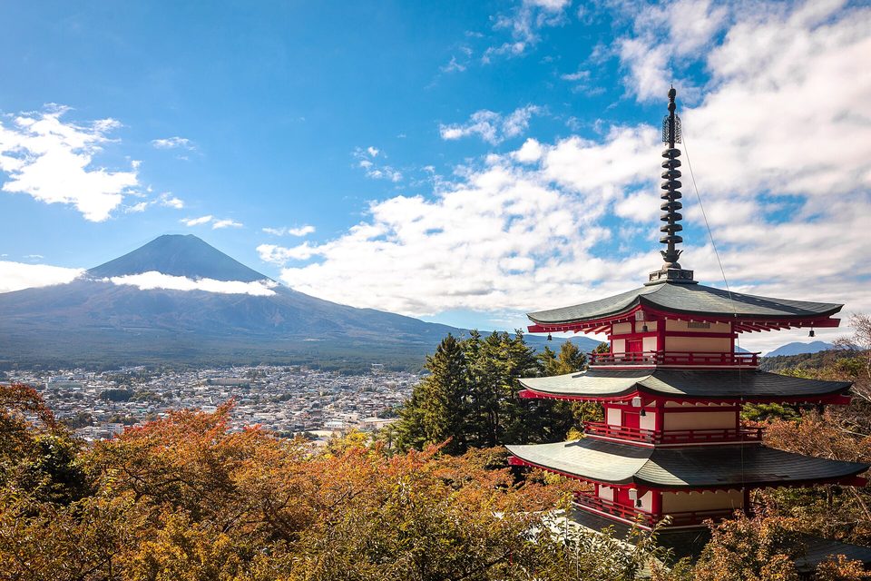
The Chureito Pagoda above Fujiyoshida with Mount Fuji beyond, October 2024.
Photograph: Supanut Arunoprayote · CC BY 4.0 · cropped
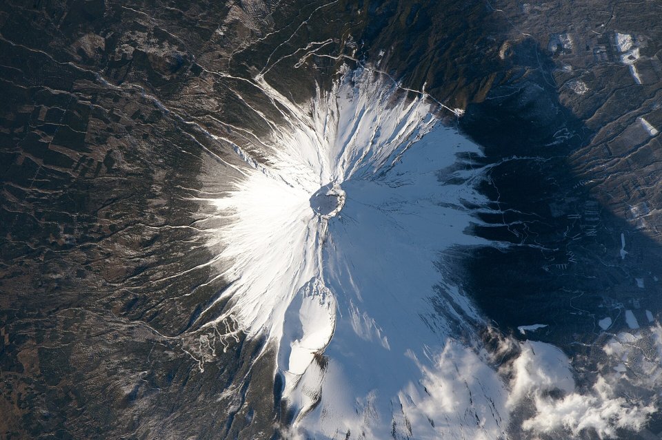
Mount Fuji from the International Space Station, February 2016: the summit crater in shadow and the Hōei crater on the south-east flank.
Astronaut photograph: NASA / Scott Kelly · Public domain
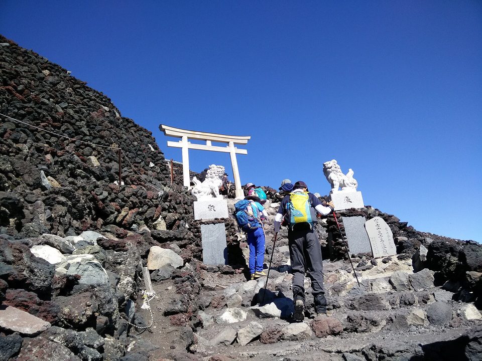
A torii and stone guardian figures near the summit, August 2015.
Photograph: Z3144228 · CC BY-SA 4.0
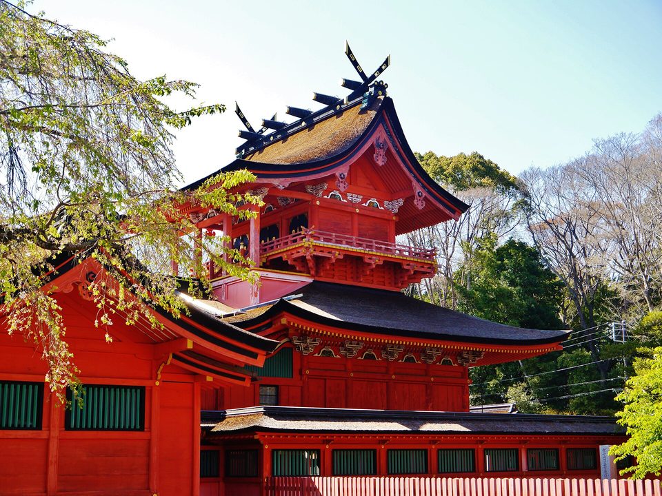
The main hall of Fujisan Hongu Sengen Taisha, Fujinomiya, April 2019.
Photograph: Zairon · CC BY-SA 4.0
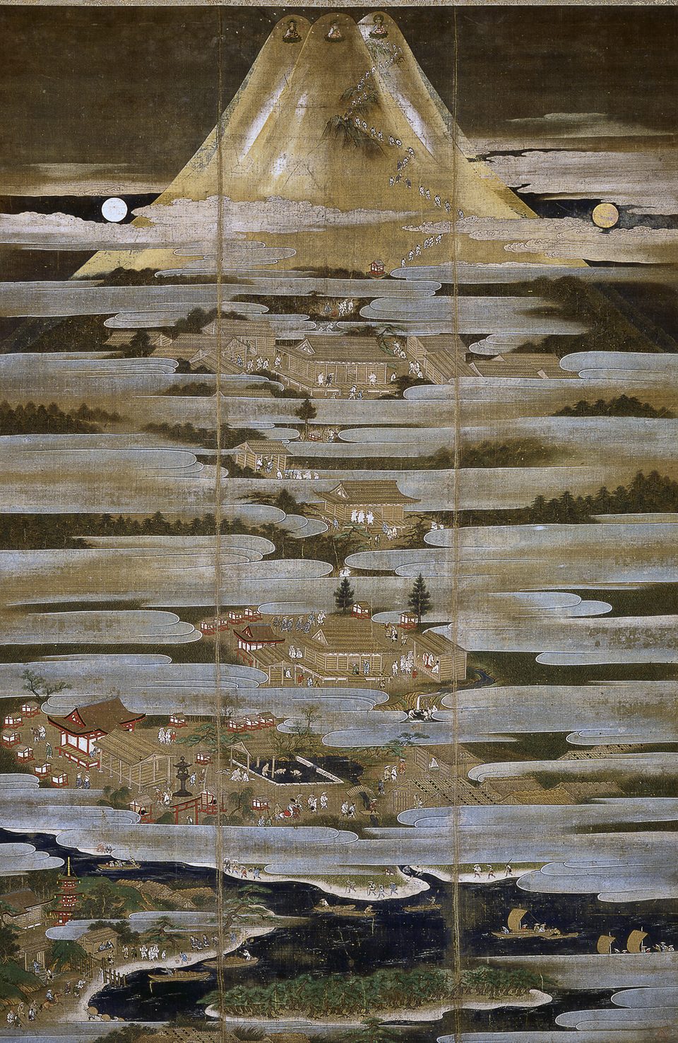
The Fuji Sankei Mandara, a pilgrimage painting attributed to Kano Motonobu, first half of the 16th century.
Photograph: Kano Motonobu (1476-1559) 狩野元信 · Public domain
- Climb through the night and arrive in time for the sun, not long before it. Waiting on the top is cold.
- Buy a plain stick at the bottom and let every hut mark it.
- Bow at the shrine at the top, or at least stop talking for a moment. You are a guest up there.
- Look at it from a lake on a still morning as well. It is kinder from a distance.
- Climb without adding anything to this list. (Failed before the car park lights were out of sight. See the items above, most of them.)
A marked walking stick. A plain length of wood bought for the ascent and carried up the mountain, marked at hut after hut on the way, so that by the summit it records the climb. Nothing about it is rare; thousands go up every season. It is the one thing on the mountain that is plainly yours, and at the top it stands on land that belongs to a shrine.
Tally, in the marginA plain stick that gets heavier with every hut, not from wood but from marks. I carried mine up as a walking stick and only at the top noticed it had become a diary.
Getting there
How to get there. Four main trails, the Yoshida on the Yamanashi side and the Subashiri, Gotemba and Fujinomiya on the Shizuoka side, start from fifth stations reached by car or bus. The summit is the tenth station on each trail.
Rules for 2026. The climbing season runs from early July (1 July on the Yoshida Trail) to 10 September. Every climber pays a hiking fee of 4,000 yen. On the Yoshida Trail a gate is closed from 14:00 to 03:00 to everyone except climbers with a mountain-hut reservation. On the Shizuoka trails every climber must pre-register in the prefecture’s FUJI NAVI app and show the permit at the trailhead. The official climbing site, fujisan-climb.jp, carries the current rules and separate guidance for outside the season.
How to climb it. Many people climb in the afternoon or evening, rest in a hut, and go on in the dark to reach the top for sunrise; the huts are the place to do it, and they should be booked ahead. It is cold at the summit even in August. Bring warm layers, a headlamp and rain gear, and turn back in bad weather.
Seeing it without climbing. The lakes on the Yamanashi side and many other places around the mountain give the classic views. The cone is often in cloud, and the clearest views tend to come on cold, still mornings.
At the summit. The crater and its shrine buildings are a place of worship. Behave as you would at any shrine.
Mark this place
Common questions
Who owns the summit of Mount Fuji?
Mount Fuji above the eighth climbing station, apart from land the state keeps, belongs to Fujisan Hongu Sengen Taisha, the Shinto shrine in Fujinomiya. According to Shizuoka Prefecture, the land passed to the state after the Meiji Restoration, Japan’s Supreme Court ruled for the shrine in 1974, and the land was transferred back to it in 2004.
Is the summit of Mount Fuji in Shizuoka or Yamanashi?
Neither, officially. Shizuoka Prefecture’s own guide states that the boundary between Shizuoka and Yamanashi above the eighth station of Mount Fuji has not been determined. That area, apart from land the state keeps, is the precinct of the Fujisan Hongu Sengen Taisha shrine.
Why is Mount Fuji a World Heritage Site?
UNESCO inscribed Mount Fuji in 2013 as a cultural site, “Fujisan, sacred place and source of artistic inspiration”, with 25 component sites, including the upper 1,500 metres with its pilgrim routes and crater shrines, and shrines, pilgrim lodging houses, lakes and springs around the base. UNESCO recognised Mount Fuji as an object of pilgrimage and a source for poets and artists.
When can you climb Mount Fuji?
The official Mount Fuji climbing season runs from early July to 10 September; in 2026 the Yoshida Trail opened on 1 July. Every climber pays a 4,000-yen fee. The Yoshida Trail is gated from 14:00 to 03:00 except for climbers with a mountain-hut reservation, and the three Shizuoka trails require pre-registration in the FUJI NAVI app.
When did Mount Fuji last erupt?
Mount Fuji last erupted in the Hoei eruption, which began on 16 December 1707 and ended about 1 January 1708. The Japan National Tourism Organization says it lasted 16 days and carried ash as far as present-day Tokyo. Mount Fuji is classified as an active volcano, and the Japan Meteorological Agency publishes its alert level.
Were women allowed to climb Mount Fuji?
Not for much of its history. The summit of Mount Fuji was held sacred and closed to women, according to Wikipedia, until a Grand Council of State edict of 4 May 1872 ordered an end to the exclusion of women from shrine and temple lands. Women now climb Mount Fuji on the same terms as men.
How high is Mount Fuji?
Mount Fuji is 3,776 metres high, the highest mountain in Japan. UNESCO describes it as a solitary stratovolcano, and its upper 1,500 metres, with the pilgrim routes and crater shrines, form part of the World Heritage property inscribed in 2013. Wikipedia records eight peaks around the summit crater.
What are the walking sticks sold on Mount Fuji?
Climbers on Mount Fuji can buy a wooden walking stick for the ascent and have it stamped at the mountain huts on the way up, as the Japan National Tourism Organization’s trail guides describe. The finished stick carries a record of the climb, hut by hut.