The short answer
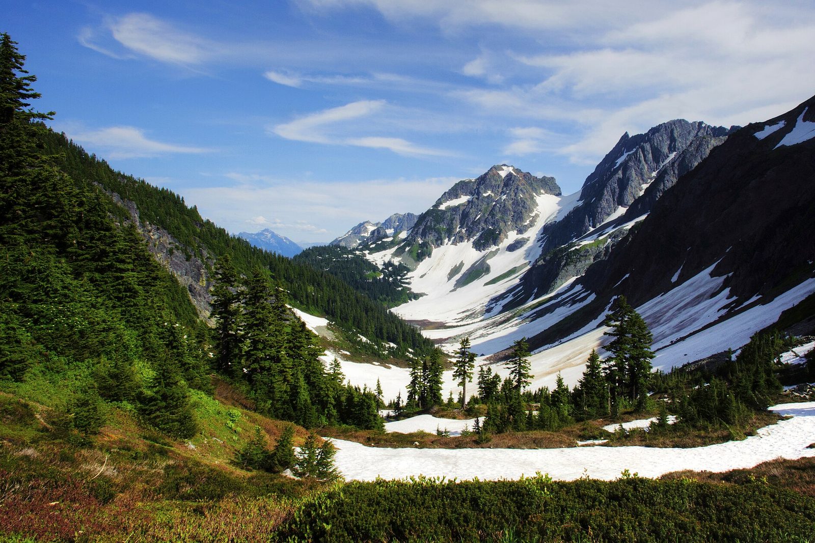
North Cascades National Park lies in the far north of Washington, along the Canadian border. Together with two neighbouring national recreation areas, Ross Lake and Lake Chelan, it makes up the North Cascades National Park Service Complex. It is a park of jagged peaks, deep forested valleys and hanging ice, rising to 9,206 feet at Goode Mountain. One highway, State Route 20, the North Cascades Highway, crosses it, and it is closed by snow for much of the winter. There is no entrance fee, and much of the park is wilderness reached only on foot.
From Tally’s diary
Up close, the ice was not white at all but a deep, sulky blue, and it creaked once while I was looking at it, which I took personally. Down in the valley later, a boat brought me to a tiny landing where there were no cars and nobody seemed to mind. Somebody gave me an apple. It was the best apple I have eaten in my life.
Why it's worth knowing
The ice of the lower 48. A glacier forms where more snow falls in winter than melts the following summer, until the old snow packs into ice and begins to creep downhill, scraping out the valleys as it goes. The range holds countless snowfields besides. Most of the glaciers have shrunk sharply over the last century, and the park runs a programme to monitor them: photographs of the Banded Glacier taken after 1960 and again in 2016 show how far the ice has drawn back.
A garden of every kind. From valley floors at about 400 feet on the Skagit River to the summits, the land passes through eight distinct life zones, from lowland forests and wetlands to alpine meadows and ice. Steep slopes, many kinds of rock and soil, and great differences in rain and sun give the park about 1,630 kinds of vascular plant, more than any other national park in the United States. More than 300 lakes and ponds feed thousands of miles of streams, and the Skagit and its tributaries make up the largest watershed draining into Puget Sound.
A valley without a road. Stehekin, at the head of Lake Chelan, has never been connected to the outside world by road. People arrive by passenger ferry from Chelan, by private boat or floatplane, or on foot or horseback over the mountains. Homesteaders settled the narrow floodplain of the Stehekin River from the late 1800s, because it was the only flat, fertile ground north of the lake. The river floods at least every spring, and families learned to read the mud marks on the trees. In 1948 the teachers Lloyd and Amy Bell helped reopen the one-room school and shared a single teacher’s salary to run it.
The field notes
Nine thousand years over Cascade Pass
It was once argued that the Native peoples of the Northwest stayed by the rivers and the sea and all but avoided the mountains. Cascade Pass says otherwise. Under its alpine meadows lie ancient campfires showing that people were crossing the range at least 9,600 years ago, often enough that the crossing became a tradition in the stories of many bands on both sides. Volcanic ash from four Cascade volcanoes buried their fires, at least eight layers of it, and people built new fires on top. Among the finds are tiny razor-sharp blades made from clear quartz crystal. It is the oldest well-dated alpine site in Washington.
The Buckner orchard
In the spring of 1911 William and May Buckner and their three children came to the Stehekin Valley and bought land on a horseshoe bend of the river. They spent their first summer pulling out tree stumps and the next months digging ditches to bring water from Rainbow Creek. They began planting apples in 1912, and by 1924 the orchard covered nearly 50 acres. At nearly ten acres, it still holds 351 trees, most of them Common Delicious, an old variety the orchard helps keep alive. Each autumn people still gather there for the harvest and to make cider, much as they did when the Buckners lived there.
Bringing back the grizzly
Grizzly bears lived in the North Cascades for thousands of years, spreading the seeds of native plants and keeping other animals in balance, until people killed most of them. In April 2024 the Park Service and the US Fish and Wildlife Service decided to restore them. The plan is to move three to seven bears a year from other places, for five to ten years, to build a starting population of 25. The bear is also culturally significant to some of the region’s tribes and First Nations.

March 2025Peaks above Sahale Arm in autumn colour.
Photograph: Jeffhollett, CC BY-SA 4.0, cropped

September 1966Jack Mountain and its glacier from the air, in an archive photograph.
Photograph: Austin Post, USGS, Public domain, cropped

October 2012The Picket Range from the Sterling Munro Trail.
Photograph: Joe Mabel, Picket Range from Sterling Munro Trail overlook 01, CC BY-SA 3.0, cropped
- Find a glacier and tell it the colour it is. (Told it. It already knew. It has been blue a long time.)
- Ride the boat to the place with no road. (Rode it. Stayed longer than I said I would. Nobody was surprised.)
- Count the kinds of flowers along one path. (Got to forty and found a bee counting too. We compared notes and disagreed.)
- Eat one apple slowly, sitting on an old apple box. (Took most of the afternoon. The apple did not seem to mind.)
- Walk up to the pass where people have been crossing forever. (Walked. Stood. Felt like the newest person ever to stand there, which I was.)
A relic from North Cascades National Park
Relic, entry 348351 trees, most Common DeliciousTrunks kept short, pruned to a bowl
An apple on a Common Delicious tree in the Buckner orchard. The trees are kept short, their trunks only knee to waist high, and pruned into an open bowl, with each tree 30 feet from the next in rows running across the bend of the river. Some of them were planted by the Buckners themselves more than a century ago. The orchard dates from a time of revolutionary change in the American apple business, and it has become a precious store of an heirloom variety. Of the 351 trees, 257 are Common Delicious, and about half of those are originals.
Tally, in the marginAn apple, I thought, simply an apple, until I learned the tree had been planted by somebody a long time ago, with a great deal of work. After that it tasted of every bit of it, in the nicest way.
Getting there
- 1
From the west
Route 20 leaves Interstate 5 at Burlington.
- 2
From the east
Route 20 meets US 97 at Okanogan and Route 153 at Twisp.
- 3
To Stehekin
Passenger ferries run up Lake Chelan.
- ✓
| J | F | M | A | M | J | J | A | S | O | N | D |
|---|---|---|---|---|---|---|---|---|---|---|---|
| June: best time | July: best time | August: best time | September: best time |
- Summer, usually June to September
How to get there. State Route 20, the North Cascades Highway, is the main way in: from the west it leaves Interstate 5 at Burlington (exit 230), and from the east it meets US 97 at Okanogan and State Route 153 at Twisp. The North Cascades Visitor Center is at Newhalem. There are no restaurants or fuel stations along Route 20 inside the park, and cell reception is limited. Hozomeen, at the north end of Ross Lake, is reached only by a 37-mile gravel road from near Hope, British Columbia. No road leads into Stehekin: passenger ferries run up Lake Chelan from Chelan and from Fields Point, and private and chartered aircraft can land there, but there is no scheduled air service. There is no entrance fee.
When to go. Summer, usually June to September, is the most popular time, and weekends and holidays are the busiest. The North Cascades Highway is typically closed by snow and avalanche danger from late November to early May; exact dates change from year to year.
Safety. The State Department’s travel advisories cover other countries, so none applies here. The park’s road-conditions page carries the highway’s current status.
Mark this place
The passport stamp for this place.
Common questions
How many glaciers are in North Cascades National Park?
More than 300. The North Cascades National Park Service Complex in Washington holds more than 300 glaciers and countless snowfields, the most heavily glaciated area in the United States outside Alaska.
Can you drive to Stehekin?
No. No outside road leads into Stehekin, at the head of Lake Chelan in the North Cascades complex; it is reached by passenger ferry, private boat, floatplane, or on foot or horseback over the mountains.
What is the highest peak in North Cascades National Park?
Goode Mountain, at 9,206 feet. In North Cascades National Park the land drops from there to about 400 feet on the Skagit River at the complex’s western edge.
When is the North Cascades Highway open?
Usually from early May to late November. State Route 20 through North Cascades National Park is typically closed by snow and avalanche danger from late November to early May, with dates that change each year.
Does North Cascades National Park charge an entrance fee?
No. There is no fee to enter the North Cascades National Park Service Complex, and no trailhead or parking fees for trails that begin on National Park Service land.
Which national park has the most plant species?
North Cascades National Park, by the park’s count. About 1,630 kinds of vascular plant have been identified in its eight life zones, more than in any other US national park.
Are there grizzly bears in North Cascades National Park?
Plans are under way to bring them back. In 2024 the National Park Service and the US Fish and Wildlife Service decided to restore grizzlies to the North Cascades, moving three to seven bears a year toward a starting population of 25.
Photographs on this page
Tap a photograph to see it full size.
Photograph: NPS / Deby Dixon, Public domain, cropped
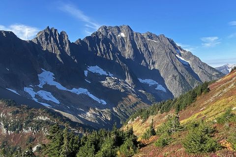
Photograph: Jeffhollett, CC BY-SA 4.0, cropped
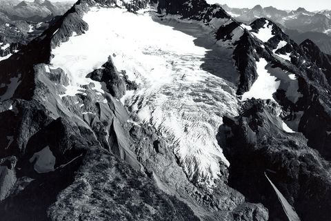
Photograph: Austin Post, USGS, Public domain, cropped
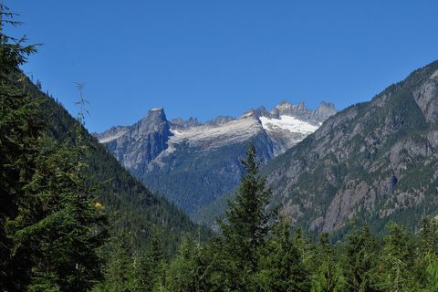
Photograph: Joe Mabel, Picket Range from Sterling Munro Trail overlook 01, CC BY-SA 3.0, cropped


