The short answer
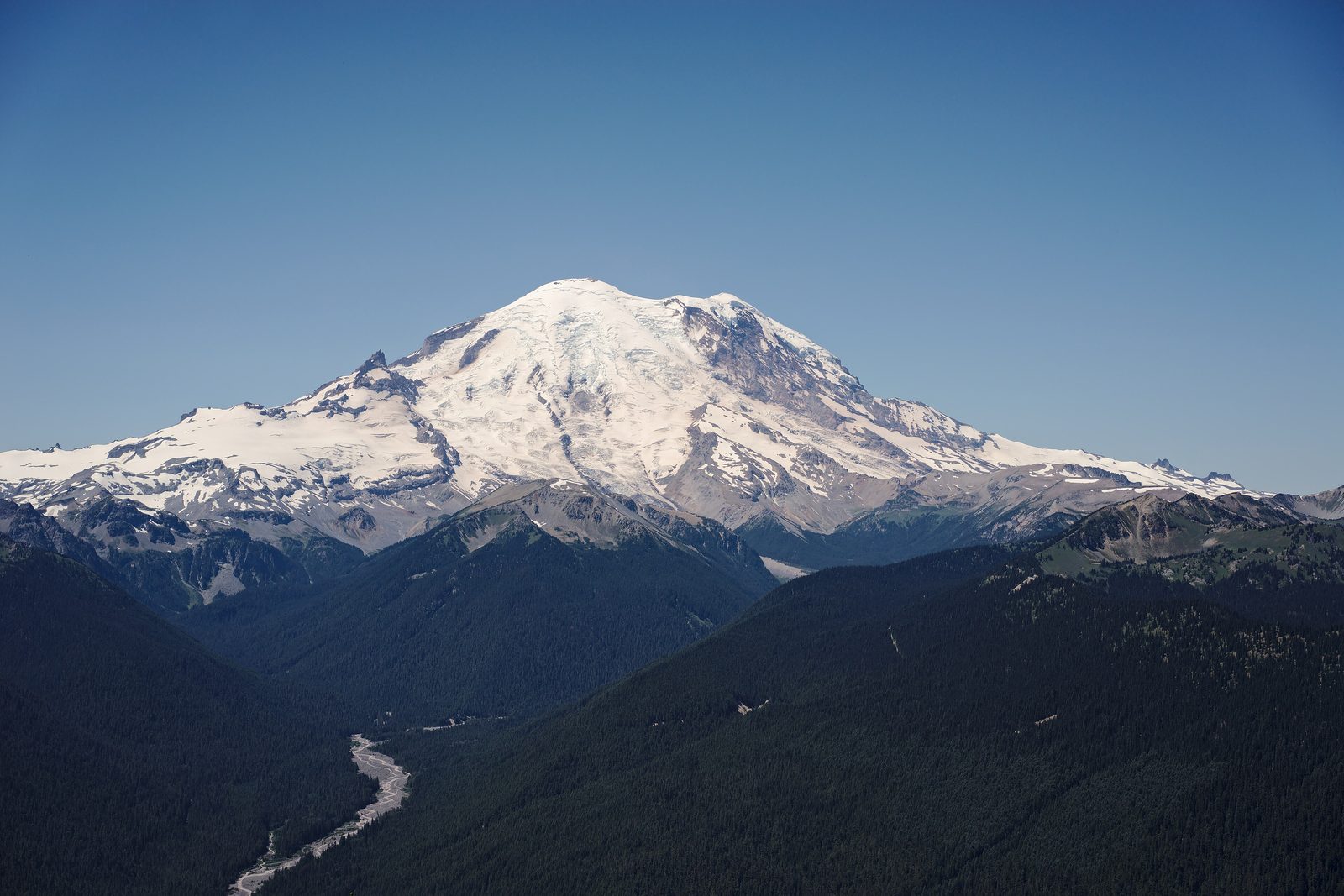
Mount Rainier National Park protects about 236,000 acres around Mount Rainier, a volcano in the Cascade Range of west-central Washington whose summit stands 14,410 feet above sea level. It is the tallest volcano and the fifth-highest peak in the contiguous United States, and the most glaciated: more than 35 square miles of permanent ice and snow cover it, feeding five major rivers. It is still an active volcano, quiet for about a thousand years. Congress made it a national park on March 2, 1899, the fifth in the country.
From Tally’s diary
Woke to cloud. Then the cloud lifted, and a whole white mountain was sitting where the sky had been, looking as if it had been waiting all along, which it had. Up in the meadows the snow had only just let go, and flowers were pushing up through its edges in a great hurry. I sat beside the path and did not hurry at all.
Why it's worth knowing
Snow on a heroic scale. Paradise, at 5,400 feet, gets about 630 inches of snow in an average winter, more than 50 feet of it. The deepest snowpack ever measured there came in March 1955: 357 inches, about 30 feet of snow on the ground at once. Most years Paradise is clear of it only from about mid-July to late September, and by Thanksgiving the ground is usually white again.
A young volcano among old mountains. Mount Rainier was built by eruption after eruption and flow after flow of lava, and it is only about 500,000 years old; the Cascade peaks it looks down on are at least 12 million. Geologists call it episodically active: quiet now, but certain to erupt again. Its last eruption was about 1,000 years ago. The Emmons Glacier has the largest surface area of any glacier in the contiguous United States, 4.3 square miles, and the Carbon Glacier is the longest, at 5.7 miles, and the thickest, at 700 feet.
A mountain with many names. In 1792 Captain George Vancouver of the Royal Navy, surveying the Pacific coast, named the mountain after his friend Rear Admiral Peter Rainier, who never saw it. The peoples who have lived around it since time immemorial, the Cowlitz, Muckleshoot, Nisqually, Puyallup, Squaxin Island, Yakama and Coast Salish, each have their own names for it: Tahoma, Takhoma, Tacoma, Ta-co-bet, Tkobed, Pshwawanoapami-tahoma and others. For millennia their ancestors came up in the warm months to hunt mountain goats and gather huckleberries in the high meadows, and many of those traditions continue.
The field notes
The first park to let cars in
The Nisqually Entrance Road, begun in 1904, was the first road built in the park, laid out by a landscape architect to carry visitors gracefully up to Longmire and on to Paradise. In 1907 Mount Rainier became the first national park to admit private cars and to collect entrance fees, and the road reached Paradise in 1911. The east and west sides of the park were joined only in 1957, when the Stevens Canyon Road was finished, 25 years after work on it began.
The flying saucer at Paradise
In 1966 the park opened a round visitor center at Paradise that people compared to Seattle’s Space Needle and to a flying saucer. Its flat roof gathered so much snow that it burned roughly 300 to 500 gallons of diesel a day, running hot water through pipes in the ceiling to melt it. It was taken down and replaced in 2008 by the smaller Henry M. Jackson Visitor Center, built to match the park’s older timber-and-stone style.
A guide named Sluiskin
The first recorded climb of the mountain was made in 1870 by P.B. Van Trump and General Hazard Stevens, after a native guide known as Sluiskin led them to a base camp near Paradise. In 1883, coming down from the summit, James Longmire found a mineral spring and soon opened a hotel and spa beside it, which is how Longmire got its name. The climbing has never stopped: in 2022, 9,530 people set out for the summit, and about half of climbers typically reach it.
Around the mountain
The first trails were cut in 1907, and by 1915 they joined into a full loop of the mountain. That first Wonderland Trail ran lower than the one walked now, so it stayed clear of snow for longer, and it was much longer, 130 to 140 miles. The modern Wonderland Trail circles the mountain in 93 miles, and most people take at least ten days over it.

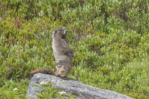
July 2026A hoary marmot on the Myrtle Falls Trail at Paradise.
Photograph: Charles J. Sharp, CC BY-SA 4.0

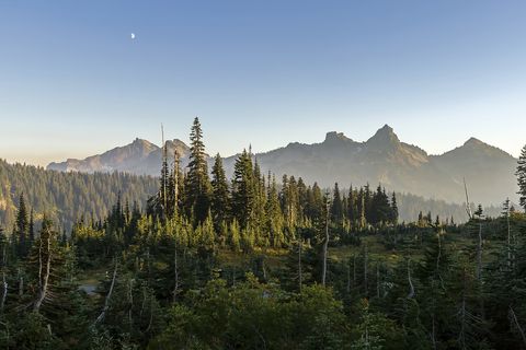
September 2009The Tatoosh Range from Paradise, with a half moon above.
Photograph: Acroterion, CC BY-SA 4.0, cropped

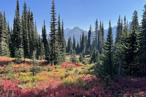
October 2022Autumn colour on Mazama Ridge above Paradise in October.
Photograph: Vulturesong, CC0, cropped
- Wait for the mountain to come out. (Waited. It came out, looked at me, and went back in. I am told this counts.)
- Stand beside the snowbank at the edge of the car park and try to see over it. (Could not. Stood on the list. Still could not.)
- Stay on the path through the flowers. They have very little summer to do all their work in.
- This mountain had names long before it had the one on my map. Learn one of them, and say it carefully.
- Put the tire chains on the list. (Put them on the list. Did not put them in the car. The list was very patient about it.)
A relic from Mount Rainier National Park
Relic, entry 327Gathered long before the parkMary Kiona, Upper Cowlitz basket-maker
A huckleberry from the high meadows. People were walking up the mountain for these long before there was a park, a road or a lodge. Mary Kiona was one of them: a Taidnapam, or Upper Cowlitz, woman born in the mid-1800s, who began making baskets at six and kept making them for more than a hundred years. She travelled the slopes of Mount Rainier to gather huckleberries, cedar bark for weaving, and plants for food and medicine, and she lived until 1970. Tribal members still come back to the mountain.
Tally, in the marginOne small purple berry. It took me most of the afternoon to see that the path I had come up by was really a path to the berries, and much older than I had assumed. I ate mine slowly, out of respect for everyone who had walked up for it before me.
Getting there
- 1
From Seattle
Seattle to Paradise is 107 miles, about two and a half hours.
- 2
The year-round way in
State Route 706 leads to the Nisqually Entrance in the south-west corner of the park.
- 3
Across the park
Paradise to Ohanapecosh is 23 miles, about 45 minutes.
- ✓
| J | F | M | A | M | J | J | A | S | O | N | D |
|---|---|---|---|---|---|---|---|---|---|---|---|
| July: best time | August: best time | September: best time |
- Mid-July to late September, when Paradise is usually free of snow
How to get there. The way in all year is State Route 706 to the Nisqually Entrance in the park’s south-west corner, through Elbe and Ashford; the road from there to Longmire stays open through winter except in extreme weather. Seattle-Tacoma International Airport is 85 miles from Ashford, Portland International 131 miles and Yakima 134 miles. Inside the park, Paradise to Ohanapecosh is 23 miles and about 45 minutes. The park has five entrances, and GPS can send drivers to a closed gate; the street address of the park leads to its headquarters in Ashford, not to an entrance.
When to go. July and August are the sunniest months, though rain can come on any day, and the meadows around Paradise are usually clear of snow from about mid-July to late September. Sunrise, White River, Ohanapecosh, State Routes 410 and 123 and the Stevens Canyon Road close for the season in mid-October or early November and reopen in summer; Longmire is open all year, and in winter the road from Longmire to Paradise closes every evening. The east side of the mountain is much drier than the west.
What to arrange ahead. As of 12 November 2026, every vehicle in the park must carry tire chains from November 1 to May 1, four-wheel drives included, and no part of the park uses timed-entry reservations in 2026. On sunny summer weekends parking at Paradise and Sunrise can fill.
Safety. The State Department’s travel advisories cover other countries, so none applies here. The Park Service describes the mountain’s own hazards plainly: mudflows called lahars and glacial outburst floods can occur without warning, and several of the park’s developed areas lie in their path. The park’s alerts page lists current road and trail closures.
Mark this place
The passport stamp for this place.
Common questions
How much snow falls at Paradise on Mount Rainier?
An astonishing amount. About 630 inches fall at Paradise on Mount Rainier in an average winter, and in 1971–72 the total reached 1,122 inches, a world record for a year’s snowfall that stood until 1998.
How tall is Mount Rainier?
14,410 feet. Mount Rainier, in Washington, is the tallest volcano and the fifth-highest peak in the contiguous United States, and more than 35 square miles of permanent ice and snow cover its slopes.
Is Mount Rainier an active volcano?
Yes, though a quiet one for now. Geologists class Mount Rainier as episodically active, a volcano that will erupt again some day; its last eruption was about 1,000 years ago, and the mountain itself is only about 500,000 years old.
When are the wildflowers out at Mount Rainier?
Late in summer, once the snow goes. The meadows around Paradise on Mount Rainier are usually free of snow from about mid-July to late September, and the subalpine wildflowers bloom in that short window.
Who named Mount Rainier?
Captain George Vancouver, in 1792, after his friend Rear Admiral Peter Rainier, who never saw the mountain. The tribes around Mount Rainier have their own, older names for it, among them Tahoma and Takhoma.
How old is Mount Rainier National Park?
It dates from March 2, 1899. Mount Rainier National Park is the fifth-oldest national park in the United States, after Yellowstone, Yosemite, General Grant and Sequoia, and in 1907 it became the first to admit private cars.
How long is the Wonderland Trail?
93 miles, all the way round the mountain. The Wonderland Trail circles Mount Rainier through forest and meadow, and most people take at least ten days to walk the whole loop.
How far is Mount Rainier from Seattle?
About two and a half hours by road. Seattle to Paradise on Mount Rainier is 107 miles, by way of State Route 706 and the Nisqually Entrance, the one way into the park that is open all year.
Photographs on this page
Tap a photograph to see it full size.
Photograph: Dllu, CC BY-SA 4.0, cropped
Photograph: Charles J. Sharp, CC BY-SA 4.0
Photograph: Acroterion, CC BY-SA 4.0, cropped
Photograph: Vulturesong, CC0, cropped


