The short answer
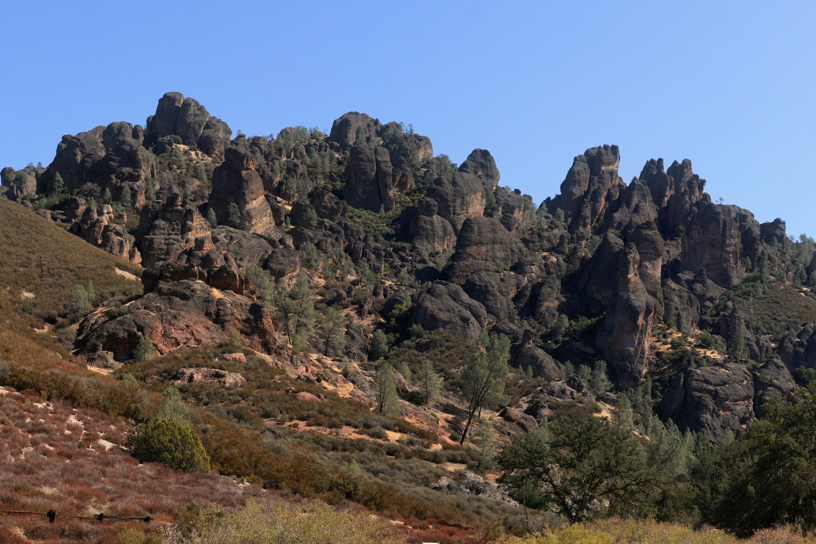
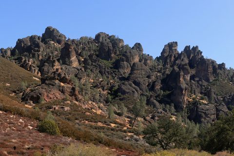
Pinnacles National Park lies in the dry hills of central California, south of Hollister. It protects the eroded remains of an ancient volcano: jagged spires of volcanic rock, talus caves where huge boulders have wedged in narrow canyons, and slopes of chaparral and oak. It was set aside in 1908 to protect 2,060 acres of its strange rock formations, grew piece by piece to about 26,000 acres, and on January 10, 2013, became a national park. It has two entrances, east and west, and no road joins them.
From Tally’s diary
The rocks stood up out of the dry hills like a crowd of old teeth, and when I looked up between them a huge black bird was turning slow circles in the blue, not flapping once. Later I went into a cave whose ceiling was a boulder the size of a house, wedged there by nobody. I walked under it very respectfully, and fairly fast.
Why it's worth knowing
A fault still at work. The San Andreas Fault is a crack in the earth’s crust stretching more than 600 miles across California, where the Pacific Plate grinds north past the North American Plate. Inside the park an older branch of it, the Chalone Creek Fault, still active, runs along the main valley on the east side. Wind and water have done the rest, carving the High Peaks into the shapes that give the park its name.
Caves made of fallen rock. Most caves are dissolved out of limestone. These were built by falling. In the narrow canyons at Bear Gulch and Balconies, cliffs fractured and dropped boulders weighing up to thousands of tons, which wedged against each other high above the canyon floor and made a roof. The passages beneath them are talus caves, cool and dark, with running water in the depths of Bear Gulch. The rockfalls are thought to date from the ice ages, and the boulders still shift now and then.
A paradise for bees. Nearly 500 kinds of bee live at Pinnacles, one of the highest numbers known anywhere on Earth, in a park of only 42 square miles. They range from the size of a sesame seed to the size of an almond, and come in black, bronze, metallic green, blue and stripes. Honeybees and bumblebees make up less than two per cent of them. About one species in six is a cleptoparasite, laying its eggs in another bee’s nest so that its young can eat the pollen stored there. They manage to share the place by taking turns: the bee season lasts nine months, but most species are out for less than two.
The field notes
Condors on the wing
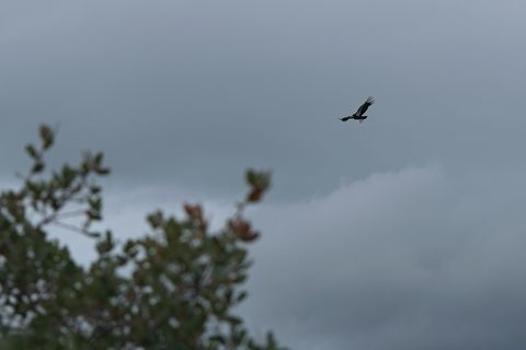
The California condor, one of the most critically endangered birds in North America, has been flying over Pinnacles since 2003, when the park became a release site for the national recovery programme. Pinnacles now manages every wild condor in central California with the Ventana Wildlife Society of Big Sur. Each bird is given a studbook number on the day it hatches, the lower the number the older the bird, and carries a numbered vinyl tag on one or both wings. The colour of the tag tells its age.
Fourteen kinds of bat
Of the 23 species of bat found in California, 14 live at Pinnacles, and the talus caves are part of the reason. All of them eat insects, spiders and other small creatures; none of them drinks nectar or eats fruit.
Homesteaders and the CCC
Local homesteaders pushed to protect the rock formations in the early 1900s; one of them, Schuyler Hain, is remembered in the Hain Wilderness, 3,000 acres added when the park was redesignated in 2013. In the 1930s young men of the Civilian Conservation Corps cut trails through the High Peaks, setting big boulders at the switchbacks, for $30 a month, $25 of which went home to their families.
Before the missions
Long before any of this, Native people gathered acorns, plants and animals here, grinding the acorns in bedrock mortars and mixing the flour with creek water for porridge. No sign of a village has been found inside the park, and many known sites are kept off maps to protect them. When the Spanish arrived in 1769, the mission system forbade people to speak their languages or keep their customs, and much of the knowledge handed down by word of mouth was broken off.

January 2026A California condor overhead.
Photograph: Milkisverytasty, CC BY-SA 4.0, cropped

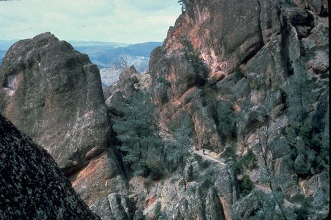
Volcanic rock walls and spires, in an archive slide.
Photograph: NPS, Public domain, cropped
- Read the number on a big black bird. (Read it. It read me back. I am almost certain I scored lower.)
- Go through the cave under the giant boulders. (Went through. Did not look up for long. The boulders did not need encouraging.)
- Count the kinds of bee on one bush. (Counted six. A seventh came to see what I was counting.)
- Listen for the creek in the dark under the boulders. (Heard it. Never found it. It seemed happier that way.)
- Find the spire that looks most like somebody I know. (Found three. I will not say who.)
A relic from Pinnacles National Park
Relic, entry 349A numbered vinyl tag on each wingThe lower the number, the older the bird
A numbered wing tag on a California condor. Each condor that flies over the High Peaks wears a numbered vinyl tag on one or both wings, so that people on the ground can tell one bird from another. The colour of the tag says how old the bird is, and the number leads back to its studbook entry, opened on the day it hatched, which records its parents and its whole life story. The lower the studbook number, the older the condor.
Tally, in the marginI thought the number was a sort of name tag, until I learned it opens a book with the whole bird in it, mother, father and every year since hatching. I would very much like a book like that, though perhaps a smaller one.
Getting there
- 1
From Hollister
Highway 25 south for about 30 miles, then Highway 146, reaches the East Entrance.
- 2
From Soledad
Highway 146 runs 14 miles east to the West Entrance.
- 3
Between them
No road joins the two; the way round is through King City.
- ✓
How to get there. Pinnacles has two entrances and no road between them; the shortest way from one to the other is round through King City on Highway 101. The East Entrance, with the Pinnacles Visitor Center and campground, is reached from Hollister by Highway 25 south for about 30 miles, then Highway 146; the Bear Gulch area is 3.5 miles further in. The West Entrance is 14 miles east of Soledad on Highway 146, which narrows to a single lane. Online maps can send drivers to the wrong side of the park; the Park Service gives coordinates for each entrance (East: 36.493545, −121.146646; West: 36.477700, −121.226136).
When to go. Cool mornings can turn into hot afternoons, and temperatures drop sharply at night in every season. There is no water on the trails.
Safety. The State Department’s travel advisories cover other countries, so none applies here. The park’s cave-status page says which parts of the caves are open.
Mark this place
The passport stamp for this place.
Common questions
How did Pinnacles National Park form?
From half of a volcano that moved. The rocks of Pinnacles National Park erupted about 23 million years ago near what is now Los Angeles, and the San Andreas Fault carried them 195 miles north to central California.
Can you see California condors at Pinnacles?
Often, yes. Pinnacles National Park has been a release site for California condors since 2003 and manages the wild condors of central California with the Ventana Wildlife Society.
What are talus caves?
Caves roofed by fallen boulders. The talus caves at Bear Gulch and Balconies in Pinnacles National Park formed when rocks, some weighing thousands of tons, fell into narrow canyons and wedged together overhead.
Is there a road through Pinnacles National Park?
No. Pinnacles National Park has an East Entrance and a West Entrance with no road between them; the shortest drive from one to the other goes round through King City on Highway 101.
When did Pinnacles become a national park?
On January 10, 2013. Pinnacles had been a national monument since 1908, when it protected 2,060 acres; it is now about 26,000 acres.
How many kinds of bee live at Pinnacles?
Nearly 500. Pinnacles National Park in California has one of the highest known bee diversities on Earth, from bees the size of a sesame seed to bees the size of an almond.
Are there bats at Pinnacles National Park?
Yes, 14 species. Of the 23 kinds of bat found in California, 14 live at Pinnacles National Park, and all of them eat insects and other small invertebrates.
Photographs on this page
Tap a photograph to see it full size.
Photograph: Brocken Inaglory, Rock formations at Pinnacles National Park 2, CC BY-SA 3.0, cropped
Photograph: Milkisverytasty, CC BY-SA 4.0, cropped
Photograph: NPS, Public domain, cropped


