The short answer
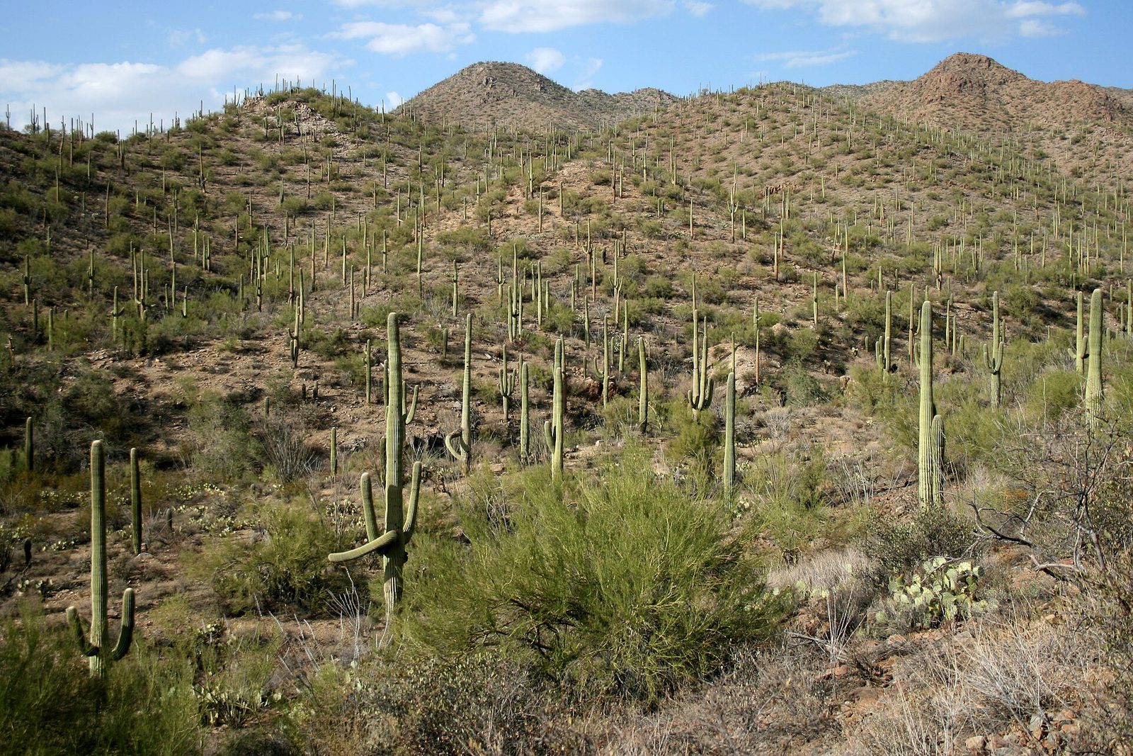
Saguaro National Park protects the giant saguaro cactus, Carnegiea gigantea, in two districts on either side of Tucson, Arizona. The Rincon Mountain District, to the east, climbs from the desert floor through six communities of plants to mixed conifer forest high in the Rincon Mountains; the Tucson Mountain District, to the west, stays lower and drier. Saguaros grow only in the Sonoran Desert, and not all of it: they need just the right balance of heat and rain, and frost limits them. President Herbert Hoover proclaimed the national monument on March 1, 1933, the Tucson Mountain District joined it in 1961, and Congress made it a national park in 1994. The 2020 saguaro census counted about two million of them.
From Tally’s diary
They stood all over the hillside with their arms up, like a crowd that had just been told some marvellous news. I put my own arms up to see how it felt, and a small bird came out of a hole in the nearest one and looked at me as though I had knocked. I apologised. At dusk they went black against the sky and kept their arms up.
Why it's worth knowing
Slow, and enormous. A saguaro can reach 50 feet. Most of it is water, so a big one may weigh 80 pounds for every foot of its main trunk, held up by a ring of woody ribs inside. After a heavy rain its pleats swell like an accordion to hold all it can drink, and in dry spells they draw in again. Each rib matches a pleat outside, and when the plant grows, a rib may fork, and its pleat forks with it. The tallest saguaro ever recorded stood 78 feet before it fell in 1986.
A desert apartment block. Gilded flickers and Gila woodpeckers dig nest holes in the soft flesh, and when they move out, elf owls, screech owls, purple martins, finches and sparrows move in. Red-tailed and Harris’s hawks build stick nests among the arms, and ravens and great horned owls take those over in turn. In midsummer the ripening fruit is food and water at the driest time of the year.
Flowers by night. From late April to early June the tips of the trunk and arms crowd with large, creamy white flowers. Each opens at night and closes the following afternoon, and in that window bats, birds and insects must pollinate it. A fruit holds about 2,000 to 3,500 tiny black seeds, and a saguaro may make 20 to 40 million seeds in its life, of which perhaps one or two will grow into an adult.
The field notes
Crested, and nobody knows why
Every so often a saguaro’s growing tip turns into a great fan-shaped crest. More than 50 of these crested, or cristate, saguaros live in the park. The same kind of growth turns up in other plants, where it is called fasciation, and it is not passed on through seeds. Damage to the growing tip might be the cause, but nobody has proved it; biologists have not pinned the reason down.
Counting cacti since 1942
From the very beginning people worried that the famous stand of saguaros at the foot of the Rincon Mountains was dying out, so in 1942 every saguaro in one square mile, Section 17, was measured and counted, and the counting has gone on every year since. After half a century of very few young plants, more began to survive in the 1960s, and new saguaros surged in the 1980s. Since 1990 a park-wide census every ten years has tracked the result: about 1.15 million saguaros in 1990, two million in 2020. The surge has largely ended now, a change the park links to the long drought that began in the 1990s.
A ring planted by the CCC
When the Civilian Conservation Corps built Camp Pima in 1933, a number of good-sized saguaros stood where the buildings had to go, so the young men moved them into a ring at the camp’s entrance. Over 80 years, 10 of the ring’s 21 mature saguaros died. In 2015 the park found a young saguaro growing in the adobe ruins of the camp, where its roots threatened the walls, and moved it into the ring to join the others.
A sky island
The Rincon Mountains rise far higher than the Tucson Mountains, so the east district holds more kinds of plants and animals, among them the black bear, the Mexican spotted owl and the Arizona mountain kingsnake. Snow is common up there in winter, and in snowy years it melts slowly into the ground and keeps desert streams running for weeks longer into spring. High in the Rincons stands Happy Valley Lookout, one of the few fire lookouts left in western national parks, staffed each summer through the 1970s by young married couples watching for smoke.

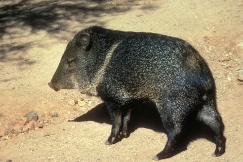
A javelina, or collared peccary.
Photograph: National Park Service, Public domain, cropped

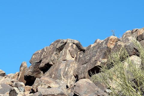
March 2016Hohokam petroglyphs on the rocks of Signal Hill.
Photograph: Matt Kieffer, Hohokam Petroglyphs, CC BY-SA 2.0, cropped

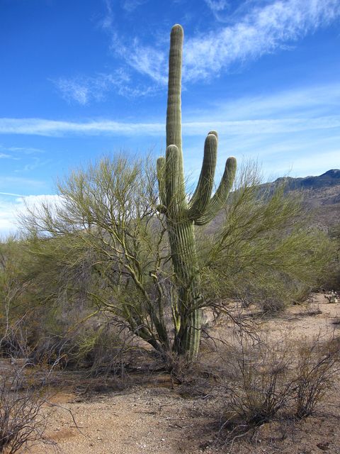
January 2010A single saguaro beside a palo verde.
Photograph: Chris M Morris, Saguaro, CC BY 2.0
- Look for one with no arms yet, and wish it well. It has a long wait ahead.
- Admire every cactus from a polite distance. (Admired one from slightly too close. It won the argument, quietly, through my sleeve.)
- The fruit up top belongs to the birds, and to the people who have been bringing it down with long poles since long before me. Leave it to them.
- Stay out for the dark. They keep their arms up long after the sky has gone, which I found very loyal.
- Give the tallest one on the hill a name. (Named it, then noticed a taller one behind it, then another. The list now has a family tree.)
A relic from Saguaro National Park
Relic, entry 3302,000 to 3,500 seeds in each fruitBrought down with a kuipad
A ripe saguaro fruit, split open. In midsummer the fruits at the tips of the trunk and arms ripen and burst, showing their seeds, about 2,000 to 3,500 tiny black ones in each; for birds and animals they are food and water at the driest time of the year. The Tohono O’odham still gather the fruit as early desert peoples did, with long poles of saguaro ribs tied together with a cross piece at the end, called kuipad, and make it into ceremonial wine, jelly and candies.
Tally, in the marginA fruit at the very top of the tallest thing in sight, which struck me as a poor place to keep a pantry. It took me an embarrassingly long while to see that this was the whole point: anyone who wanted it had to fly, or ask nicely, or bring a very long pole.
Getting there
- 1
Saguaro East
From I-10 at exit 275, Houghton Road runs eight miles north to Old Spanish Trail.
- 2
Saguaro West
From I-10 at Avra Valley Road, exit 242, Sandario and Kinney roads lead to the Red Hills Visitor Center.
- ✓
| J | F | M | A | M | J | J | A | S | O | N | D |
|---|---|---|---|---|---|---|---|---|---|---|---|
| March: also a good time | April: best time | May: best time | June: best time |
- Saguaros flower from late April to early June
- Wildflowers peak in March
How to get there. The city of Tucson lies between the two districts. The Rincon Mountain District, Saguaro East, is reached from Broadway and Freeman Road on the city’s far east side, or from I-10 at exit 275, Houghton Road, eight miles north to Old Spanish Trail; it has no parking for RVs. The Tucson Mountain District, Saguaro West, is reached from I-10 at Avra Valley Road, exit 242, then Sandario and Kinney roads to the Red Hills Visitor Center, or over Gates Pass on Speedway Boulevard, which carries a 12,000-pound vehicle limit. The Park Service warns that map apps often confuse the two districts and advises entering each one’s street address.
When to go. Winters are mild, with days around 65°F and nights around 40°F. Wildflowers peak in March, and the saguaros flower from late April to early June. Summer days pass 100°F, and the monsoon, from June 15 to September 30, brings afternoon storms over the mountains and sometimes flash floods in the washes. June is usually the driest month.
What to arrange ahead. As of 12 November 2026, backcountry campsites in the Rincon Mountains are reserved through Recreation.gov. Picnic areas are first come, first served.
Safety. The State Department’s travel advisories cover other countries, so none applies here. The park publishes its own guidance for hiking in the heat on its weather page, and its conditions page lists road and trail news, including burned areas from two 2020 fires in the Rincon high country.
Mark this place
The passport stamp for this place.
Common questions
How old is a saguaro when it grows arms?
Older than most people expect. In Saguaro National Park, saguaros usually start growing arms at 60 to 75 years old, and in drier places it can take up to 100 years; they first flower at about 35.
How many saguaros are in Saguaro National Park?
About two million. The 2020 census in Saguaro National Park counted roughly two million saguaros, nearly double the estimated 1.15 million of 1990.
When do saguaros bloom?
From late April to early June. Saguaros in Saguaro National Park carry big creamy white flowers at the tips of their trunks and arms, and each flower opens at night and closes the following afternoon.
How tall do saguaros grow?
Up to about 50 feet. Saguaros in Saguaro National Park can reach that height, and the tallest saguaro ever recorded stood 78 feet tall before it fell in 1986.
What is a crested saguaro?
A saguaro with a fan-shaped crest at its tip. More than 50 grow in Saguaro National Park, and biologists have not pinned down why: the shape is not passed on through seeds, and damage to the growing tip is suspected but not proven.
Why does Saguaro National Park have two districts?
Because the city of Tucson lies in between. Saguaro National Park has a Rincon Mountain District east of the city, protected since 1933, and a Tucson Mountain District to the west, added in 1961.
Who harvests saguaro fruit?
The Tohono O’odham, as their ancestors did. In and around Saguaro National Park they knock the ripe fruit down with long poles of saguaro ribs, called kuipad, and make it into ceremonial wine, jelly and candies.
When did Saguaro become a national park?
In 1994. Saguaro National Park in Arizona began as a national monument proclaimed by President Herbert Hoover on March 1, 1933, and Congress made it a national park in 1994.
Photographs on this page
Tap a photograph to see it full size.
Photograph: NPS / Todd M. Edgar, Public domain
Photograph: National Park Service, Public domain, cropped
Photograph: Matt Kieffer, Hohokam Petroglyphs, CC BY-SA 2.0, cropped
Photograph: Chris M Morris, Saguaro, CC BY 2.0


