The short answer
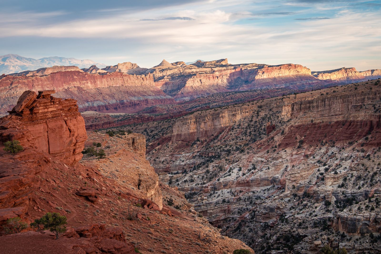
Capitol Reef National Park, in south-central Utah, protects most of the Waterpocket Fold, a nearly 100-mile wrinkle in the Earth’s crust where colourful cliffs, white domes, canyons, arches and monoliths have been carved from 19 different layers of rock. The name joins two comparisons from early travellers: the white domes of Navajo Sandstone looked like the dome of the Capitol in Washington, and the cliffs blocked travel like an ocean reef. At its heart is Fruita, an oasis on the Fremont River with historic orchards, a one-room schoolhouse and the Gifford farmhouse, all reached from Utah Highway 24. It became a national park in 1971.
From Tally’s diary
Under the red cliffs, of all places, there were fruit trees in rows, and a ditch of water chuckling along beside them as if it had heard a joke a long time ago and never got over it. I picked one apple, paid for it, and ate it in the shade, looking up at the stone. It seemed a most unlikely spot for an orchard. Nobody had told the orchard.
Why it's worth knowing
A wrinkle in the crust. Between 50 and 70 million years ago, a great mountain-building event in western North America woke an old buried fault, and the land to the west of it rose. The layers of rock on top did not break; they draped over the step like a rumpled tablecloth, and now the west side sits more than 7,000 feet higher than the east. Erosion has since sliced the fold open, showing nearly 200 million years of history in its layers: rivers and swamps, a Sahara-like desert of dunes, a shallow ocean. The reds are rusted iron from dry times and the greens are iron from swampy ones. The name comes from the “waterpockets”, small hollows worn into the sandstone that catch rain and snowmelt for desert wildlife.
The Eden of Wayne County. The little settlement where Sulphur Creek meets the Fremont River was settled around 1880; its first landholder of record was Nels Johnson, and it was called Junction until 1902, when it became Fruita. It never had more than ten families. With no post office, the mail was left in a big Fremont cottonwood, the Mail Tree. In 1901 it took the bishop of Torrey more than an hour and a half to cover the ten miles to Fruita in the best weather. The wagon track through Capitol Gorge was so rough that the river settlements stayed among the most isolated in America until the mid-20th century. Fruita bought its first tractor during the Second World War.
A desert that once held lakes. The Navajo Sandstone was laid down as a vast sea of sand dunes, long imagined as bone-dry. Then, on a long backpacking trip in the park, a researcher stumbled on what looked like “a giant haystack”: a fossil stromatolite, a layered mound built by bacteria, standing about 20 feet tall when most are under 3 feet. Mounds that big needed large bodies of standing water, so the old desert had lakes after all.
The field notes
Eleven children and one room
In the 1890s Elijah Cutler Behunin, his wife Tabitha and 11 of their 13 children lived in a one-room cabin in the Fremont River canyon. Not everyone slept inside: the girls slept in a wagon box in the yard, and the boys in a rock alcove. Behunin gave land for a school, and in 1896 the settlers built the Fruita Schoolhouse, which doubled as a dance hall and meeting room. Its pupils hid the teacher’s alarm clock in the woodpile to put off the start of lessons. They also found that a scrap of calcium carbide from a lantern, dropped into an inkwell, made the ink overflow, or, with the lid on tight, explode.
Pie, from Pi Day
Dewey and Nell Gifford farmed in Fruita from 1928 to 1969, for much of that time with no running water, electricity or telephone. When they sold their land to the Park Service and moved to Torrey they were the last settlers to leave. Their farmhouse, a mile south of the visitor center on the Scenic Drive, is now a museum and shop furnished as an early 1900s rural Utah home. It usually opens each year on March 14, Pi Day, and is known for its locally baked fruit pies.
Temples of the Sun and Moon
In the remote north of the park, Cathedral Valley holds free-standing monoliths of soft, buff-pink Entrada Sandstone, about 160 million years old, with names like the Walls of Jericho and the Temples of the Sun, Moon and Stars. Nearby, Glass Mountain is a mound of glassy selenite crystals pushed up as a plug of gypsum. The usual loop drive is 57.6 miles of unpaved road and takes six to eight hours, and its southern end fords the Fremont River, where there is no bridge.
The black boulders
Rounded black boulders lie scattered along the Fremont River valley, out of place among all the red. They are lava, from flows that capped Boulder Mountain and Thousand Lake Mountain some 20 million years ago. At the end of the last ice age, small glaciers on those mountains broke the lava up, and meltwater and mudflows rolled the pieces down into the valleys, smoothing them on the way.

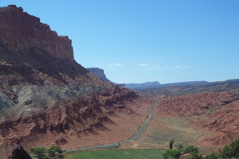
June 2013The Scenic Drive below red cliffs, from the Fremont Gorge Overlook Trail.
Photograph: NPS, Public domain, cropped

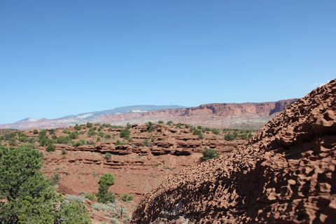
June 2017Red sandstone ledges and pinyon pines, with cliffs along the horizon.
Photograph: Julianibarra, CC0
- Find the ripest apricot in the orchard. (Found it. It was on the highest branch. I admired it from below and left it to be somebody else’s triumph.)
- Write a letter and imagine posting it in a tree. (Wrote it. Could not decide which branch. Kept it.)
- Count the sheep carved on the rock wall. (Counted them twice. Got two different answers. Decided they were still grazing.)
- Buy a pie. (Bought one. Planned to save half for later. Later turned out to be very soon.)
- Stay up for the dark. (The stars came out over the cliffs so thickly that I gave up naming them and just said thank you.)
A relic from Capitol Reef National Park
Relic, entry 334Where Fruita collected its mailStill standing by the road
The Mail Tree, beside the road through Fruita. The little settlement never had a post office of its own, so letters were left at a big Fremont cottonwood in the middle of the community, and the families picked up their mail beneath it. The tree still towers over the road through the Fruita Rural Historic District, now beside a picnic area.
Tally, in the marginA tree that used to be a post office. I stood under it waiting, purely out of habit, and nothing came, which I found oddly restful. Then a leaf landed on my hat and I decided that counted as a reply.
Getting there
- 1
From Interstate 70
Highway 24 runs west from exit 149 for 43.8 miles, then 37.3 miles more to the visitor center.
- 2
From Bryce Canyon
Utah Highway 12 crosses a 9,600-foot summit on Boulder Mountain.
- 3
From the east
Hanksville is 37 miles east of Fruita.
- ✓
How to get there. Utah Highway 24 runs through the middle of the park, and the visitor center sits beside it. From Interstate 70, exit 149 leads west on Highway 24 for 43.8 miles, and then another 37.3 miles to the visitor center. Hanksville is 37 miles east of Fruita, and Torrey about ten miles away. From Bryce Canyon, Utah Highway 12 takes about three hours, over a summit of 9,600 feet on Boulder Mountain that can be hazardous in winter. Some GPS units suggest the South Draw Road from Lower Bowns Reservoir, an unmaintained high-clearance four-wheel-drive track; the Park Service advises a map instead.
When to go. The park is open all year. Much of its rain, about 8 inches a year in all, falls in the summer monsoon, usually July to September, which brings flash floods and brief waterfalls along Highway 24. Apricots and cherries ripen early in the summer and apples and pears into the autumn, when the cottonwoods along the river turn yellow.
What to arrange ahead. Canyoneering, rock climbing, backpacking and group activities need permits. Fruit may be picked only from orchards with “U-Pick Fruit” signs, and is paid for at a self-pay station by the gate.
Safety. The State Department’s travel advisories cover other countries, so none applies here. The park’s conditions page carries flash-flood warnings and road reports.
Mark this place
The passport stamp for this place.
Common questions
Why is it called Capitol Reef?
Two comparisons, joined together. At Capitol Reef National Park the white domes of Navajo Sandstone reminded early travellers of the Capitol dome in Washington, and prospectors called the cliffs of the Waterpocket Fold a reef because they blocked travel like a reef at sea.
Can you pick fruit at Capitol Reef?
Yes, in season. The historic Fruita orchards in Capitol Reef National Park hold about 1,900 fruit trees, and visitors may pick ripe fruit from orchards with “U-Pick Fruit” signs, paying at a self-pay station.
What is the Waterpocket Fold?
A giant step in the Earth’s crust. The Waterpocket Fold, the heart of Capitol Reef National Park, is a warp nearly 100 miles long where the rock layers on the west were lifted more than 7,000 feet above those on the east.
Who made the petroglyphs at Capitol Reef?
The Fremont, who lived here for about a thousand years. Their carvings of bighorn sheep and human-like figures can be seen from two boardwalks off Highway 24 in Capitol Reef National Park, and are about 700 to 1,000 years old.
What are the black boulders at Capitol Reef?
Pieces of old lava that rolled downhill. The rounded black boulders in Capitol Reef National Park came from lava flows on Boulder and Thousand Lake mountains, carried down by meltwater and mudflows at the end of the last ice age.
What is Cathedral Valley?
The park’s remote north end. Cathedral Valley in Capitol Reef National Park is known for free-standing sandstone monoliths such as the Temples of the Sun and Moon, reached by a 57.6-mile unpaved loop that takes six to eight hours.
Where is Capitol Reef National Park?
In south-central Utah, on Highway 24. Capitol Reef National Park lies between Torrey and Hanksville, about 81 miles from exit 149 on Interstate 70, and about three hours from Bryce Canyon by Highway 12.
Photographs on this page
Tap a photograph to see it full size.
Photograph: Nur Nafis Naim, CC BY 4.0, cropped
Photograph: NPS, Public domain, cropped
Photograph: Julianibarra, CC0


