
Part of The Antarctic & Southern Ocean
- Where
- Antarctic ice sheet,
latitude 90° S - Coordinates
- 90.0000° S
(all longitudes meet) - Elevation
- 2,835 m;
air pressure like about 3,400 m - Ice flow
- About 10 m a year;
new marker every 1 January - Station
- Amundsen–Scott (US NSF),
occupied since 1956 - Sun
- About six months up,
about six months down - Best visited
- November to January,
with a private expedition operator
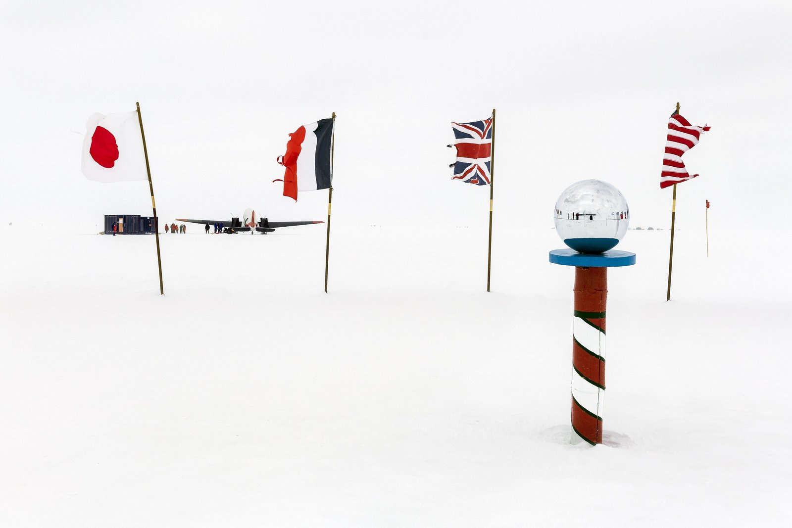
White in every direction, flat as a plate, and the sun going round the sky at the same height all day instead of up and down. The snow squeaked. The air was thin enough to make me puff. There was a ring of flags around a striped pole with a mirrored ball on top, and I saw my own face in it, very small and very far from everything.
The short answer
The geographic South Pole is the southernmost point on Earth, where every line of longitude meets and every direction is north. It lies on the high, flat Antarctic ice sheet at 2,835 metres above sea level; Wikipedia notes that the cold thins the air so much that the pressure there is like that at about 3,400 metres. The United States’ Amundsen–Scott South Pole Station, run by the National Science Foundation, stands beside it and has been occupied without a break since it was built in the southern summer of 1956–57. The sun is up for about six months and down for about six; it rises and sets once a year. Roald Amundsen’s Norwegian party reached the pole first, on 14 December 1911, and Robert Falcon Scott’s British party on 17 January 1912. Visitors reach it with private expedition operators in the southern summer.
Why it's worth knowing
A pole is a fixed idea. The ground on top of it is not.
The ice sheet at the South Pole is moving. The U.S. Antarctic Program puts its speed at about ten metres a year, and Wikipedia gives the direction as down towards the Weddell Sea. Anything set on the surface travels with it: the station, the flags, and the marker that showed where the pole was. So every year, according to the National Science Foundation, a new marker is placed at the pole on 1 January, and each year’s marker is designed and made during the austral winter by the people at the station.
No two markers are the same, and the designs have become a tradition of their own. The most famous point on the Antarctic continent is marked afresh by hand every New Year’s Day, and the markers of past years are carried off across the ice.
There are two poles within sight of each other. The geographic pole, a plain stake and sign with this year’s marker, is the one that is moved every January. A few metres away stands the Ceremonial South Pole: a red-and-white striped pole topped with a mirrored sphere, ringed by the flags of the twelve nations that first signed the Antarctic Treaty. It is set up for photographs.
The field notes
The marker and the sign
Wikipedia describes the geographic pole as marked by a stake in the ice with a small sign, both repositioned each New Year’s Day; the sign records the dates on which Amundsen and Scott reached the pole, each with a short quotation. The marker changes every year.
The 2026 marker, according to southpolestation.com, a long-running unofficial site about the station, was designed by two members of the winter crew and is hexagonal, with an ice crystal at its centre surrounded by a mosaic of 42 blocks, one for each member of the winter community, over engravings of what the station runs on: power, water, fuel, satellite links and people.
The station
The first Amundsen–Scott station was built by U.S. Navy Seabees from November 1956 for the International Geophysical Year, and has been rebuilt since. Wikipedia describes the present station as raised on columns and designed so that it can be lifted as snow builds up around it, since about 20 centimetres accumulate every year and never melt. Much of the winter science is done for the IceCube Neutrino Observatory and for telescopes that study the cosmic microwave background, which the cold, dry, dark air suits.
The two parties of 1911 and 1912
Amundsen’s party reached the pole on 14 December 1911 and left a tent there, now buried under the snow and designated a Historic Site or Monument under the Antarctic Treaty. Scott’s party reached it on 17 January 1912. All five members of Scott’s polar party died on the return journey. The station is named for both leaders.
Who may visit
The station is a research base, not a destination, and the U.S. Antarctic Program is not authorised to support private visitors except in an emergency. The area around it is an Antarctic Specially Managed Area, and its management plan tells visitors from private expeditions what to expect, where they may go and when a visit is least disruptive. The State Department advises travelling with a professional operator, such as a member of the International Association of Antarctica Tour Operators, and buying insurance that covers evacuation.
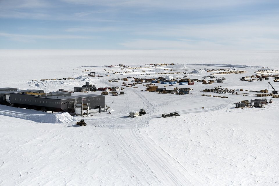
The station, its summer camp and the skiway on the flat polar plateau, February 2018.
Photograph: Christopher Michel · CC BY 4.0
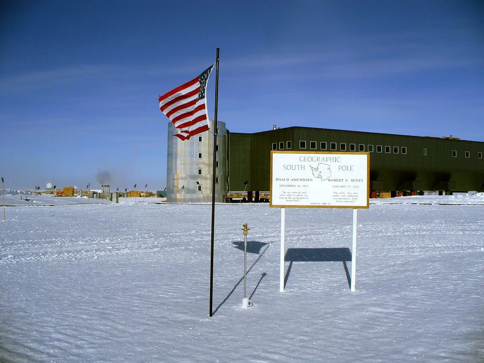
The Geographic South Pole in January 2010: that year's marker on its post, the sign and the elevated station.
Photograph: Amble · South pole geographic el station · CC BY-SA 3.0

Earlier Geographic South Pole markers on display inside the station, February 2018.
Photograph: Christopher Michel · CC BY 4.0
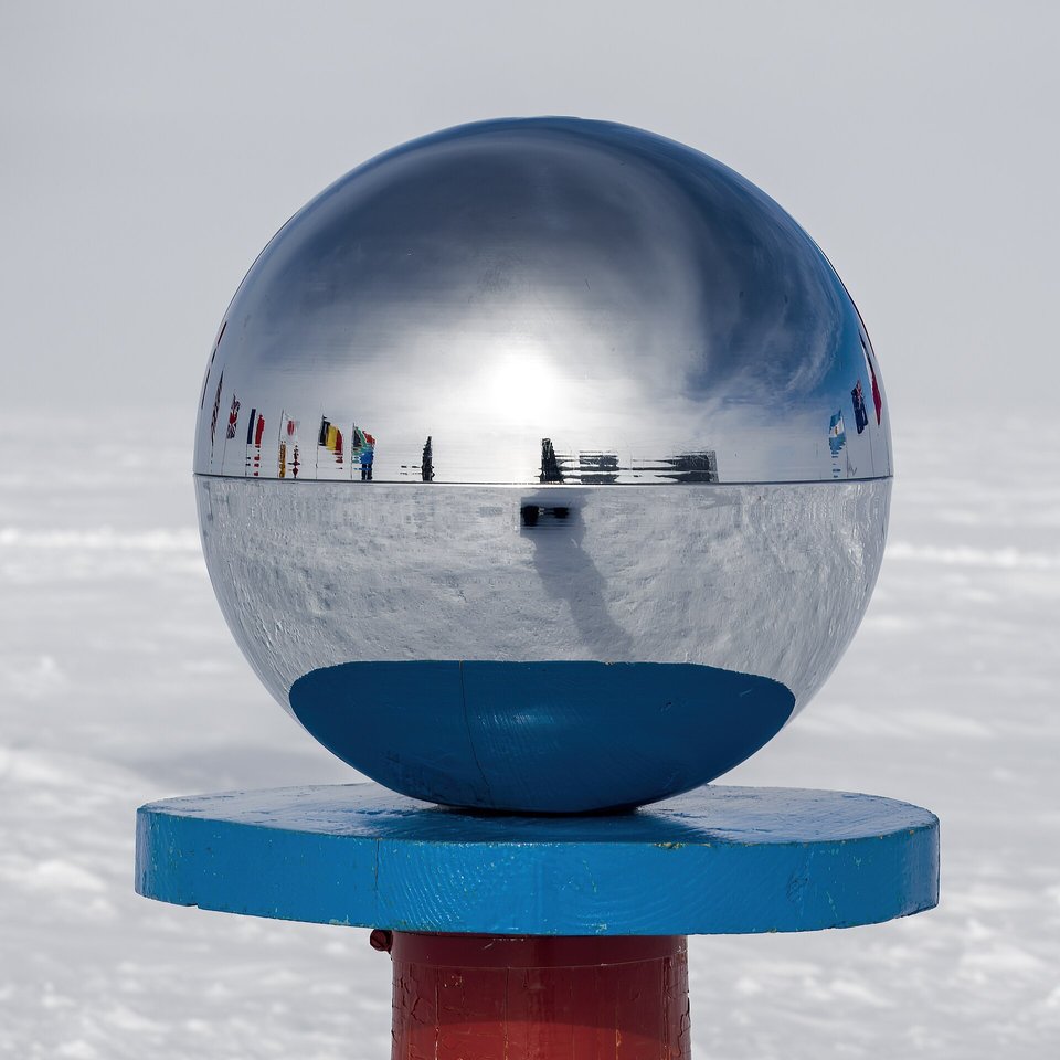
The ceremonial pole's mirrored ball, reflecting the ring of flags, February 2018.
Photograph: Christopher Michel · CC BY 4.0
- Pack for a longer stay than you booked. The weather decides when you leave.
- Find the plain marker as well as the shiny one. The plain one is the one that matters.
- Keep out of the places marked for the instruments, and keep your voice down near the buildings. People are working.
- Walk once round the flags, slowly. (Walked round. Dizzy. Walked round the other way to undo it.)
- Stand at the bottom of everything and add nothing to the list. (Added a winter, the stars and a longer visit. It is very hard to stand anywhere without adding something.)
This year’s geographic pole marker. A small marker designed and machined by hand during the months of darkness at the Amundsen–Scott station and set on a stake at 90 degrees south on New Year’s Day. From that morning it moves with the ice, about ten metres in a year, and the next January a new one takes its place. Most photographs are taken beside the striped pole with the mirrored ball; the plain stake is the one that marks the pole.
Tally, in the marginA little brass thing somebody made by hand, set down in all that white, and already drifting. I spent an hour posing by the striped pole with the shiny ball before anybody told me the plain one was the one.
Getting there
How to get there. Antarctic Logistics & Expeditions, an IAATO member, flies from Punta Arenas in Chile to its camp on the Union Glacier ice runway between November and January, and from there to the pole, a flight of four to five and a half hours. Its guests spend two or three hours at the pole on a day trip, or stay overnight at its South Pole camp, about a kilometre from the geographic pole. Others arrive on skis at the end of a guided expedition.
What to expect. This is a private charter to the interior of Antarctica, priced accordingly; ask operators for current prices and booking lead times. Weather can hold flights for days, so leave spare time at both ends. In January the average high at the pole is about −26 °C, and the altitude is felt.
At the station. Visitors are guests near a working research base. Follow the operator’s and the station’s instructions about where to walk and when, keep out of areas set aside for instruments, and do not expect services.
Mark this place
Common questions
Why does the South Pole marker move every year?
The geographic South Pole itself stays put, but the ice sheet it sits on flows about 10 metres a year, according to the U.S. Antarctic Program, carrying everything on the surface with it. So every 1 January a new marker is set at 90 degrees south beside the Amundsen–Scott South Pole Station, and last year’s moves off with the ice.
Who makes the South Pole marker?
The people who spend the austral winter at the Amundsen–Scott South Pole Station design and make each year’s geographic South Pole marker, according to the National Science Foundation, and it is placed on 1 January. No two are the same. The 2026 marker, as southpolestation.com describes it, is hexagonal with an ice crystal at its centre.
What is the difference between the ceremonial and geographic South Pole?
The geographic South Pole, at 90 degrees south, is marked by a stake, a sign and a new marker set every 1 January, and moves with the ice. The Ceremonial South Pole, a few metres away at the Amundsen–Scott station, is a red-and-white striped pole topped with a mirrored sphere and ringed by the flags of the twelve original Antarctic Treaty signatories, set up for photographs.
Can tourists visit the South Pole?
Yes, with a private operator. Antarctic Logistics & Expeditions flies visitors from Punta Arenas, Chile, to Union Glacier and on to the South Pole between November and January, for a day trip of two or three hours at the pole or an overnight stay at its camp. The U.S. Antarctic Program does not support private visitors except in emergencies.
Who reached the South Pole first?
Roald Amundsen’s Norwegian party reached the South Pole first, on 14 December 1911. Robert Falcon Scott’s British party arrived on 17 January 1912 and died on the return journey. The United States’ Amundsen–Scott South Pole Station, built in 1956–57 and occupied ever since, is named for both leaders.
How high and how cold is the South Pole?
The South Pole is 2,835 metres above sea level on the Antarctic ice sheet, and the cold thins the air so that its pressure is like that at about 3,400 metres, according to Wikipedia. The average high in January, midsummer, is about −26 °C, and in the long winter night temperatures can fall below −73 °C.
Does the sun set at the South Pole?
Only once a year. At the South Pole the sun stays above the horizon for about six months, circling the sky at almost the same height each day, then below it for about six months. It rises near the September equinox and sets near the March equinox, a few days off each because of atmospheric refraction, according to Wikipedia.
Is there a travel advisory for Antarctica?
Yes. The U.S. State Department has Antarctica at Level 2, exercise increased caution, because of extreme and unpredictable weather and limited emergency services (advisory of 23 September 2025). It notes that no U.S. consular services exist in Antarctica and recommends travelling with a professional operator, such as an IAATO member, with insurance that covers evacuation.