
Part of The Antarctic & Southern Ocean
- Where
- Southern Ross Sea,
Antarctica - Coordinates
- 81.5000° S
175.0000° W - Size
- About 500,000 km²;
roughly the size of France - The front
- More than 600 km long;
15–50 m above the water - Found
- 28 January 1841,
by James Clark Ross - Farthest south by ship
- 78° 44.405′ S,
25 February 2026 - Getting there
- Expedition ship,
January–February
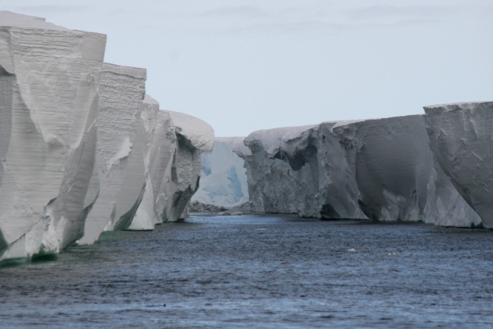
Sailed south until the sea ended in a wall: white cliffs, flat as a table along the top, running away to both horizons without a gap. Blue light in the cracks. The ship crept close and stopped, because there was nowhere left to go. A penguin on a floe looked at us, then at the wall, and went back to sleep. I stayed at the rail until my fingers complained.
The short answer
The Ross Ice Shelf is the largest ice shelf in Antarctica and in the world: a sheet of glacier ice floating on the sea, filling the southern end of the Ross Sea between Victoria Land and Marie Byrd Land. The Australian Antarctic Program gives it as half a million square kilometres, about 800 kilometres across; NASA’s Earth Observatory compares it to France. Wikipedia’s account says it is several hundred metres thick, up to about 750 metres in the south, and that its seaward face runs for more than 600 kilometres, standing 15 to 50 metres above the water with about 90 per cent of the floating ice below it. Glaciers feed it from the land, and seawater freezes on underneath. Most of it lies in the Ross Dependency, the sector New Zealand has claimed since 1923; Wikipedia’s account notes that the United States does not recognise the claim. Under Article IV of the Antarctic Treaty, nothing done while the treaty is in force can support or deny a claim, and for the treaty’s purposes Antarctica includes its ice shelves.
Why it's worth knowing
The Ross Ice Shelf is where the world’s ocean runs out. Wikipedia’s account of the Bay of Whales, an inlet in its front, places it at the southernmost point of the world’s ocean: the Ross Sea runs on much farther south, but under the shelf, so open water stops at the ice. The same account describes the inlet as the farthest south that ships can reach, and a record that keeps changing, because the front itself moves.
The record has been broken again and again this century. Wikipedia lists the Russian icebreaker Kapitan Khlebnikov at 78° 37′ S in 2001, then a series of expedition ships and research vessels edging farther: the yacht Arctic P in 2014, the Spirit of Enderby in 2017, Italy’s Laura Bassi at 78° 44.280′ S in 2023. On 25 February 2026 the expedition ship Douglas Mawson, of Aurora Expeditions, reached 78° 44.405′ S, which Australian Geographic, with a contributor on board, reported as a new record for any vessel.
The name on those records is itself out of date. Ernest Shackleton named the Bay of Whales on 24 January 1908 for the whales he saw there. Wikipedia’s account says the original bay was eliminated in 1987, when the iceberg B-9, 154 kilometres long, broke away; yet the same article, and the record-setters, still call the inlet at that point of the front the Bay of Whales. This entry uses the name as they do.
The field notes
The Barrier
James Clark Ross, commanding HMS Erebus and HMS Terror for the British Admiralty, came upon the ice front on 28 January 1841, by the date Wikipedia gives, while trying to reach the South Magnetic Pole. It was first called the Barrier, later the Great Ice Barrier, because it barred the way south; Wikipedia quotes Ross writing that they might as well try to sail through the cliffs of Dover. This entry could not open his published narrative of 1847. By Wikipedia’s account of Ross, his ships followed the front for 250 nautical miles. The United States’ naming board settled on “Ross Ice Shelf” in January 1953.
Floating, and moving
It took decades to prove the Barrier was afloat. On the Discovery Expedition of 1901–1904, by Wikipedia’s account, Robert Falcon Scott estimated its average thickness at 274 metres from the icebergs it shed, concluded from its shape and temperatures that it was floating, and measured it moving north by 555 metres in 13 and a half months. Wikipedia now gives its seaward push as 1.5 to 3 metres a day. It sheds icebergs as it goes: in March 2000 it calved B-15, the largest iceberg ever recorded.
What is built on it moves too. Roald Amundsen set up his base, Framheim, on the ice at the Bay of Whales in January 1911, and Richard Byrd built his Little America bases there from 1928. Wikipedia’s account of Framheim says that some time between 1957 and 1962 the block of the shelf carrying Framheim and the Little America sites broke away from the Barrier.
The road to the pole
For the first expeditions to the South Pole, the shelf was the way in. Shackleton’s southern party of the Nimrod expedition were the first to cross it, in 1908; Amundsen’s and Scott’s parties both crossed it in 1911. Scott and his four companions died on the return journey from the pole in 1912; Scott, Wilson and Bowers were halted on the shelf by a blizzard on 20 March, 11 miles from a depot of supplies, and a search party found them eight months later.
Scientists have since gone under it. By Wikipedia’s account, the Ross Ice Shelf Project first drilled through the shelf in 1977 and found fish and other life in the dark water beneath; New Zealand teams returned from 2017, drilling to the ocean cavity and sending a robotic vehicle, Icefin, underneath the ice.
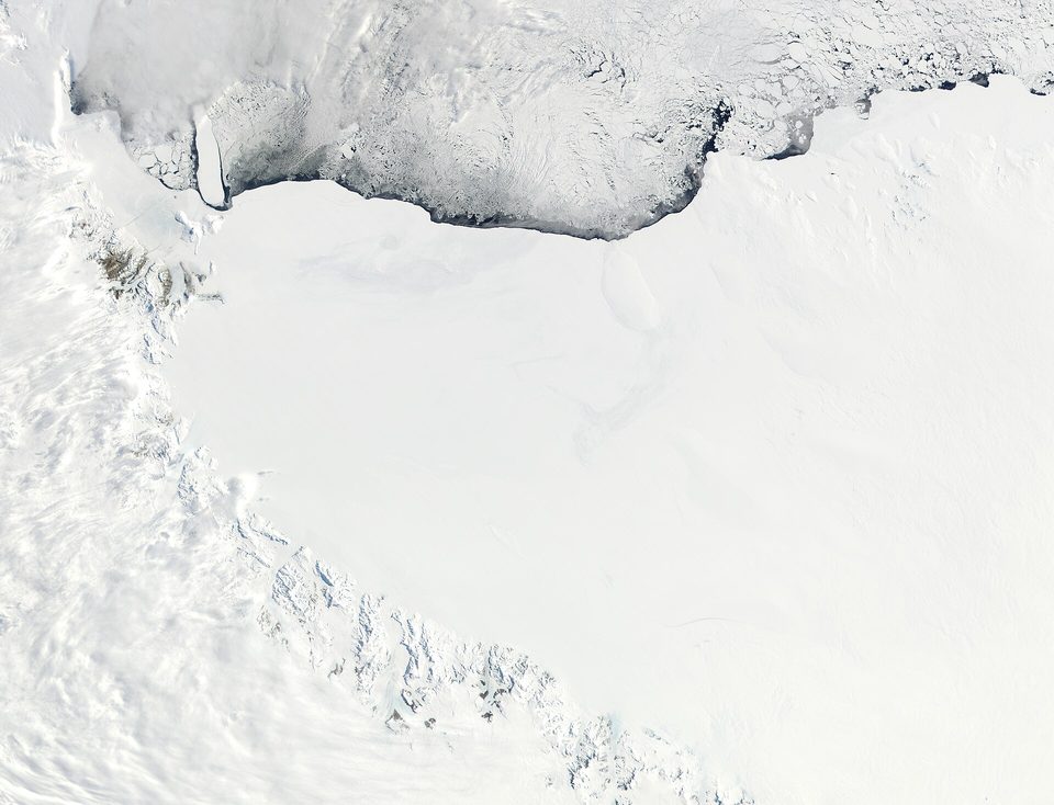
The Ross Ice Shelf from NASA’s Terra satellite, November 2001: its front runs across the top against broken sea ice, and the Transantarctic Mountains line its western edge (satellite image).
Satellite image: Jacques Descloitres, MODIS Land Rapid Response Team, NASA/GSFC · Public domain
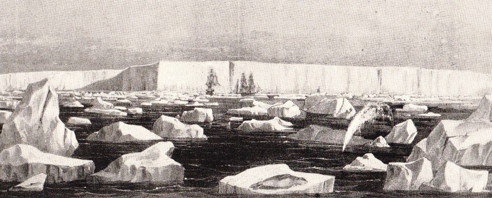
The Great Southern Barrier with two ships beneath it, a plate from James Clark Ross’s account of his 1839–43 Antarctic voyage (historic engraving).
Engraving: unknown artist, from James Clark Ross’s voyage narrative, reproduced in H. R. Mill, The Siege of the South Pole (1905) · Public domain · cropped
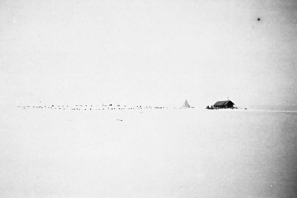
Framheim, Amundsen’s hut on the ice at the Bay of Whales, with the expedition’s dogs picketed in a line, 1911 (historic photograph).
Photograph: unknown photographer (National Library of Norway) · Framheim med alle hundene utenfor, 1911 (7675742662) · CC BY 2.0 · cropped
- Dress for the deck, not the cabin, and go out every time the engines slow.
- Keep a respectful distance from everything that was here before you, which is everything.
- Look at the wall for a long while before you photograph it. It is bigger than the picture.
- Bring home only what you brought, and leave the rest exactly where it was.
- Go a little further south than the ship. (Declined by the captain, politely and at once. Starred anyway, as the farthest south I have ever asked to go.)
The ice front. The seaward edge of the Ross Ice Shelf is a cliff of ice 15 to 50 metres high and more than 600 kilometres long, flat along the top, where the floating shelf meets the open Ross Sea. It was first named the Barrier because it barred the way south; for ships it still does. About nine-tenths of what you see from a deck is under the water, and the whole wall is moving out to sea at a pace of a metre or more a day, to be replaced from behind.
Tally, in the marginA wall that is sailing out to sea while standing perfectly still. I watched it closely for most of an hour and it did not budge, which I now think was the most impressive part.
Getting there
How to get there. Only by expedition ship, and only in high summer. Heritage Expeditions of New Zealand runs Ross Sea voyages from Bluff, in January and February, that include cruising along the ice front, which it describes as 30-metre cliffs. Aurora Expeditions runs Ross Sea voyages and, on the Douglas Mawson, a 34-day crossing from Dunedin to Ushuaia. Voyages run for about a month, and ice decides the itinerary: by Wikipedia’s account the 2023 record was made possible by an unusual lack of ice, and no voyage can count on a particular latitude.
When to go. January and February, the season in which operators sail the Ross Sea.
How to be there. Everything in Antarctica is protected. Follow the expedition staff’s rules on distances from wildlife and on what can be taken ashore and brought back.
Safety. The United States has Antarctica at Level 2, exercise increased caution, because of extreme and unpredictable weather and limited emergency services. There are no US consular services anywhere in the Antarctic region; the advisory recommends travelling with a professional operator, such as a member of the International Association of Antarctica Tour Operators, with insurance that covers evacuation.
Mark this place
Common questions
How big is the Ross Ice Shelf?
The Ross Ice Shelf in Antarctica is the largest ice shelf in the world. The Australian Antarctic Program gives it as half a million square kilometres and about 800 kilometres across, and NASA compares its area to France. Wikipedia’s account says it is several hundred metres thick, up to about 750 metres in places, with a seaward front more than 600 kilometres long.
Is the Ross Ice Shelf floating?
Yes. The Ross Ice Shelf is glacier ice floating on the southern Ross Sea. Wikipedia’s account says its front stands 15 to 50 metres above the water with about 90 per cent of the floating ice below the surface. Robert Falcon Scott concluded it was afloat during the Discovery Expedition of 1901–1904, and the Ross Ice Shelf Project drilled through it to the ocean in 1977.
Who discovered the Ross Ice Shelf?
The British naval officer James Clark Ross, commanding HMS Erebus and HMS Terror, came upon the Ross Ice Shelf on 28 January 1841 while seeking the South Magnetic Pole. It stopped his ships, and it was first called the Barrier, later the Great Ice Barrier. The name Ross Ice Shelf was adopted by the United States naming board in 1953.
What is the farthest south a ship has sailed?
The farthest south reached by ship is at the Bay of Whales, an inlet in the front of the Ross Ice Shelf in Antarctica. On 25 February 2026 the expedition ship Douglas Mawson reached 78° 44.405′ S there, reported by Australian Geographic as a record for any vessel; the previous marks, from 2001 to 2023, were all set at the same ice front.
What is the Bay of Whales?
The Bay of Whales is an inlet in the front of the Ross Ice Shelf in Antarctica, named by Ernest Shackleton on 24 January 1908. Roald Amundsen based his South Pole expedition there in 1911. Wikipedia’s account says the original bay was eliminated in 1987 when iceberg B-9 broke away, but the name is still used for the inlet where ships set farthest-south records.
Can tourists visit the Ross Ice Shelf?
Yes, by expedition ship. Operators including Heritage Expeditions, sailing from Bluff in New Zealand, and Aurora Expeditions run Ross Sea voyages in January and February that cruise along the front of the Ross Ice Shelf. The United States has Antarctica at Level 2 and recommends a professional operator and evacuation insurance.
How fast does the Ross Ice Shelf move?
Wikipedia’s account says the Ross Ice Shelf pushes out to sea at 1.5 to 3 metres a day, fed by glaciers from the land. It sheds its growth as icebergs: in March 2000 it calved B-15, the largest iceberg ever recorded. The block of the shelf carrying Amundsen’s old base, Framheim, broke away between 1957 and 1962.
Who owns the Ross Ice Shelf?
Most of the Ross Ice Shelf lies in the Ross Dependency, the sector of Antarctica New Zealand has claimed since 1923; the United States does not recognise the claim. Article IV of the Antarctic Treaty says nothing done while the treaty is in force can support or deny a territorial claim, and the treaty makes the continent, ice shelves included, a scientific preserve with military activity banned.