Region
The Poles
The far south and the far north: ice and open ocean, short seasons and long crossings.
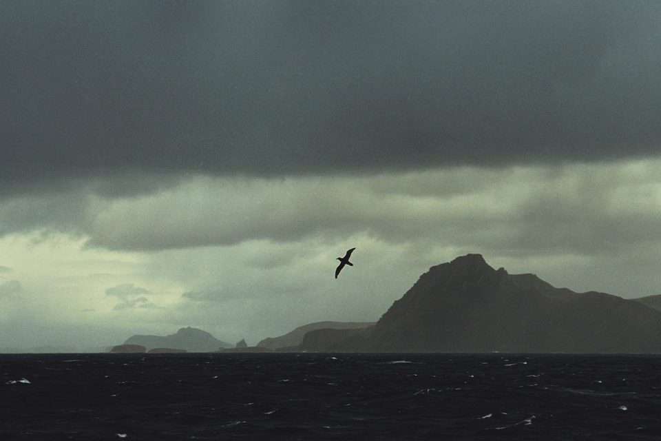
The Drake Passage. Photograph: Jerzy Strzelecki, Antarctica(js) 2, CC BY-SA 3.0, cropped
The polar places sit at both ends of the Earth, where seasons are short and crossings are long. In the south, ships cross the Drake Passage, 36 to 48 hours each way, to the Antarctic Peninsula, and visits fall between November and March. South Georgia has no airport and is reached by ship. The South Pole is reached by air: an expedition operator flies from Punta Arenas in Chile to an ice runway between November and January, then on to the pole. In the north are Greenland's icefjord and towns, an Icelandic island on the Arctic Circle, and the Arctic coasts and dunes of Canada and Alaska, where Tuktoyaktuk sits at the end of a road to the Arctic Ocean.
18 places in this region
 The Drake PassageSouthern Ocean
Two days of open water where the largest current on Earth meets no land at all, and the gap whose opening let Antarctica freeze.
 South GeorgiaSouth Georgia and the South Sandwich Islands
King penguin colonies that fill whole beaches, a rusting whaling station, and the grave where every passing ship still stops to raise a glass.
 Port LockroyPalmer Archipelago, Antarctic Peninsula
The world's most southerly post office, on an island the size of a football pitch, run by a core team of four among a gentoo colony of 445 breeding pairs.
 Scoresby SundSermersooq, East Greenland
The largest fjord system on Earth, with one town of about 330 people at its mouth, placed there in 1925 to strengthen a claim.
 Deception IslandSouth Shetland Islands, Antarctica
The best harbour in the South Shetlands is the flooded crater of an active volcano. Ships sail in through a gap in the cliffs, and the beach steams.
 The South PoleAntarctica
The pole stays put; the ice on top of it moves about ten metres a year. So every New Year's Day the station's people mark the pole again, with a marker made by hand over the winter.
 Ilulissat IcefjordAvannaata, West Greenland
The glacier behind Ilulissat's icebergs slowed and thickened from 2016 as the sea cooled, then sped up again from 2018 before the warm water came back. Its biggest icebergs still queue on a ridge at the fjord's mouth.
 Ross Ice ShelfRoss Sea, Antarctica
The largest ice shelf on Earth, a floating slab about the size of France, ends in a cliff more than 600 km long. Ships sail south until they meet it, and the record for the farthest south keeps moving.
 McMurdo Dry ValleysVictoria Land, Antarctica
Antarctica's largest ice-free region, where a glacier leaks brine sealed underneath it for perhaps two million years. It comes out clear and turns red in the air.
 Tuktoyaktuk and the PingosNorthwest Territories, Canada
An Inuvialuit hamlet on the Arctic Ocean at the end of a gravel highway across the tundra, opened in 2017. Nearby stand pingos, smooth green hills with a core of solid ice, among them Canada's tallest.
 GrímseyAkureyri municipality, Iceland
A treeless island off north Iceland, the only part of the country the Arctic Circle crosses. A grey concrete sphere marks the line, and it is moved to follow the circle as it drifts north.
 UummannaqAvannaata municipality, Greenland
A Greenlandic town of coloured houses on a rocky island, under a sheer mountain of about 1,170 m, named for its heart shape. No plane can land on the island, so the last leg is by helicopter.
 Point WildElephant Island, Antarctica
A spit of stones under a glacier on Elephant Island, where twenty-two of Shackleton's men lived under two upturned boats for four and a half months until a Chilean Navy tug came for them in August 1916.
 Pond InletNunavut, Canada
An Inuit hamlet of about 1,500 people on a gravel shore in Nunavut, facing the glaciers of Bylot Island across Eclipse Sound. Narwhals spend the summer in the sound, and the way in is by air through Iqaluit.
 Hvalsey ChurchKujalleq, Greenland
The best-preserved Norse ruin in Greenland, by UNESCO’s account: a roofless granite church on a fjord near Qaqortoq, where a wedding in September 1408 is the last written record of the Greenland Norse.
 Kobuk ValleyAlaska, United States
Bare golden dunes up to a hundred feet high, north of the Arctic Circle in Alaska, with spruce and tundra at their edge and caribou crossing them. No road goes in: a small plane lands on the sand.
 Lemaire ChannelGraham Coast, Antarctica
A strait 600 metres wide at its narrowest between ice-hung cliffs on the Antarctic Peninsula, usually as calm as a lake, sometimes blocked by icebergs, and threaded slowly by expedition ships heading south.
 Herschel Island (Qikiqtaruk)Yukon, Canada
An Arctic island off the Yukon coast where American whalers wintered in the 1890s. Its wooden buildings still stand at Pauline Cove, but the island has no bedrock, and its ice-rich ground is slumping into the Beaufort Sea.
About this hub
Nearby on the shelf
- The Antarctic & Southern Ocean (collection, 7)
- Deserts (collection, 20)
- The whole map
Know somewhere that belongs here?
Each place page names its sources and the date it was checked.
Photo credits for the thumbnails
- The Drake Passage: Photograph: Jerzy Strzelecki, Antarctica(js) 2, CC BY-SA 3.0, cropped
- South Georgia: Photograph: Hannes Grobe, CC BY 4.0, cropped
- Port Lockroy: Photograph: Liam Quinn from Canada, Gentoo Penguin nests surround the boathouse, CC BY-SA 2.0
- Scoresby Sund: Photograph: Rob Oo, Little boxes on the hillside, CC BY 2.0
- Deception Island: Photograph: Murray Foubister, Excursion No. 12. into the old caldera of Deception Island., CC BY-SA 2.0
- The South Pole: Photograph: Christopher Michel, CC BY 4.0
- Ilulissat Icefjord: Photograph: Christoph Strässler, Iceberg in the Ilulissat Icefjord, Greenland, CC BY-SA 2.0, cropped
- Ross Ice Shelf: Photograph: lin padgham, Ross Ice-Shelf, CC BY 2.0
- McMurdo Dry Valleys: Photograph: U.S. Department of State, Public domain
- Tuktoyaktuk and the Pingos: Photograph: Lorenz King, CC BY-SA 4.0, cropped
- Grímsey: Photograph: Steinninn, CC BY 4.0, cropped
- Uummannaq: Photograph: Algkalv, Uummannaq-mountain-southern-wall, CC BY-SA 3.0, cropped
- Point Wild: Photograph: Rob Oo, Imagine..., CC BY 2.0, cropped
- Pond Inlet: Photograph: Paul Gierszewski, CC BY-SA 4.0, cropped
- Hvalsey Church: Photograph: jtstewart, Hvalsey Church 2014 04, CC BY-SA 2.0, cropped
- Kobuk Valley: Photograph: NPS / Western Arctic National Parklands, The Southern Edge of the Dunes, CC BY 2.0
- Lemaire Channel: Photograph: Liam Quinn, Lemaire Channel 2, CC BY-SA 2.0, cropped
- Herschel Island (Qikiqtaruk): Photograph: Boris Radosavljevic, Permafrost in Herschel Island 016, CC BY 2.0, cropped