
Part of Patagonia
- Where
- Isla Grande de Tierra del Fuego
on the Beagle Channel - Coordinates
- 54.8019° S
68.3030° W - Founded
- 12 October 1884
(sub-prefecture, Augusto Lasserre) - The claim
- “Southernmost city in the world”
(Ushuaia’s tourism secretariat) - The rival
- Puerto Williams, Chile
a city since 2019 (INE) - Season
- October to April
(tourism secretariat) - Advisory
- Argentina Level 1
Paper stars and tinsel in the shop windows in the long summer light, and snow on the mountains straight behind the town. In front, a grey channel, and big ships waiting to go somewhere colder still. The trees on the hills all leaned the same way, as if listening. Everybody told me this was the end of the world. Across the water, somebody else’s lights were a little farther on.
The short answer
Ushuaia is the capital of Argentina’s province of Tierra del Fuego, Antarctica and South Atlantic Islands. It stands in a wide bay on the southern coast of Isla Grande de Tierra del Fuego, with the Martial range behind it and the Beagle Channel in front. Wikipedia gives its population as 89,606. It grew from an Anglican mission among the Yámana people, whose first missionary lived there in 1869, and on 12 October 1884 Commodore Augusto Lasserre established the Argentine sub-prefecture there. Its tourism secretariat and Argentina’s national government pages call it the southernmost city in the world, and its port is the busiest departure point for tourist voyages to the Antarctic Peninsula.
Why it's worth knowing
“End of the world” is Ushuaia’s brand, and it is worth reading the small print. The city’s own claim is the largest: Ushuaia’s tourism secretariat, and an educational page of Argentina’s space agency, describe it as the southernmost city on Earth.
Across the Beagle Channel, on Navarino Island, stands Puerto Williams, a Chilean naval town founded in 1953. It lies at about 54°56′ south to Ushuaia’s 54°48′, roughly 15 km farther south by this entry’s measurement from the two towns’ coordinates. For decades the answer to “which is the southernmost city?” turned on the word city. Puerto Williams had 1,868 people at Chile’s 2017 census, by Wikipedia’s account; Ushuaia has nearly fifty times that.
Then Chile changed its definition. In its 2019 classification of cities, towns, villages and hamlets, Chile’s National Statistics Institute (INE) added a political-administrative test: a settlement that is a provincial or regional capital counts as a city. Puerto Williams is the capital of the Chilean Antarctic Province, and the INE’s 2019 list names it a city. Ushuaia’s tourism secretariat still uses the title. Both towns can point to a document; they are measuring different things.
The field notes
A lighthouse with a borrowed name
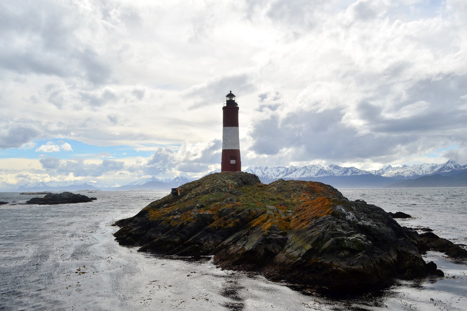
The lighthouse on every Ushuaia postcard is Les Eclaireurs, a brick tower painted red, white and red, standing on a rocky islet east of the city in the Beagle Channel. Wikipedia’s account gives it a height of 11 metres and a first lighting on 23 December 1920; it is automated, uninhabited and not open to the public, and the channel boat tours circle it.
It is often sold as the “Lighthouse at the End of the World”. Ushuaia’s own tourism secretariat says plainly that it is not: the lighthouse of Jules Verne’s novel of that name is on the Isla de los Estados, more than 200 kilometres away. The one in the photographs earned its fame, in the secretariat’s phrase, by its own light.
A railway built for a prison
Argentina settled Ushuaia partly by sending prisoners there. The building that now holds the Museo Marítimo y del Presidio was begun in 1902 and built by the prisoners themselves, according to Tierra del Fuego’s tourism board, as a prison for repeat offenders; its five wings radiate from a central rotunda. Wikipedia records earlier inmates from 1896, a separate military prison merged into it in 1910, and political prisoners among those held there.
The prisoners cut timber from the forests around the town and hauled it on a narrow-gauge railway. Wikipedia’s account says the prison closed in 1947, by order of President Juan Perón, after reports of abuse and unsafe conditions. The railway survives as a tourist line, the Tren del Fin del Mundo, which Wikipedia calls the southernmost railway in the world. This entry has not verified that superlative independently.
Where the road runs out
Argentina’s National Route 3 ends inside Tierra del Fuego National Park, west of the city, at Bahía Lapataia, where a sign marks the end of the road. Argentina’s national parks administration describes new walkways there, raised above the ground to protect the shell middens of the Yámana; the park’s archaeological sites, by the same administration’s account, reach back as far as 1,800 years. The Yámana lived by canoe along these channels for thousands of years before the mission arrived; Wikipedia records that epidemics of typhus, whooping cough and measles in the late nineteenth century greatly reduced them, and that the mission closed in 1911.
On the hills around the town, Wikipedia’s account notes, the southern beeches grow bent in the direction of the wind, and are called flag trees.
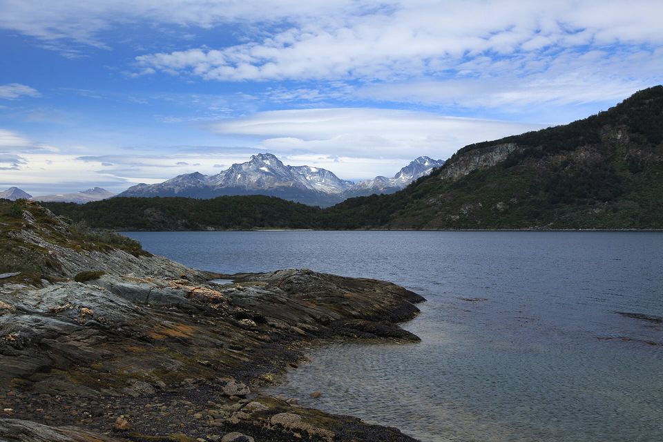
Lapataia Bay in Tierra del Fuego National Park, January 2011.
Photograph: Liam Quinn · Lapataia Bay, Tierra del Fuego National Park · CC BY-SA 2.0
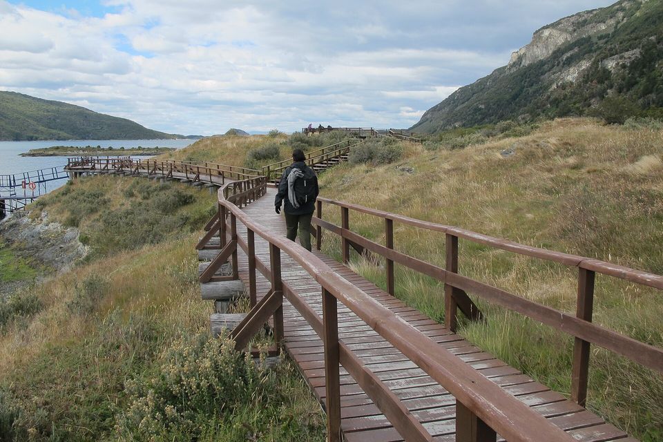
A boardwalk trail at Bahía Lapataia in Tierra del Fuego National Park, February 2012.
Photograph: K. Ø. Oftedal / NTNU Vitenskapsmuseet · Cultural heritage management, Lapataia · CC BY 2.0 · cropped
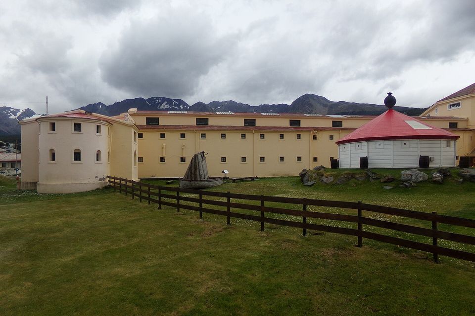
The former Ushuaia prison, now the Maritime Museum, February 2014.
Photograph: Gastón Cuello · CC BY-SA 4.0 · cropped
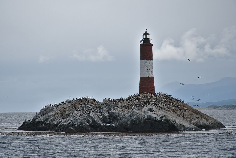
Cormorants crowd the rocks around Les Éclaireurs lighthouse, February 2019.
Photograph: mike from New York · Faro Les Éclaireurs · CC BY-SA 2.0
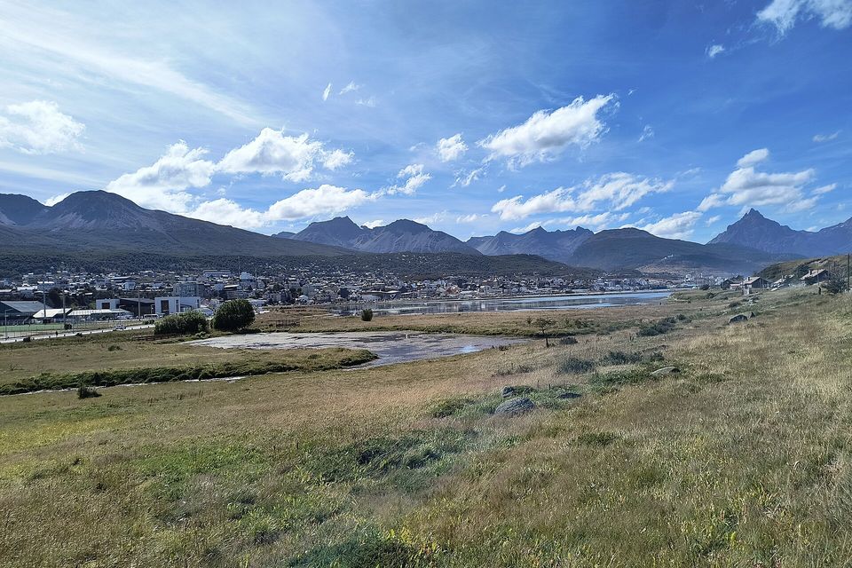
Ushuaia across the Bahía Encerrada reserve, with mountains close behind, February 2026.
Photograph: Vlasta x · CC BY-SA 4.0 · cropped
- Pack for every season before lunch, and keep the last one handy for the afternoon.
- Take the boat out along the channel on a calm morning, and wave at the lighthouse whatever anybody tells you about it.
- Visit the old prison, and give it the time it asks for, which is longer than you planned.
- Stay on the boardwalks at the end of the road, and remember whose shore it was first.
- Go no farther. (Saw lights across the water that evening. They are item six.)
Les Eclaireurs lighthouse. A small brick tower painted red, white and red on a bare islet in the Beagle Channel east of Ushuaia, lit since 1920, automated and closed to visitors, and circled every day by the channel boats. It is known to Argentines as the Lighthouse at the End of the World, a name that belongs to a different lighthouse, on the Isla de los Estados, the one in Jules Verne’s novel, more than 200 kilometres away. It carries the borrowed name and keeps its own light.
Tally, in the marginA lighthouse going about under a borrowed name and keeping its own light on regardless. I waved at it on the way out as a celebrity, and on the way back, having been told, as a colleague.
Getting there
How to get there. Ushuaia’s international airport has regular flights from Buenos Aires and El Calafate, and from Santiago in Chile. By road, National Route 3 crosses the Fuegian Andes to reach the city from the north. The Beagle Channel boat tours, which pass the sea-lion and bird islands and Les Eclaireurs lighthouse, leave daily from the port.
When to go. Ushuaia’s tourism secretariat gives its summer season as October to April, when January averages 9.6 °C and from November to March the days run to nearly eighteen hours of light; it warns that the weather is close to unpredictable within a single day. From June to October the city is a snow resort instead. Tierra del Fuego National Park opens 8:00 to 21:00 from December to February and shorter hours at other seasons, according to Argentina’s national parks administration.
Antarctica. The tourism secretariat describes Ushuaia as the gateway for most Antarctic tourism (90 per cent on one of its pages, 95 on another), with a season running from October or November to March or April and classic voyages of ten to twelve days. Those voyages are sold by the expedition operators, often well in advance; this entry does not cover them.
Safety. The State Department has Argentina at Level 1, exercise normal precautions; its only area note concerns Rosario, far to the north. The advisory also carries a Centers for Disease Control Level 1 travellers’ health notice for Andes virus (hantavirus) in the region, and says the risk for most travellers is extremely low.
Mark this place
Common questions
Is Ushuaia the southernmost city in the world?
Ushuaia calls itself the southernmost city in the world, and its tourism secretariat uses the title. Chile’s Puerto Williams, across the Beagle Channel on Navarino Island, lies about 15 km farther south, and Chile’s National Statistics Institute has classified it as a city since 2019 because it is a provincial capital. Which town holds the title depends on how a city is defined.
Where is Ushuaia?
Ushuaia is on the southern coast of Isla Grande de Tierra del Fuego, at the southern tip of South America, facing the Beagle Channel with the Martial range behind it. It is the capital of Argentina’s province of Tierra del Fuego, Antarctica and South Atlantic Islands, at about 54.8° south.
Is the lighthouse at Ushuaia the Lighthouse at the End of the World?
No. The red-and-white Les Eclaireurs lighthouse in the Beagle Channel near Ushuaia, first lit in 1920, is often called that, but Ushuaia’s tourism secretariat notes that the lighthouse of Jules Verne’s novel is on the Isla de los Estados, more than 200 km away.
What is the End of the World Train in Ushuaia?
The Tren del Fin del Mundo is a tourist railway running west from Ushuaia into Tierra del Fuego National Park. It follows the line of a narrow-gauge railway that served the Ushuaia prison, which operated until 1947, and carried the timber prisoners cut from the forests around the town.
When is the best time to visit Ushuaia?
Ushuaia’s tourism secretariat gives its summer season as October to April, when January averages 9.6 °C and the days from November to March bring nearly eighteen hours of light. The weather can change several times in one day in any season. From June to October Ushuaia operates as a winter sports destination.
Can you go to Antarctica from Ushuaia?
Yes. Ushuaia is the main departure port for tourist voyages to the Antarctic Peninsula; its tourism secretariat puts its share of Antarctic tourism at 90 per cent on one page and 95 per cent on another. The season runs roughly from October or November to March or April, and a classic voyage from Ushuaia lasts ten to twelve days.
Where does Argentina’s Route 3 end?
Argentina’s National Route 3 ends at Bahía Lapataia in Tierra del Fuego National Park, west of Ushuaia, where a sign marks the end of the road. Raised walkways there, built by Argentina’s national parks administration, protect the shell middens left by the Yámana people.
Who lived in Ushuaia before the city was founded?
The Yámana people lived along the Beagle Channel for thousands of years before Europeans arrived, travelling by canoe. The name Ushuaia comes from their language. A British missionary lived among them in 1869, an Anglican mission followed, and Argentina established its sub-prefecture there on 12 October 1884; epidemics in the following decades greatly reduced the Yámana.