The short answer
Voyageurs National Park lies on the Canadian border in far northern Minnesota, near International Falls. It covers about 218,000 acres, almost 40 per cent of it water: big lakes, among them Rainy Lake and Kabetogama Lake, wrapped around the Kabetogama Peninsula and its islands. It is named for the French-Canadian voyageurs whose fur-trade canoe route passed through here. Three visitor centres, at Rainy Lake, Kabetogama Lake and Ash River, sit at the water’s edge; beyond them, most of the park is reached by boat in summer and over the ice in winter.
From Tally’s diary
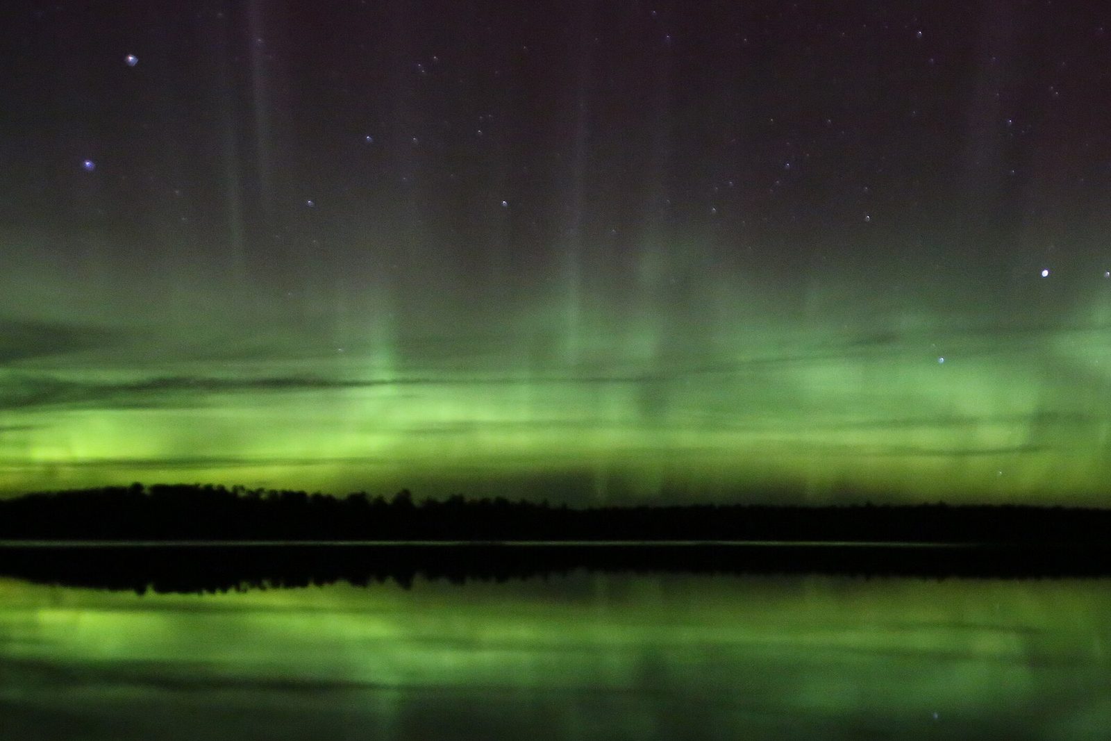
The lake was so big and so still that the islands seemed to be floating on it, dark with pines, and the rocks at the edge were grey and pink and very old-looking, as if they had been waiting a long time for somebody to sit on them. I obliged. Late that night the sky went green at the top and shivered. I did too.
Why it's worth knowing
Rocks from the birth of a continent. Voyageurs sits on the southern edge of the ancient volcanic bedrock at the core of North America, one of the few places on the continent where anyone can touch rocks half the age of the Earth. Explosive volcanoes once laid down layer after layer of ash and lava, and heat and pressure turned it to new rock. Erosion wore the mountains down, and the ice ages scraped away the younger layers to expose their roots of granite, migmatite and schist. As the glaciers drew back, meltwater filled the low places and made the lakes and bogs. In the 1890s, gold was found in quartz veins in the park’s oldest rock, 2.8-billion-year-old greenstone, and a short-lived boomtown sprang up; many of the newcomers stayed, and their descendants still live in the area.
The voyageurs’ highway. As Europe’s demand for beaver hats grew and the furs in the east ran out, trade goods had to travel much further. The voyageurs carried them west from Grand Portage as soon as the lakes thawed, bound for the Lake Athabasca country far to the north-west, and their route ran straight through what is now the park. They paddled North Canoes with a crew of four to six: a guide in the bow, paddlers in the middle and a steersman in the stern. On the way they bought wild rice and smoked fish from the Ojibwe, and the bales they hauled over the portages held fur or trade goods.
Lights over the lakes. Voyageurs is an International Dark Sky Park. On a clear night the Milky Way spreads over the water, and when the conditions are right the northern lights can show over the park too. More than 50 kinds of mammal live here, among them wolves, bears, beavers and moose, and wolves, bears, deer and moose are all strong swimmers, sometimes seen crossing from one island to the next in the middle of the day.
The field notes
Four barrels of whiskey
The Kettle Falls Hotel, on the border at the eastern tip of the Kabetogama Peninsula, has been putting up travellers since 1913. It was built by a timber cruiser, Ed Rose, reputedly with money from Nellie Bly, and in 1918 Robert Williams bought it for $1,000 and four barrels of whiskey. Its first guests were the stonecutters building the dams at Kettle Falls, then lumberjacks, trappers and fishermen; in the 1930s it advertised itself as a “Hay Fever Victims Sanctuary” with “not a sneeze on the border.” The Park Service restored it in 1987. It is the only lodging inside the park, and it is reached only by water.
A garden on a rock
On a rocky outcrop on the north shore of Kabetogama Lake, Jack Ellsworth, a Chicago carpenter and self-taught artist, spent about twenty years building a garden. He made 62 terraced flower beds, planted them with more than 13,000 lilies and topped the dry-stone walls with crushed white quartz like frosting. Then he dotted the slope with more than 200 abstract sculptures of rock and concrete, which have been compared with the work of Brancusi and Noguchi. The Ellsworth Rock Gardens have been called the “Showplace of Lake Kabetogama” since the 1940s, and are now the park’s most popular place to spend a day, about five miles by boat from the Kabetogama Lake Visitor Center.
Ten thousand years of people
People first came here nearly 10,000 years ago, as glacial Lake Agassiz, which once covered 110,000 square miles of what is now Minnesota, North Dakota and three Canadian provinces, drained away. They hunted, gathered and fished, and later harvested the wild rice that grows here. Over 220 archaeological sites from before European contact have been found in the park, and Native people speared sturgeon at Kettle Falls long before the hotel was built.

July 2020Saginaw Bay from its rocky shore.
Photograph: NPS, Public domain, cropped
- Paddle round one island. (Paddled round it twice. It was a different island the second time, or I was.)
- Find the garden where somebody piled up stones into people. (Found it. Shook hands with three. They were very stiff about it.)
- Stay up for the green lights. (Stayed up. They came. I forgot entirely to write anything down.)
- Listen across the water for a long, lonely howl. (One came in the grey before breakfast. I felt honoured, and also went indoors.)
- Carry something heavy across a portage, the old way. (Carried my list. It is heavier than it looks.)
A relic from Voyageurs National Park
Relic, entry 351Four feet wide, about 300 poundsBuilt by the Ojibwe of birch bark
A North Canoe, the canot du nord. The voyageurs bought them from the Ojibwe, who built them of birch bark over a cedar frame, sewn together with watap, which is split spruce root, and sealed with spruce resin. The whole boat was four feet wide and weighed around 300 pounds, yet it could carry up to 3,500 pounds, 25 to 30 bales of goods, on a skin of bark.
Tally, in the marginA long, slim boat of bark and roots and pine gum, and I could not see how it had carried anybody across all that water, until I tried to imagine doing it in anything heavier. I bowed to it on my way past, the way one does to a hard worker.
Getting there
- 1
From Minneapolis-St. Paul
Interstate 35 and Highway 53 lead north, about five hours.
- 2
By air
Falls International Airport is at International Falls.
- 3
By boat
Kettle Falls is 13 miles by water from Ash River.
- ✓
How to get there. Voyageurs is about five hours north of Minneapolis-St. Paul by Interstate 35 and Highway 53, three hours north of Duluth and four hours south of Winnipeg. Falls International Airport, at International Falls, has taxis and rental cars; most flights connect through Minneapolis-St. Paul. There is no bus or train. The Rainy Lake, Kabetogama Lake and Ash River visitor centres all have public boat ramps, and guides and water taxis operate from the gateway towns. By boat, Kettle Falls is 13 miles from the Ash River Visitor Center and 34 miles from Rainy Lake.
When to go. In summer the park is a boating park; in winter the lakes freeze and the park publishes a winter trails and frozen-lakes report.
Safety. The State Department’s travel advisories cover other countries, so none applies here. The park’s conditions page carries current alerts and the ice report.
Mark this place
The passport stamp for this place.
Common questions
Do you need a boat to visit Voyageurs National Park?
For most of it, yes. Almost 40 per cent of Voyageurs National Park in Minnesota is water, and much of the park, including the Kabetogama Peninsula and the Kettle Falls Hotel, is reached only by boat in summer.
Who were the voyageurs?
French-Canadian canoemen of the fur trade. Their route from Grand Portage to the Lake Athabasca country ran through what is now Voyageurs National Park, in birchbark North Canoes about 25 feet long.
How old are the rocks at Voyageurs National Park?
Some are about half the age of the Earth. The oldest rock in Voyageurs National Park is greenstone about 2.8 billion years old, part of the ancient bedrock at the core of North America.
Can you see the northern lights at Voyageurs National Park?
Sometimes, yes. Voyageurs National Park in northern Minnesota is an International Dark Sky Park, and the northern lights can be seen there when conditions are right.
What is the Kettle Falls Hotel?
The only lodging inside Voyageurs National Park. Built in 1913 and reached only by water, it was bought in 1918 for $1,000 and four barrels of whiskey and restored by the National Park Service in 1987.
What are the Ellsworth Rock Gardens?
A terraced garden of 62 flower beds and over 200 rock sculptures. Jack Ellsworth built it over about twenty years on the north shore of Kabetogama Lake, now in Voyageurs National Park.
How do you get to Voyageurs National Park?
By road to its edge, then by boat. Voyageurs National Park is about five hours north of Minneapolis-St. Paul; Falls International Airport at International Falls is the nearest, and three visitor centres have boat ramps.
Photographs on this page
Tap a photograph to see it full size.


