The short answer
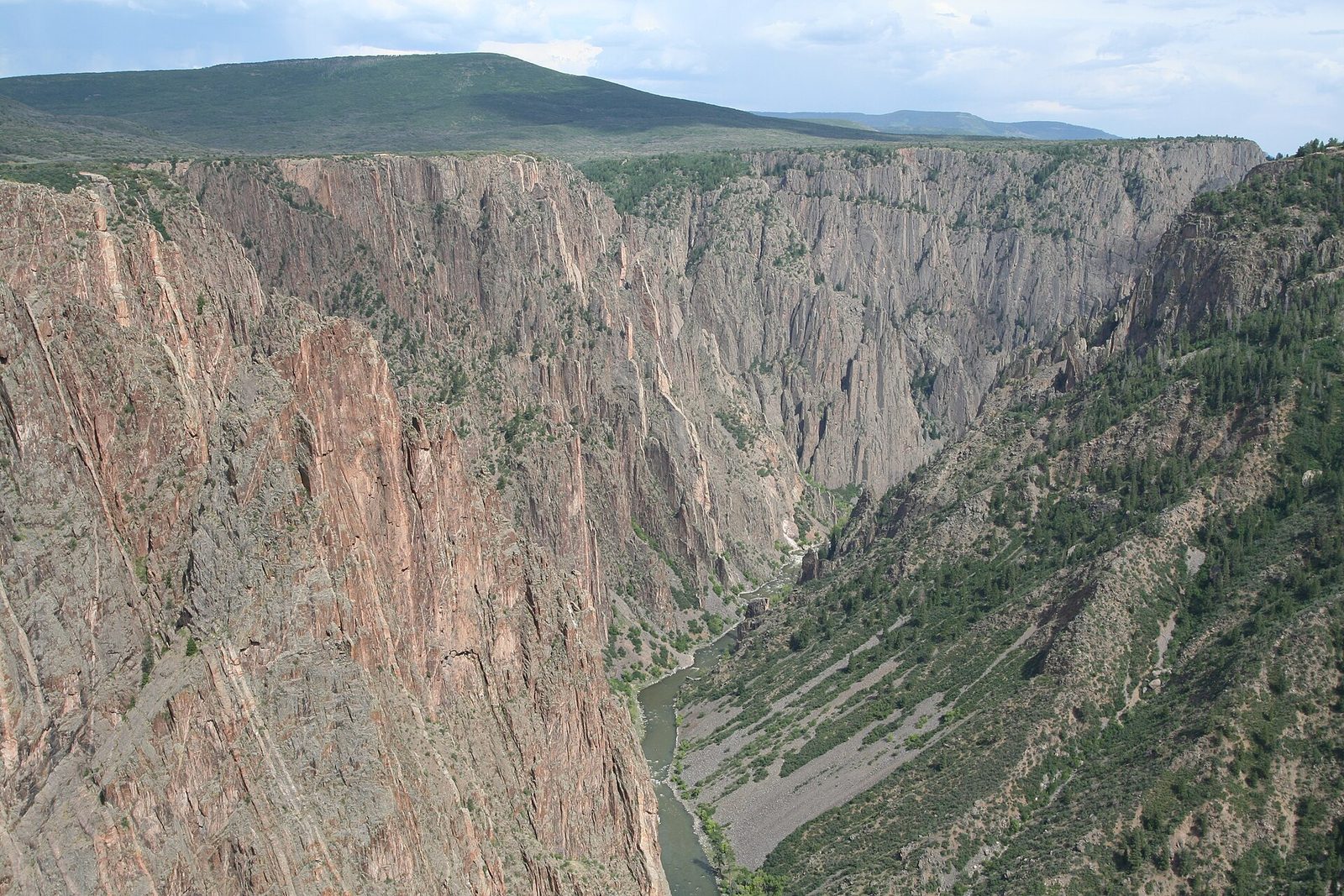
Black Canyon of the Gunnison National Park protects a particularly steep, deep and narrow stretch of a gorge cut by the Gunnison River on the western slope of the Rocky Mountains, about 14 miles north-east of Montrose, Colorado. At its deepest, just north of Warner Point, the canyon is 2,722 feet deep. The canyon divides the park in two: a busier South Rim, with a paved drive and a visitor centre open all year, and a quieter North Rim reached by gravel road.
From Tally’s diary
I lay on my front at the rim and looked over, and the dark walls went down and down into the shade until the river was only a thread with a voice. Across the gap, close enough to shout at, the other side looked back. It took me most of the next day to drive round to it. I shouted first anyway, to be polite.
Why it's worth knowing
Deep, steep and narrow. At Chasm View the river drops 240 feet in a single mile, the steepest fall anywhere along the canyon. The Painted Wall would stand over the Empire State Building with plenty of cliff to spare. Only the canyon rims, never the inner canyon, show any sign that people ever lived here.
How a river got trapped. About 60 million years ago a small block of land rose and lifted 1.8-billion-year-old metamorphic rock high into the air. About 30 million years ago volcanoes erupted on either side and buried it. Then, as early as two million years ago, the Gunnison River came through in force, stripped away the soft volcanic rock and hit the hard rock beneath. Trapped in its own canyon, it had no choice but to keep cutting down, at about an inch every hundred years.
A night sky to match. Black Canyon became an International Dark Sky Park in 2015. Darkness is measured on a scale where higher is darker: parks need an average of 21.2 to qualify, Black Canyon’s readings have averaged 21.5, and a big city like Denver reads about 18. By day the canyon is home to 59 kinds of mammal and 174 of bird, and parts of the walls close to climbers each spring and summer while raptors nest.
The field notes
A tunnel through the wall
Farmers in the Uncompahgre Valley, to the west, needed water, and the Gunnison had plenty, at the bottom of a canyon. From 1905 to 1909 workers drove a tunnel 5.8 miles long from East Portal, through the cliffs and under the ground, to the valley side. It was hard, dangerous work in toxic gases, heat and seeping water, and twenty-six workers were killed. The crews digging from each end met in the middle in July 1909, and on 23 September President William Taft pressed a button at West Portal and the water flowed. The tunnel still carries irrigation water to the valley’s farms, usually from April to October.
Air mattresses down the river
The canyon had never been explored when, in 1900, a party set out to scout a tunnel site in wooden boats. Near the stretch now called the Narrows they gave up and climbed out to the rim. The next year the hydrologist Abraham Lincoln Fellows and William Torrence, who had been on the first trip, tried again, nine days in the canyon with rubber air mattresses and waterproof bags. Their surveys, and later ones, showed the tunnel could be built.
A town at the bottom
A road was blasted down the cliffs to East Portal in 1904, with grades as steep as 32 per cent, and three 11,600-pound boilers for the power plant were lowered down it. By 1906 a town stood on the lower slopes: tents at first, then cabins, a dining hall, bunkhouses for men working three shifts around the clock, a hospital, post office, library, billiard hall and school. It never held more than 250 people, and when the tunnel was done most of it was taken down.
Older neighbours
The known sites around the canyon suggest people have used it for 9,000 years. Five federally recognized tribes and one tribal community have cultural ties to the land in and around the park. They are the Ute Indian Tribe of the Uintah and Ouray Reservation, the Ute Mountain Ute Tribe, the Southern Ute Indian Tribe, the White Mesa Ute Community, Jemez Pueblo and the Absentee-Shawnee Tribe of Indians of Oklahoma.

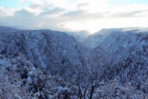
November 2024Snow on the canyon rim in low winter light.
Photograph: NPS, Public domain

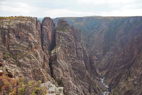
September 2020Autumn colour on the rim above the narrow canyon and the river.
Photograph: NPS, Public domain
- Throw a hello across to the far rim. (It came back a moment later, slightly smaller. I took that as a yes.)
- Count the pink stripes on the big wall. (Lost count at the first crack. Began again. The wall has more patience than I do.)
- A big bird rode the air below my boots, which is an odd way round to watch a bird. I kept quite still and let it.
- Wait for dark and find the stars. (Found them all at once, which was rather a lot to take in. I sat down.)
- Whisper something to the river. (It did not answer. It was busy, and had been for a long time.)
A relic from Black Canyon of the Gunnison National Park
Relic, entry 333Crystals up to 6 feet longPink from potassium feldspar
A pink stripe of pegmatite on the Painted Wall. The bands that streak the wall are granite with enormous crystals of quartz, feldspar and mica, some up to 6 feet long. They began as molten rock so rich in water that it squeezed into cracks in the older rock like toothpaste from a tube, and cooled slowly enough to grow giants; potassium feldspar turned them pink. Pegmatite wears away more slowly than the dark gneiss and schist around it, so the stripes stand out boldly on the cliff.
Tally, in the marginA pink stripe across a dark wall, which from far off I took for a painted road and planned to walk along. Close to, it was crystal, grown slowly in the dark over more time than I can picture. I put the road plan away and just admired it.
Getting there
- 1
To the South Rim
Colorado Highway 347 runs 7 miles north from US Highway 50, east of Montrose.
- 2
To the North Rim
The North Rim is 11 miles south-west of Crawford; the last 7 miles are unpaved.
- 3
Down to the river
East Portal Road is the only road down to the river.
- ✓
How to get there. The South Rim is 7 miles north on Colorado Highway 347 from US Highway 50, east of Montrose: 14 miles north-east of Montrose, 63 miles north-west of Gunnison, 75 miles south-east of Grand Junction and 264 miles south-west of Denver. Buses and planes serve Montrose, Gunnison and Grand Junction; there is no public transport in the park. The North Rim is 11 miles south-west of Crawford, off Colorado Highway 92, and the last 7 miles are unpaved. There is no bridge across the canyon, so getting from one rim to the other takes 2 to 3 hours of driving. East Portal Road, the only road down to the river, leaves the South Rim and is steep, with limits on vehicle size. All the water on both rims is trucked in.
When to go. The South Rim Road is usually open to cars from late April to mid-November; in winter it stays open as far as the visitor centre at Gunnison Point. The North Rim road typically closes in mid-November and reopens in May. The rim sits at about 8,000 feet and the river at about 6,000. In winter, mapping apps may refuse to route to the South Rim Visitor Center, which stays open; the South Rim entrance station works as a destination instead.
What to arrange ahead. Every trip into the inner canyon, a designated wilderness, needs a permit. As of 13 November 2026, day and overnight trips on the South Rim wilderness routes between May 1 and October 31 must be reserved on Recreation.gov.
Safety. The State Department’s travel advisories cover other countries, so none applies here. The park’s current conditions page lists road, trail and route status, including closures since the 2025 South Rim Fire.
Mark this place
The passport stamp for this place.
Common questions
How deep is the Black Canyon of the Gunnison?
At its deepest, 2,722 feet. The Black Canyon of the Gunnison reaches that depth just north of Warner Point, and at the Narrows it is only 40 feet wide at the river.
What is the Painted Wall?
The highest cliff in Colorado. The Painted Wall in Black Canyon of the Gunnison National Park stands 2,250 feet from river to rim, striped with pink bands of pegmatite, a granite-like rock with huge crystals.
Can you drive from the South Rim to the North Rim?
Yes, but it takes a while. There is no bridge across the Black Canyon of the Gunnison, so the drive between the rims, on roads outside the park, takes 2 to 3 hours, and the North Rim road is closed to cars in winter.
How old are the rocks in the Black Canyon?
Nearly two billion years old. The Gunnison River has cut down through Precambrian rock in Black Canyon of the Gunnison National Park, one of the best examples of such ancient basement rock in the world.
How did the Black Canyon form?
Slowly, and in a trap. In Black Canyon of the Gunnison National Park the Gunnison River cut through soft volcanic rock into hard ancient rock and, unable to change course, kept cutting down at about an inch every hundred years.
Is Black Canyon of the Gunnison a dark sky park?
Yes, since 2015. Black Canyon of the Gunnison National Park is an International Dark Sky Park, with sky readings that have averaged 21.5, much darker than a big city like Denver.
What is the Gunnison Tunnel?
A 5.8-mile irrigation tunnel through the canyon wall. Workers built it from East Portal in Black Canyon of the Gunnison between 1905 and 1909, and it still carries river water to the farms of the Uncompahgre Valley.
When is the South Rim open?
All year, with a shorter drive in winter. In Black Canyon of the Gunnison National Park the South Rim Road is usually open from late April to mid-November, and in winter cars can still reach the visitor centre.
Photographs on this page
Tap a photograph to see it full size.
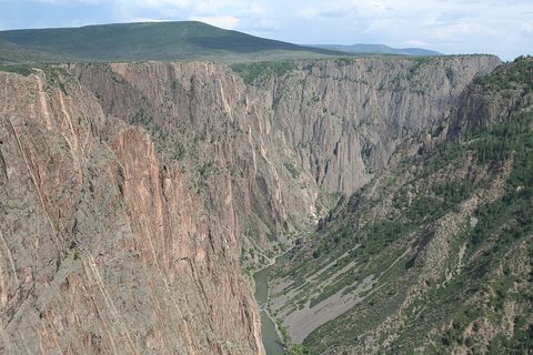
Photograph: Massimo Catarinella, BlackCanyonoftheGunnisonNationalPark, CC BY-SA 3.0, cropped
Photograph: NPS, Public domain
Photograph: NPS, Public domain


