The short answer
Hawaiʻi Volcanoes National Park lies on the south-eastern side of the Island of Hawaiʻi, about 30 miles south-west of Hilo. It protects two active volcanoes, Kīlauea and Mauna Loa, and the land between them and the sea: lava fields old and new, rainforest, desert, lava tubes, coastal cliffs and sacred places. The Kahuku Unit, on Mauna Loa’s southern slopes, adds old ranch land and forest. It was created in 1916 as Hawaii National Park. Fifty-four threatened or endangered plants and animals find refuge inside it.
From Tally’s diary
The ground under my feet was black and crinkled like the skin on hot milk, and in places it was still faintly warm, which I found hard to forgive. A grey-brown goose walked across the road in front of me as if it owned it, which, it turned out, it more or less does. I waited. It did not hurry. Neither, after that, did I.
Inside the park
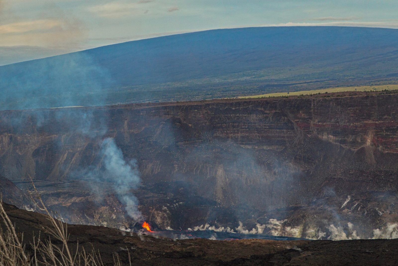
- Kīlauea
The summit crater that filled with a lake and then boiled it dry in a single night.
Photograph: Janice Wei, NPS via Flickr, Public domain (PD-USGov, US National Park Service)

Why it's worth knowing
An island still being built. The eight main Hawaiian Islands are only the newest end of a chain of more than 80 volcanoes stretching thousands of miles to the north-west, all made by the Hawaiian hot spot, a stationary plume of very hot material deep in the earth. The younger the volcano, the further south-east it sits. The Island of Hawaiʻi is made of five of them, and the two inside the park are by far the most active. Mauna Loa’s flows are huge and travel far: about 90 per cent of its surface has been covered by lava in the last 4,000 years, and in 1984 a flow from its north-east rift headed toward the city of Hilo.
Rivers of fire underground. When a big lava river crusts over at the edges and then the top, the molten core keeps flowing beneath the crust, insulated and hotter than 2,000°F, sometimes for miles. When the eruption stops, the lava drains away and leaves an empty tunnel. The island is criss-crossed with these lava tubes, and the Kazumura tube, in a 500-year-old flow from Kīlauea, is more than 40 miles long, thought to be the longest lava tube cave in the world. In their darkness live crickets, spiders and microbes found nowhere else.
A goose that came back. At least seven kinds of goose once lived in Hawaiʻi, most of them flightless, and all but one died out. The survivor, the nēnē, Hawaiʻi’s state bird, walks more than it swims, with short wings, long legs and little webbing between its toes. Perhaps 25,000 lived on the islands in 1778; by the mid-1940s only about 50 were left, killed off by mongooses, cats, dogs, grazing animals, hunters and lost land. The park began breeding and releasing nēnē in the 1970s, and its biologists still band their legs to follow each bird.
The field notes
Twenty-three thousand pictures in the rock
On the southern flank of Kīlauea, on lava that flowed between about 1200 and 1450, lies Puʻuloa, “long hill” or “hill of long life”, a place sacred to the people of Hawaiʻi and to those of Kalapana in particular. Over 23,000 images are pecked into its smooth pāhoehoe lava: circles, canoe sails, feathered capes, human figures and, above all, small cup-shaped holes, which make up 84 per cent of them. In 1823 the missionary William Ellis wrote that a ring with a dot at its centre marked a party who had travelled round the island, the rings counting how many had gone.
A guest book that watches a volcano
There has been an inn on the rim of Kīlauea’s summit, in one form or another, since 1846. The first was a thatched shelter built “in the native style” by Benjamin Pitman, with a dirt floor, a fireplace and lodging at “a dollar a head per night, food extra”. Its drinking water came from an old canoe hung under the eaves, and was said to be so foul that even the horses refused it. Better inns followed from 1866. The Volcano House guest book began in Pitman’s day, and the eruptions its visitors wrote down are now among the oldest records of what happened in the caldera. Its volumes are still in use.
The largest land division
Kahuku, on the southern slopes of Mauna Loa, was the largest of Hawaiʻi’s 1,300 ahupuaʻa, the traditional land divisions that ran from mountain to sea. Lava has buried many of its old sites, but petroglyphs, trails, rock cairns and ranching sites remain. Before Western contact, the coastal village of Waioʻahukini was home to the war chief Kalaniʻōpuʻu, and it was there that his nephew, the young Kamehameha, later Kamehameha the Great, learned the skills of combat.

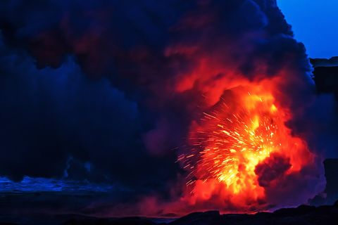
January 2017Lava meeting the sea at dusk.
Photograph: NPS, Public domain

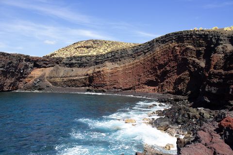
November 2021Banded sea cliffs at Pōhue.
Photograph: NPS / J. Ferracane, Public domain

February 2021A lenticular cloud over Mauna Loa.
Photograph: NPS / J. Wei, Public domain
- Walk on the newest ground I have ever stood on. (Walked on it very gently, as one does with something brand new.)
- Go through a tunnel the fire made. (Went through. It was cool and dark and dripping, which was not at all what I expected of fire.)
- Let a goose cross first. (Let three. They each looked at me as if I should have let four.)
- I wrote my name in the old book at the inn and then, not knowing what else to say, wrote that the mountain had been very kind to me that day.
- Find a picture in the rock that I could understand. (Found a circle with a dot. Decided it meant somebody had been here before me. That seemed right.)
A relic from Hawaiʻi Volcanoes National Park
Relic, entry 354Begun in Pitman’s dayKept by guests, not scientists
The Volcano House register. The inn’s guest book was begun in the days of Benjamin Pitman’s thatched shelter on the rim of Kīlauea, and visitors have been writing in it ever since. They wrote down their names, and then, being on the edge of a volcano, what the volcano was doing: fountains, glowing lakes, a quiet night. Together the early volumes became some of the oldest written records of eruptions in the caldera, kept not by scientists but by guests, and the book is still being written in.
Tally, in the marginAn old book of names, I thought, until I saw that half the entries said what the volcano was up to, as if the guests had been asked to keep an eye on it. I added a line of my own, in case it was keeping an eye on me.
Getting there
- 1
From Hilo
Highway 11 runs 30 miles south-west, about 45 minutes.
- 2
From Kailua-Kona
Highway 11 runs 95 miles south-east, two to two and a half hours.
- 3
By bus
The Hele-On county bus stops by Volcano House.
- ✓
How to get there. The park is 30 miles south-west of Hilo on Highway 11, about a 45-minute drive; from Kailua-Kona it is 95 miles south-east on Highway 11, about two to two and a half hours. Hilo International Airport has inter-island flights, and Ellison Onizuka Kona International Airport has flights across the Pacific as well. Rental cars from both airports are the usual way in. The Hele-On county bus stops by Volcano House and the Kīlauea Visitor Center, but there is no public transport or shuttle inside the park, and rideshare drivers are scarce. The park charges an entrance fee.
When to go. The park is open all year. The island’s weather is unpredictable, and parking at popular spots can be full by 10 a.m.
Safety. The State Department’s travel advisories cover other countries, so none applies here. Eruptions, volcanic gas and closures change from day to day; the park’s current-conditions page and the USGS Hawaiian Volcano Observatory carry the latest.
Mark this place
The passport stamp for this place.
Common questions
What is the largest active volcano in the world?
Mauna Loa, in Hawaiʻi Volcanoes National Park. It stands 13,681 feet above sea level, rises about 30,000 feet from the sea floor and makes up about half of the Island of Hawaiʻi.
How many volcanoes are in Hawaiʻi Volcanoes National Park?
Two, both active. Hawaiʻi Volcanoes National Park protects Kīlauea and Mauna Loa, the most active of the five volcanoes that make up the Island of Hawaiʻi.
How far is Hawaiʻi Volcanoes National Park from Hilo?
About 30 miles, a 45-minute drive. Hawaiʻi Volcanoes National Park is south-west of Hilo on Highway 11; from Kailua-Kona it is 95 miles, two to two and a half hours.
What is Puʻuloa?
A sacred place full of petroglyphs. Puʻuloa, on the southern flank of Kīlauea in Hawaiʻi Volcanoes National Park, has over 23,000 images pecked into the lava, most of them small cup-shaped holes.
What is a lava tube?
A tunnel left by flowing lava. In Hawaiʻi Volcanoes National Park and across the island, lava that crusts over keeps flowing underneath, and when it drains it leaves a cave; the Kazumura tube is more than 40 miles long.
What is a nēnē?
The Hawaiian goose, Hawaiʻi’s state bird. About 50 nēnē were left by the mid-1940s; Hawaiʻi Volcanoes National Park has bred and released them since the 1970s, and they remain threatened.
When was Hawaiʻi Volcanoes National Park established?
In 1916, as Hawaii National Park. In 1918 the summit of Mauna Loa, 5,700 acres, became part of the park.
Photographs on this page
Tap a photograph to see it full size.
Photograph: NPS / Pono Christianson, Public domain, cropped
Photograph: NPS, Public domain
Photograph: NPS / J. Ferracane, Public domain
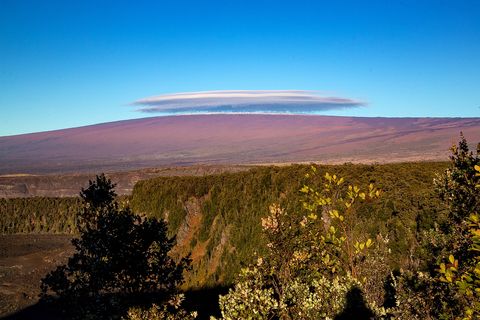
Photograph: NPS / J. Wei, Public domain


