The short answer
Redwood National and State Parks are four parks run as one: Redwood National Park, created in 1968, and three older California state parks around it, Prairie Creek, Del Norte Coast and Jedediah Smith Redwoods. They stretch about 50 miles along the northern California coast, from Crescent City near the Oregon border to the Redwood Creek watershed south of Orick, and take in prairies, oak woodland, rivers, 40 miles of rugged coastline and some 39,000 acres of old-growth forest. The tallest known tree, a coast redwood in the Redwood Creek watershed, stands 379 feet. There are no entrance stations, so it is entirely possible to drive through without realising the forest outside the window holds the tallest trees in the world.
From Tally’s diary
It was dark at noon in there, and green, and very quiet, the sort of quiet that makes you lower your voice without being asked. I tipped my head back to find the tops and kept tipping until I sat down on the path, and still did not find them. Something yellow and slow crossed my boot. I let it go first.
Why it's worth knowing
Taller than anything. Coast redwoods are the world’s tallest trees; their Sierra Nevada cousins, the giant sequoias, are bigger by volume but shorter. A redwood here is often more than 300 feet tall and 16 to 20 feet across, and from the forest floor only about a third of an old one can be seen. Several things help them grow so tall: shelter from the wind among their neighbours, thick bark against fire, tannin-rich bark that turns away insects and decay, and burls that sprout new growth after damage. Some live 2,000 years, though 500 to 700 is more usual; the oldest trees in the world are bristlecone pines, at some 5,000.
What was saved. Ninety-six per cent of the original old-growth coast redwoods have been logged. California began protecting groves as state parks in the 1920s, and the federal government followed in the 1960s. The national park began in 1968 with 56,201 acres, grew to 106,000 acres in 1978, and in 2005 the Mill Creek watershed added another 25,000. Together the parks now protect 45 per cent of the old-growth redwood forest that remains in California, and they are a World Heritage Site.
The condors come home. In 1982 only 22 California condors were left in the world. It had been more than a century since a condor flew over the redwoods when, in March 2022, the first birds of a new population arrived at a release site in Redwood National Park. The Yurok Tribe, in whose ancestral territory they now fly, made bringing back the condor, prey-go-neesh, a top priority in 2003 and is a full partner in the work, alongside the Park Service, the US Fish and Wildlife Service and many others.
The field notes
The tree nobody is meant to find
Since its “discovery” in 2006, a redwood named Hyperion has been on many tree-lovers’ wish lists, and the Park Service would much rather people left it alone. It stands off trail in dense vegetation, and visitors bushwhacking to it have trampled the forest floor bare: the ferns around its base are gone. The park adds, with some candour, that a view of Hyperion “doesn’t match its hype”: its trunk is small beside many other old redwoods, and its height cannot be seen from the ground. It points instead to more than 100 miles of maintained trails among enormous trees, including the Grove of Titans, which got its own elevated boardwalk in 2022.
The tall tree that lost its top
The Tall Tree in Tall Trees Grove once measured 367.8 feet, and in the 1980s it lost its crown. Redwoods often lose sections of their tops to wind and lightning, and although they try to regrow them, they may never reach their old height again. So the title of tallest tree keeps changing hands, and the park expects it to change again.
Fog, by appointment
Ocean air keeps this coast mild all year, from the mid-40s to the low 60s°F. From October to April, storms off the North Pacific bring most of the 60 to 80 inches of yearly rain. In summer the storms move north, the California Current draws cold water up from the deep close to shore, and where that cold sea meets warm land a narrow band of fog creeps up the river canyons and wraps the redwoods in moisture through the driest months.
Orchards in the forest
At least nine orchards survive inside the parks. At Boyes Prairie, beside Elk Prairie, some fruit trees are more than 100 years old, and the Lyons Ranch homeplace orchard is kept by the park. The Bald Hills Archeological District holds more than 4,500 years of human activity, and on an ocean bluff south of Klamath stands Radar Station B-71, a rare surviving World War II early-warning station.

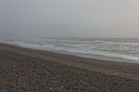
August 2017Gold Bluffs Beach on a grey day.
Photograph: Dirtsc, Redwood NSP Gold Bluffs 5, CC BY-SA 3.0

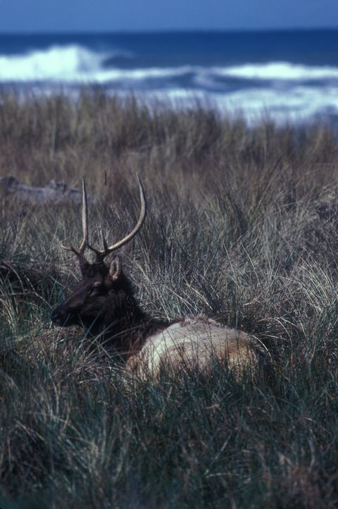
A Roosevelt elk resting in the dune grass at Gold Bluffs Beach.
Photograph: US Fish and Wildlife Service, Public domain

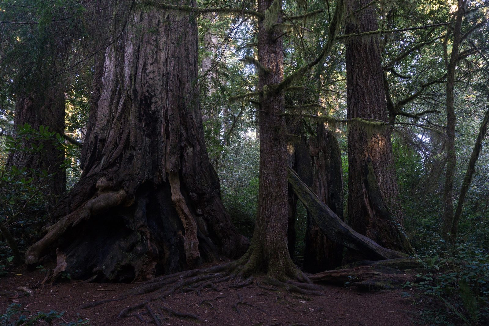
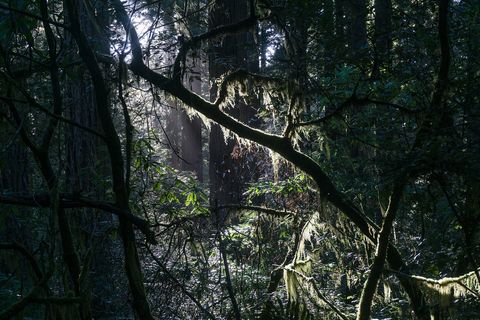
September 2019Moss-hung branches in the redwood forest.
Photograph: Alexey Komarov, CC BY-SA 4.0
- Find the top of one tree. (Lay flat on my back to do it. Found some clouds instead, which were also very high and quite pleasant.)
- I said hello to the most famous tree from a polite distance. The ground around it has been loved to bits.
- Give the yellow slug the right of way. It is going somewhere, eventually.
- Wait at the edge of the meadow for the elk, quietly, from a long way off. They were there first, and they know it.
- Write a sentence about the fog. (Wrote it at dawn. By noon the fog had taken the page back, and most of the hill.)
A relic from Redwood National and State Parks
Relic, entry 328A knob of dormant budsHow a damaged tree grows back
A burl on a redwood trunk. It looks like a great lumpy swelling on the trunk, and that is what it is: a knobby growth of dormant buds that never became branches and gathered into a mass instead. When the tree is damaged, the waiting buds sprout, and the burl helps the redwood grow back.
Tally, in the marginA great knobbly lump on the trunk that I took for a wound and was sorry about, until I learned it was the opposite: the tree keeping a spare of itself, just in case. I have started carrying a spare pencil, in its honour.
Getting there
- 1
Along the coast road
The parks follow US Highway 101 for about 50 miles between Crescent City and Orick.
- 2
From San Francisco
About 325 miles, or six hours by road.
- 3
The nearest airports
Del Norte County Airport is about 4 miles from the Crescent City Information Center; Arcata-Eureka is about 25 miles from the Kuchel Visitor Center.
- ✓
How to get there. The parks follow US Highway 101 for about 50 miles between Crescent City and Orick, about 325 miles, or six hours by road, north of San Francisco. The Thomas H. Kuchel Visitor Center, on Freshwater Beach a mile south of Orick, is the largest and is about 40 miles north of Eureka; the Crescent City Information Center is 26 miles south of Brookings, Oregon. The nearest airports are Del Norte County Airport, about 4 miles from the Crescent City Information Center; Arcata-Eureka Airport, about 25 miles south of the Kuchel Visitor Center; and Rogue Valley International-Medford, about 100 miles from the Hiouchi Visitor Center. The Park Service warns that many GPS and mapping services give wrong directions inside the parks and follows its own road signs.
When to go. Any month: temperatures barely change through the year, though most of the rain falls between October and April and summer brings the fog. Native rhododendrons are at their best from mid-May to early June, and maples and oaks colour in autumn.
What to arrange ahead. As of 12 November 2026, from May 15 to September 15 each vehicle driving to the Fern Canyon trailhead needs a reservation, and the road there crosses two streams that can be hard going after rain. The national park charges no entrance fee; the state parks charge day-use fees in some areas, including the road to Gold Bluffs Beach and Fern Canyon.
Safety. The State Department’s travel advisories cover other countries, so none applies here. The parks’ conditions page lists trail closures, fallen trees and planned burns.
Mark this place
The passport stamp for this place.
Common questions
How tall are the trees in Redwood National and State Parks?
Taller than any other trees on Earth. Coast redwoods in Redwood National and State Parks are often more than 300 feet tall, and the tallest known tree, in the Redwood Creek watershed, stands 379 feet.
Which is bigger, a coast redwood or a giant sequoia?
It depends what you measure. The coast redwoods of Redwood National and State Parks are the tallest trees in the world, while the giant sequoias of the Sierra Nevada are bigger by volume.
How old are the redwoods?
Some live 2,000 years. Coast redwoods in Redwood National and State Parks average 500 to 700 years old, though the oldest trees in the world are bristlecone pines, at some 5,000 years.
Can you drive through a tree in Redwood National Park?
No, there are no drive-through trees in Redwood National and State Parks. Three privately owned drive-through redwoods stand elsewhere in California, and the famous old photograph of a car driving through a tree is probably Yosemite’s Wawona Tree, a giant sequoia that fell in 1969.
Does it cost anything to visit Redwood National Park?
Not to drive through. Redwood National Park has no entrance stations and charges no entrance fee; the three state parks within Redwood National and State Parks charge day-use fees in some areas, such as the road to Fern Canyon.
How much old-growth redwood forest is left?
Very little: 96 per cent of the original old-growth coast redwoods have been logged. Redwood National and State Parks protect 45 per cent of the old-growth redwood forest that remains in California.
Are there condors in Redwood National Park?
Yes, since 2022. California condors returned to Redwood National Park in March 2022, more than a century after they last flew over the redwoods, in a project led with the Yurok Tribe.
Can you visit Hyperion, the famous tall redwood?
The Park Service asks people not to. Hyperion, in Redwood National and State Parks, stands off trail, and visitors seeking it have trampled the forest around its base; the park points to more than 100 miles of trails among other giant redwoods instead.
Photographs on this page
Tap a photograph to see it full size.
Photograph: Alexey Komarov, CC BY-SA 4.0, cropped
Photograph: Dirtsc, Redwood NSP Gold Bluffs 5, CC BY-SA 3.0
Photograph: US Fish and Wildlife Service, Public domain
Photograph: Alexey Komarov, CC BY-SA 4.0


