The short answer
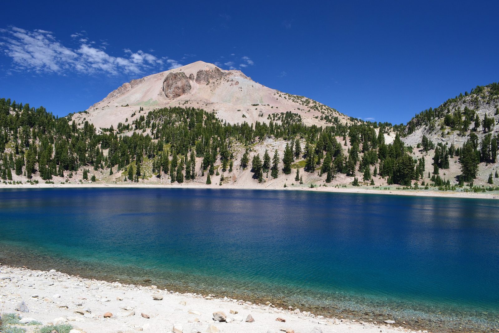
Lassen Volcanic National Park lies in northern California, about three hours north-east of Sacramento, and climbs from about 5,000 feet to 10,457 feet, from forests and meadows to bare volcanic summits. Its centre is Lassen Peak, which erupted between 1914 and 1915, and around it the ground still steams, bubbles and boils. The Lassen Park Highway crosses the park for 30 miles between the Kohm Yah-mah-nee Visitor Center at the south-west entrance and the Loomis Museum at Manzanita Lake in the north-west. It became a national park on August 9, 1916, taking in the Cinder Cone and Lassen Peak national monuments.
From Tally’s diary
The path went down between tall pines into a bowl that hissed and thumped and smelled of very old eggs, and steam rose from the ground in a dozen places at once, as if the hill were cooking several dinners and had burned them all. Above, snow still lay in the shade in midsummer. I took my coat off, put my scarf on, and kept doing both all afternoon.
Why it's worth knowing
Every kind of volcano. Shield, composite, cinder cone and plug dome: Lassen has all four. Unlike other volcanoes of the Cascades, its big plug dome and composite volcanoes sit close beside the smaller cinder cones that surround the volcanic centre. Two of them have erupted recently by a volcano’s standards: Cinder Cone about 350 years ago and Lassen Peak about a hundred years ago. The Devastated Area, along the park highway, still shows the destruction of Lassen Peak’s eruptions, along a short trail that is accessible by wheelchair.
Hot water from snow. The rain and snow that fall on the high country soak deep into the ground, where they are heated by a body of hot or molten rock beneath Lassen Peak. Rising again, the water boils into pools and mud pots, and superheated steam bursts out through cracks as fumaroles, at Bumpass Hell, Sulphur Works and elsewhere. Boiling Springs Lake, in Warner Valley, is around 125 degrees. Cold Boiling Lake, near Kings Creek, plays a trick: it is cold, and the “boiling” is carbon dioxide bubbling up through it like soda water.
Snow on a grand scale. The park gets up to 30 feet of snow a winter, which usually starts to pile up in October and in most places does not melt until July. The deepest snowpack on record, in 1983, was 331 inches. Along the 30-mile highway it can lie 40 feet deep on avalanche-prone slopes above 2,000-foot drops, and clearing the road takes crews about two months from as early as mid-March. A snow sensor 36 feet tall stands at the Lake Helen picnic area, sending its readings to California’s water managers.
The field notes
Snow Mountain
The visitor center at the south-west entrance opened in 2008 as Kohm Yah-mah-nee, “Snow Mountain” in Mountain Maidu, the first park building to receive a tribal name. Tribes with ancestral ties to the land around Lassen Peak include the Atsugewi, Yana, Yahi and Maidu. In 1952 Selena LaMarr, a member of the Atsugewi tribe and the park’s first woman naturalist, began demonstrating Atsugewi traditional skills to visitors outside the Loomis Museum, and other demonstrators, among them Dessie Snooks and later her daughters, carried on the work.
The photographer and his daughter
Benjamin Franklin Loomis photographed Lassen Peak’s eruptions, and he did much to build the visitor services around Manzanita Lake. In 1927 he built a museum there in honour of his daughter, Louisa Mae. The Loomis Museum is open seasonally, and its exhibits include his historic photographs of the 1914 eruption.
A president at the lake
Touring the West to promote his conservation agenda, President John F. Kennedy visited Lassen Volcanic on September 27 and 28, 1963. His party arrived at the Devastated Area by helicopter from Redding, and while a park naturalist led the Secretary of the Interior and the press around the lake, the president retired to the lodge manager’s residence at Manzanita Lake for a much-needed rest.

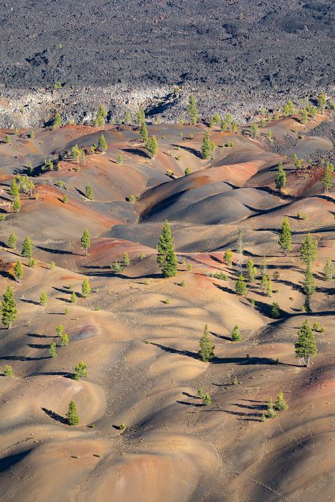
June 2020The Painted Dunes below the Fantastic Lava Beds, dotted with young pines.
Photograph: Frank Schulenburg, CC BY-SA 4.0

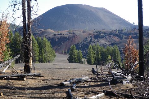
August 2010Cinder Cone above burned trees and dark cinders.
Photograph: NPS, Public domain, cropped

July 2010Lassen Peak reflected in Manzanita Lake.
Photograph: Av9, Public domain, cropped
- Walk the boardwalk over the bubbling bowl without holding my nose. (Held it. Let go for a breath. Held it again. The bowl did not mind either way.)
- Find the lake that boils without being hot. (Found it. Put one finger in. Cold. The bubbles were laughing at me, I think.)
- Throw a snowball in summer. (Threw it. Hit a tree. The tree took it in good part.)
- I kept to the boards and paths around the steaming ground, and let the bubbling mud have its privacy.
- Stay out for the stars over the cold lake. (Stayed. They came out, then came out some more. I ran out of wishes before they ran out of stars.)
A relic from Lassen Volcanic National Park
Relic, entry 341Once in the vent of Lassen PeakA 30-ton boulder
Hot Rock, at the foot of the Devastated Area. This 30-ton boulder was once in the vent of Lassen Peak. In the eruption a violent lahar, a mudflow, carried it speeding down the mountain in a slurry of mud, earth and rock, and visitors reported it still hot to the touch months later; inside, it is thought to have been about 1,000°F when it came tumbling down. It has rested beside the park highway for more than a hundred years, while a new forest grows back around it.
Tally, in the marginA great grey boulder sitting quietly by the road, which I patted before I learned where it had come from, and how fast. I took my hand back. Then I put it back again, gently. It seemed to have calmed down about the whole business long ago.
Getting there
- 1
To the south-west entrance
State Route 36/89 leads to the Kohm Yah-mah-nee Visitor Center, near Mineral.
- 2
To the north-west entrance
State Route 44/89 leads to the Loomis Museum and Manzanita Lake, near Shingletown.
- 3
Across the park
The Lassen Park Highway runs 30 miles between the two entrances.
- ✓
| J | F | M | A | M | J | J | A | S | O | N | D |
|---|---|---|---|---|---|---|---|---|---|---|---|
| June: best time | July: best time | August: best time | September: best time | October: best time |
- Roughly June to October, when the trail to Bumpass Hell is open
How to get there. Lassen Volcanic is about three hours north-east of Sacramento. State Route 36/89 leads to the south-west entrance and the Kohm Yah-mah-nee Visitor Center, near Mineral; State Route 44/89 leads to the north-west entrance, the Loomis Museum and Manzanita Lake, near Shingletown. The Lassen Park Highway joins them across the park, and three unpaved roads reach the remote east side. There is no public transport to or in the park, and fuel is scarce: the nearest stations are in Shingletown, Old Station, Chester and Red Bluff, and the camper store at Manzanita Lake usually sells gas from mid-May to early October.
When to go. The trail to Bumpass Hell is usually open from about June through October, and snow can cover high trails into July and patches of the Lassen Peak Trail into August. The park highway closes with the first heavy snows, as early as October or as late as December, and reopens between May and July, depending on the winter; the park itself stays open all year, and in winter both entrances are open for snowshoeing and skiing. In autumn the aspens turn yellow and gold along the road between Hot Rock and the Devastated Area.
What to arrange ahead. All of the park’s campgrounds take reservations only, through Recreation.gov, and backcountry camping needs a wilderness permit, also from Recreation.gov.
Safety. The State Department’s travel advisories cover other countries, so none applies here. In the hydrothermal areas the ground can look solid and hide pools of acid water at boiling point, which is why the boardwalks and paths are there. The park’s current conditions page lists road and trail openings.
Mark this place
The passport stamp for this place.
Common questions
What kinds of volcano are in Lassen Volcanic National Park?
All four types found in the world. Lassen Volcanic National Park has shield, composite, cinder cone and plug dome volcanoes, with the large plug dome of Lassen Peak close beside smaller cinder cones.
When did Lassen Peak last erupt?
In 1914 and 1915, with minor steam eruptions through 1921. The eruptions of Lassen Peak, in Lassen Volcanic National Park, were photographed by Benjamin Loomis, and their effects can still be seen at the Devastated Area.
What is Bumpass Hell?
The park’s largest hydrothermal area. Bumpass Hell, in Lassen Volcanic National Park, is a 16-acre basin of mud pots, steam vents and boiling pools, reached by a 3-mile round-trip trail from the park highway and crossed by a boardwalk.
When is the Lassen Park Highway open?
Usually from late spring or early summer until the first heavy snow. The highway through Lassen Volcanic National Park can open as early as May or as late as July, and close as early as October or as late as December.
How much snow does Lassen Volcanic get?
Up to 30 feet a winter. The snow in Lassen Volcanic National Park usually starts to build in October and does not melt in most places until July; the deepest snowpack on record, in 1983, was 331 inches.
What does Kohm Yah-mah-nee mean?
“Snow Mountain”, in Mountain Maidu. The Kohm Yah-mah-nee Visitor Center, at the south-west entrance of Lassen Volcanic National Park, opened in 2008 as the first park building to receive a tribal name.
Where is Lassen Volcanic National Park?
In northern California, about three hours north-east of Sacramento. Lassen Volcanic National Park has entrances near Mineral, on State Route 36/89, and near Shingletown, on State Route 44/89.
Photographs on this page
Tap a photograph to see it full size.
Photograph: NPS, Public domain, cropped
Photograph: Frank Schulenburg, CC BY-SA 4.0
Photograph: NPS, Public domain, cropped
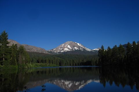
Photograph: Av9, Public domain, cropped


