The short answer
Wind Cave National Park lies on the southern edge of the Black Hills in South Dakota, 11 miles north of the town of Hot Springs. Below ground it protects Wind Cave, one of the longest caves in the world and still being explored, famous for its boxwork, delicate honeycombs of stone. Above ground it protects a stretch of mixed-grass prairie and ponderosa pine woodland where bison, elk, coyotes and deer live. Established in 1903, it was the first national park created to protect a cave, and was later enlarged to save its prairie too. The cave is entered only on ranger-guided tours.
From Tally’s diary
I bent down to look into a small dark hole in the hillside and it breathed at me, a long cool breath that smelled of stone, and then, a while later, seemed to breathe in. I held on to my hat. Up on the grass a great shaggy shape was grazing slowly towards me, and I decided to be somewhere else by the time it arrived.
Why it's worth knowing
Older than almost anything around it. About 350 million years ago a warm, shallow sea covered the area, and seashell fragments built up into limestone, with lumps of gypsum crystallising inside it as seawater evaporated. The gypsum swelled and shrank as it took up water, cracking the stone; later it turned to calcite, and the acids made in that change dissolved the first cave passages, about 320 million years ago. Seas came and went for the next 240 million years. The uplift of the Black Hills, 40 to 60 million years ago, opened more cracks, and the cave grew slowly in water that sat in the rock rather than flowing through it like a river.
A honeycomb of stone. The cave’s great treasure is boxwork: thin blades of calcite jutting from the walls and ceilings and crossing one another to form a honeycomb of little boxes. It turns up in small amounts in other caves, but nowhere is it as well formed or as plentiful as here; Wind Cave has more boxwork than all the other caves on Earth put together. How exactly it formed is still one of the cave’s biggest mysteries. The leading idea is that calcite filled narrow cracks left by the gypsum, and that the softer rock around those veins later crumbled away, leaving the fins standing.
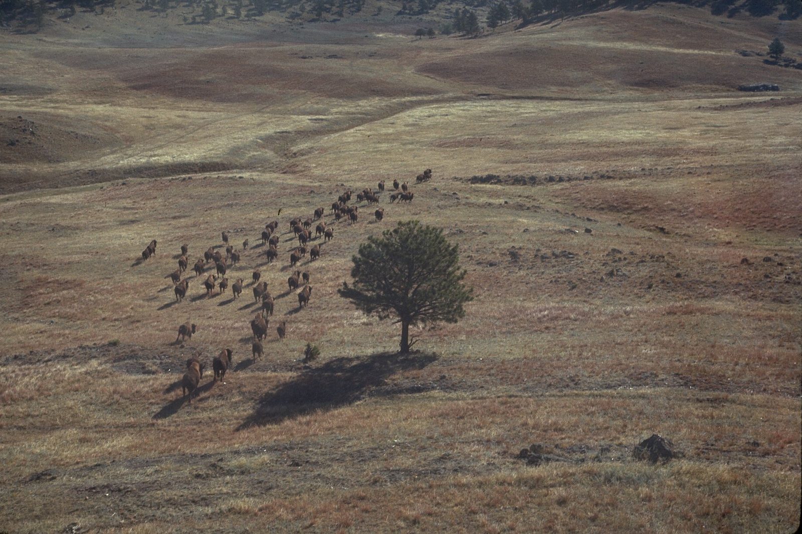
The prairie above. Wind Cave sits where the open prairie meets the pine forest, and the park is known for its intact prairie ecosystem. About 400 to 450 bison graze it, roaming as they eat and rarely staying in one place for long, and elk, coyotes, deer and many birds use the edge where grass meets trees. The Lakota word for bison is tatanka; another is pte, and the Lakota are sometimes called pte oyate, the buffalo nation.
The field notes
Where the earth breathes
Lakota oral tradition tells of a “hole that breathes cool air” near Pte Tatiopa, the “Doorway of the Buffaloes”, now known as Buffalo Gap. The ancestors called the place Oniya Oshoka, where the earth breathes inside; in modern Lakota it is Maka Oniye, “breathing earth.” One version of the Emergence Story was told by the tribal historian Wilmer Mesteth of the Cheyenne Creek community on the Pine Ridge Reservation. In it, people once lived underground in the spirit lodge, waiting while the earth was made ready, and the passage to it runs through Wind Cave. Tipi rings near the natural entrance show it was known long before 1881.
Candles and string
After the Binghams found the hole, a local man, Charlie Crary, is credited with being the first to go down into it. The first written account came from Frank Herbert, who squeezed through a hole “I could just about squeeze through”, crawled fifty feet on hands and knees “facing a terrible wind”, and found his way back by following a string. Others in his party “got scared and went back.” In the 1890s the cave became a business: a hotel was built beside it, a “petrified man” found nearby was shown inside for 25 cents, and in 1892 explorers broke into the room still called the Fairgrounds.
A young explorer
The McDonald family came to manage the cave in 1890, and the teenage Alvin McDonald explored it, keeping a diary of what he found. On July 17, 1893, he and a friend, Joe Shirk, wrote their names in the soft residue on the wall of a small dome. That December Alvin died, at the age of 20. In 2003 explorers found another of his signatures, high in a dome they named High Hopes. A plaque now marks his grave.

May 2006Boxwork in the Elks Room.
Photograph: USGS, Public domain

November 2009Stalactites over Skyway Lake.
Photograph: NPS, Public domain, cropped

A pronghorn on the prairie.
Photograph: NPS, Public domain, cropped
- Say good afternoon to the hole in the hill. (Said it. It breathed back. I am taking that as a reply.)
- Go down underground and look up. (Looked up. The ceiling was made of tiny boxes. I counted until my neck gave out.)
- Hold on to my hat at the entrance. (Held it. Held it tighter. Lost a feather.)
- I stood at the edge of the trees in the evening and watched the grass go gold, and watched a bison walk slowly past a long way off, and kept very still anyway, out of respect.
- Come back up into the daylight slowly. (Came up. Blinked. The prairie had gone on being enormous without me.)
A relic from Wind Cave National Park
Relic, entry 352Blade-thin fins of calciteLeft behind as the rock wore away
A panel of boxwork on a cave ceiling. In the middle levels of Wind Cave the rock overhead is laced with a raised honeycomb: blade-thin fins of calcite meeting at all angles to make hundreds of small open boxes, like the inside of a wasps’ nest turned to stone. The fins are what was left behind. The rock between them, weakened into crumbly sand, weathered away in the damp air of the cave, so the boxwork stands out from the surface like a lattice somebody forgot to take down.
Tally, in the marginI took it for some sort of lattice that somebody had put up on the ceiling and forgotten, until I learned it had been left behind when the rock around it simply gave up and fell away. Patience, I suppose, looks like that from the inside.
Getting there
- 1
From Rapid City
Highway 79 runs about 50 miles south, then US 385 north through Hot Springs.
- 2
Through the Black Hills
The Black Hills route runs through Hill City and Custer.
- 3
To Mount Rushmore
41 miles north, about an hour.
- ✓
How to get there. The visitor centre is 11 miles north of Hot Springs, South Dakota, about half a mile west of US Highway 385; from Rapid City it is about 50 miles south on Highway 79, then north on US 385 through Hot Springs, or by the Black Hills route through Hill City and Custer, about 20 miles north of the park. Many GPS units send drivers to the wrong place; the Park Service gives the visitor centre’s coordinates as N43° 33′ 22″ W103° 28′ 38″. The nearest commercial airport is Rapid City, and no public transport serves the park. Mount Rushmore is 41 miles away, about an hour’s drive.
When to go. Cave tours leave from the visitor centre; in summer they run about every twenty minutes.
Safety. The State Department’s travel advisories cover other countries, so none applies here. Bison are large, fast and unpredictable, and the park asks people to watch them from a safe distance; the conditions page lists tour and road changes.
Mark this place
The passport stamp for this place.
Common questions
Why is it called Wind Cave?
Because its entrance blows. In 1881 Jesse Bingham heard wind coming from a small hole in the Black Hills and had his hat blown off when he looked in; the Lakota call the place Maka Oniye, “breathing earth.”
What is boxwork?
Thin blades of calcite crossing each other in a honeycomb on cave walls and ceilings. Wind Cave National Park in South Dakota has more boxwork than all the other caves on Earth combined.
Was Wind Cave the first cave national park?
Yes. Wind Cave National Park was established in 1903 as the first national park dedicated to preserving a cave system, and was later expanded to protect its mixed-grass prairie.
Are there bison in Wind Cave National Park?
Yes, about 400 to 450. Bison graze the prairie of Wind Cave National Park and are often seen along US Highway 385 and South Dakota Highway 87.
Is Wind Cave sacred?
To the Lakota, yes. In Lakota tradition the natural entrance of Wind Cave is the passage through which the first people and bison emerged from the spirit world, and the park shares a version of the Emergence Story.
How far is Wind Cave from Mount Rushmore?
About 41 miles, roughly an hour’s drive. From Wind Cave National Park, US Highway 385 runs north through Custer, and South Dakota Highway 244 leads east to Mount Rushmore National Memorial.
Can you go into Wind Cave without a guide?
No. Wind Cave in Wind Cave National Park is entered on ranger-guided tours that start at the visitor centre, 11 miles north of Hot Springs, South Dakota.
Photographs on this page
Tap a photograph to see it full size.


