The short answer
Cuyahoga Valley National Park covers about 33,000 acres of the Cuyahoga River valley in north-east Ohio, a short drive from both Cleveland and Akron. It protects 26 miles of the river, a quarter of its length, along with woods, wetlands, waterfalls, old farms and the route of the Ohio and Erie Canal, whose towpath is now a 20-mile trail. President Ford signed the law that created it in 1974, and it became a national park in 2000. There are no entrance gates and no fee; the park is threaded with roads, villages and trailheads, and a scenic railroad runs the length of the valley.
From Tally’s diary
The river slid along brown and quiet under the trees, and a tall grey bird stood in the shallows on one leg, so still I took it for a post until it lowered its head and stabbed. Further on, a train went by full of waving people. I waved back at all of them. The bird did not wave at anybody. It had fish to think about.
Why it's worth knowing
A river that came back. When the park was made in 1974, mining, farming and building had left thousands of acres of the valley bare. The park replanted them, cleaned up old waste dumps and later helped take out two old dams. Now more than 1,500 wetlands soak up and filter the rain, a whole valley quietly working as the river’s sponge.
A ditch that changed a country. Before the Ohio and Erie Canal was dug, between 1825 and 1832, Ohio was frontier, and getting crops to market was nearly impossible. The canal joined the Ohio River at Portsmouth to Lake Erie at Cleveland, and mules walked the towpath beside it pulling boats of goods and passengers. The same path is now the park’s most popular trail, flat and crushed limestone, used by walkers and cyclists. Beside it runs a railroad that began hauling coal in 1880 and turned to scenic trips in the 1970s. In season, a cyclist or walker can ride the train back to the start, and flags it down at the platform by waving both arms over their head.
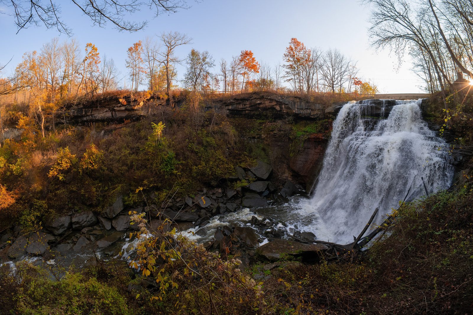
Where the plains begin. The valley sits on the last ripples of the Appalachians, just where they give way to the flat country of the Midwest. Its rocks are 410 to 315 million years old, laid down by seas and slow rivers. At Brandywine Falls a cap of hard Berea Sandstone protects soft shales below, and the water spreads over them like a bridal veil, 60 feet high. At the Ritchie Ledges, cliffs of Sharon Conglomerate are studded with quartz pebbles carried here by ancient streams. South of the park, in Akron, runs a continental divide: rain on one side ends up in the Atlantic, rain on the other in the Gulf of Mexico.
The field notes
Beavers in the marsh
Beavers were once trapped right out of Ohio. When they returned to the valley, they built wetlands, and the wetlands brought everything else. The Beaver Marsh, where the Towpath Trail becomes a boardwalk, is now one of the richest corners of the park. Over 50 kinds of bird nest there each year, otters play in the early morning and snapping and painted turtles bask on the logs. Great blue herons, almost absent once, have followed: the first nesting pair was recorded in 1985, and one colony held 176 nests in 2003.
A rifle for a stack of pelts
In the 1700s the valley was a place of refuge for Lenape, Ottawa and other peoples pushed west by war, disease and treaty after treaty, and it filled with villages and trading posts. Beaver pelts were the currency. The price of a rifle was a stack of pelts as tall as the rifle, so dishonest traders jumped on the stack to squash it down, and sold rifles with ever longer barrels. Before the newcomers, people had lived in the valley for some 500 generations. By the mid-1800s war had killed or driven out most native people from Ohio; the park now consults more than 25 federally recognised tribes with ties to the valley.
A covered bridge and a winter night
Everett Covered Bridge, over Furnace Run, is the last covered bridge in Summit County, from a time when Ohio had more than 2,000 of them and led the nation in building them. Local history tells that on a winter night in 1877 a farmer named John Gilson drowned trying to cross the swollen, icy stream, and that the bridge was built because of it. Nobody can prove the story; the bridge’s date is unknown, though its truss design was patented only in 1867. A spring flood in 1975 lifted it off its stone supports and dropped it in the creek. Schoolchildren and neighbours raised money, and the Park Service rebuilt it as it had been, in 1986.

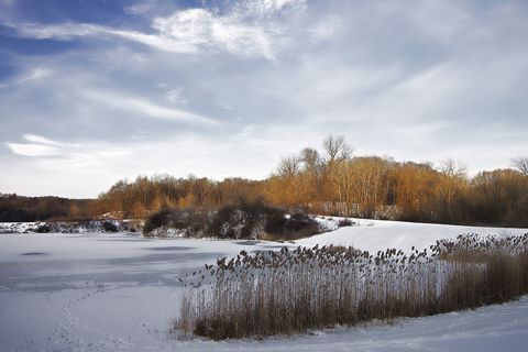
January 2015A frozen pond and its reeds in winter.
Photograph: Niagara66, CC BY-SA 4.0

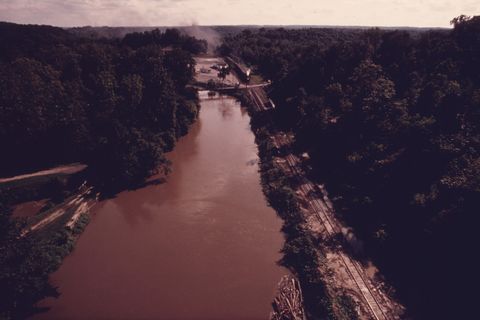
September 1975The Cuyahoga River from above, with a weekend steam train on the line beside it.
Photograph: Frank John Aleksandrowicz (EPA Documerica), Public domain, cropped
- Walk the old path beside the water where the mules once pulled the boats. (Pulled nothing. Felt I ought to have.)
- Stop a train by waving at it. (Waved with both arms. It stopped. Nobody has ever listened to me so promptly.)
- Count the turtles on one log at the marsh. (Seven. Then one slid off. Then two climbed on. The count is still open.)
- Stand where the water falls like a lace curtain and try to describe it properly. (Got as far as ‘lace curtain’. It will have to do.)
- Wait on the boardwalk for a flat-tailed somebody to come out of the reeds. (One did, just after breakfast. I held my breath so long I had to sit down.)
A relic from Cuyahoga Valley National Park
Relic, entry 344Willow and aspen above allBeavers were once trapped out of Ohio
A willow branch, peeled by a beaver. In autumn the beavers of the Beaver Marsh cut softwood branches, willow and aspen above all, and stack them in the water in front of their lodge, a winter larder they can reach under the ice. A stripped branch shows the work: bark nibbled off in neat rows by front teeth, the pale wood underneath, the end cut to a point like a pencil. Beavers were once trapped right out of Ohio, and a branch like this is the sign that they are back.
Tally, in the marginA stick, I thought, until I saw the tooth marks running down it in tidy rows, and realised somebody had eaten their dinner off it with great care. I would like to be that careful about anything at all.
Getting there
- 1
From Cleveland
Interstate 77 south for 15.5 miles leads to exit 147 and on to Riverview Road.
- 2
From Akron
Interstate 77 and Route 8 north lead to exit 14A, then four miles west on Boston Mills Road.
- 3
By train
The scenic railroad runs from Rockside in the north to Akron Northside in the south.
- ✓
How to get there. The park lies between Cleveland and Akron, and Interstate 77 and Ohio Route 8 run close by. From Cleveland, I-77 south for 15.5 miles leads to exit 147 (Miller Road) and local roads to Riverview Road and the Boston Mill Visitor Center, at 6947 Riverview Road, Peninsula. From Akron, I-77 north and Route 8 north lead to exit 14A, then four miles west on Boston Mills Road, across the Cuyahoga River. There are many ways in and no entrance gates. Cuyahoga Valley Scenic Railroad stops at stations through the valley, from Rockside in the north to Akron Northside in the south; its own website carries tickets and timetables.
When to go. The park is open all year; most areas are open 24 hours, though Brandywine Falls and a few others close at dusk. Wood ducks return to the Beaver Marsh in mid-March, the herons nest from about Valentine’s Day to Independence Day, and the marsh is usually frozen by mid-December.
Safety. The State Department’s travel advisories cover other countries, so none applies here. The park’s alerts page lists Towpath Trail closures.
Mark this place
The passport stamp for this place.
Common questions
Is this the river that caught fire?
Yes. The Cuyahoga River caught fire in Cleveland on Sunday, June 22, 1969, a few miles north of what became Cuyahoga Valley National Park, when oil and debris trapped by railroad bridges near a steelworks were lit, probably by a flare tossed from a passing train. The fire lasted under half an hour, but Time magazine described a river that “oozes rather than flows,” and the Cuyahoga became a symbol of water pollution around the world.
Does Cuyahoga Valley National Park charge an entrance fee?
No. Cuyahoga Valley National Park in Ohio is fee-free, needs no reservation and has no entrance gates; it is spread over 33,000 acres with many ways in.
What is the Towpath Trail?
The path the canal mules walked. The Ohio and Erie Canal Towpath Trail follows the route of the 1825-1832 canal for 20 miles through Cuyahoga Valley National Park, flat, surfaced and open 24 hours.
How tall is Brandywine Falls?
Sixty feet. Brandywine Falls, in Cuyahoga Valley National Park, pours over a cap of Berea Sandstone onto soft shales that spread the water into a bridal veil.
Are there bald eagles in Cuyahoga Valley National Park?
Yes, and they are a comeback story. The first bald eagle nest ever recorded in Cuyahoga Valley appeared in 2006, the first eaglet flew in 2007, and more than a dozen have fledged from the valley since.
Can you ride a train through Cuyahoga Valley National Park?
Yes. Cuyahoga Valley Scenic Railroad runs through Cuyahoga Valley National Park on a line that began in 1880; in season, walkers and cyclists can flag it down at a station by waving both arms.
When did Cuyahoga Valley become a national park?
In 2000. Cuyahoga Valley was created as a national recreation area in 1974, when President Ford signed the law, and was renamed Cuyahoga Valley National Park in 2000.
Photographs on this page
Tap a photograph to see it full size.
Photograph: Erik Drost, CC BY 4.0, cropped
Photograph: Niagara66, CC BY-SA 4.0
Photograph: Frank John Aleksandrowicz (EPA Documerica), Public domain, cropped


