The short answer
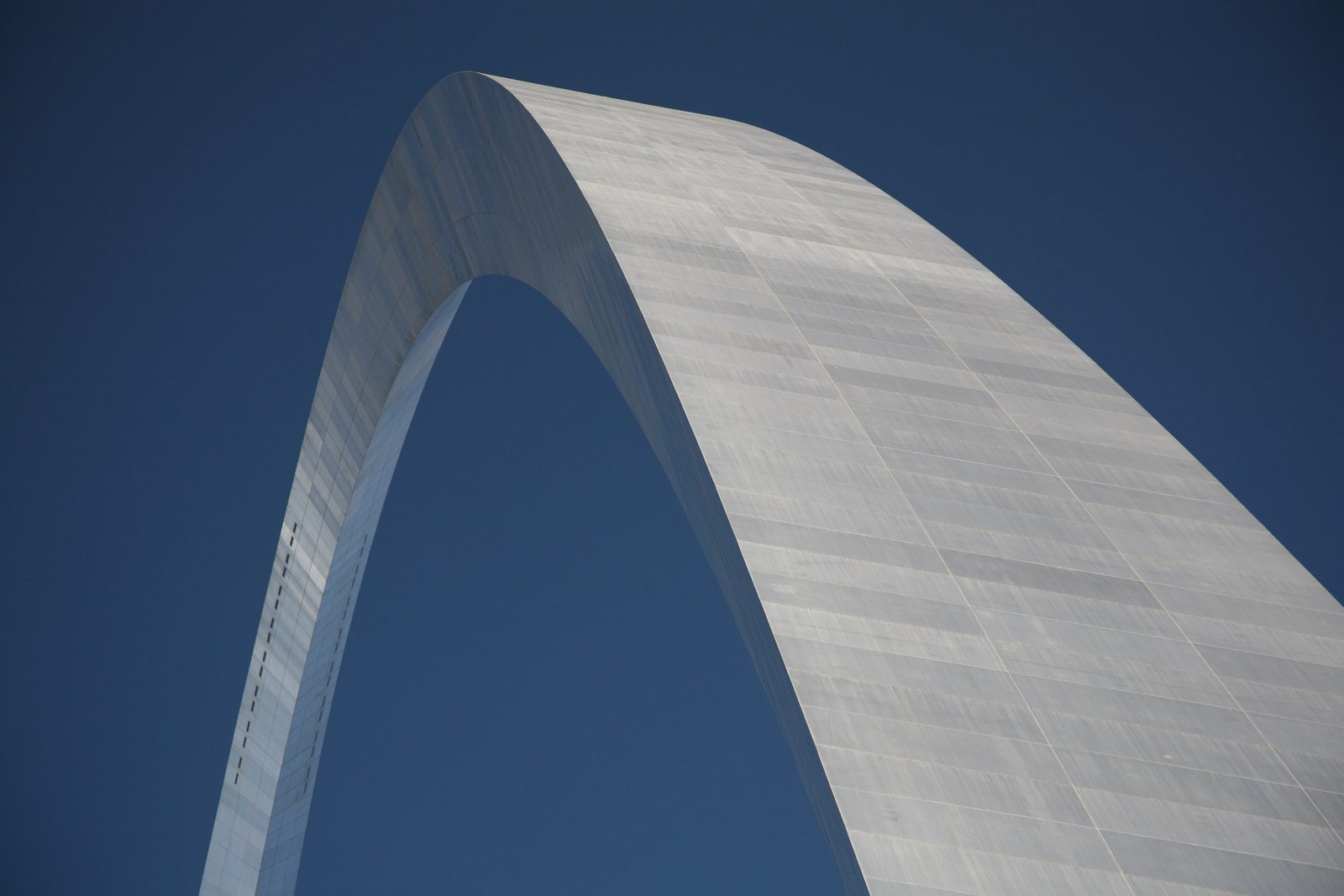
Gateway Arch National Park covers about 91 acres of the Mississippi riverfront in St. Louis, Missouri: the Gateway Arch and its grounds, and the Old Courthouse a few blocks to the west. The stainless-steel arch, 630 feet tall, was completed in October 1965 as a symbol of Thomas Jefferson’s vision of a nation reaching across the continent, and of St. Louis’s role as the “Gateway to the West”. A museum beneath it tells the story of the land from the Mississippi to the Pacific and the many peoples who lived on it, explored it and settled it. The Old Courthouse is where Dred and Harriet Scott sued for their freedom in 1846.
From Tally’s diary
I rode up inside the curve in a little round pod that tipped and clicked and settled itself every few seconds, like a cat finding the right spot. At the top the windows were small and the river was wide, with the city on one side and the flat land on the other. I looked for a long time at both. Nobody spoke much. It seemed the right amount.
Why it's worth knowing
A curve of steel. Allowing ten feet a storey, the arch is exactly 63 storeys tall. It is built to sway as much as 18 inches in a 150-mile-an-hour wind, though under normal conditions it does not sway at all. Lightning rods on top, grounded in the bedrock, take the hundreds of strikes that hit it each year. Each leg holds 1,076 steps, used only by maintenance and emergency crews. More than 500 tons of pressure jacked the legs apart so the last four-foot piece could go in at the top. That is why the 16 windows on each side are only 7 by 27 inches: a bigger window would not have withstood it. On a clear day the view runs about thirty miles.
The ride to the top. Dick Bowser, a second-generation elevator man who had left college to serve in the Navy, drew up the tram in his basement in two weeks, working day and night. Each of the two trams is a train of eight capsules, barrels five feet across with five seats, that rotate about 155 degrees on the four-minute climb so the riders stay upright. In 2001 a new levelling system was installed that could have smoothed out the swinging entirely, but the traditional tilting ride was judged part of the arch’s character, and kept. His contract was for a two-year job; it lasted six years.
The architect. Eero Saarinen was born in Finland in 1910 and, at 12, won first place in a matchstick design contest. He entered the 1947 competition for the memorial. Neither an obelisk nor a box nor a dome seemed right for the site, he said, but “here, at the edge of the Mississippi River, a great arch did seem right.” He went on to design the TWA Terminal in New York and Dulles Airport near Washington, and died in 1961, at 51, before the arch was built.
The field notes
The courthouse steps
Under the law of the time, any person held in slavery could ask the court for permission to sue for freedom, and between 1812 and 1865 more than 300 enslaved people in St. Louis did so; fewer than half won. On April 6, 1846, Dred Scott and his wife Harriet filed suit at the Old Courthouse. Their case went all the way to the Supreme Court, whose 1857 decision, that no African Americans were entitled to citizenship, hastened the Civil War. The Scotts did not find their freedom through the courts, but the case they began is counted among the most important ever tried in the United States. The courthouse also heard Virginia Minor’s case for a woman’s right to vote in the 1870s, and reopened in May 2025 with new exhibits.
Names in the keystone
About a month before the final piece of the arch was put in place, the mayor, Alfonso Cervantes, became the first to sign a “signatorium sheet”. The sheets, each with room for 100 names, went out to schools across St. Louis city and county and to the park’s visitor center, and thousands of people signed. The time capsule that holds them was welded into the final section of the arch, and cannot be taken out as long as the arch stands.
Nothing at the top but the view
There is no restroom or snack bar at the top, and there never was a restaurant; the observation platform is the only thing up there. Visitors stay for one tram cycle, about seven to nine minutes, and ride back down in the same capsule. Rangers work a single two-hour shift at the top each day. By local legend, the arch is shaped like a boomerang because anyone who touches it will never be able to leave St. Louis.
Before the arch
The arch stands on roughly the site of the French colonial village that the merchants Pierre Laclede and Auguste Chouteau founded near where the Missouri River meets the Mississippi, as a trading post with the region’s American Indian tribes. By the 1930s the railroads had taken much of the river trade and businesses had left the riverfront. Two years after the Second World War, a competition was held to revive it, and Saarinen’s arch won.

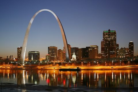
January 2008The arch and the St. Louis skyline at dusk, across the Mississippi.
Photograph: Daniel Schwen, CC BY-SA 4.0, cropped

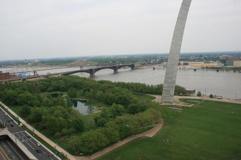
April 2010One leg of the arch and the park grounds beside the Mississippi, from above.
Photograph: Jefferson National Expansion Memorial, NPS, Jefferson National Expansion Memorial, CC BY 2.0
- Ride up without holding on to the seat. (Held on to the seat. Held on quite firmly. The pod tipped politely the whole way.)
- Find a window of my own at the top. (Found one about the size of a letterbox. Shared it. The view was big enough for two.)
- I stood a while on the old courthouse steps and did not say much. Some places ask a person to stand still, and this was one.
- Touch one leg of the great curve. (Touched it. It was cool and smooth and, as far as I can tell, has not let go of me since.)
- Watch the river go by from underneath the curve. (Watched. It went by. It is still going by, I expect.)
A relic from Gateway Arch National Park
Relic, entry 336Five seats in each capsuleTurns about 155 degrees on the way up
A tram capsule from inside the Gateway Arch. Each is a barrel five feet across, open at the front and closed at the back, with five fibreglass seats in a body of aluminium. Its inventor, Dick Bowser, compared the capsules to the barrels of cement mixers. Riding on a frame of rollers, each one turns about 155 degrees on the way up, pivoting gently with relays clicking, so the people inside stay upright.
Tally, in the marginA little round pod with five seats and a door like a porthole, which I took for a toy at first. Then it carried me to the top of the sky and back, tipping its head every few seconds to keep me level. I thanked it on the way out. It clicked.
Getting there
- 1
By MetroLink
Trains run from Lambert St. Louis International Airport to the arch in 28 minutes.
- 2
On foot
The stops at 8th and Pine and at Laclede's Landing are about a ten-minute walk away.
- 3
Through security
All visitors to the arch pass through an airport-style security checkpoint.
- ✓
How to get there. St. Louis’s MetroLink trains run from Lambert St. Louis International Airport to the arch in 28 minutes, leaving every 15 to 20 minutes; the stops at 8th and Pine and at Laclede’s Landing are about a ten-minute walk from the park. All visitors to the arch pass through an airport-style security checkpoint, and weapons are not allowed. The Gateway Arch Visitor Center is open from 9 am to 6 pm, and the last tram goes up about an hour before closing.
When to go. The tram runs rain or shine, and is cancelled as a precaution during tornado warnings. On cool, damp mornings dense fog can leave the view at the top at nothing at all.
What to arrange ahead. Tickets for the ride to the top can be bought in advance, and on busy days the ride sells out. The whole trip takes 45 to 60 minutes, with four minutes up and three down. It involves 96 steps, in six flights, and standing for 30 to 60 minutes; wheelchairs, scooters and strollers are not permitted on the observation deck, and a replica capsule beside the ticket counter lets anyone try the seat first.
Safety. The State Department’s travel advisories cover other countries, so none applies here. The park’s alerts page carries current closures.
Mark this place
The passport stamp for this place.
Common questions
How tall is the Gateway Arch?
630 feet, and exactly as wide. The Gateway Arch in St. Louis is 630 feet tall, and 630 feet is also the distance between its legs at ground level, which makes it 63 storeys high.
How do you get to the top of the Gateway Arch?
In a tilting tram of little capsules. Each of the Gateway Arch’s two trams carries eight five-seat capsules that pivot as they climb, reaching the top in about four minutes.
Who designed the Gateway Arch?
Eero Saarinen, the Finnish-American architect. Saarinen won the 1947–48 competition for the memorial on the St. Louis riverfront; the ingenious tram to the top of the Gateway Arch was designed by Dick Bowser.
When was the Gateway Arch built?
Between 1963 and 1965. Construction of the Gateway Arch began on February 12, 1963 and was completed on October 28, 1965; the north tram opened to the public on July 24, 1967.
Does the Gateway Arch sway?
Only in a very strong wind. The Gateway Arch is designed to sway up to 18 inches in a 150-mile-an-hour wind; it takes a 50-mile-an-hour wind to move the top an inch and a half either side of centre.
Why was it renamed Gateway Arch National Park?
To match the name everyone used. The park in St. Louis was called the Jefferson National Expansion Memorial, after Thomas Jefferson, until a law signed in February 2018 renamed it Gateway Arch National Park.
What happened at the Old Courthouse?
Dred and Harriet Scott sued there for their freedom. The Old Courthouse in Gateway Arch National Park heard the first two trials of the Dred Scott case, in 1847 and 1850, and Virginia Minor’s case for women’s right to vote in the 1870s.
Can you touch the Gateway Arch?
Yes, though local legend has a warning. Visitors are welcome to touch the Gateway Arch, but by St. Louis lore it is shaped like a boomerang because anyone who touches it will keep being pulled back to the city.
Photographs on this page
Tap a photograph to see it full size.
Photograph: Daniel Schwen, CC BY-SA 4.0, cropped
Photograph: Daniel Schwen, CC BY-SA 4.0, cropped
Photograph: Jefferson National Expansion Memorial, NPS, Jefferson National Expansion Memorial, CC BY 2.0


